

This is a final glance at the free paper maps that have been available to the public over the decades to aid in navigating the streets and green spaces of London- one of the most congested and built up cities on the planet. London has played host to many sporting events over the centuries though few appear to have warranted the creation of dedicated free maps for the public. Three Points of the Compass is aware of just a handful of events and sporting occasion where maps were freely available and some of these are shown here. Click on any image to enlarge it.
Wembley
The British Empire Exhibition Stadium was built in 1923 for the 1924/5 British Empire Exhibition though it hosted the first ever FA Cup Final in 1923 due to being completed ahead of schedule. More commonly known as the Empire Stadium, it was renamed Wembley Stadium and subsequently used for football and rugby matches and finals, also speedway, greyhound racing, the 1948 Olympics and other sports and concerts, including Live Aid in 1985.
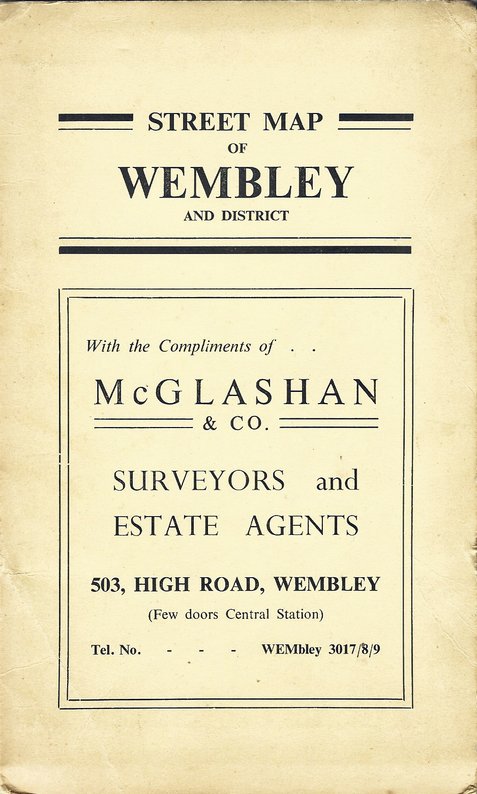
In the first half of the 20th century, there were few free map resources to aid a pedestrian in walking to a sporting fixture. Beyond bus maps, local knowledge and ‘follow the crowd’, one of the complimentary maps from an estate agent would have been of great help. Street map showing the area surrounding Wembley Stadium. McGlashan & Co. Surveyors and Estate Agents. Map copyright Maurice Linton Publications, 1950s
The stadium closed in 2000 and a replacement opened on the same site in 2007. The site is easily accessed by public transport and few free maps seem to have been produced specifically as aids in finding it though an example for the 1948 London Olympics is included below. The stadium and immediate area does obviously appear on more general London street maps such as bus route maps and those given away free by estate agents.
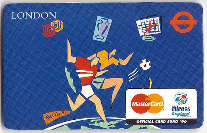
Cover of small Euro ’96 London map sponsored by MasterCard, this includes a simple diagram of the Wembley Stadium and its approach
MasterCard was one of the eleven official sponsors for the 1996 UEFA European Football Championship, more commonly known as Euro ’96 and was behind the production of a small credit card sized folding map that as well as including simple detail on Wembley seating and stadium approach, included a simple street map of central London.
Produced by Z-Cards, and extremely limited in size and area covered, it is actually a fairly good street map of central London, including most major streets, which are named, places of interest but it lacks any detail on paths across green spaces.
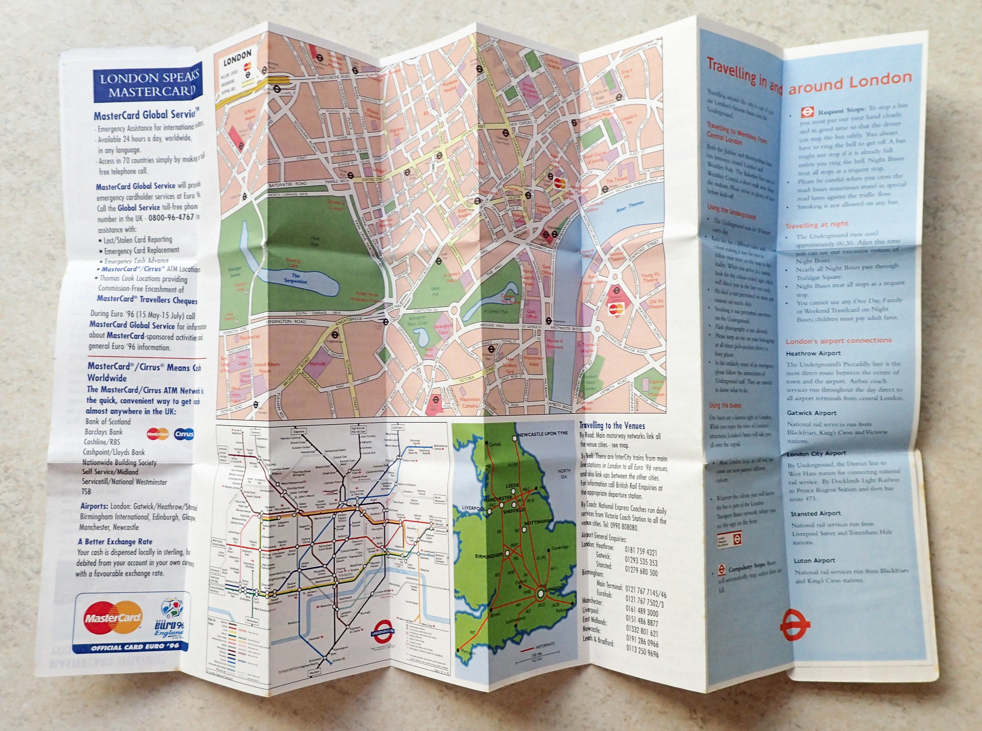
Doubly folded sheet card produced by Z-Card showing Wembley Stadium seating plan (on reverse), Euro ’96 fixture list, travel information, map of central London and the sponsor MasterCard’s ‘welcome centres’
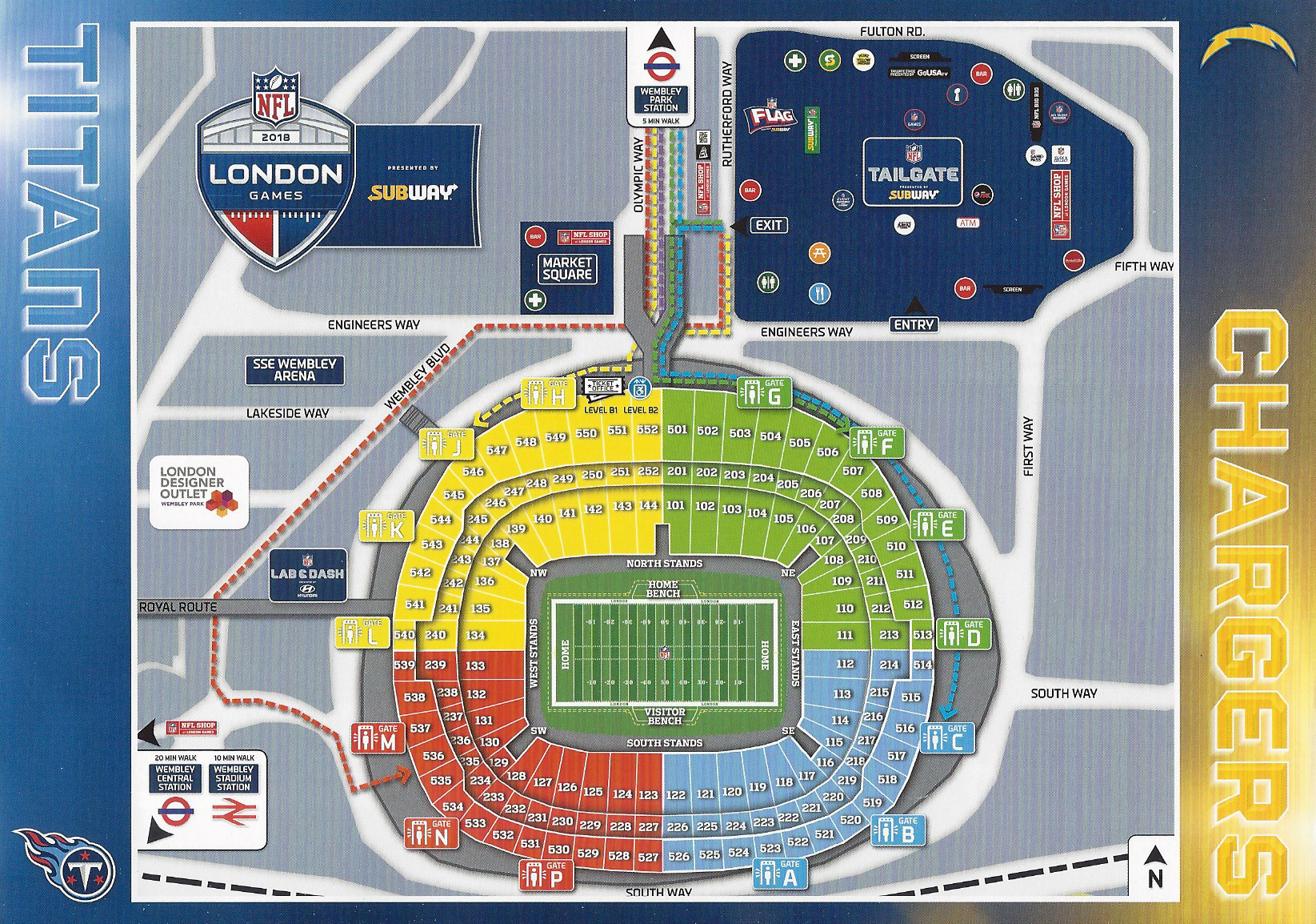
Simple diagram map of the ‘new’ Wembley Stadium and its approach. The free map was intended to reduce congestion of spectators in the streets outside. Sent free with tickets to the 2018 London NFL Games game between Los Angeles Chargers and Tennessee Titans, the Chargers won 20-19
London Marathon
One of the largest and most well attended marathons globally is that held in London each year. Marathon runners enjoy free travel on the London Tube and Docklands Light Railway on race day. Many spectators decide to walk to their vantage point rather than struggle to travel on an overburdened transport network. In anticipation of this, and additionally expecting many spectators from out of London that may be largely unaware of even the rough layout of both city and race course, free ‘maps’ are produced each year by Transport for London.
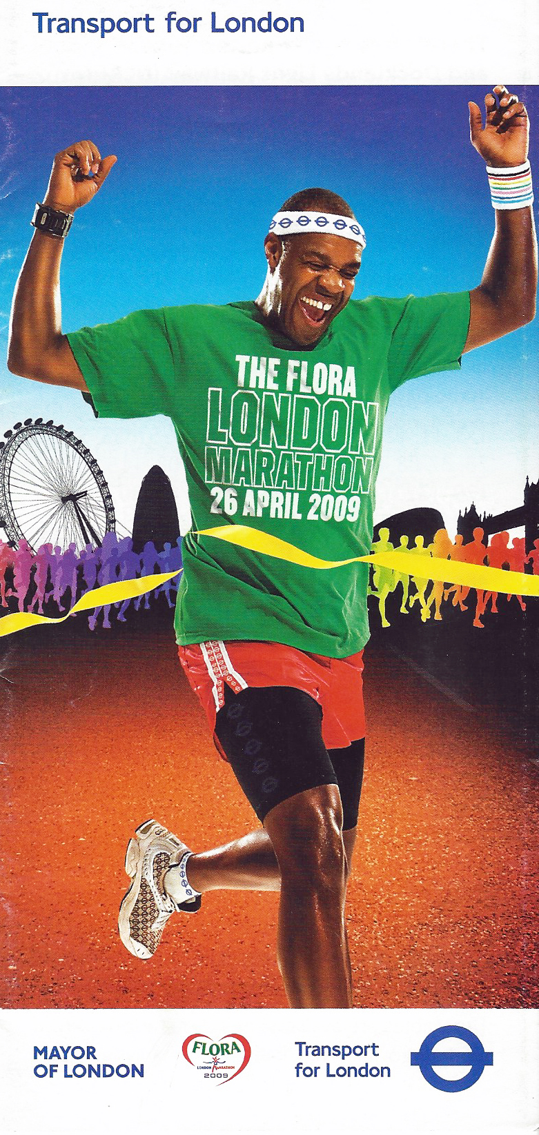
Free map with travel information produced for the Flora London Marathon, 2009
Maps they may be, but the information on them is cursory in the extreme. There is just about enough information to orientate in London but considerable reliance would have been placed on maps situated in Tube station concourses and online mapping.
The leaflets advise those walking to view the race to visit tfl.gov.uk/walking for routes and tfl.gov.uk/journeyplanner to plan their journey. It is a shame that the decision had not been taken to simply include a good map and trust spectators to plan their route accordingly rather than rely on an automated system that continues to funnel the majority of people through what Transport for London and the race organisers feel is their preferred route, rather than actually create less congestion as a result of independent route planning. Is map reading that much of a lost skill? If it isn’t, then we are certainly heading that way as an over reliance on algorithms and event planners relieves us all of individual thought and expertise.
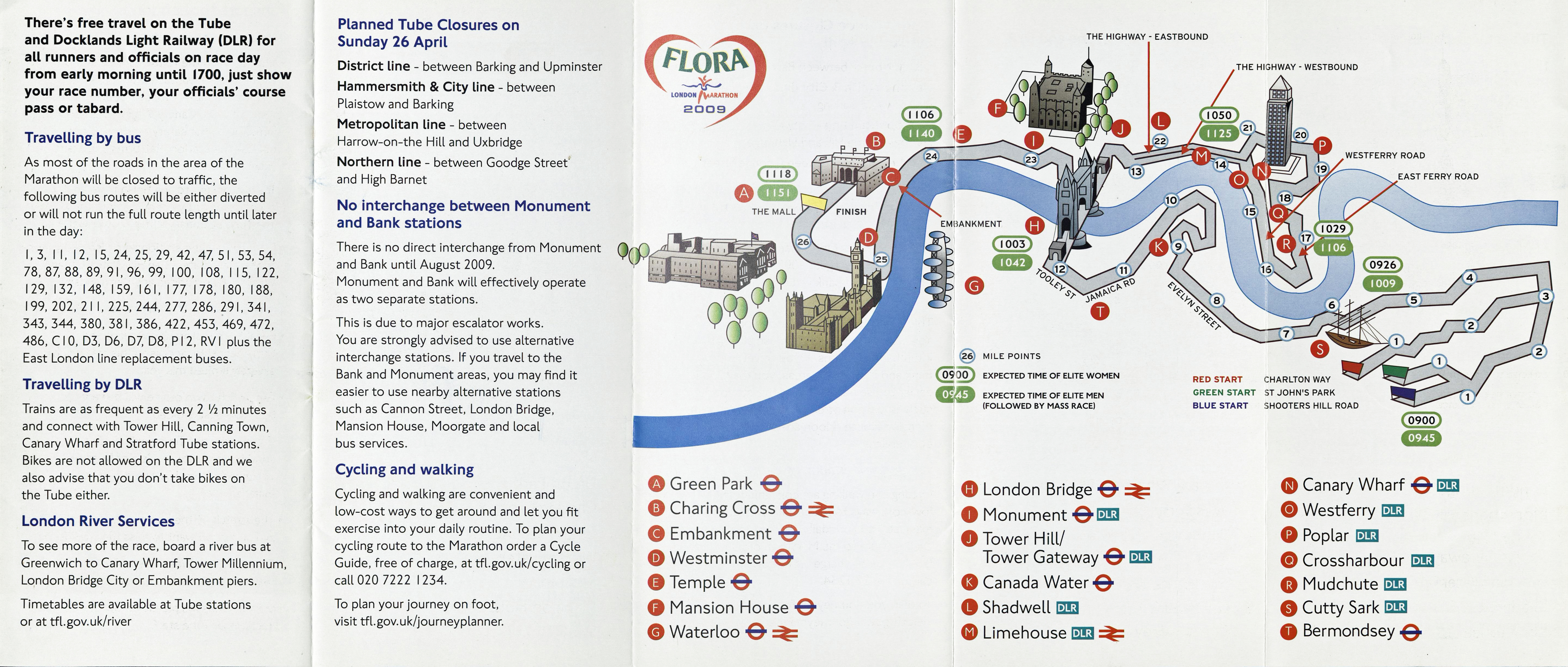
Map detail in 2009 ‘Marathon’ leaflet produced by Transport for London
Wimbledon
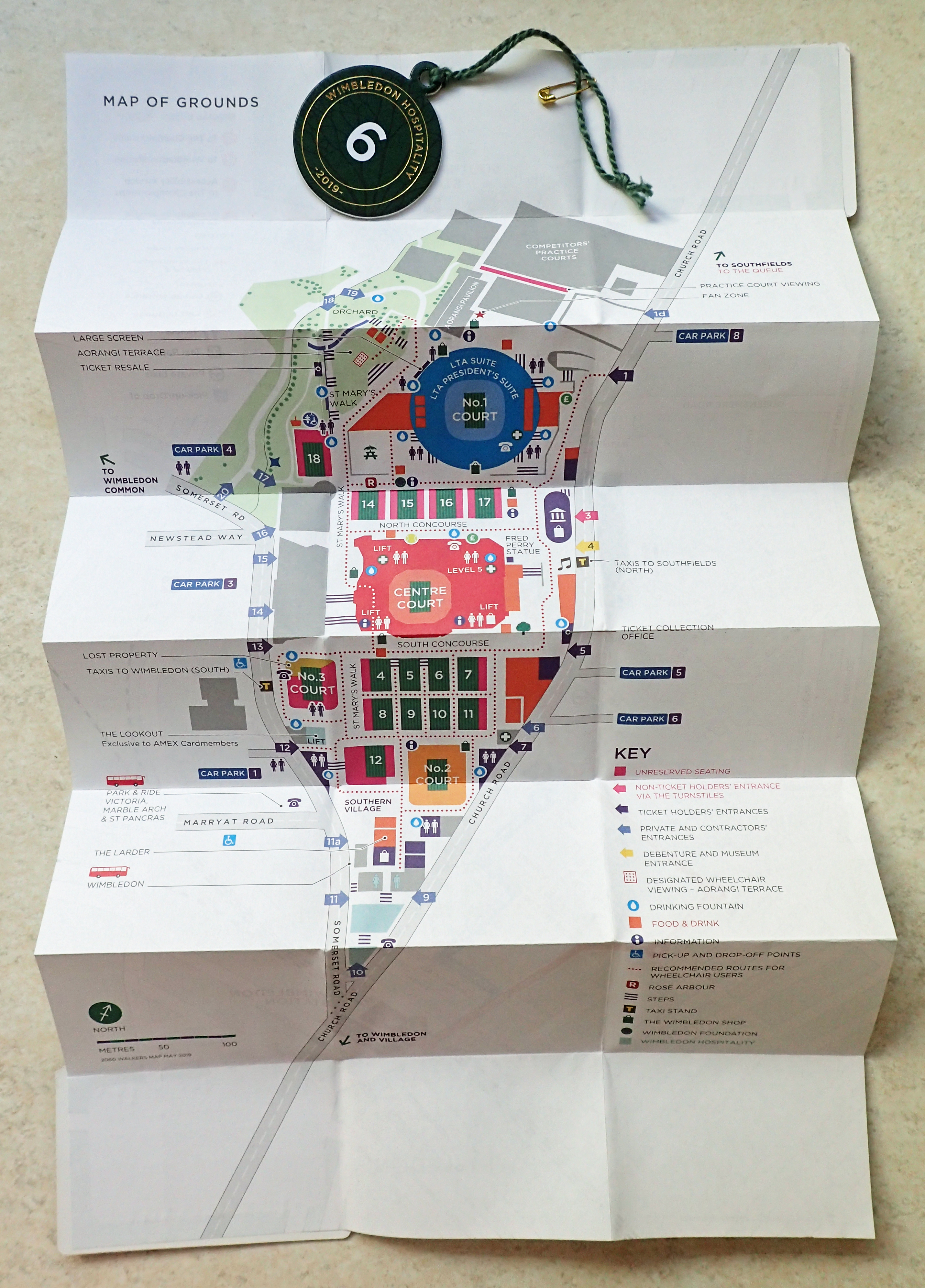
Free map given to some attendees at the 2019 Wimbledon Tennis Championship, with hospitality pass. Walkers Map 2019
Some 7 miles south-west of central London is another of the capital’s great sporting venues- Wimbledon, home to the Wimbledon Tennis Championships each year. Some attendees are provided with a small folding map of the grounds and a map showing how to walk from either Southfields or Wimbledon Underground stations to the tennis courts.
Both are a short walk and signposting is excellent however it is refreshing that, possibly reluctant, walkers are still encouraged to use ‘shank’s pony’ and walk the streets, aided of course, by a paper map.
Walk the Circle Line
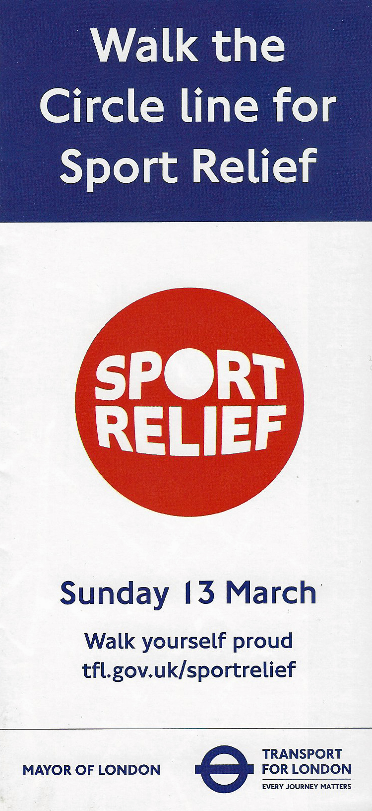
Free leaflet detailing the Walk the Circle Line for Sport Relief event held on 13 March 2016
Soon after its establishment in 2002, the charity organisation Sport Relief teamed up with Comic Relief, and the two have subsequently aired, in association with BBC Sport, on alternate years in March each year. Many charity fund raising exploits are completed by the public throughout the year and in 2016 Transport for London (TfL) promoted a ‘Walk the Circle Line’ event. Thousands joined the above ground 14.5 mile walk around the original route followed by the Circle Underground Line. The great majority walked on 13 March, with sponsorship going to Sport Relief. Participants could start at one of four locations on the route- Fitzroy Square Gardens, St Botolph-without-Bishopgate Gardens, Christchurch Gardens and Kensington Gardens. The map is perfectly adequate to follow the route but poor once it is left as few streets are named. It is interesting to note that this map actually includes one of the best printed representations of the myriad of paths that cross Hyde Park.
This is a good walk to take in many of the notable landmarks of London- Westminster, Buckingham Palace and Tower Bridge amongst them. The free leaflet and map also included a diagram of the underground system, which included an estimate of walking times between stations.
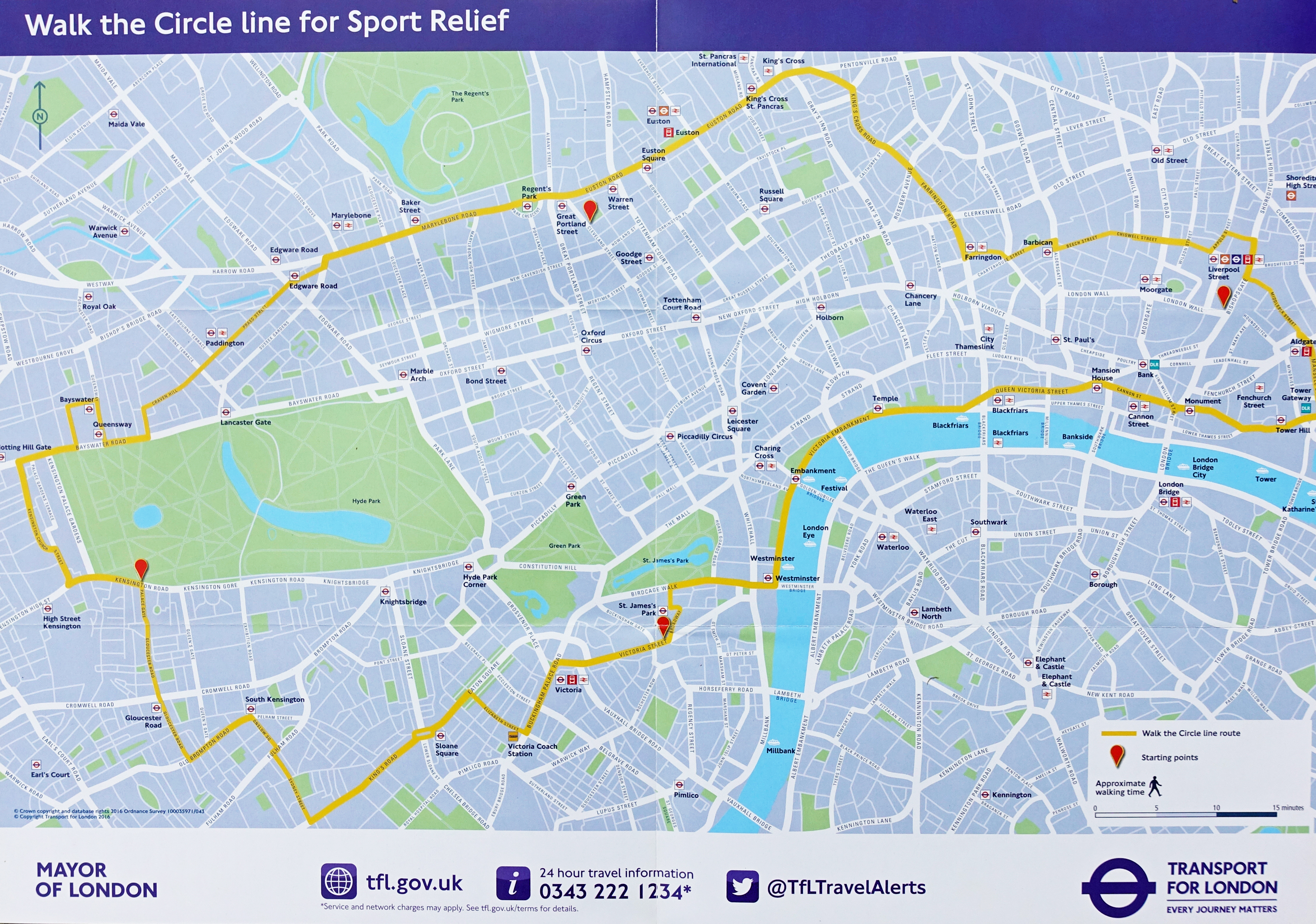
Sponsored by Sainsbury’s and produced by TfL, this free map enabled participants to navigate their way at street level around the original route of the Underground Circle Line, 2016
The London Olympics
London has hosted the Olympic Games three times- in 1908, 1948 and 2012 however I can find no examples of free maps provided for the public in 1908. This is to be expected as there was no established practice at that juncture in producing free street maps for the public. As an aside, it was at the 1908 Olympics that race walking made its debut as a standalone sport.
1948 Olympics
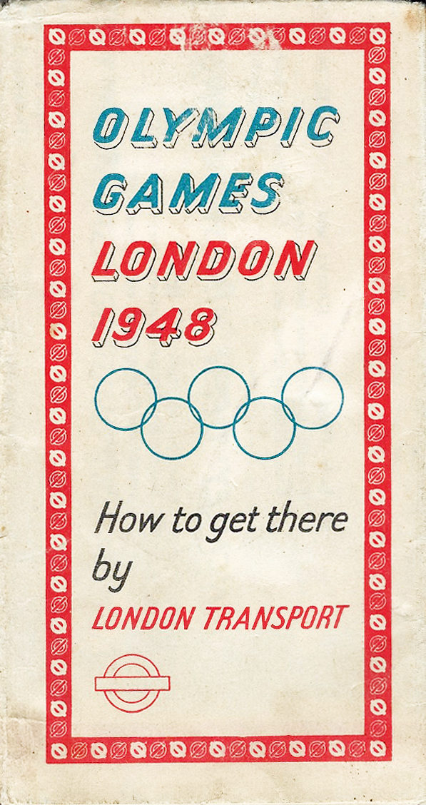
Free London Transport map for the 1948 Olympics
While the situation in 1948 was little changed from the 1908 Olympics in that few free maps were being produced for the public visiting London, the issue of small, pocket-sized and free transport maps was now well established. It is therefore unsurprising that London Transport produced a free paper map for those visiting the capital at the time of the Games of the XIV Olympiad. Additionally, competitors and officials were provided with free travel (bus and underground) passes and maps of the transport network. The success in securing a free map must have been a bit of a coup considering that more commercial offerings, such as a special Olympic transport guide and map produced by the Daily Telegraph, cost two shillings and sixpence.
Huge numbers of additional visitors to London were expected. Many of these would be unfamiliar with the street network, transport options or how to access any of the areas where Olympic events were scheduled to take place. In the wake of a financially crippling World War, the events were termed the Austerity Games and sixteen existing sporting venues were utilised. The free, two sided, fold-out leaflet included tourist information on London Museums and Art Galleries, general places of interest, embassies and consulates. Alongside a rail map showing the London Transport Railways in central London, a second street map showed the Wembley area which included the Empire Stadium (later named Wembley Stadium) and the Empire Pool (later named Wembley Arena). A new road linking Wembley Park Station with Wembley Stadium, named Olympic Way, opened on 8 July 1848.

Map to Wembley area included in free 1948 Olympic guide produced by London Transport. The designer- ‘Hale’ is shown bottom right. Printed by Waterlow & Sons Ltd.
2012 Olympics and Paralympics
It has been the London Olympics, especially those held in 2012, that has seen, by far, the greatest number of free maps produced to aid those in walking London’s streets.
The Cultural Olympiad
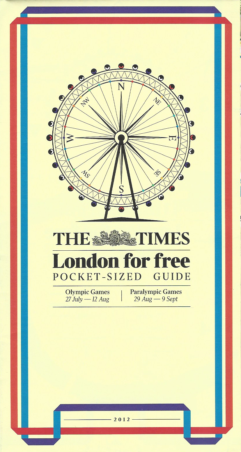
Careful to not use any official branding, for which a licencing fee would have been required, The Times newspaper gave away a free ‘London for free’ map in 2012
By 2012 many visitors to London were relying on what online resources were available for finding their way through unfamiliar streets. Only official sponsors and those licenced were permitted to use any Olympic branding of any form on any product so this may account for the lack of much in the way of third party mapping. In particular this would have been relevant to anything that was supplied free of charge as production of these had to be paid for somehow.
“from riverside fireworks to athletic parades, fashion displays to world-class exhibitions, The Times brings you the best things to do during the Olympics- for free”
One of the few free maps produced was that given away to the public showing what could be enjoyed for free across London in 2012. From parks and walks, to museums and galleries, many locations were indicated on the map. However the map itself is woeful and more intended just to indicate what was available and roughly where in the Capital it could be experienced. It would be very difficult to navigate by foot using this map alone. This hinges on a statement made in the first of these blogs on free maps for walking in London- The production of a map costs money, to produce a good map costs a lot of money.
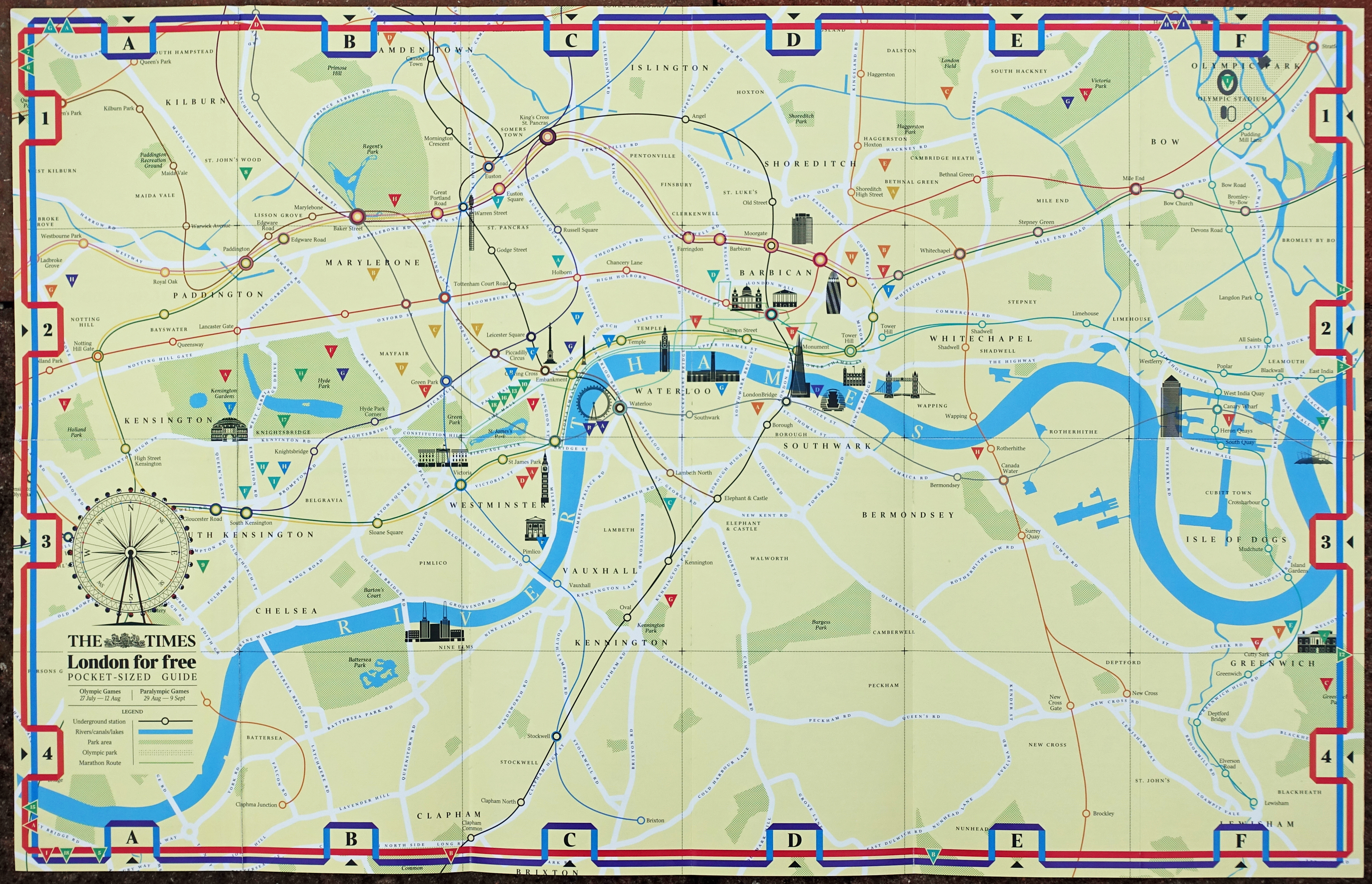
‘London for free’ pocket sized guide produced by The Times newspaper in 2012. The reverse includes a tube map, river view, guide to free museums, galleries, cultural events, parks, walks and where major markets and shopping is located. The Olympic sporting venues are also shown. Important or distinctive buildings are indicated on the simple map but only major roads are included
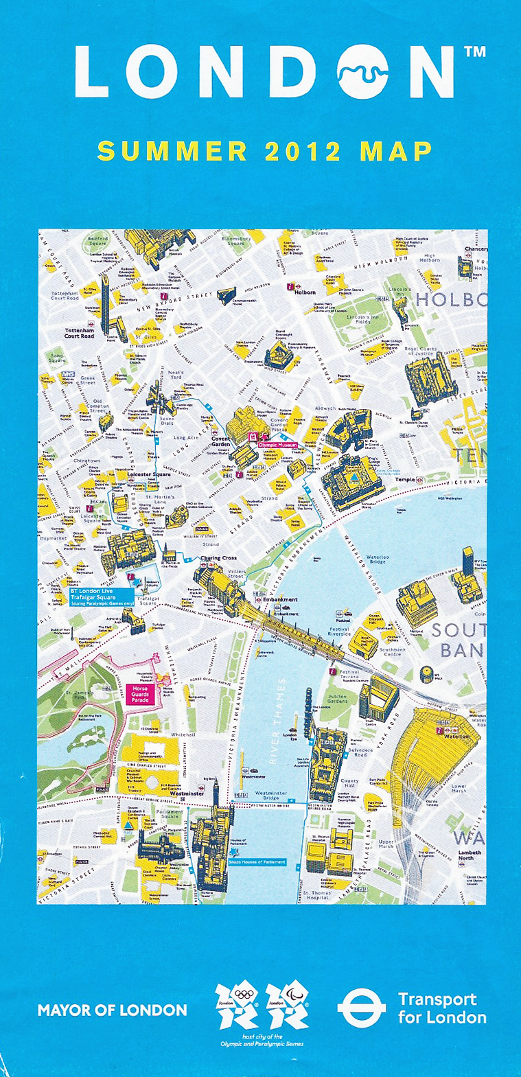
Large free ‘Summer 2012 Map’. produced by TfL. This is probably the best walking map that TfL has ever produced
In 2012 there was strong concern that the public transport system would not be able to handle the huge number of additional visitors to London. There were some 8.2 million tickets sold for Olympic Games events and a further 2.7 million tickets for the Paralympics that followed. Demand for most events often far outstripped supply and while ticket holders were entitled to free use of London’s public transport system on the day of their event, the public were encouraged to consider walking to their venue to reduce congestion.
Alongside the summer Olympics, everyday London was still going about its business, with commuters, traders and residents being joined by thousands of tourists and those visiting the capital for one of the cultural events associated with the Olympiad. There were also many tens of thousands of people expected for the free events such as the marathon, triathlon and road cycling. A very large number of free maps were produced showing how pedestrians could get around an unfamiliar London. Advice for commuters and travellers to London was provided by Transport for London (TfL) as part of a combined information hub termed Get ahead of the Games. Alongside various publications and maps, a dedicated informative and updated website was maintained.

Free leaflet that included two maps containing helpful information for visitors to London. This was aimed more at those not attending sporting events and aided street level navigation and exploration of various associated events and tourist destinations. 2012
Olympic torch and marathon routes:
The Olympic Torch made its way through London on 26 July 2012 and a free ‘Square Mile‘ map to the route was available that also included the Olympic and Paralympic marathon course routes.
Both sides of the freely available leaflet were printed, Torch and Marathon routes were shown on one side and a more general visitor information map on the other. Both maps are very simple in design and are very much aimed at people unfamiliar with using maps for navigating. Helpfully, distinctive tall buildings such as St. Paul’s cathedral and the ‘Gherkin’ are included to enable even the most inept to orientate themselves.
A little surprising is the inclusion of two ‘Stroll Discovery’ Trails on the visitor information map. These yellow and blue trails took in London’s East End, and St. Paul’s Cathedral, Monument and the River Thames. However the respective trail map format is very different to those produced for four other Stroll Discovery Trails shown below.
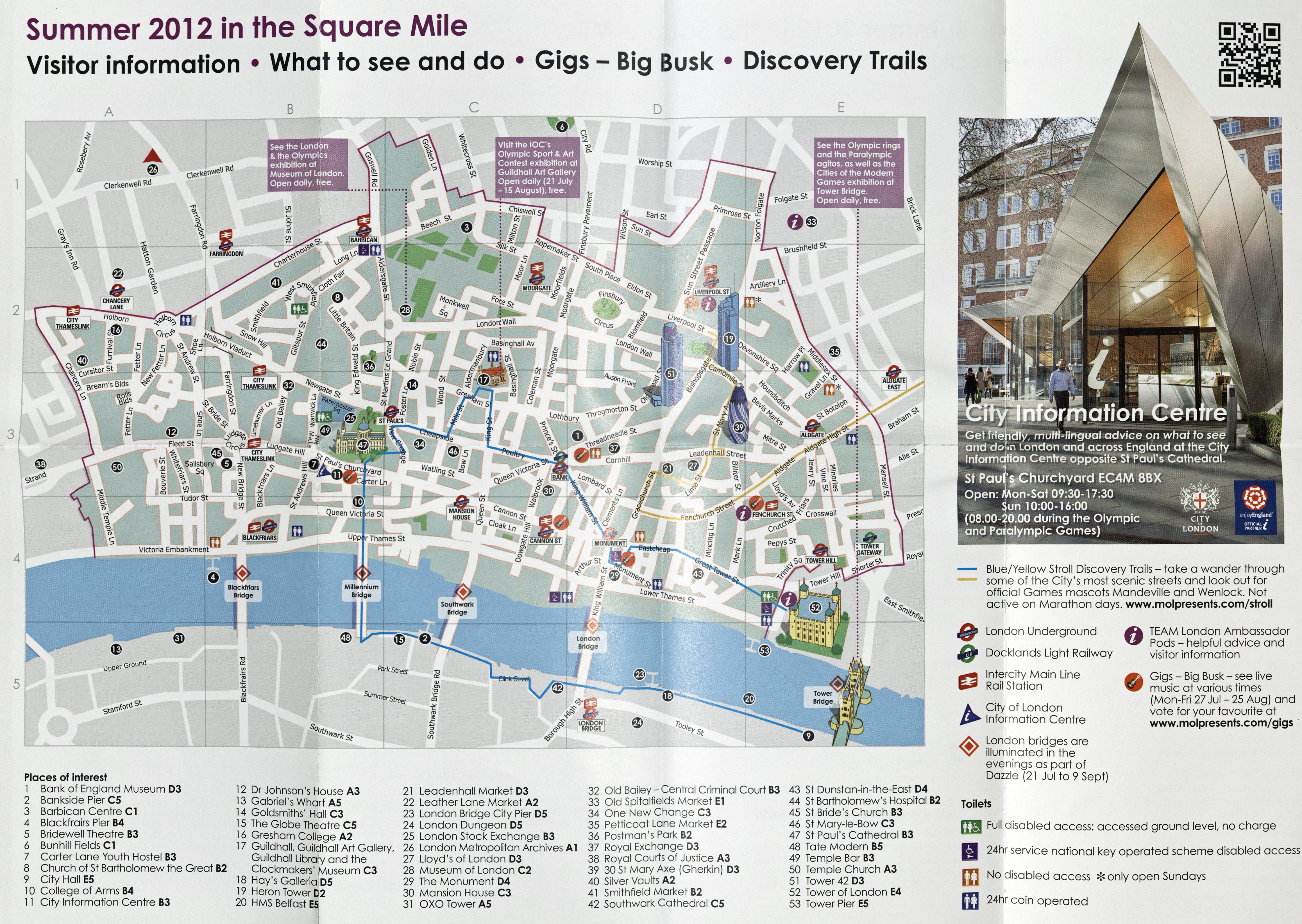
Visitor Information map on free ‘Square Mile’ leaflet produced in 2012. This includes two short ‘Discovery Trails’ for those walking around London
Stroll Discovery Trails:
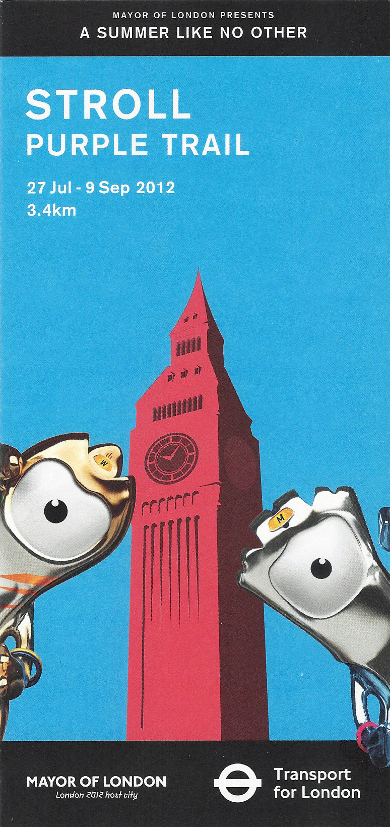
One of the Stroll trail maps produced for London visitors in 2012. Purple Trail is a short 3.4km walk around Mayfair and Soho taking in Berkeley Square, Grosvenor Square, Bond Street, Hanover Square and Piccadilly Circus.
Four small maps that encouraged visitors to explore parts of London by foot were printed on thin card that was slightly more robust than more cheaply produced paper maps. This is probably because many would have been clutched by young children guiding their families around the short trails. The covers of the four 2012 ‘Stroll’ maps featured Big Ben and the two official Olympic mascots. The London 2012 mascots divided opinion and while appreciated by most, there were many that felt they were, simply, rather odd. The mascots were Wenlock, named after the Shropshire village of Much Wenlock (where the Wenlock Olympian Games were an inspiration for the revival of the Olympic Games), and Mandeville, named after Stoke Mandeville hospital (the birthplace of the Paralympic Games). Each Discovery trail was supposed to be walked in a clockwise direction, walkers would come across the two mascots at various places en route “highlighting some great photo opportunities on the way”.
Each folded map card is small, measuring just 98mm x 210mm and they are pretty basic in design despite being based on Ordnance Survey mapping. There is little street naming added and few paths across green spaces are included. However their production and free issue is to be applauded. None of the trails were particularly long, varying from 2.6km to 4.8km. Though simple, each map is easy to follow and actually encourages the pedestrian to explore and learn a little of London.
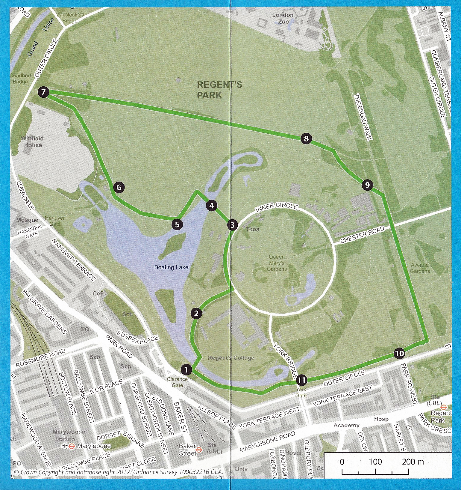
Stroll Green Trail- 3.7km taking in Regent’s Park
Stroll Red trail- 4.8km on the side of River Thames
Yellow and Blue routes are included on the ‘Square Mile’ map, the remaining four had dedicated print runs. The six Discovery Trails created in 2012 as part of the Cultural Olympiad were:
-
- Route 1- Blue Trail 4.4km. St. Paul’s Cathedral, Monument and banks of River Thames
- Route 2- Pink Trail 2.6km. London’s West End
- Route 3- Green Trail 3.7km. Regent’s Park
- Route 4- Red Trail 4.8km. Political London, South Bank
- Route 5- Yellow Trail 3.2km. London’s East End
- Route 6- Purple Trail 3.4km. Piccadilly and Oxford Street
The six trails were also shown on the ‘Summer 2012 Map’, produced by TfL, the blue cover of which was shown earlier. A small detail is taken from that large map and shown below, compare how the 3.7km Green trail through Regent’s Park is depicted, with the dedicated Green trail leaflet reproduced above.
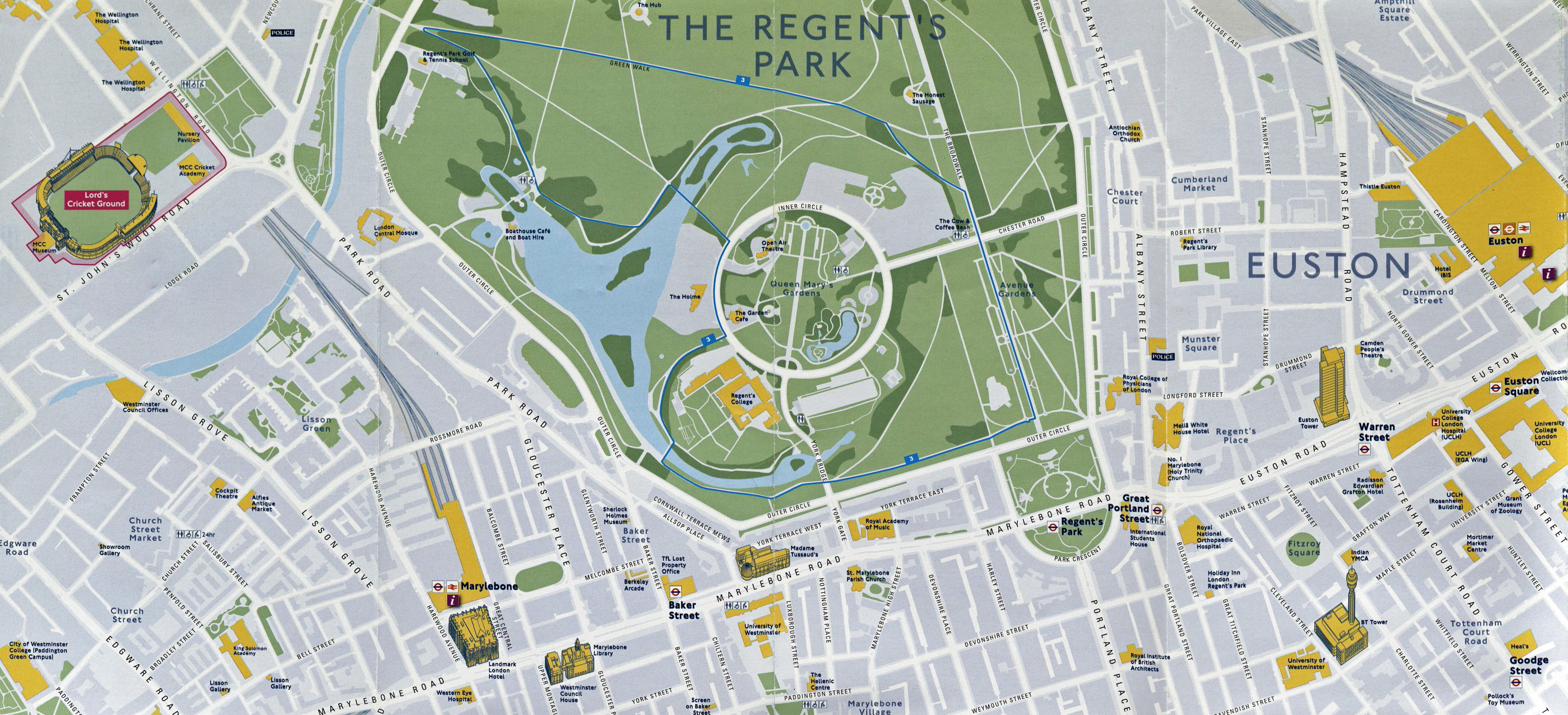
Detail from TfL’s ‘Summer 2012 Map’, showing the Green Discovery Stroll through Regent’s Park
Why not walk it? maps:
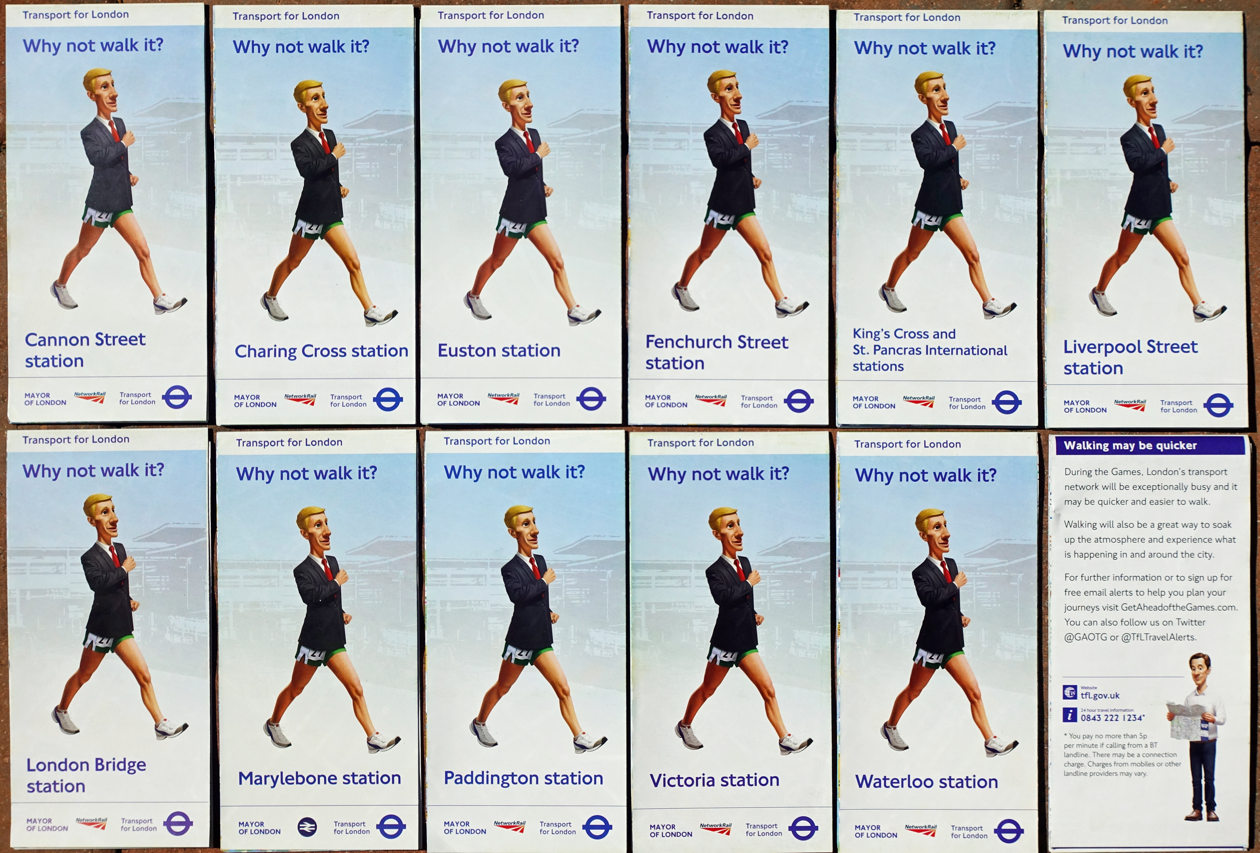
Eleven maps, each centred on a London railway station, were distributed free of charge to aid visitors to London during the 2012 Olympics
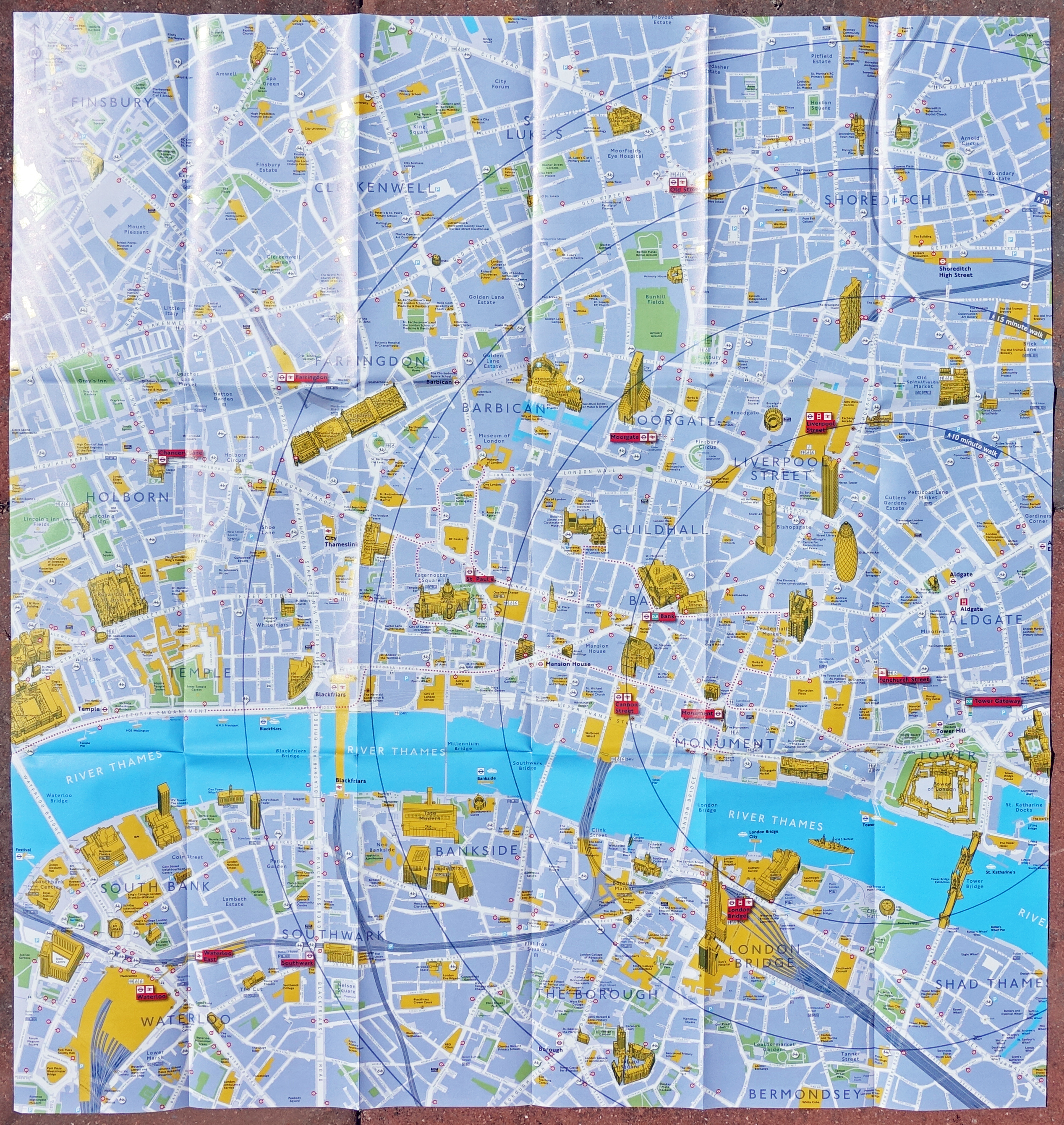
Detail from Victoria ‘Why not walk it?’ map. The detail included on this free map is impressive
London, purely as a result of historic anomaly, with many disparate companies building their own railway and subsequent London terminus, has eleven mainline railway stations. Each of these railway termini had a dedicated Get ahead of the Games map produced in 2012.
An unprecedented eleven ‘Why not walk it?’ maps were available free of charge to visitors to the Olympics and Paralympic Games. The maps are very well produced. Production and distribution costs were met by the London Mayor’s office, Network Rail and Transport for London. Based on Ordnance Survey mapping, each is roughly centred on its respective station and features concentric circles depicting 10, 15, 20 and 25 minute walk estimates.
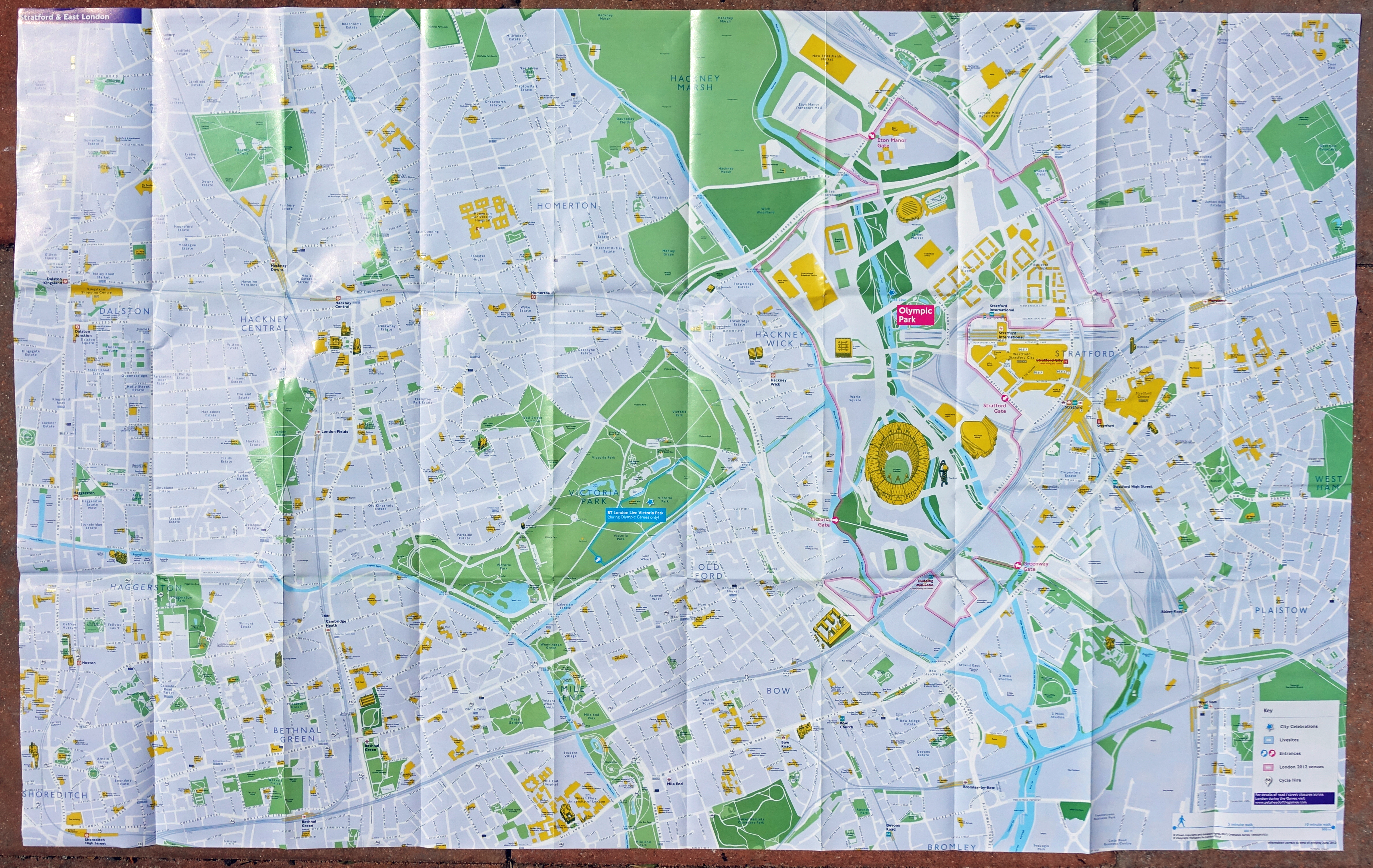
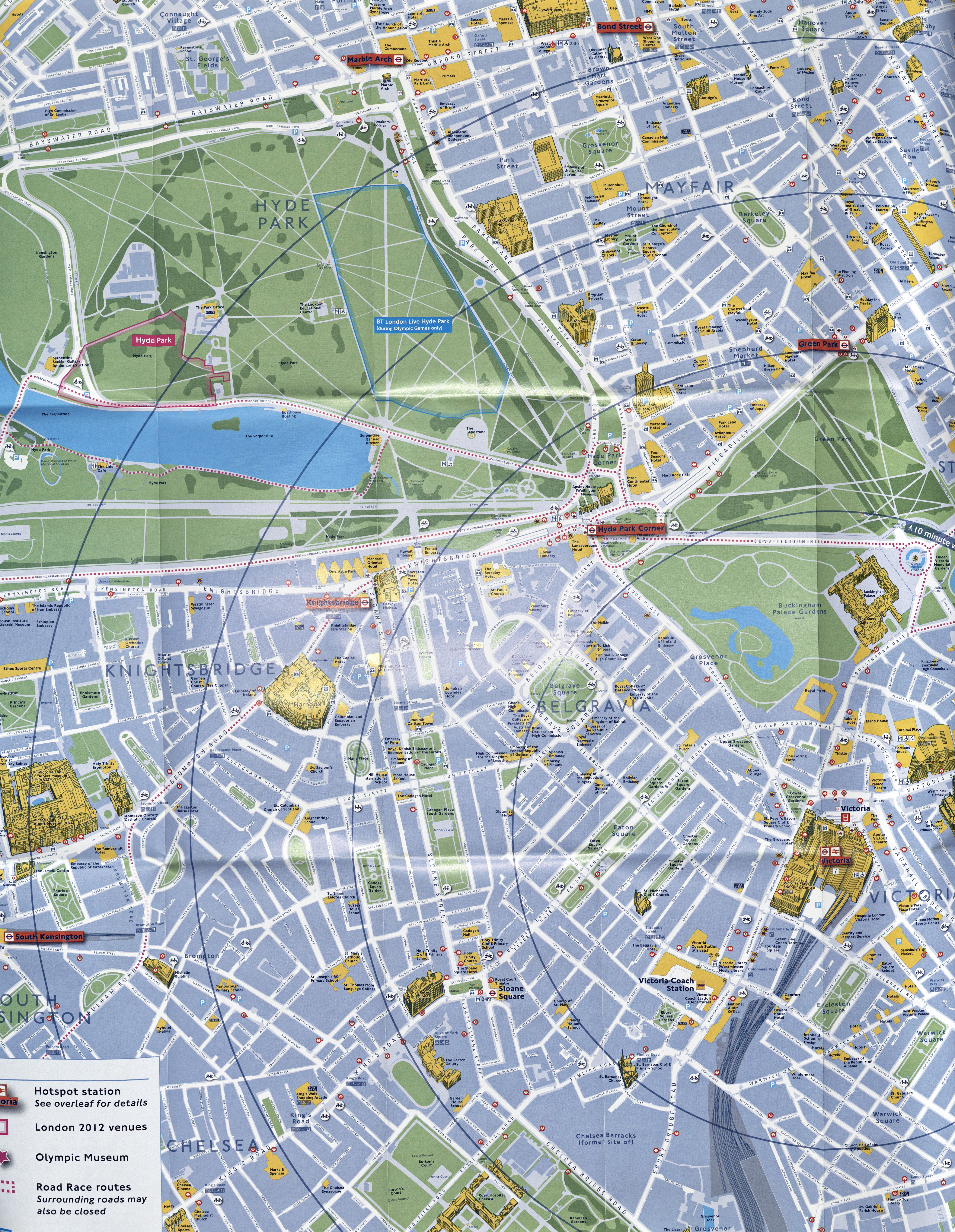
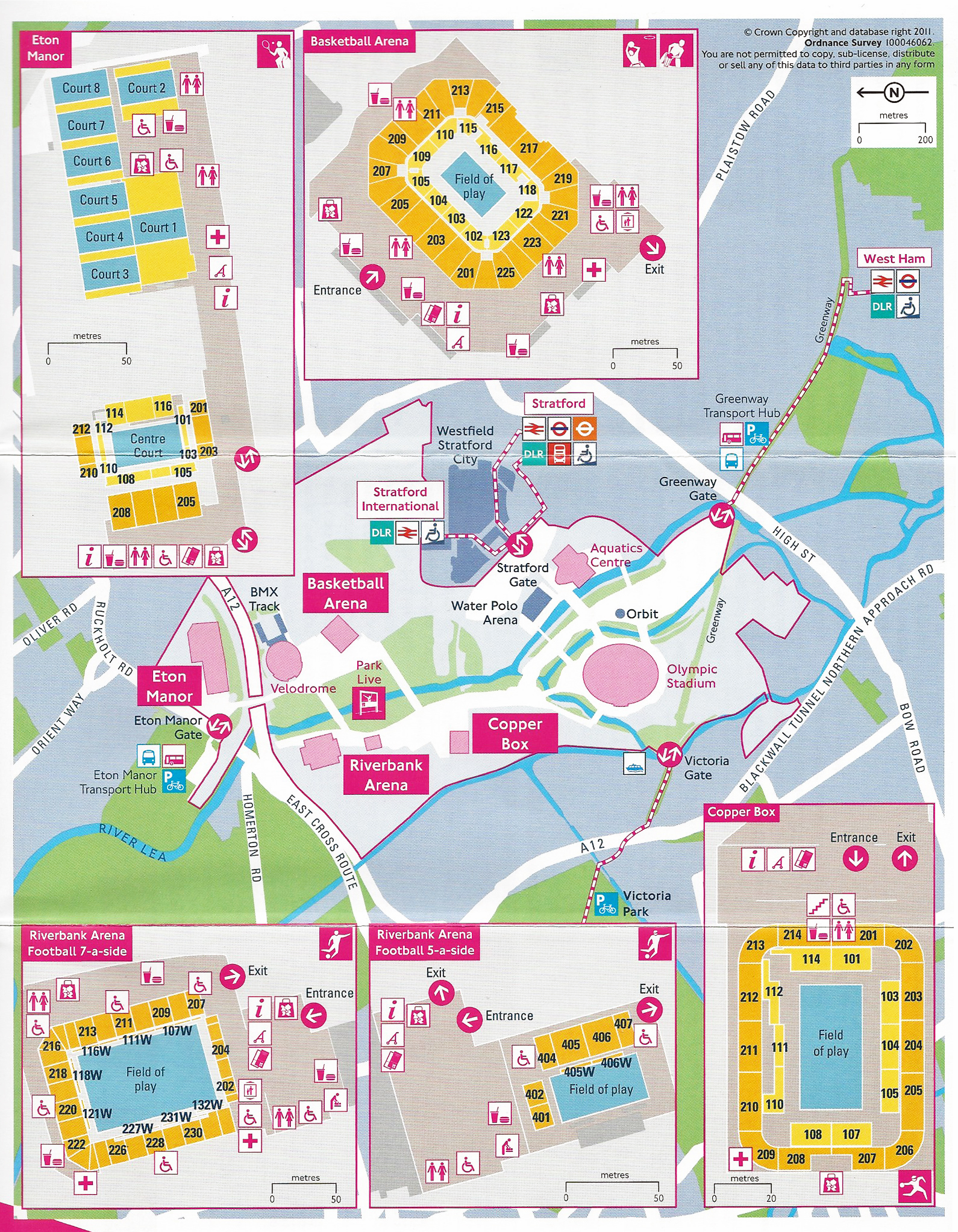
Large free map centred on Stratford and East London given free in 2012. There is a lot of detail on this map which includes the Olympic Park. 980mm x 620mm
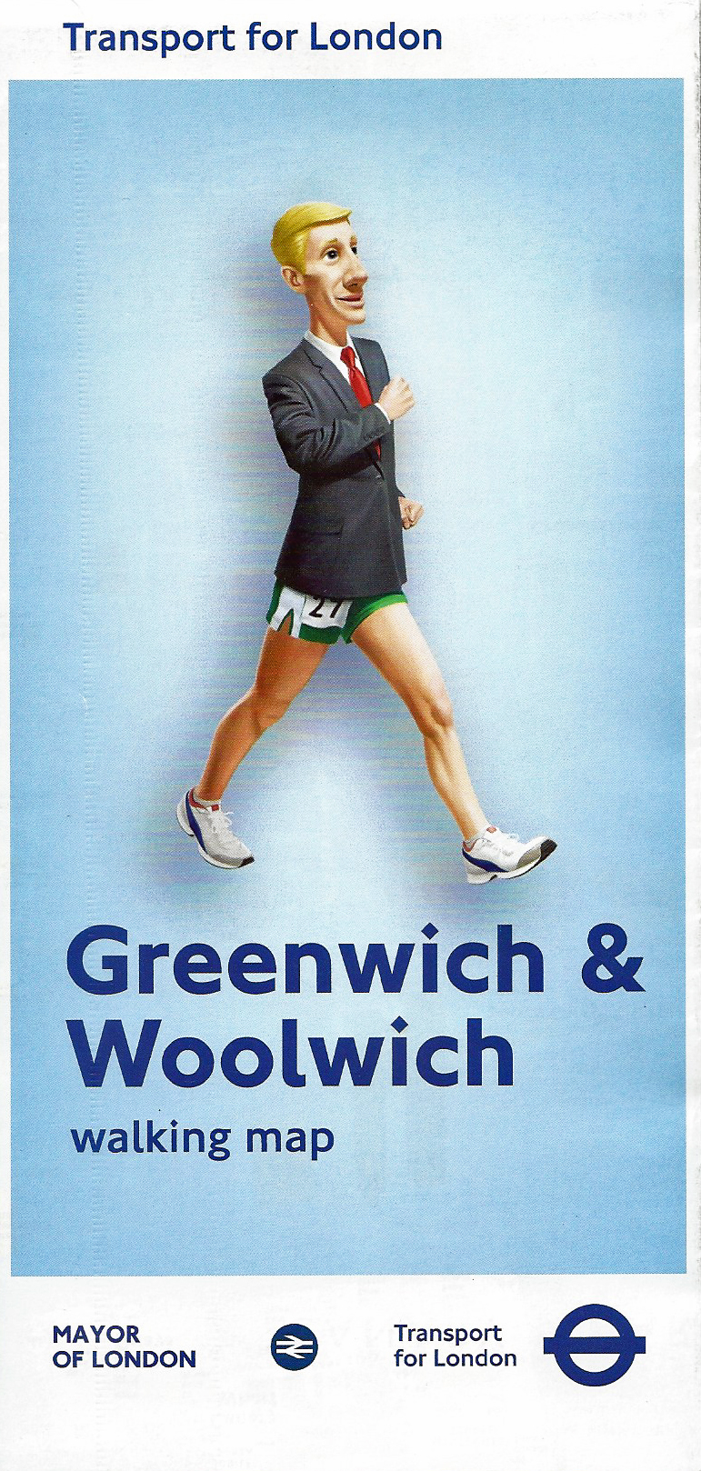
Greenwich & Woolwich map available during the 2012 Olympic and Paralympic Games. One of two larger area London maps available free of charge to the public
In addition to the eleven station maps there were two similarly promoted maps available free of charge. These covered the Greenwich & Woolwich area and Stratford & East London. The second map was especially important as it focused on an area of London historically poorly served by map makers. Each large map included a smaller reproduction of the other on its reverse.
These two specially produced complimentary maps covered parts of London that were receiving the greatest number of unique visitors, especially the Olympic Parks area in a part of London that benefited greatly from the injection of money on the back of the 2012 Olympics. Again, these maps were based on Ordnance Survey mapping and included a central London planner map on the reverse with associated travel information. These are amongst the finest of free map resources ever produced for someone intending to walk in London.
The Olympic Park:
The 2012 Olympic Park was a 2.5 square kilometres area divided into four zones: Orbit Circus, Britannia Row, World Square and The Street Market. It was a focus for anyone attending the Olympics and Paralympics and away from events themselves was where the main buzz was to be experienced.

Olympic Park map. Specifically prepared in support of the Paralympic Games that took place 29 August to 9 September 2012

Olympic Park map. Specifically prepared in support of the Olympic Games that took place 27 July to 12 August 2012
Events were screened live, music performances, street performers, street theatre, choirs, poetry and buskers abounded.
Needless to say, simple maps of the park were produced and were freely available for both the Olympics and Paralympics that followed. There was little difference in the map itself or information included. Though note the slightly differing logo used for the respective Games.
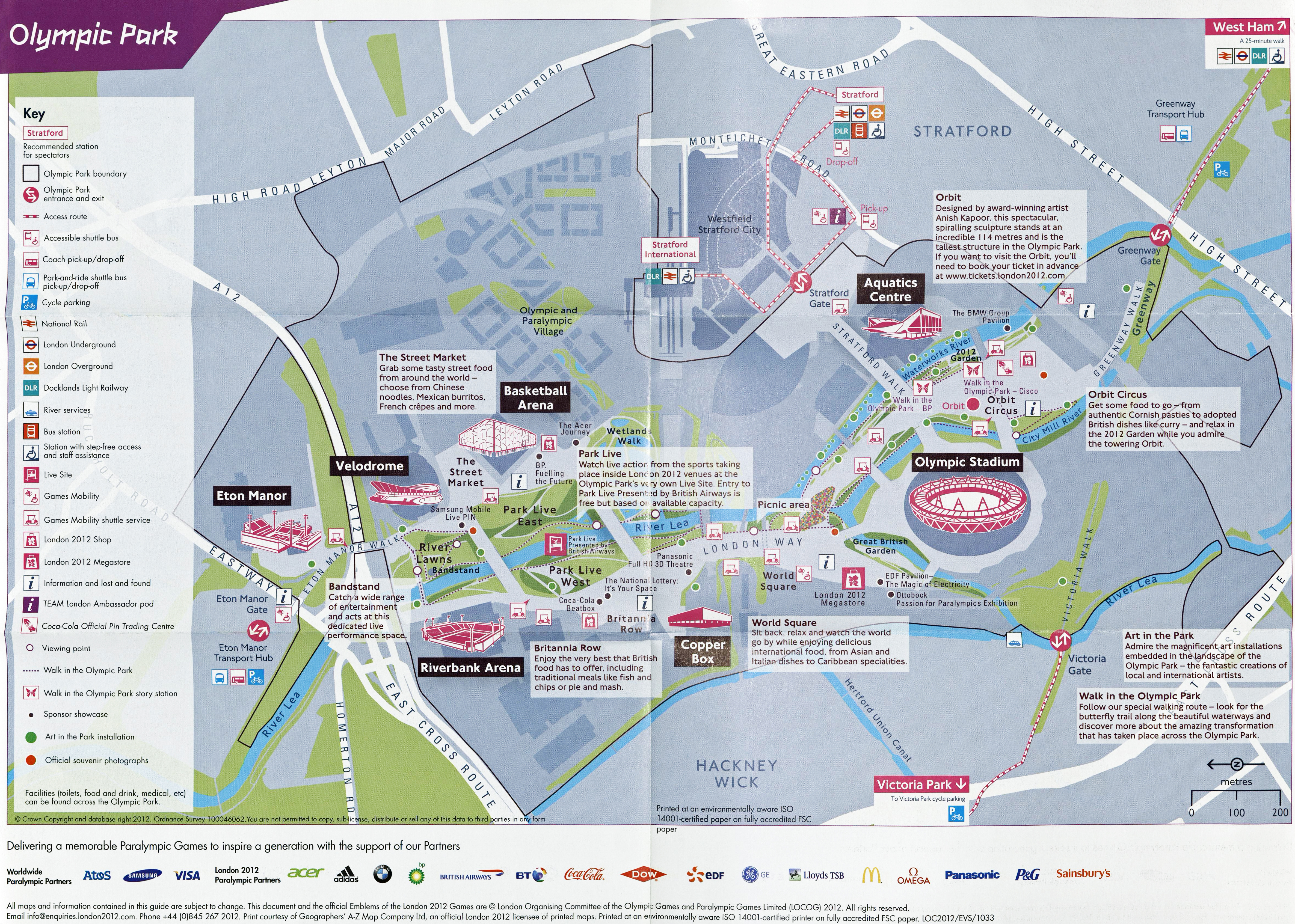
Based on Ordnance Survey mapping but including very simple detail. There is sufficient information on this map to enable those unfamiliar with maps to navigate around the 2012 Olympic Park. An identical map appeared in both Olympic and Paralympic park maps. Different Games partner sponsors were shown at the bottom. Print courtesy Geographers’ A-Z Map Company, who were an official London 2012 licensee of printed maps
Borough guides:
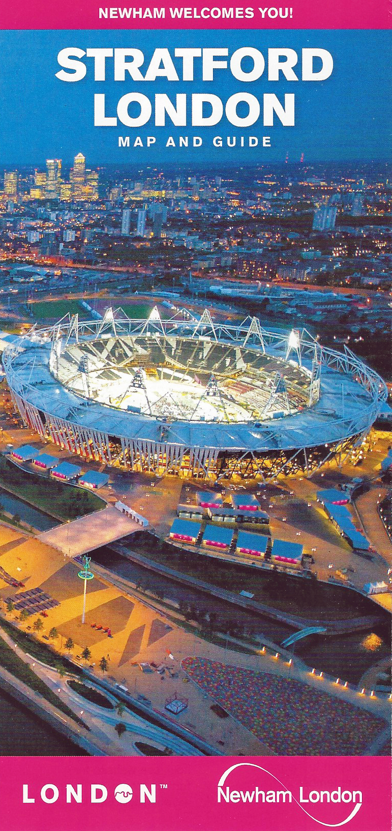
Guide to the Royal Docks and Stratford districts. Produced by Newham Borough Council, 2012
“Welcome to Stratford, gateway to the 2012 Olympic and Paralympic Games”
If ever parts of London were going to be affected by huge numbers of additional visitors in 2012, it was the six host boroughs for the Olympic events. In addition to spectators travelling to and from their chosen event, there was obviously considerable peripheral commercial opportunity.
The London Borough of Newham lies some 5 miles east of the City of London and contained most of the Olympic Park including the London Stadium. The local council produced a free leaflet of Stratford and Royal Docks London ‘setting out their wares’.
The map makers have, as usual, removed helpful street naming for the sake of simplicity. This design brief aids the pedestrian visitor in accessing their sporting venue, but also directs them to the commercial outlets within the borough.
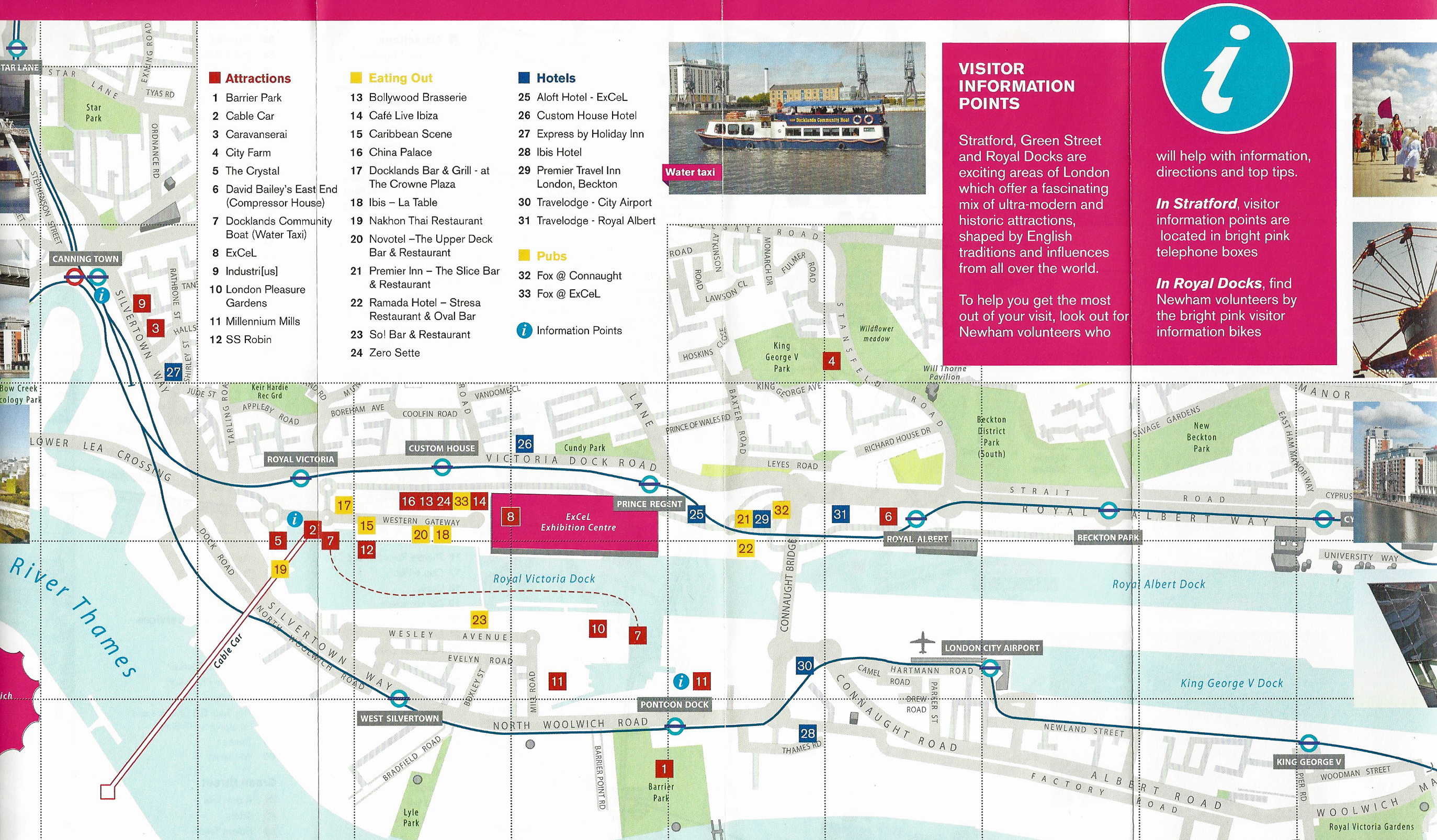
Detail from 2012 Newham Council leaflet showing the included map of Royal Docks London. This includes detail on the Excel centre, which hosted the largest cluster of Olympic and Paralympic events outside the Olympic Park, including boxing, judo, fencing and table tennis
In addition to the maps available for free to the public there were official maps produced and supplied to support staff, media and the athletes themselves. The Olympic/Paralympic Village at Stratford had its own map showing locations of transport, shopping and post office.
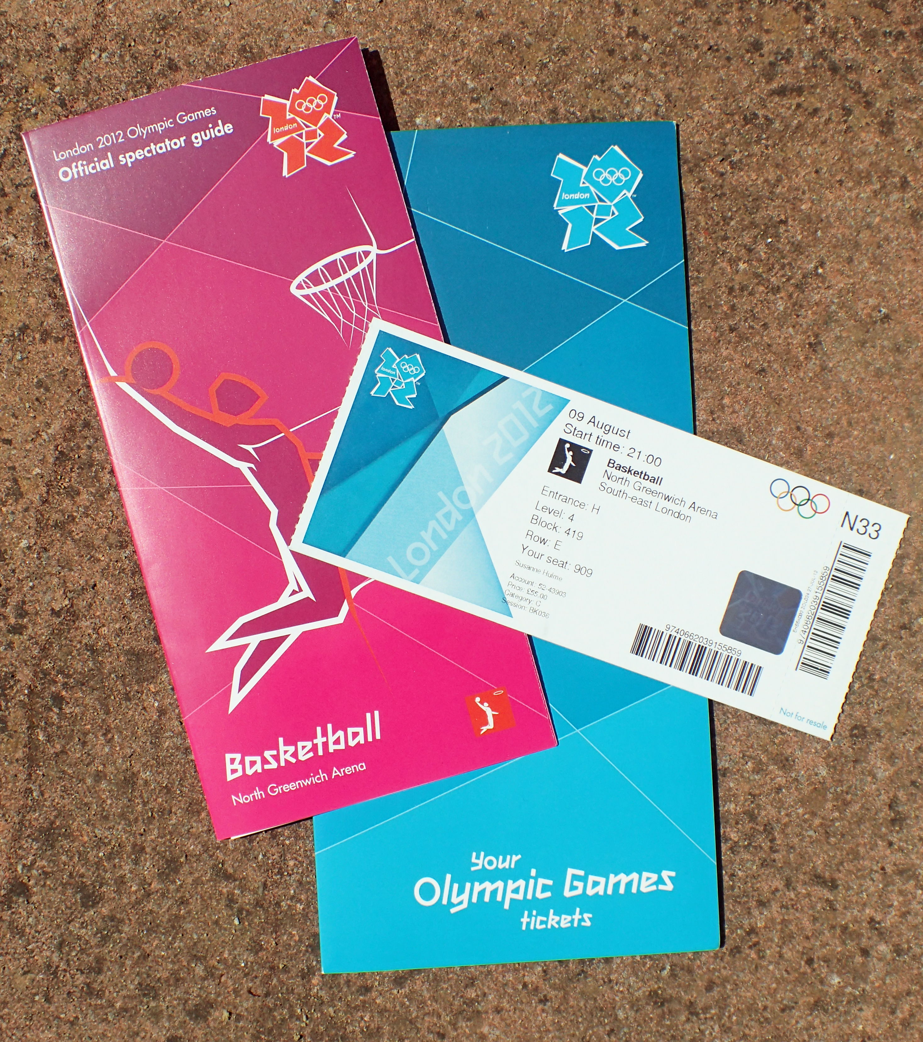
Ticket pack sent to someone fortunate enough to have gained a ticket to an Olympic event. This ticket to the Basketball taking place at the North Greenwich Arena includes a street map to the locale
It is astonishing that so many free maps were produced in conjunction with the 2012 Olympics. There had never been anything like this produced before. The closest historically has been the many bus and tube maps that could also be used for walking the London streets and parks however those have been specifically aimed at providing travel information and the pedestrian has suffered as a result. Anyone visiting London during 2012 with the aim of exploring the capital by foot was well served. And it didn’t end there, people attending the many sporting events were also aided by free maps. Individuals that had been successful in obtaining a ticket usually had an event guide included with the ticket posted to them.
Event maps:
Fifty-one official event guides for spectators for the various Olympic sporting events, taking place in London and elsewhere, were produced and distributed free of charge in 2012. Despite being small and very simple in their design, omitting considerable street detail, the small individual paper guides, with accompanying map where necessary, would have been of immense help in guiding spectators to their event. The list is long but it is included for completeness below.
Olympic Event guides:
Archery (Lords Cricket Ground), Athletics (Olympic Stadium), Badminton (Wembley Arena), Basketball (Basketball Arena), Basketball (North Greenwich Arena), Beach Volleyball (Home Guards Parade), Boxing (ExCel), Canoe Slalom (Eton Dorney), Canoe Sprint (Eton Dorney), Closing Ceremony (Olympic Park), Cycling (BMX- Olympic Park), Cycling (Mountain Bike- Hadleigh Farm), Cycling (Road: Road Race- Box Hill), Cycling (Road: Road Race- The Mall), Cycling (Road: Time Trial, Hampden Court Palace), Cycling (Track- Olympic Park), Diving (Olympic Park), Equestrian (Eventing, Dressage, Jumping, Greenwich Park), Equestrian (Eventing: cross-country, Greenwich Park), Football (City of Coventry Stadium), Football (Hampden Park, Glasgow), Football (Millennium Stadium, Cardiff), Football (Old Trafford, Manchester), Football (St James’ Park, Newcastle), Football (Wembley Stadium), Fencing (ExCel), Gymnastics (Artistic, Trampoline- North Greenwich Arena), Gymnastics (Rhythmic- Wembley Arena), Handball (Basketball Arena, Olympic Park), Handball (Olympic Park), Hockey (Olympic Park), Judo (ExCel), Marathon and Race Walk (The Mall), Marathon Swimming (10Km- Hyde Park), Modern Pentathlon (Copper Box, Olympic Park, Aquatics Centre, Olympic Park, Greenwich Park), Modern Pentathlon (Riding and Combined Event- Copper Box Olympic Park, Aquatics Centre Olympic Park, Greenwich Park). Opening Ceremony (Olympic Park), Olympic Park, Rowing (Eton Dorney), Sailing (Weymouth), Shooting (Royal Artillery Barracks), Swimming (Olympic Park), Synchronised Swimming (Olympic Park), Table Tennis (ExCel), Taekwondo (ExCel), Tennis (Wimbledon), Triathlon (Hyde Park), Volleyball (Earls Court), Water Polo (Olympic Park), Weightlifting (ExCel), Wrestling (ExCel).
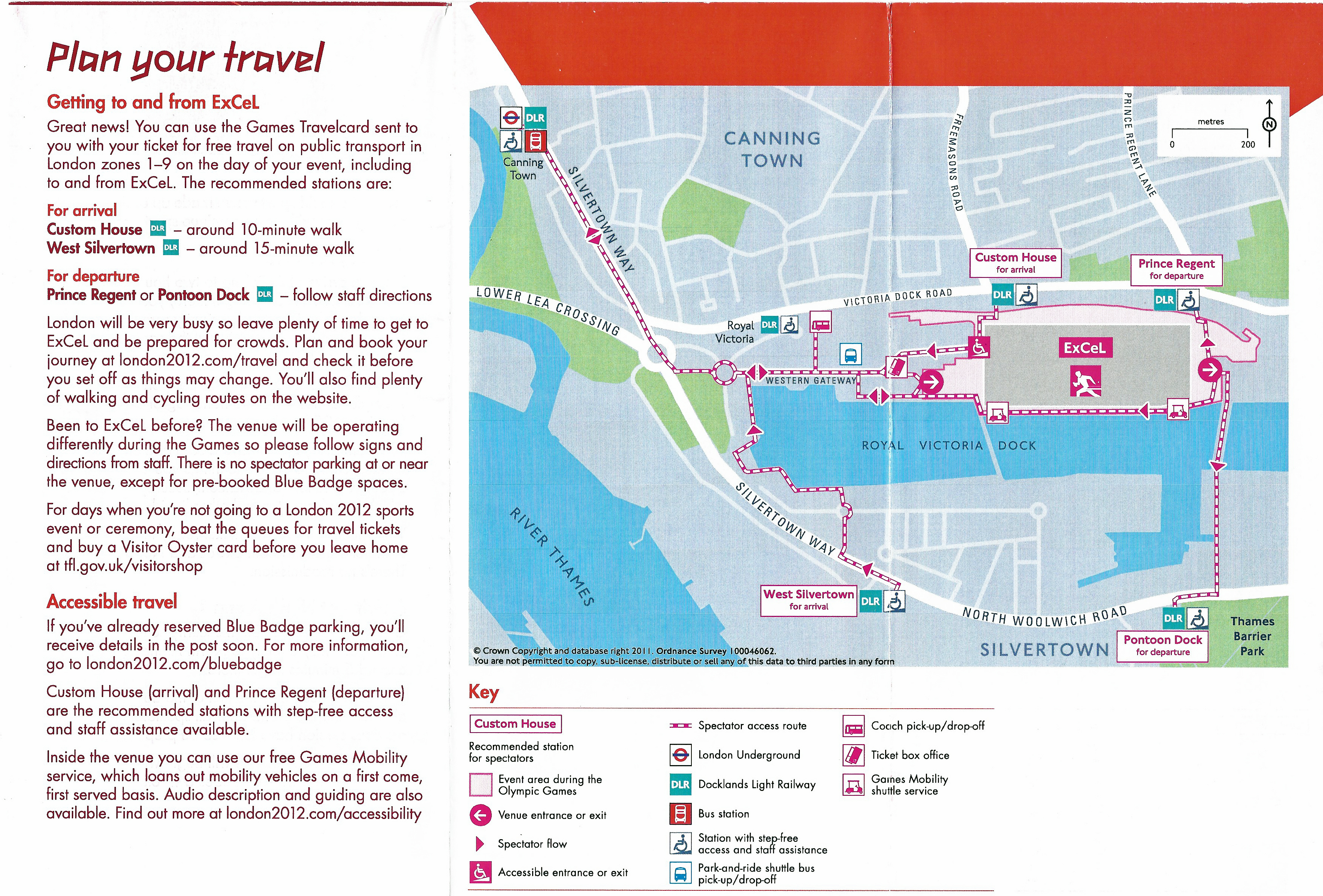
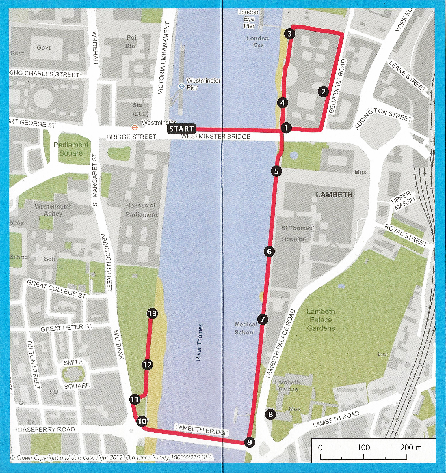
Every ticket holder for the 2012 Olympic Games was provided with an ‘Official spectator guide’ that included a simple street map to the event location. This is the map for the Table Tennis competition held at the ExCel North Arena 1 that took place 28th July – 8th August 2012. Map based on 2011 Ordnance Survey mapping.
Paralympic Event guides:
Free map sent to holders of tickets for Paralympic events taking place in the Olympic Park. The park was large and much of the layout temporary for the games themselves. 2012
In addition, there were 13 official Paralympic spectator guides produced, again, taking place in London and elsewhere. These included park and stadia maps etc. where necessary. These were:
Athletics (Olympic Stadium, Olympic Park), Closing Ceremony (Olympic Stadium, Olympic Park), Cycling (Road: Brands Hatch), Cycling (Track: Velodrome, Olympic Park), Equestrian (Greenwich Park), Excel Centre (for Boccia, Judo, Powerlifting, Sitting Volleyball, Table Tennis and Wheelchair Fencing), Marathon (The Mall), Opening Ceremony (Olympic Stadium, Olympic Park), Olympic Park (for Football Five-a-Side, Football Seven-a-Side, Goalball, Wheelchair Basketball, Wheelchair Rugby, Wheelchair Tennis), Rowing (Eton Dorney), Swimming (Aquatics Centre, Olympic Park), Shooting and Archery (Woolwich Artillery Barracks), Wheelchair Basketball, (North Greenwich Arena).

Small fold out maps from the pocket guide given to the many thousands of accredited individuals attending the 2012 Paralympics. Adapted from Ordnance Survey mapping and produced by the London Organising Committee of the Olympic Games and Paralympic Games Limited
It wasn’t just the spectators that were attempting to get to each sporting venue, many by foot. There was also media, officials, support staff and the athletes themselves. Almost every tranche had their own published guide on location, facilities, transport arrangements and many of these free resources also contained a map of respective locations.
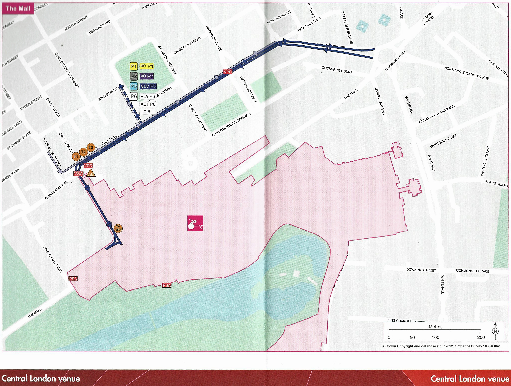
Street map of The Mall central London sporting venue. Based on 2012 Ordnance Survey mapping. Pages 61-62 from the 98 page Athletes’ transport guide, published by the London Organising Committee of the Olympic Games and Paralympic Games Limited, July 2012
The considerable number of guides and publications that were produced and distributed included pocket guides for accredited individuals and a large ring bound guide detailing transport arrangements for athletes. Every event venue and the lesser known training locations had an immediate area street map produced. The hundreds of guides produced in association with the 2012 Olympics and Paralympics resulted in the largest ever distribution of maps, many free, to aid people in walking in London. It is quite phenomenal how many were produced.
This concludes this brief glance at some of the free paper maps produced for those visiting London over the decades. Today, most visitors intending to walk the London streets and parks will very likely place their faith on what is available online. A shame, as there is something tangible in using a well produced map and having the ability to see the ‘bigger picture’- not being confined to the dimensions of a phone screen. Discovery is as much a part of exploration as anything else. The relation of place to place is how one truly understands London.
The previous three blogs in this short series can be found at-
Part One: Free maps for exploring London by foot
Part Two: Free maps produced by Transport for London
Part Three: Free maps produced for Royal occasions
