
Three Points of the Compass recently looked at the FREE paper maps that have been available for those wishing to explore London by foot. Most commonly encountered amongst these were the large number produced by the various organisations responsible for transport in London.
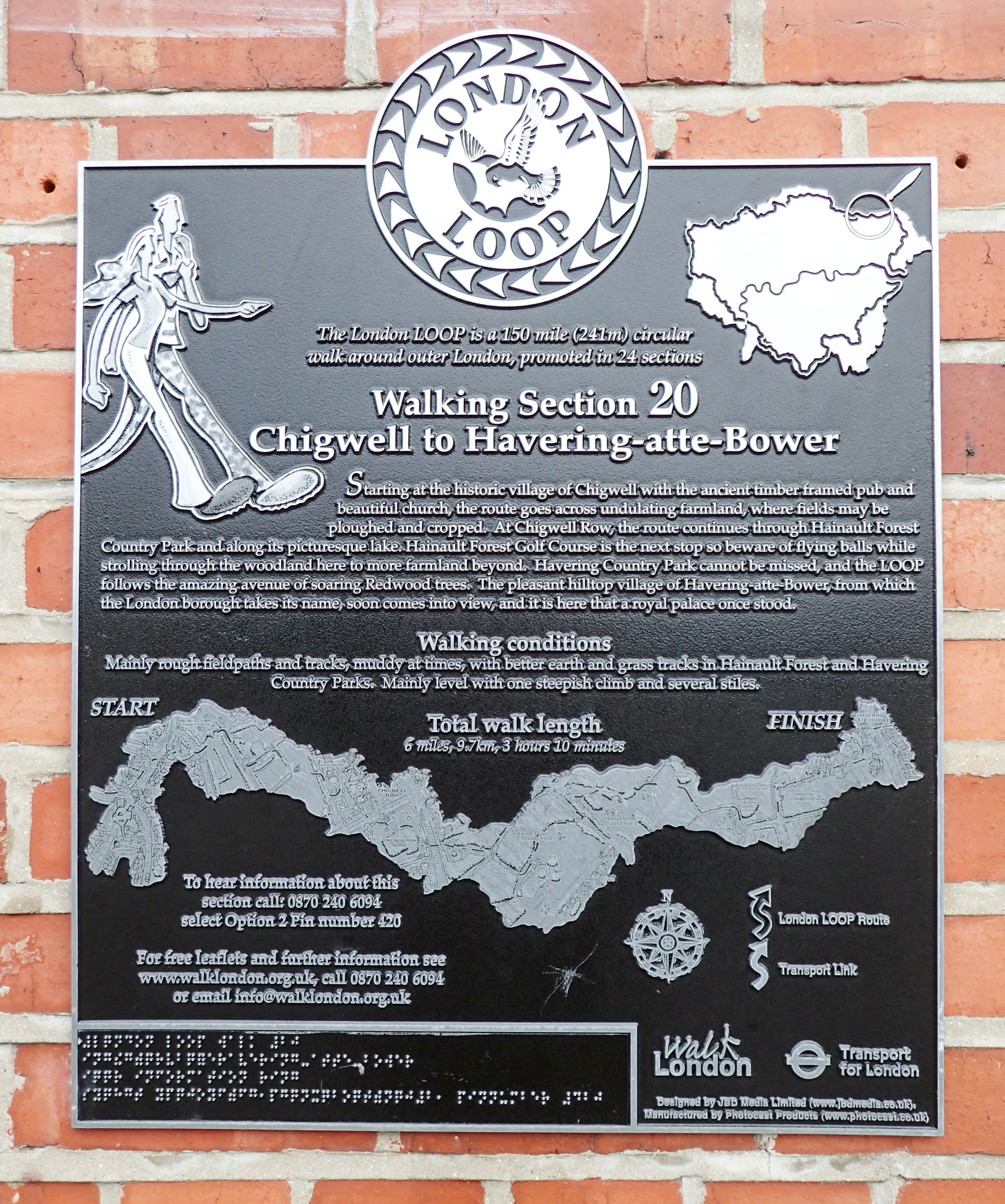
TfL also support and promote various long distance walks around and through London. Three Points of the Compass walked the London LOOP in 2016, utilising various TfL transport links to do so
With the devolution of government for London, Transport for London (TfL) was formed and from 3 July 2000 became responsible for most bus and many rail transport routes across London. The London Underground, more commonly known as the Tube, passed to TfL control in 2003. TfL also controls London trams, taxis, cycle provision, travel by river and other services. These included the UK’s first urban cable car which opened in June 2012, connecting the Greenwich Peninsula with the Royal Docks. Historically, many of the free paper maps produced by TfL since 2000 have also proved useful for walking or were specifically aimed at those preferring to explore London under their own steam.
Note that this is a retrospective glance at what has been produced by TfL over the years and many of those shown below are now unobtainable.
Click on any image to enlarge it.
London buses
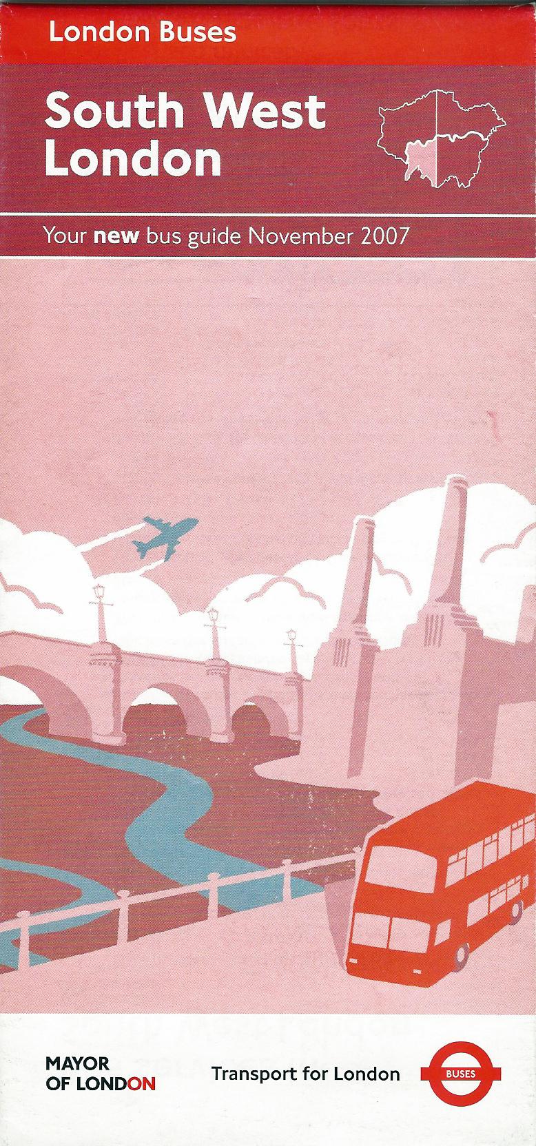
Free Transport for London bus guide for South West London, November 2007
Of all the free maps that have been available over the decades, amongst the most suited for walking in London have been those produced by the bus companies. The London bus guides produced by TfL have continued this trend. Unlike many parts of the UK, almost all of London continues to enjoy an excellent bus service.
TfL divided London into four quarters and produced a large guide- 990mm x 625mm. While some minor street detail is excluded these have been one of the best free map resources ever produced for exploring London by foot. Each of them also shows central London.
While these in no way equal the better maps produced covering London such as those by Ordnance Survey, these paper maps encompass outskirts barely covered by other printed free resources. With these four maps it would be perfectly possible to explore almost all of London.

Free Transport for London bus guide to services in South West London. There are thirteen maps spread across the two sides of this map- eleven small, local area maps, a small scale map of south-west London and a large scale map of central London, a small part of which is shown here. Map drawn October 2007. Printed November 2007
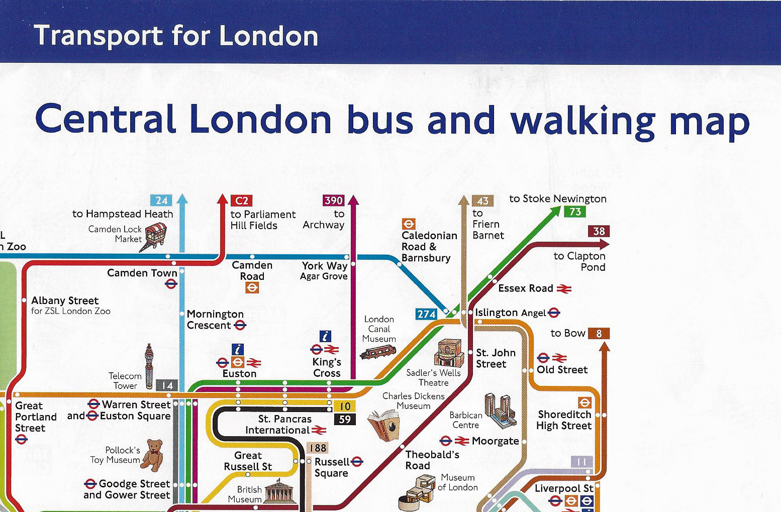
Folded TfL Central London bus and walking map. Too large to be pocket sized, it appears that the designers failed to properly complete a good idea. 2017
TfL have also produced a bus map specifically aimed at those walking in London. Their Central London bus and walking map included a map of key bus routes in central London on one side and a simple street map on the other.
While limited in range and excluding considerable street detail, that the TfL map makers obviously felt irrelevant, the free map does show the most direct and easiest routes to walk between locations. A basic guide on how long it will take to walk between points on the map is included.
One of the two maps included on TfL’s Central London bus and walking map. October 2017
London Underground
Special TfL Tube map produced for an event in London. July 2005
While the constantly updated map, or diagram, for the London Underground is an icon in itself, it purposely distorts geography in order to perform better in use whilst travelling by Tube. As such, TfL Tube maps are little use for walking though some attempt has been made in recent years to improve that to a degree. I will return to these changes at the end.
Every now and then London can be swamped by visitors and the public transport system can struggle to cope. Special instructions on getting around with accompanying maps were produced by TfL for New Year celebrations, especially on the Millennium when even greater numbers packed central London to watch the fireworks along the River Thames.
Some Tube maps have been produced by TfL for special events where a large influx of visitors unfamiliar with specific parts of London have been expected. This is both a responsible act by TfL and advisable, funnelling people by the best, or most appropriate route, and reducing strain on the transport network.
TfL excel at this, having control over the various transport options in London, there is no commercial competition swaying the advice provided. Such maps would be welcome but are only of use for walking in the immediate vicinity of event locations.
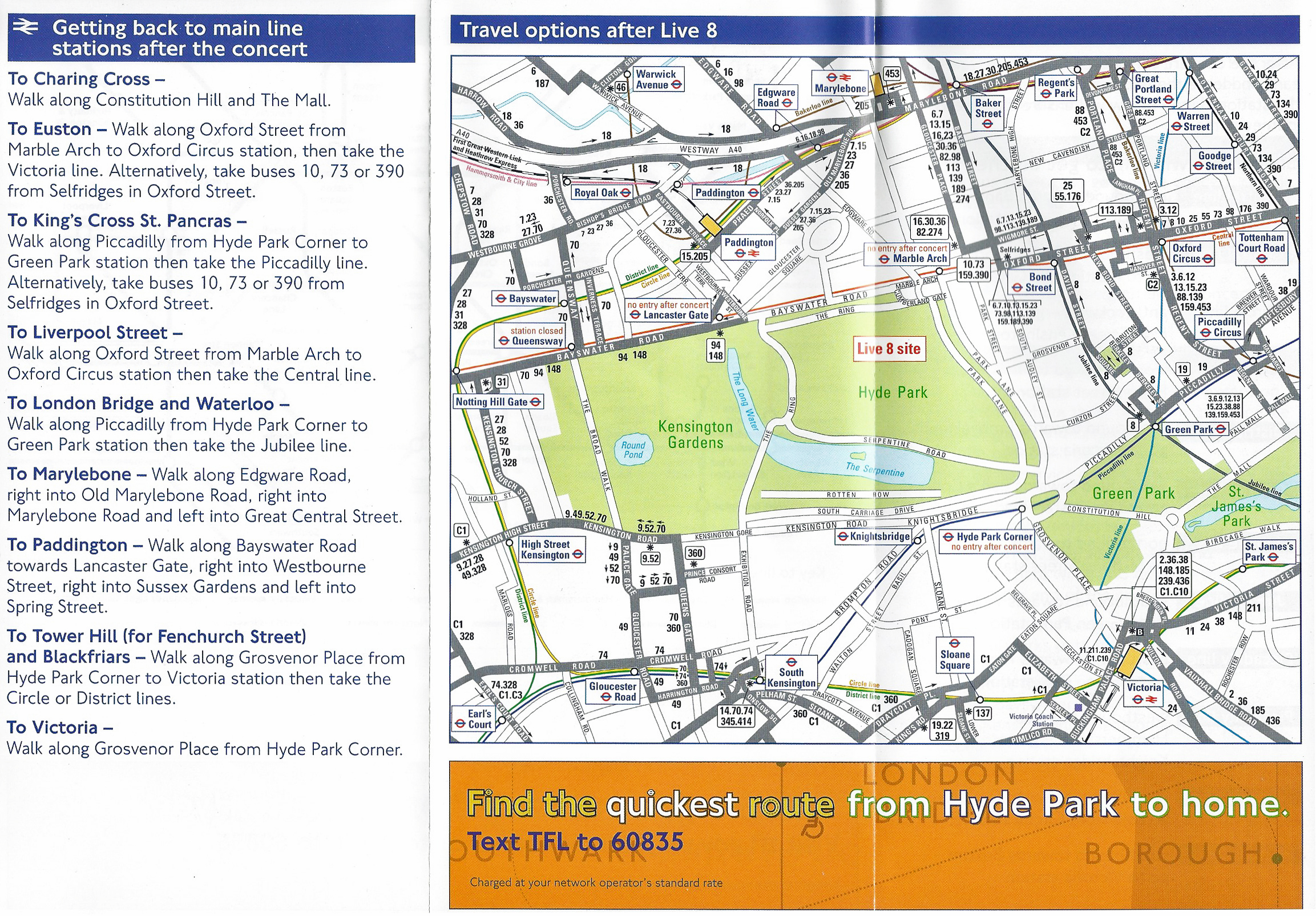
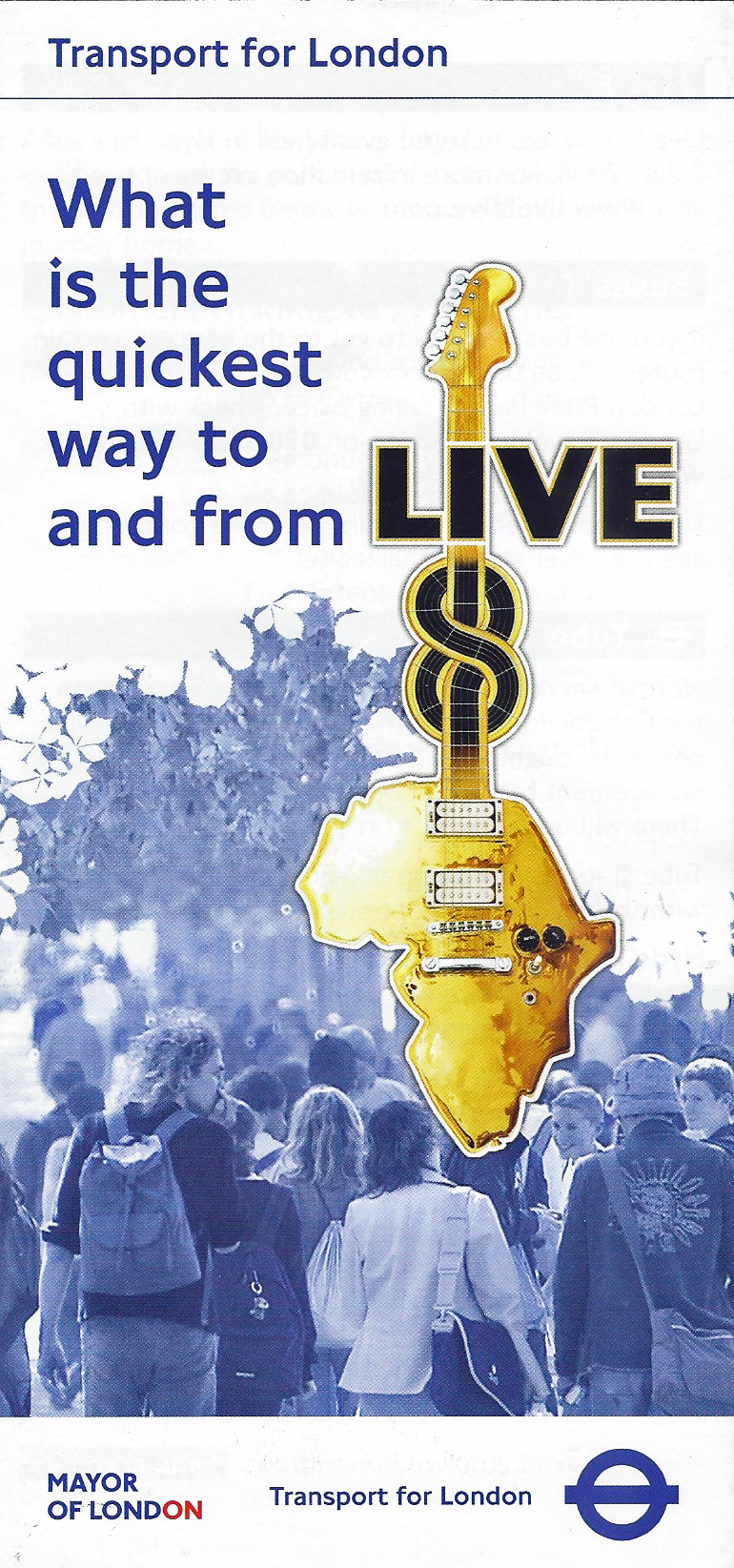
Live 8 was a free ticketed music event held in Hyde Park on 2 July 2005. TfL produced a free transport guide and map for attendees. 2005
Soon after their creation, Transport for London began to produce paper maps showing the immediate area around each of their underground stations. It was usually possible to pick these maps up in the station itself and were of immense help to those arriving at an unfamiliar station who needed to quickly orientate themselves and walk to a local destination. However the area shown is not large. The Debden map shown here only escorts the walker some 3/4 km in any direction.
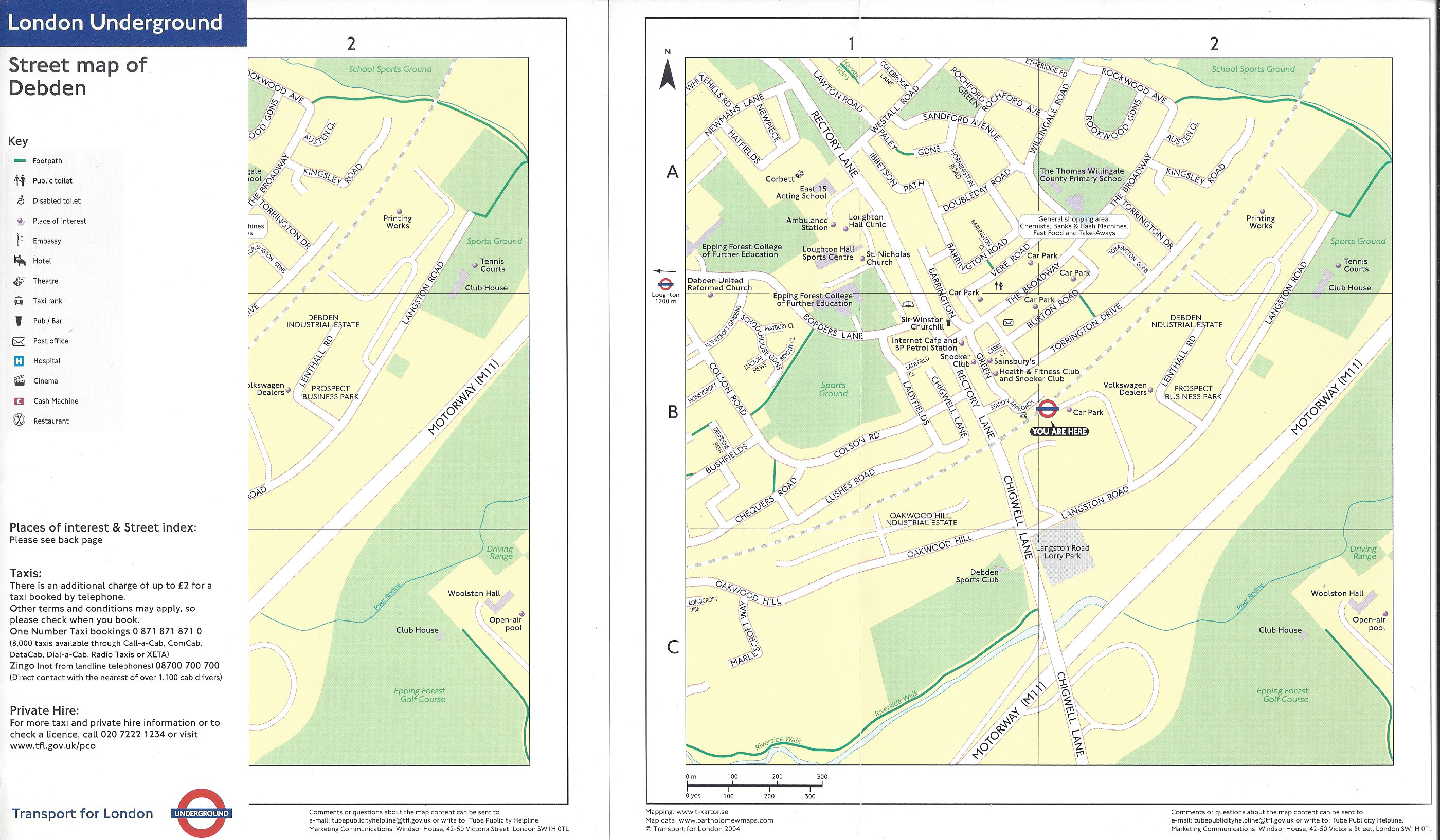
Two identical TfL produced maps showing the streets close to the Debden station, on the Central Underground line. Folded on left and open on right. 2004
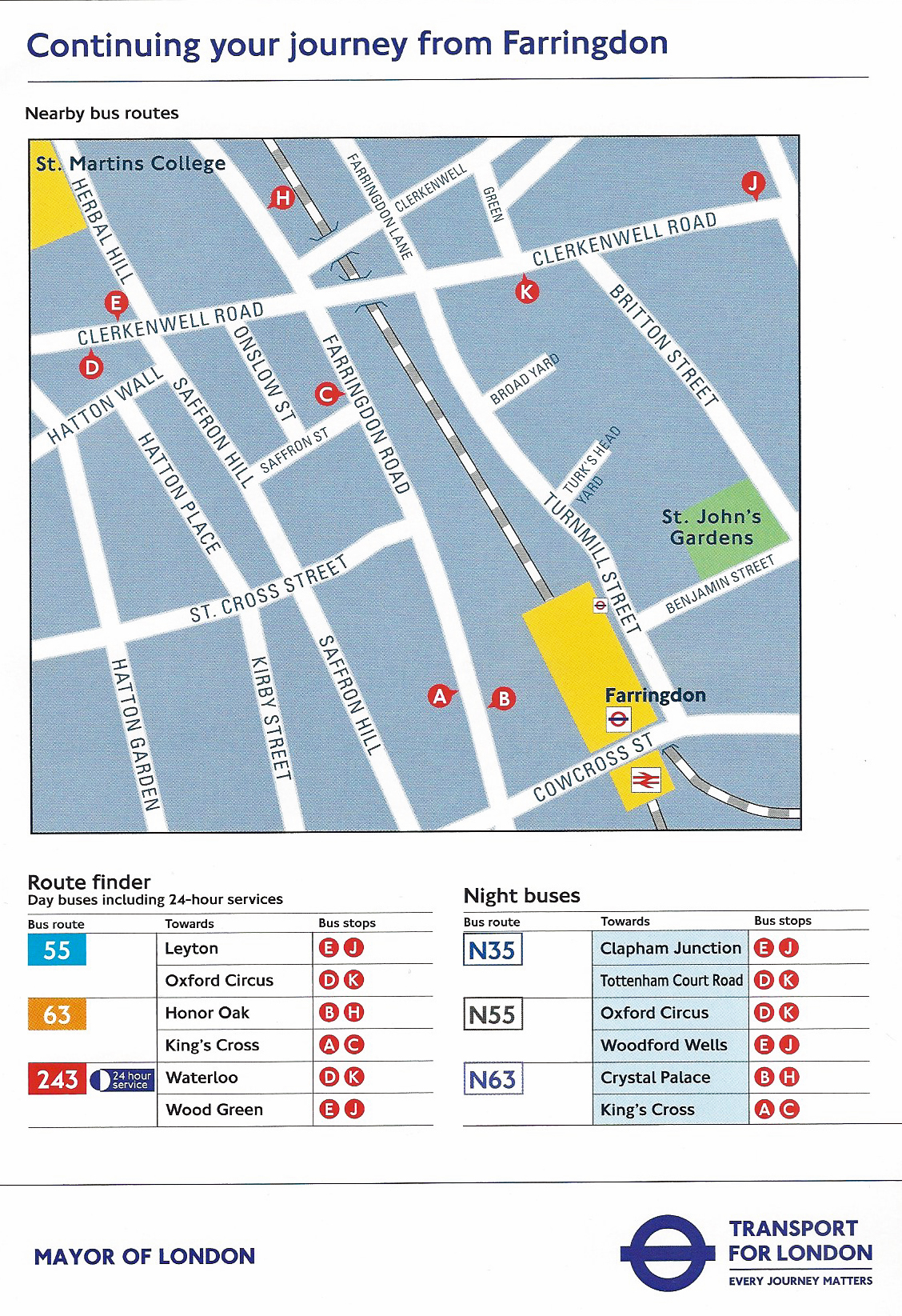
‘Continuing your Journey’- Front cover of free paper map showing the streets and transport links around the Farringdon station. 2016
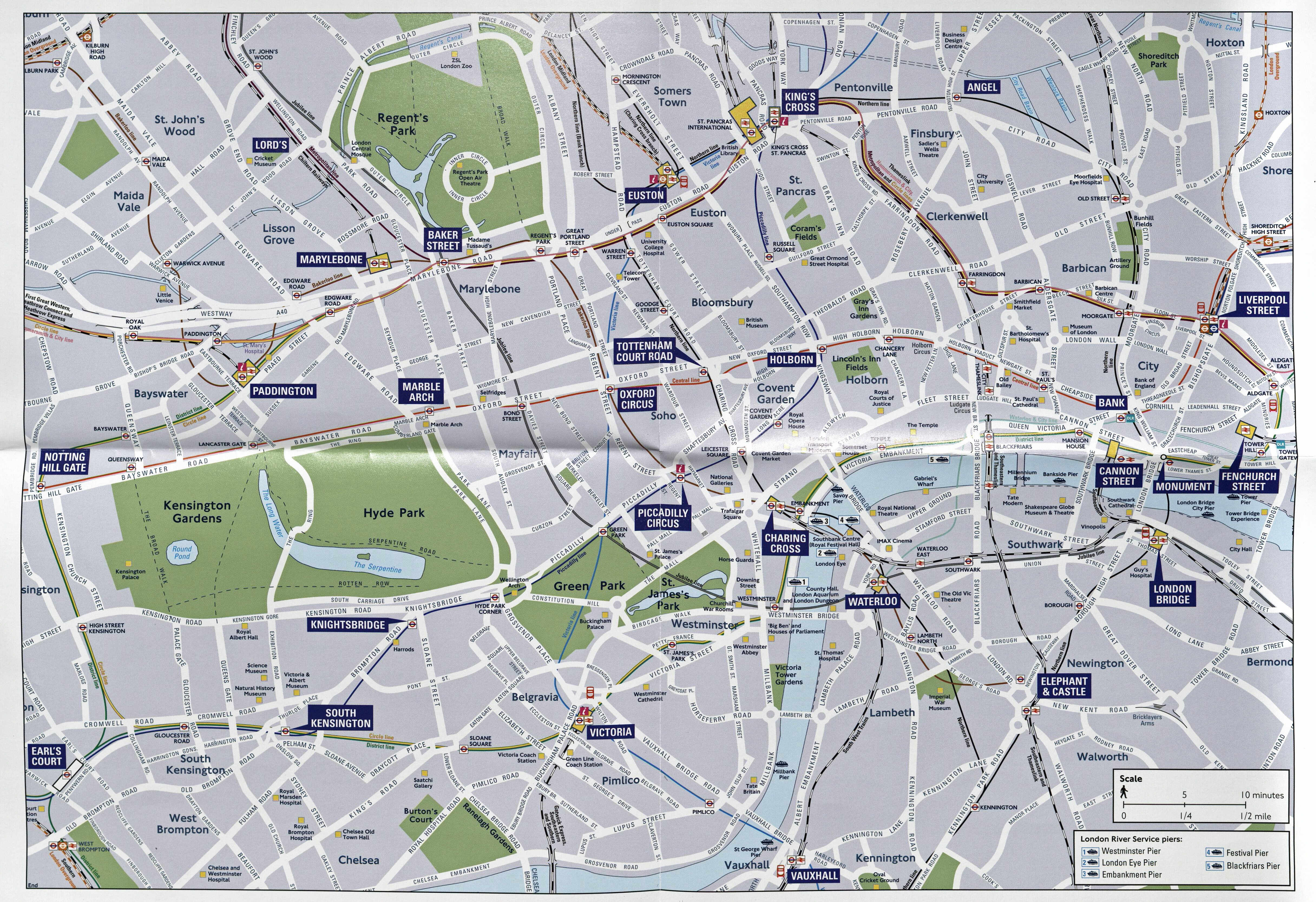
At some point TfL switched from map detail obtained from Bartholomew to that produced by the Ordnance Survey. The production of local maps by TfL improved greatly since those first offered free of charge to the travelling public. Frequently, not only are local transport links shown, but also places of interest. An indication of time to walk a distance are also often now included. ‘North’ is also shown.

Legible London map. opposite St. Paul’s Cathedral, London
The maps are also shown on large posters on station concourses. The paper maps themselves can be freely picked up by anyone entering the station and there is no need to cross the ticket barrier.
The maps are very similar to those introduced in 2007 and found at street level across London as part of the Legible London scheme.
The paper maps are quite expensive to produce and Three Points of the Compass does wonder how long TfL will persist in providing them.
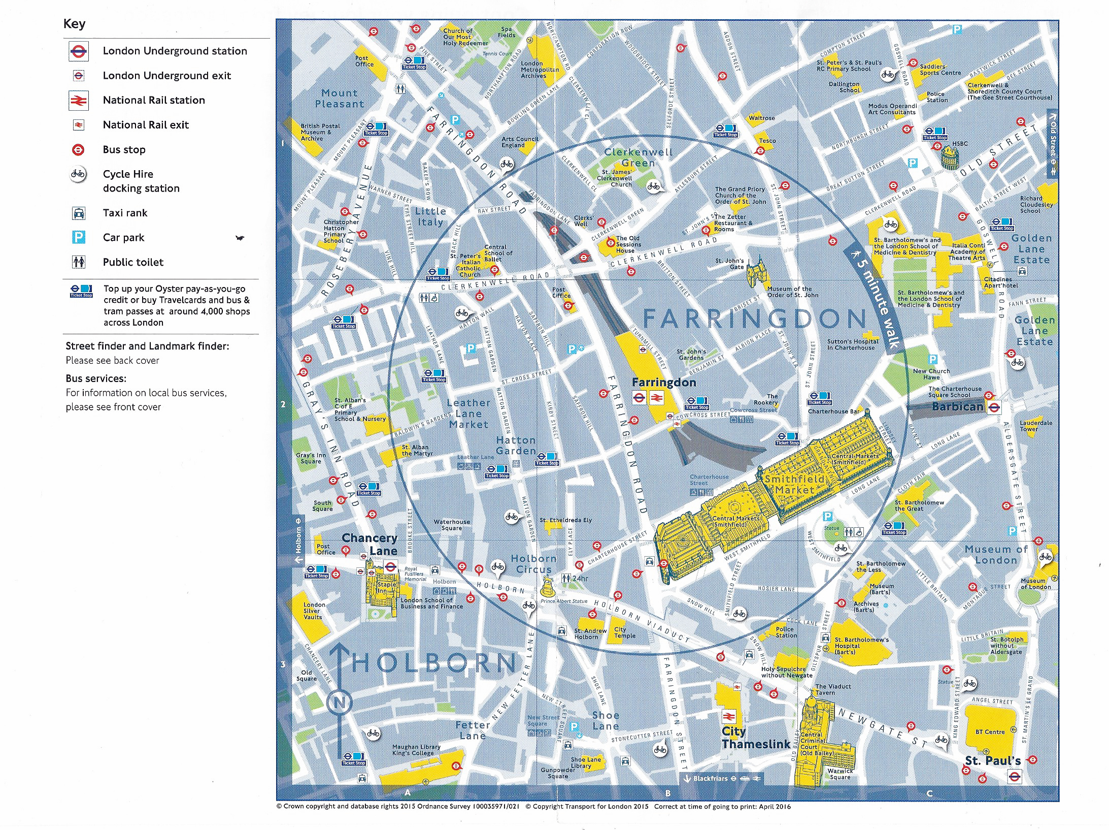
‘Continuing your Journey’- centre pages of map freely available for travellers on the London Underground. Based on Ordnance Survey mapping. April 2016.
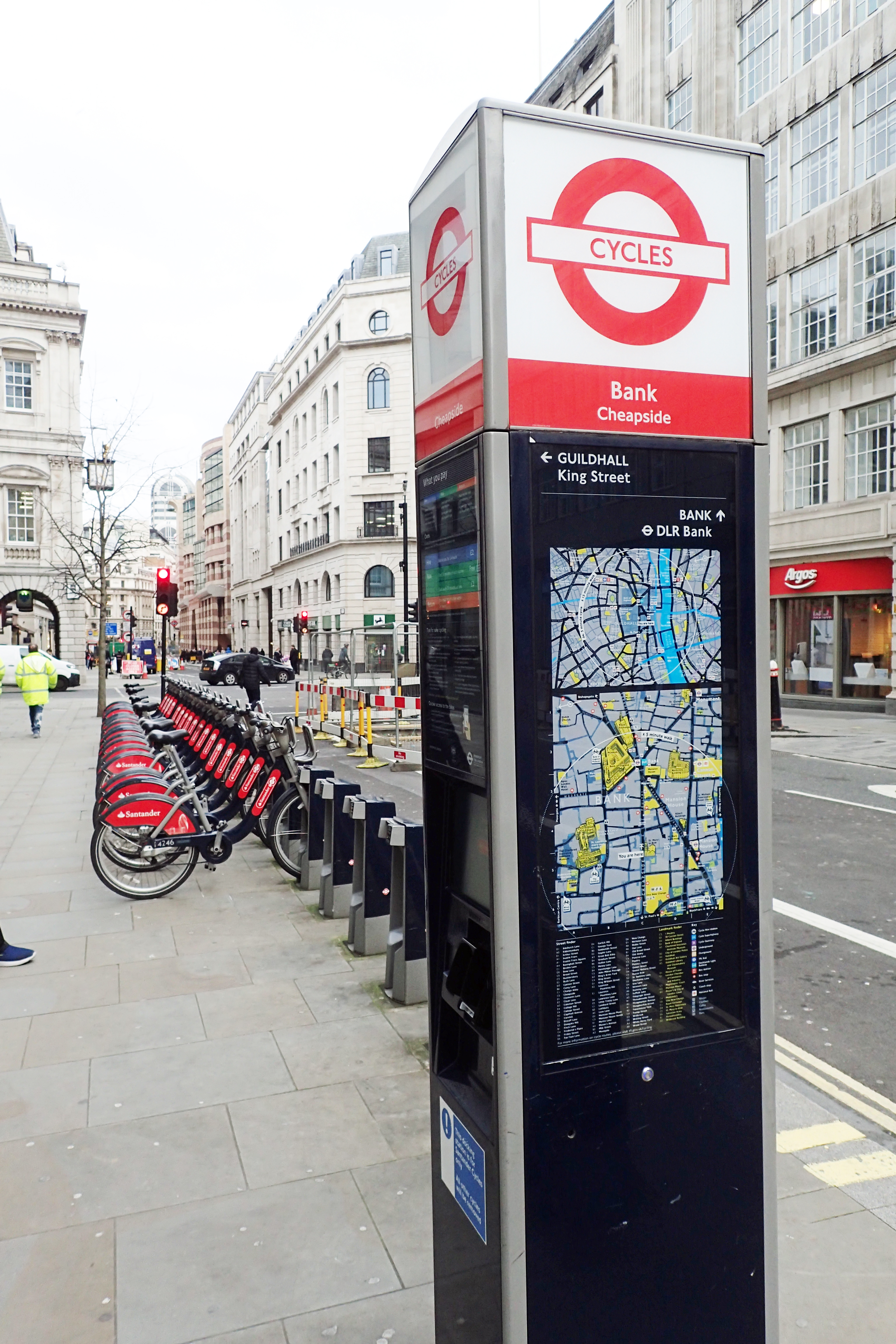
Santander Cycles hire docking station. Cheapside, London. Photographed 2020
Cycle hire
From July 2010 6000 bicycles were available for short term rentals from 400 docking stations in central London. This was a joint initiative- promoted by TfL and funded by Barclays Bank. The number available via the Barclays Cycle Hire was quickly increased to 8000 cycles from 570 docking stations.
Barclays probably lamented their failure in having the new provision known colloquially as ‘Barclays Bikes’, instead the public quickly began referring to them as ‘Boris Bikes’ after Boris Johnson, the London Mayor at the time of their introduction.
The scheme, cycles and docking stations are provided and managed by PBSC Urban Solutions. Further major expansions in the scheme followed and it is now the largest cycle hire scheme in Europe with over 11000 bikes and 800 docking stations. Each docking station also has a map showing the immediate locality.
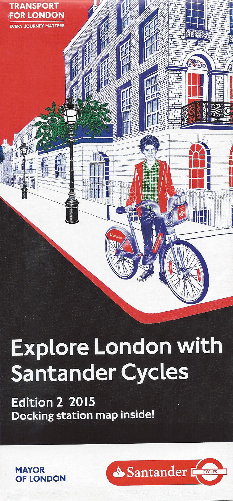
2015 Santander Cycle Hire leaflet
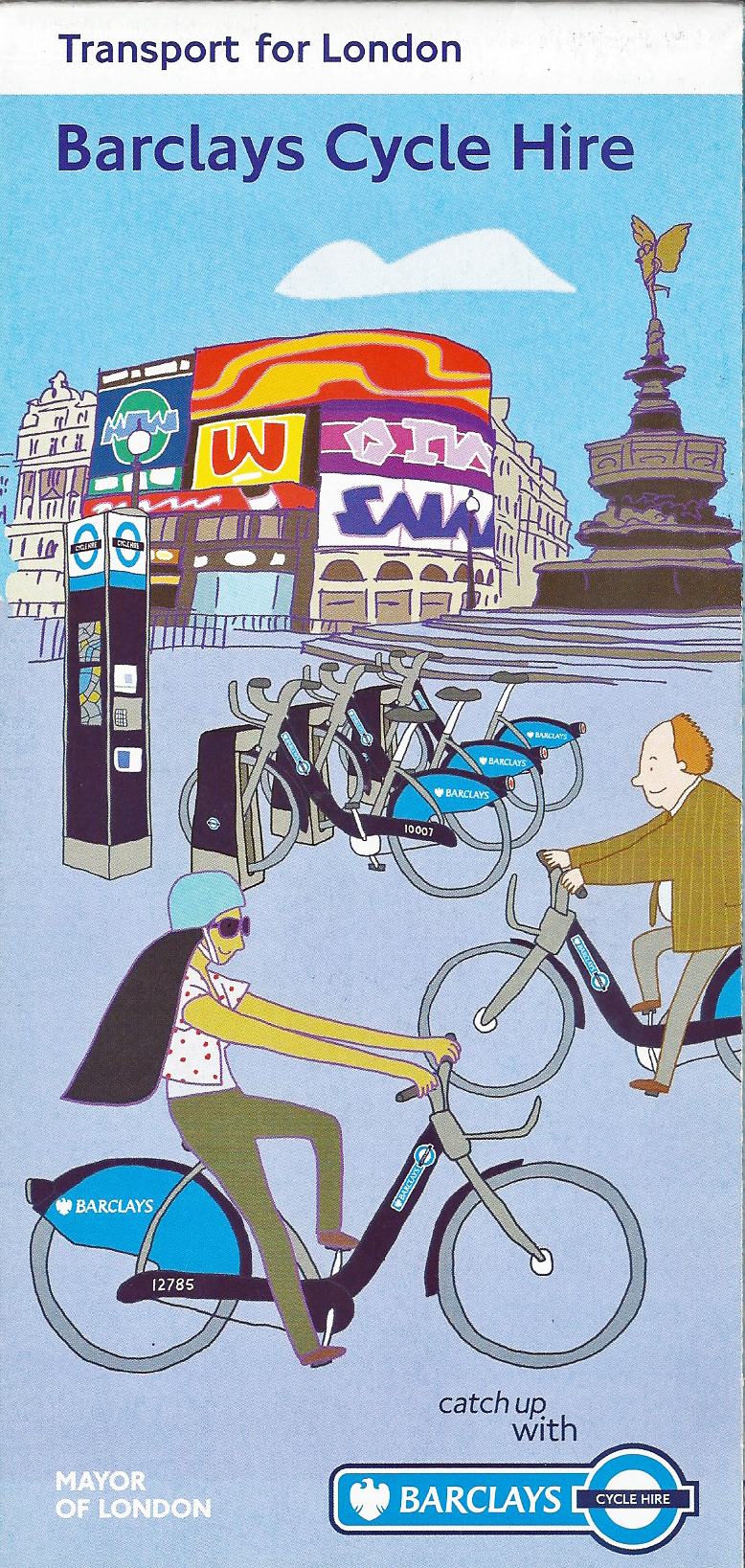
2010 Barclays Cycle Hire leaflet
Sponsorship of the scheme transferred from Barclays to Santander in 2015. Free paper leaflets were produced that explained the scheme and how to hire cycles. A good street map also showed the location of cycle docking stations.
Reflecting the large extension in the scheme in the intervening years, the paper map of the Santander Cycles provision is huge. While the TfL map for Barclays Cycle Hire measures 590mm x 420mm, the open Santander sheet measures 890mm x 625mm. This is one of the largest paper maps available, free of charge, for London. Today, most users can access an online map that provides the same detail.
Free TfL map of London streets showing Barclays Cycle Hire docking stations. 2010
Centre section from free TfL leaflet on the Santander Cycle Hire scheme. This leaflet includes a street map that is over twice as large as the Barclays Cycle map. Some street names are now omitted on this version however paths across parks are included. 2015
River Services
Thames Clipper boarding pass, 2015
TfL have not provided any maps detailing River Services, such as the Thames Clipper, that are of much use to anyone seeking to walk around London.
‘Getting around in Central London’. June 2019
The closest TfL have come was with a variant of a standard Tube map. Expanding on the handy folding, pocket sized ‘Tube Map’, another version of the standard leaflet advises on ‘Getting around Central London’ and as well as a map of the underground lines, includes both a basic map of River Services and a simple walking map with detail on the Santander Cycles, tourist route and feeder routes in central London.
While it would be difficult to fully explore central London with just this little leaflet, it actually does quite a good job of combining basic information on a handful of transport alternatives.
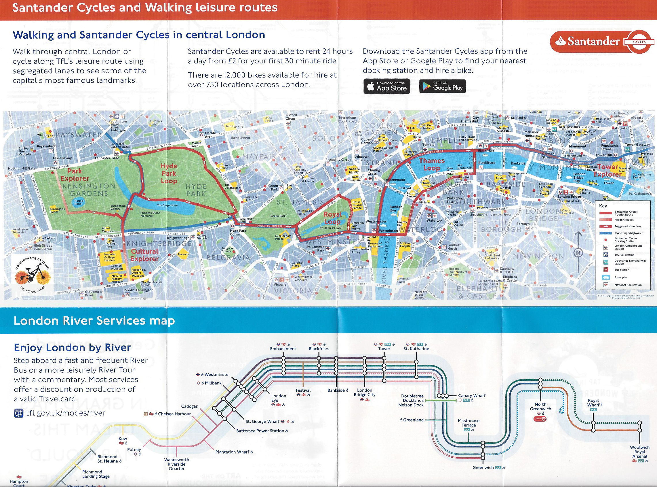
Map detail from free TfL ‘Getting around in Central London’ leaflet. June 2019
North Bank
TfL guide to walking in the North Bank area of London, 2017
TfL have also targeted pedestrians with the production of simple discreet guides to walking the streets in some London districts. The city originally formed on the north bank of the River Thames and today, centuries later, many important buildings are found there.
TfL’s 2017 guide to exploring by foot the North Bank area, taking in Charing Cross, Leicester Square and Covent Garden includes additional information on mainline rail and Tube links alongside cycle docking stations.
The map is a mixture of styles and the simple pictorial suggestions of major buildings, such as the National Gallery, Covent Garden Market and the Royal Opera House are a great aid to a tourist in identifying specific locations while surrounded by many other impressive structures dating from the 18th and 19th centuries.
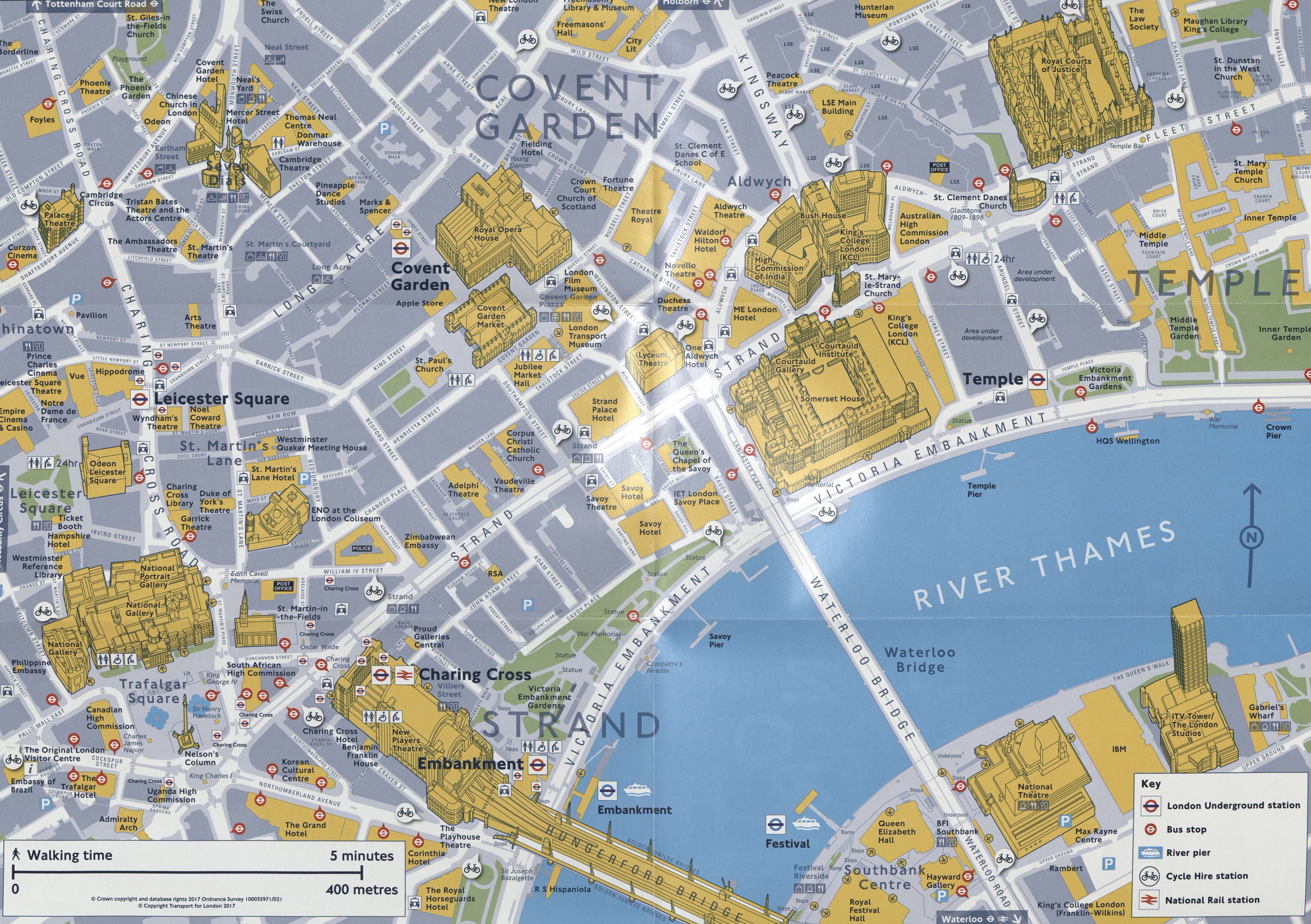
TfL’s guide to London’s North Bank truly integrates the pedestrian with the various alternative forms of transport. The guide is based on 2017 Ordnance Survey mapping with added pictorial representation of important buildings. Copyright Transport for London 2017
Emirates Air Line
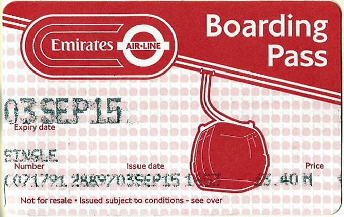
‘Boarding Pass’ for the Emirates Air-Line. 2015
The Emirates Air Line opened 28 June 2012. The kilometre long cable car service crosses the River Thames and connects the Greenwich Peninsula, home of the 02 indoor shopping, dining and entertainment centre with the Royal Victoria Docks, site of the ExCel convention centre. The cable car route was immediately added to the Tube map however, as previously mentioned, Tube maps are of little use to those walking in London. Paper maps showing the area local to each cable car station were produced but are minimal in useful navigation detail. Though an enjoyable ride, the cable car ride has never seen much use, linking two parts of London that are perhaps better served by other means. The number of people travelling can be less than a thousand a day on occasion.
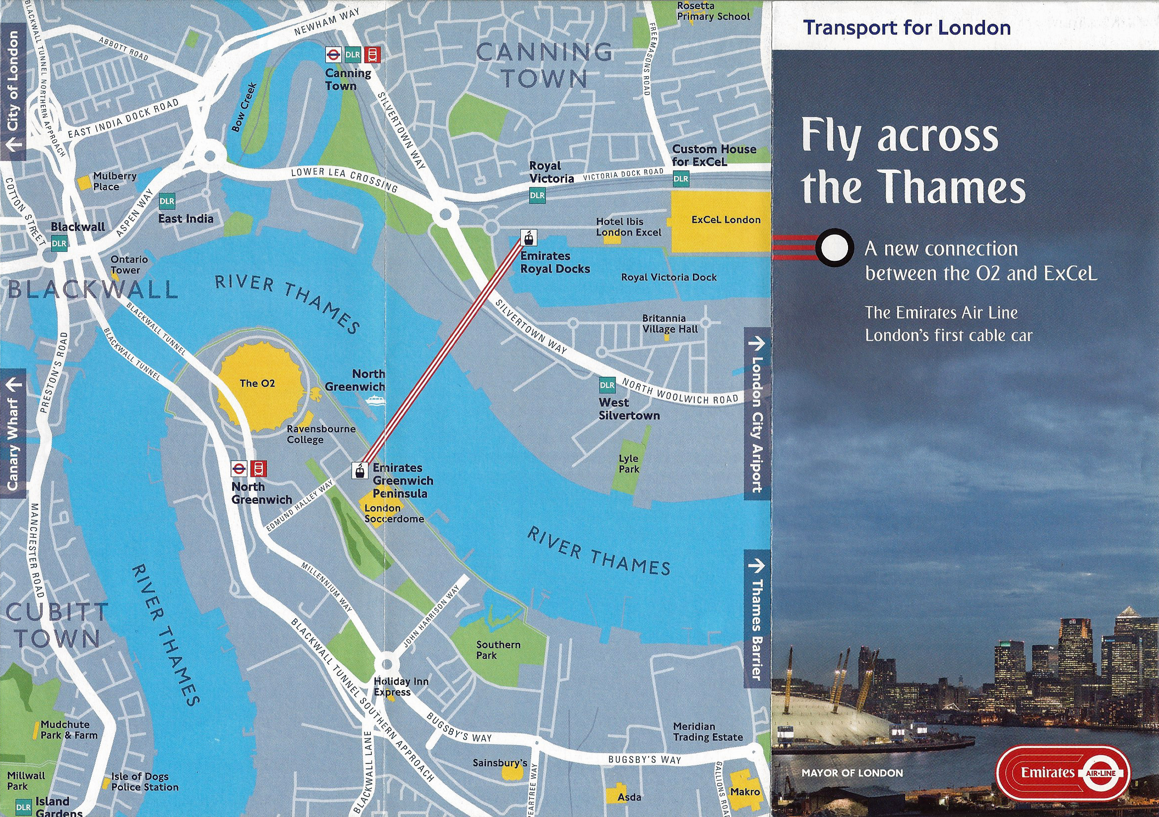
Transport for London leaflet, with map, for the Emirates Air Line. June 2012
Walking between Tube stations
Anyone that has travelled by Tube in London is very familiar with the handy little paper pocket guide to the network. Large print versions are also available and large scale posters showing the map are widely displayed- on trains, platforms and station concourses. The diagrammatic map is constantly updated online and frequent updating of map content is made each year that reflects extensions to the various lines and permanent additions and temporary closures.
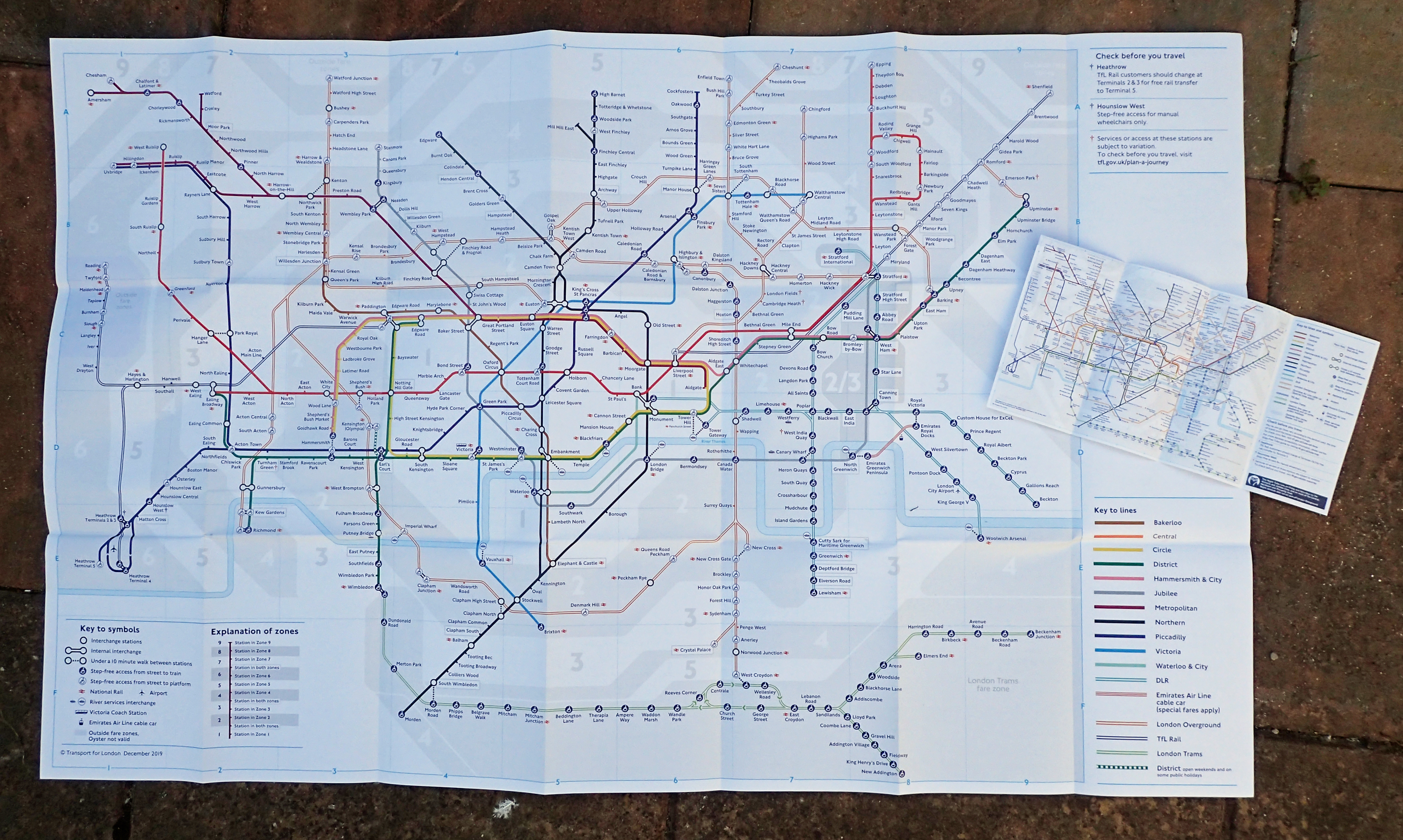
Colour large print Tube map with standard pocket size version. Each includes ‘under a 10 minute walk’ detail. Both December 2019
Detail from December 2019 Tube map showing the addition to the key to lines and symbols on the maps
‘The Bower of Bliss’ Tube Map introduced the ten minute walk dotted lines to the network diagram. December 2018
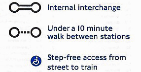
Beginning with the December 2018 ‘The Bower of Bliss‘ tube map, a subtle addition was made that is especially helpful for those frustrated by a previous failing of the maps- a dotted line has been added where there is only a short walk at surface level between some stations on different lines, negating the need to make quite complex or needless journeys between them on the Tube network.
When the ‘under a 10 minute walk’ addition was made, the central area (Zone 1) of London was largely ignored due to the cramped aspect of the map in this area, the large number of stations and the sheer impracticality of showing all possible ground level walking connections. There are also some glaring omissions outside the central area but no doubt future map refinement will add these where practical and possible on an already cramped map. In addition to the standard Tube map, there is also an online version of the map that provides an indication of how long it takes to walk between stations.
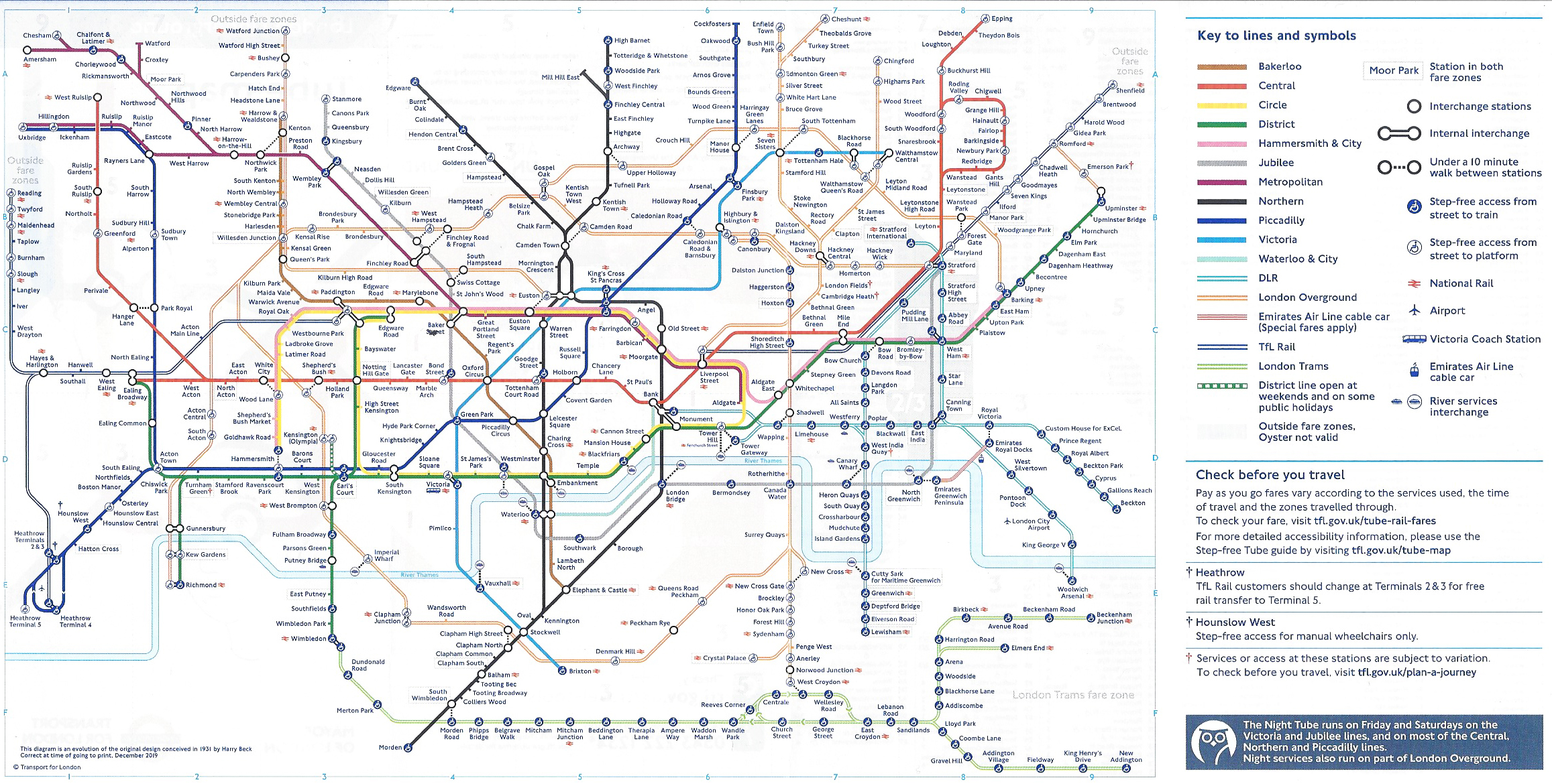
Transport for London Tube map. This includes detail on some stations where there is less than ten minutes walk between them. May 2019
London- Summer 2012 Map
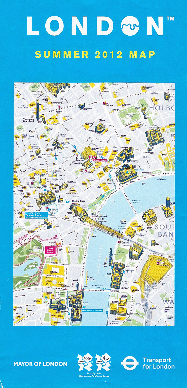
Large free map produced by TfL for Summer 2012
Possibly the best free paper map ever produced by TfL was the large (990mm x 620mm) double sided map released as part of the 2012 celebrations when London hosted the Olympic Games.
Tens, if not hundreds, of thousands of people unfamiliar with London descended upon the city. Not only for the Olympic Games but also for the many other cultural events that were offered throughout the year. There was a very real possibility of public transport being swamped and recognising this, TfL produced a wide range of free maps assisting people with walking the streets between locations.
While many minor streets go nameless, the detail included on this free map is fantastic. It also covers parts of London largely ignored elsewhere, especially in East London. Some detail is included on the map of six specially developed ‘Stroll’ routes, Three Points of the Compass will cover these in a future blog in this series when looking at maps produced for sporting occasions.
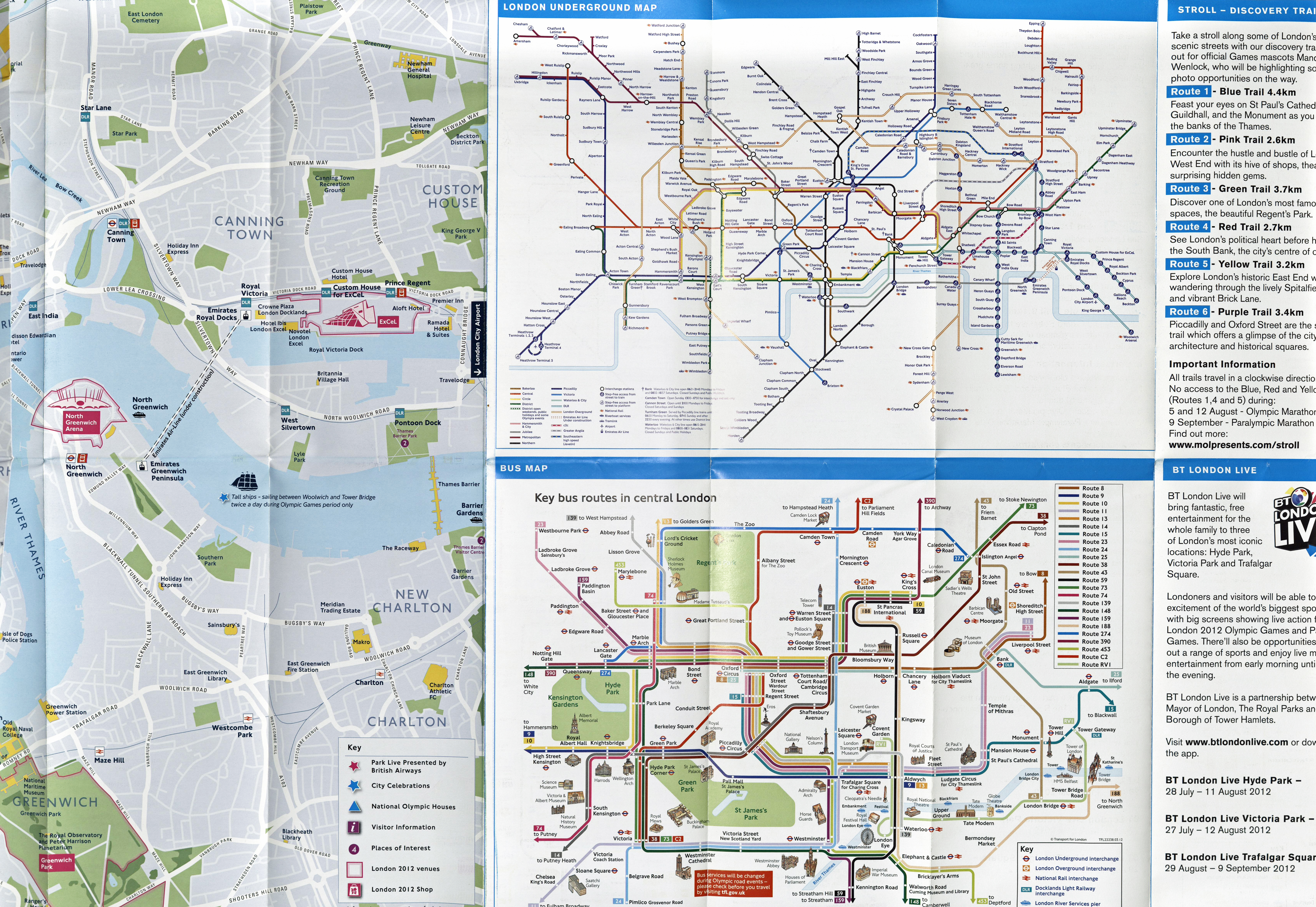
Detail from TfL produced Summer 2012 map. Based on Ordnance Survey mapping. This map included detail on East London, an area that is seldom represented in free map resources. April 2012
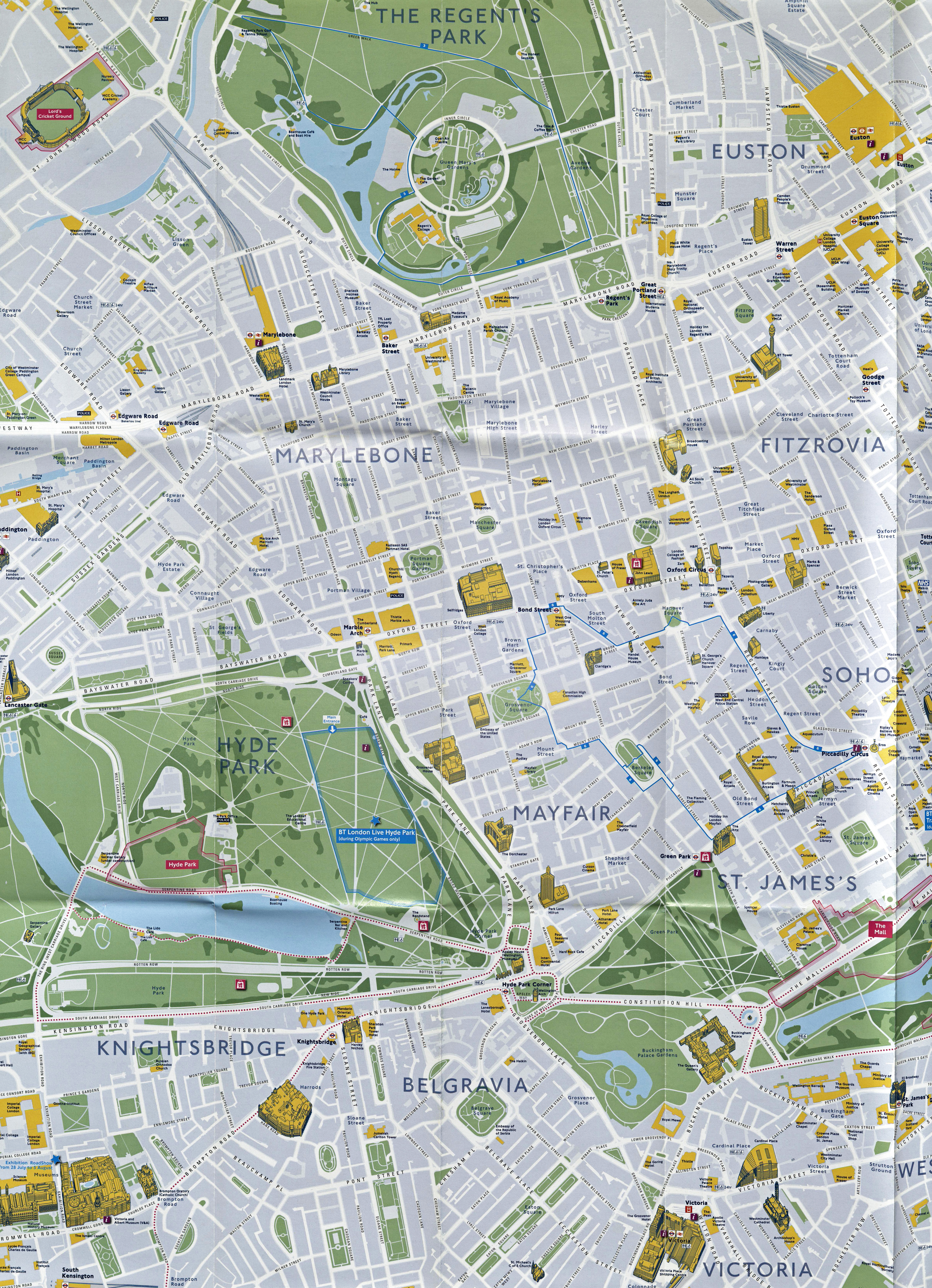
Detail from large free Summer 2012 map produced by TfL. While many places go un-named, for example those in Hyde Park, paths across green spaces are included. Based on Ordnance Survey mapping. April 2012
Most people choosing to walk across London today will be accessing some form of online mapping resource and there are also some excellent official portals. However, a paper map continues to provide an idea of the bigger picture, where the current location is and how it relates to the larger city. Paper maps can be stuffed into a pocket with no worries as to batteries fading, they can be scribbled on, they remain a memento of a visit to the great metropolis. In the next of this short series on free maps for walking in London, Three Points of the Compass shall be looking at some of the paper maps that have been available for people visiting London when attending some of the Royal celebrations over the years.
