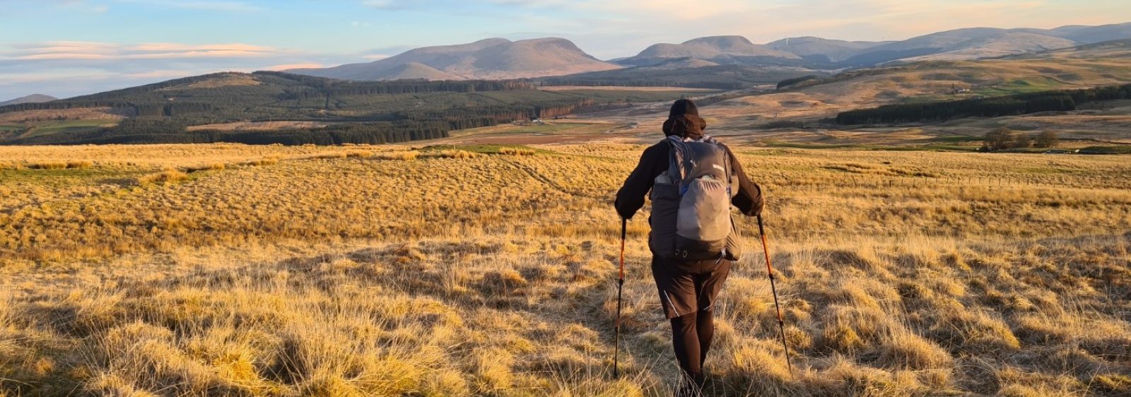
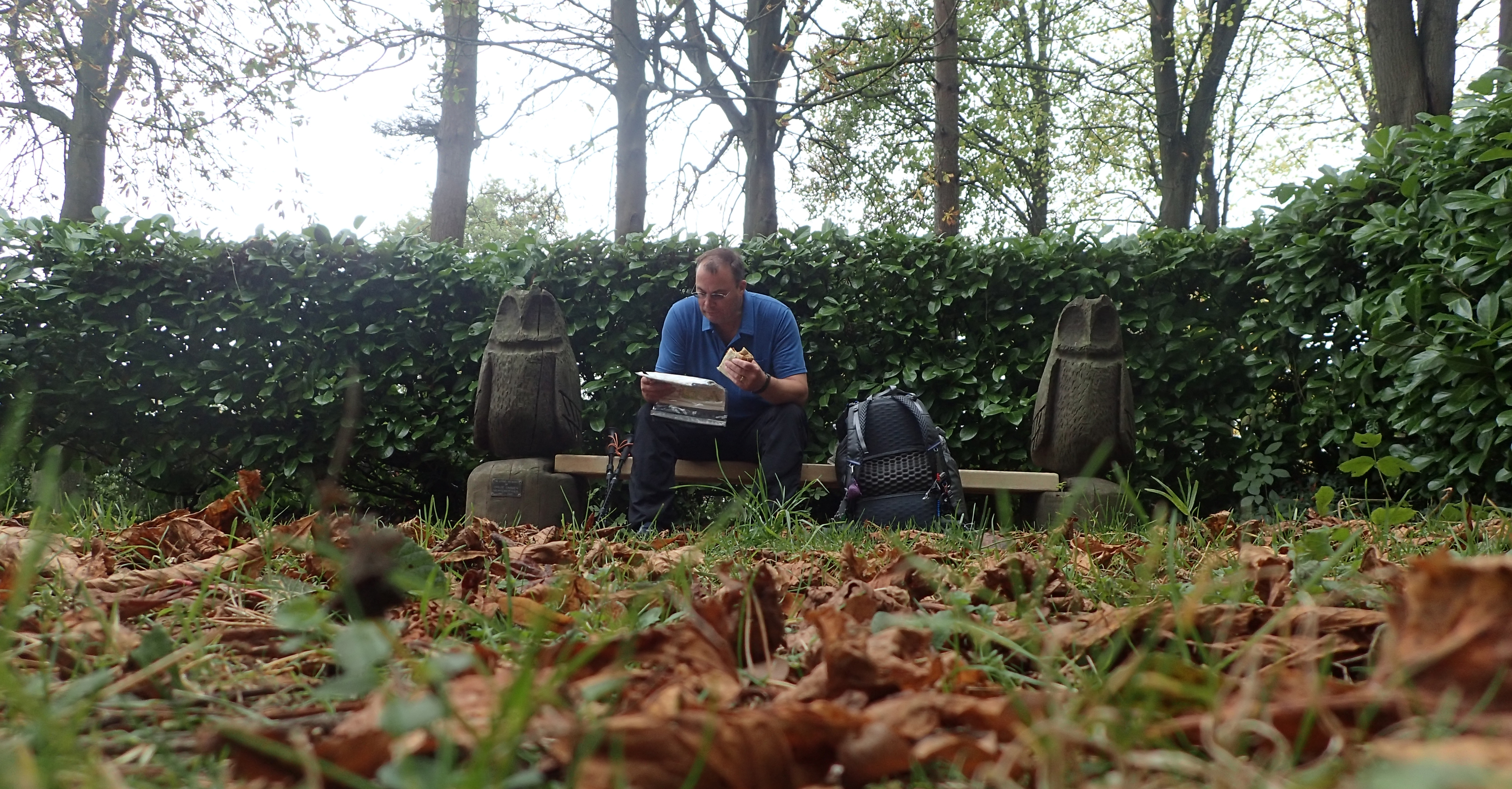
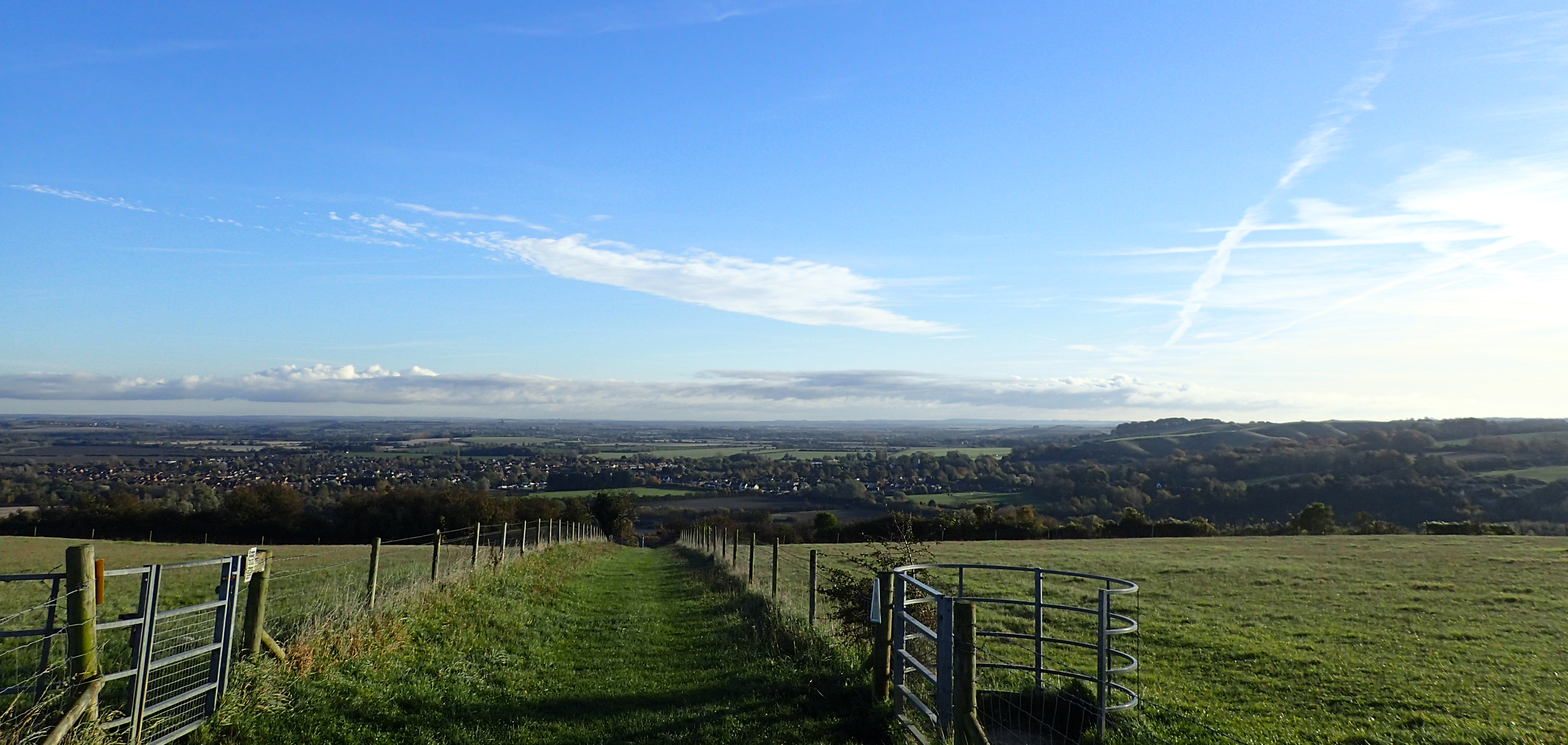
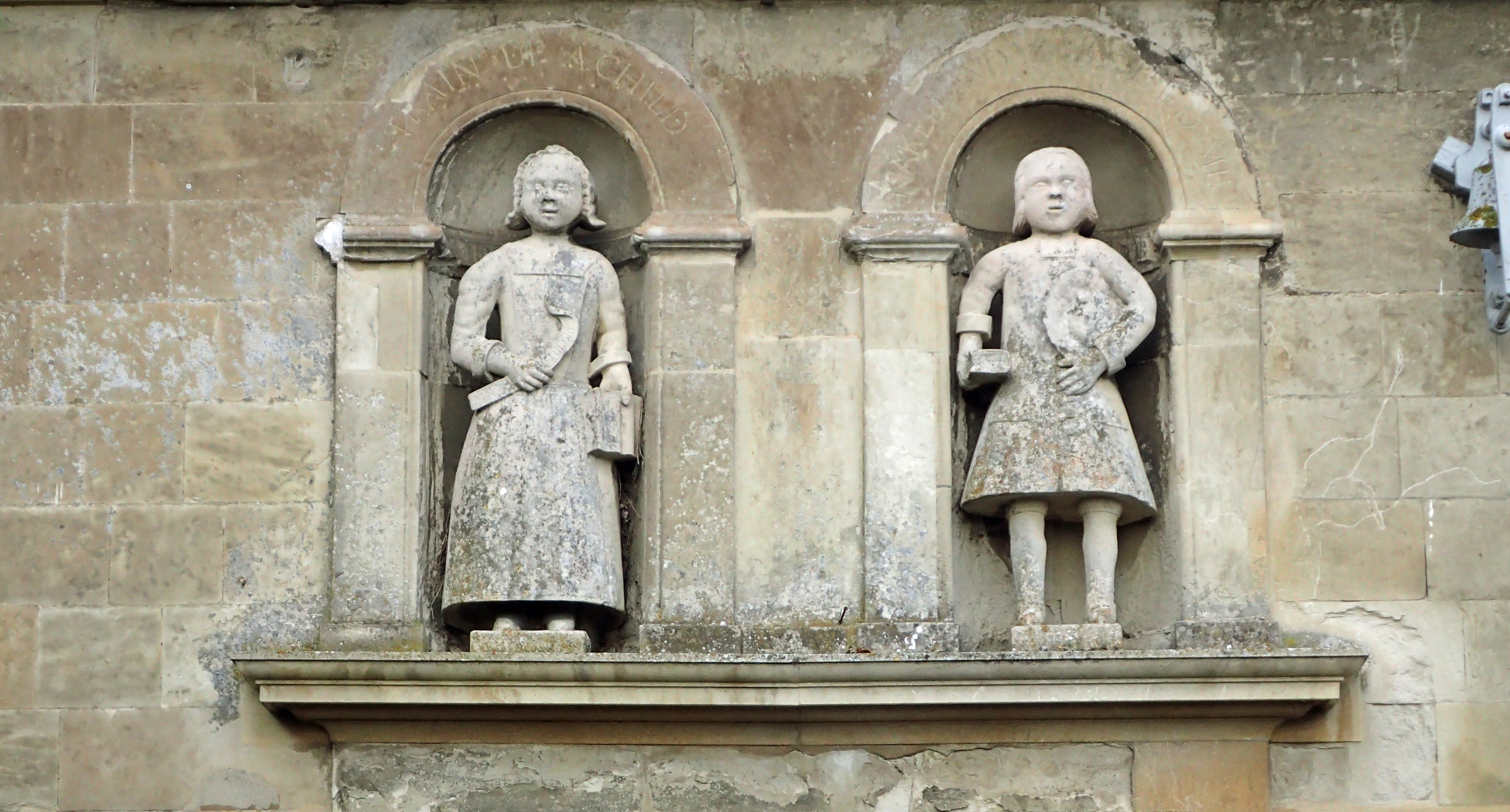
Three Points of the Compass pauses for lunch on Day One on the Icknield Way Trail. Lady Chapel, Whipsnade Tree Cathedral
As the time approaches for Three Points of the Compass to set off on the Long Walk, I thought it wise to fit in another week or so walking with, more or less, the gear that I am planning to set off with on April 1st 2018. Some contents of the pack have altered since last I hit the trail for any distance, not least, my tent. I’ll chat about a few of those items in a follow up post in a week or two.
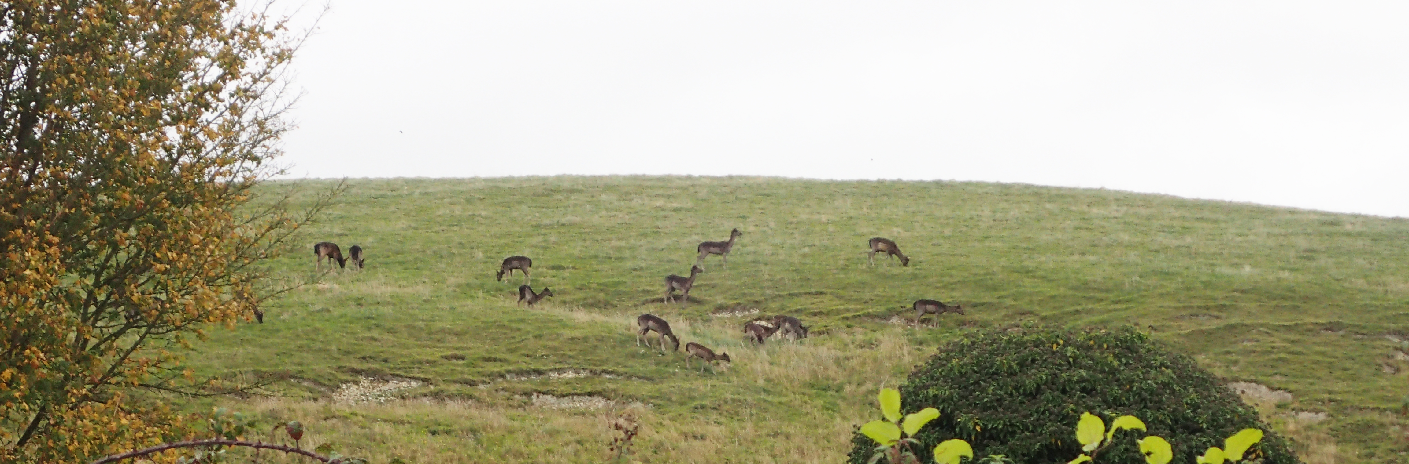
Deer were seen on every day, usually Muntjac, or Barking Deer, which were seen in the hundreds, also, the occasional Fallow Deer

The damage caused to crops from raiding deer was only too apparent. If I were a farmer, it would make me weep
I walked The Ridgeway in May 2016, and the Peddars Way in April this year. These form part of The Greater Ridgeway which stretches for some 363 miles from Lyme Regis in Dorset, to Hunstanton, on the North Norfolk Coast. The Icknield Way Trail formed another link. Being around a weeks walking, it was perfect for an autumn excursion.
Mind you, this did not go down particularly well with Mrs Three Points of the Compass as we had just returned from a fortnights holiday in Cyprus (more on that in another blog). While she had to return to work, I fortunately found myself still with a weeks annual leave to take. So a weeks walking it was.
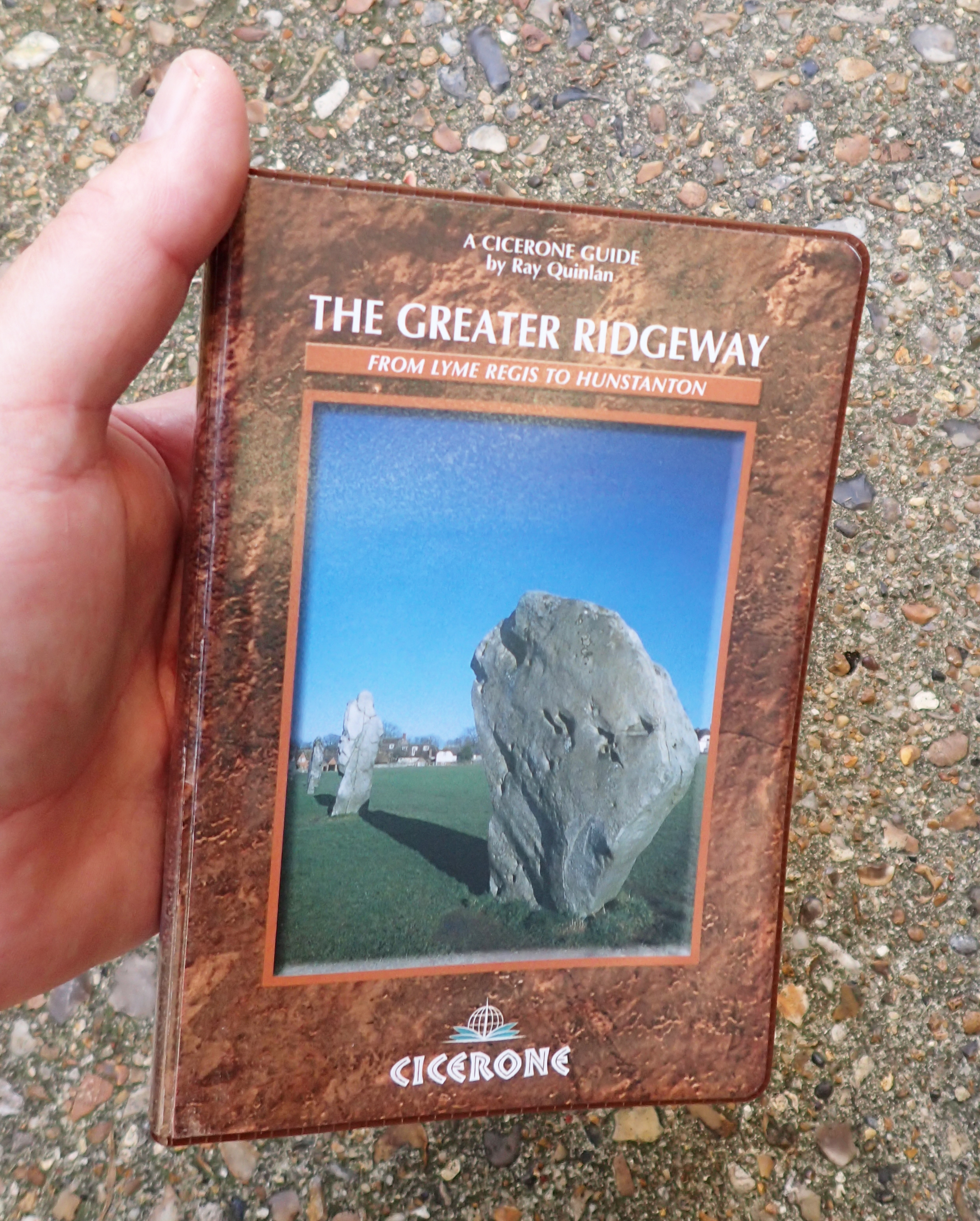
Only published in 2003, and already not the easiest of books to find these days. The Greater Ridgeway by Ray Quinlan is to the usual high Cicerone standard. It is the ideal companion for anyone attempting the whole 363 mile distance rather than just one of the constituent paths. There are also dedicated Cicerone guides to both The Ridgeway and the Peddars Way and Norfolk Coast Path
There are differing lengths to be found for the Icknield Way Trail in publications and online, varying from 98.5 to 110 miles. For this walk, I set off from Tring Railway station, Hertfordshire, where my Ridgeway walk had ended, the morning after completing that trail at Ivinghoe Beacon in 2016. This autumn, I finished walking six days later at the lonely carpark on Knettishall Heath, Suffolk. My total, with a bit of wandering, just a little exploring and not getting lost (sorry, momentarily unlocated) too much, was 120 miles.
| Start point | Finish point | Mileage | |
| Day one | Tring station | Upper Sundon | 19 |
| Day two | Upper Sundon | Clothall | 21 |
| Day three | Clothall | Elmdon | 19.5 |
| Day four | Elmdon | Willingham Green | 19 |
| Day five | Willingham Green | Cavenham Heath | 24 |
| Day six | Cavenham Heath | Knettishall Heath | 17.5 |
| 120 |
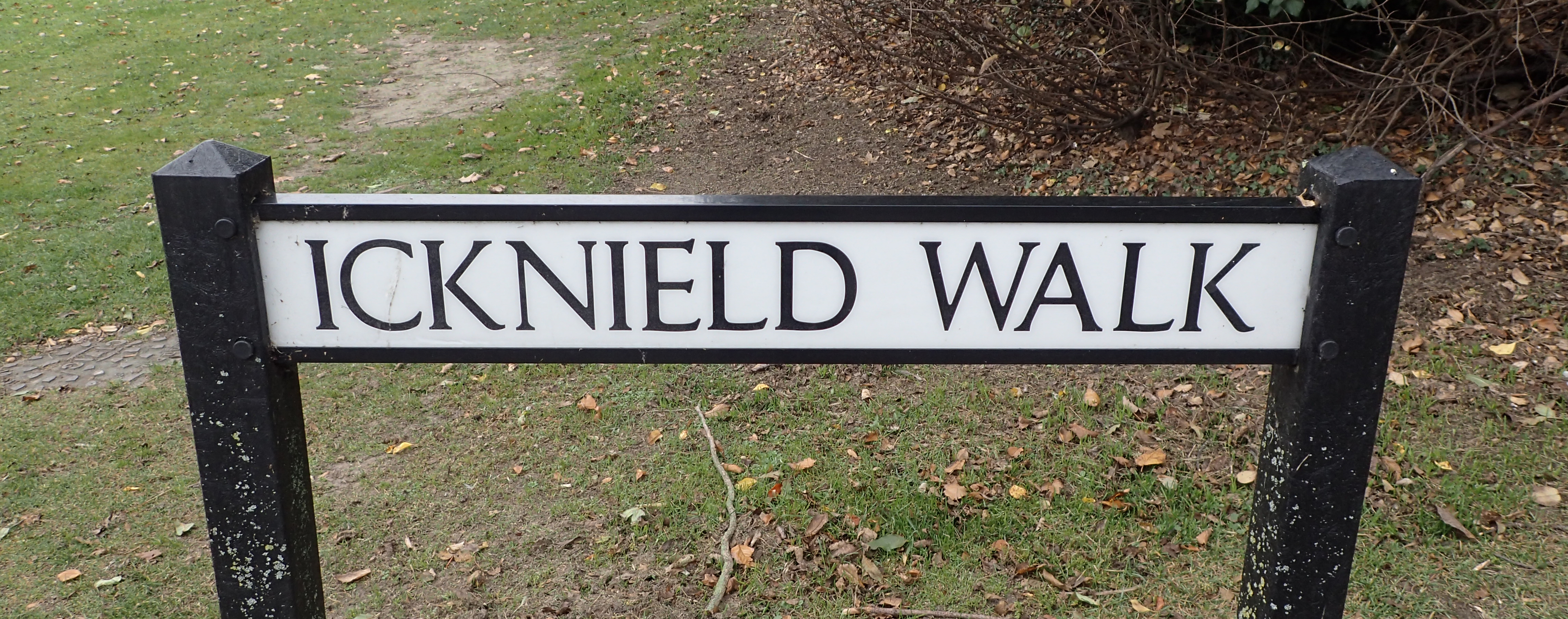
The old trail is reflected in many place and street names
I deliberately carried out little planning, as I wanted to get a better idea on how days might pan out on my longer walk next year where planning will frequently be day-by-day. I allowed myself eight days for the Icknield Way Trail, not really caring how long the walk took. In the end, it was six, finishing a little before 13.00 on the final day. In truth, I probably pushed myself too much, I am still recovering from Plantar fasciitis after all. I did get the occasional twinge from that on my walk. I would certainly aim at much lower mileages next year.

A basic lunch on trail
I carried plenty of food, enough for six days. This was shop bought, mostly low bulk, low weight. I never took any sort of specialised, dehydrated ‘backpacking’ food. Again, to see how both myself and my pack handled the extra weight and bulk. Needless to say, some uneaten food returned home with me afterward, mostly due to my eating a couple of meals in pubs en route.
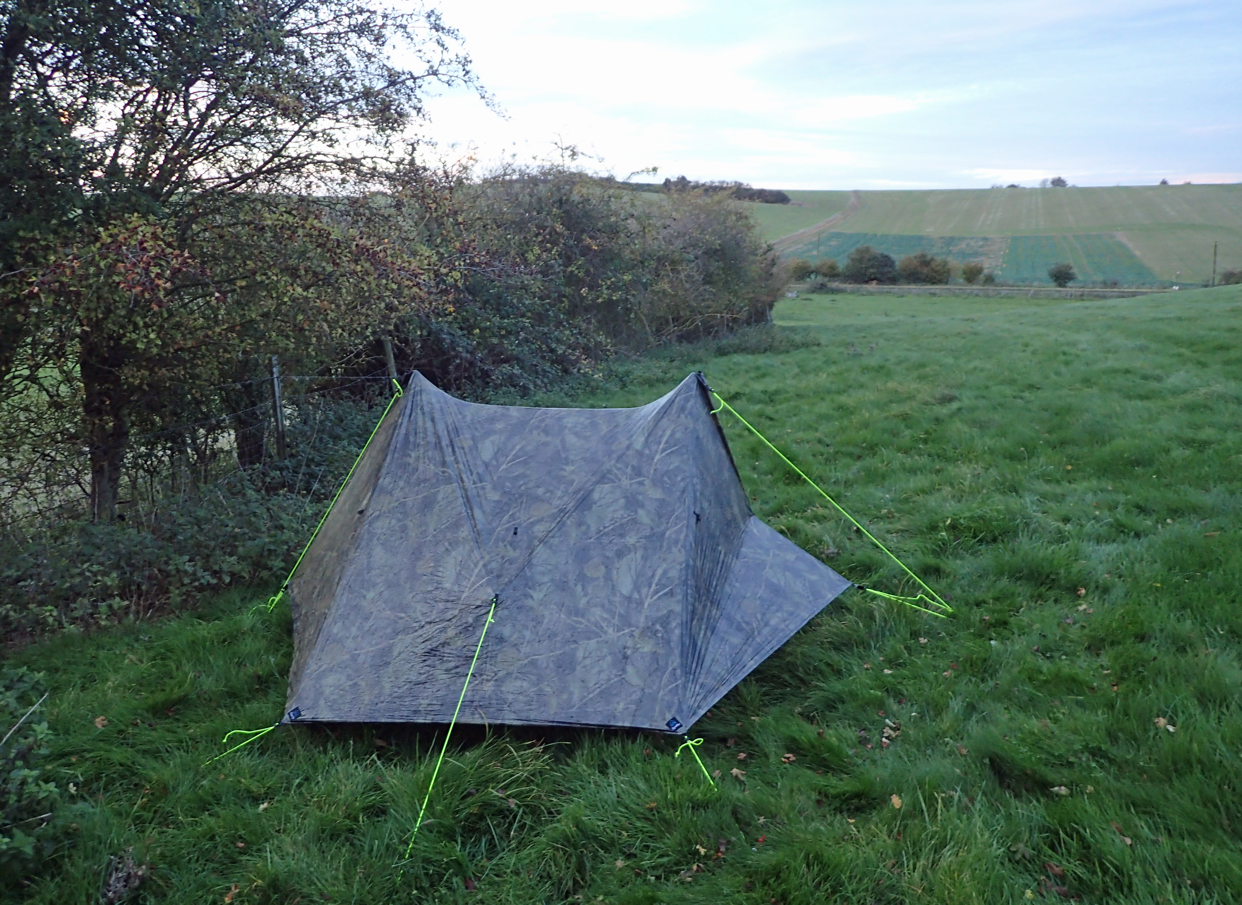
Wildcamp on Day Two on the Icknield Way Trail. Long wet grass and little breeze meant that this was the worst night for condensation in my Z Packs Duplex
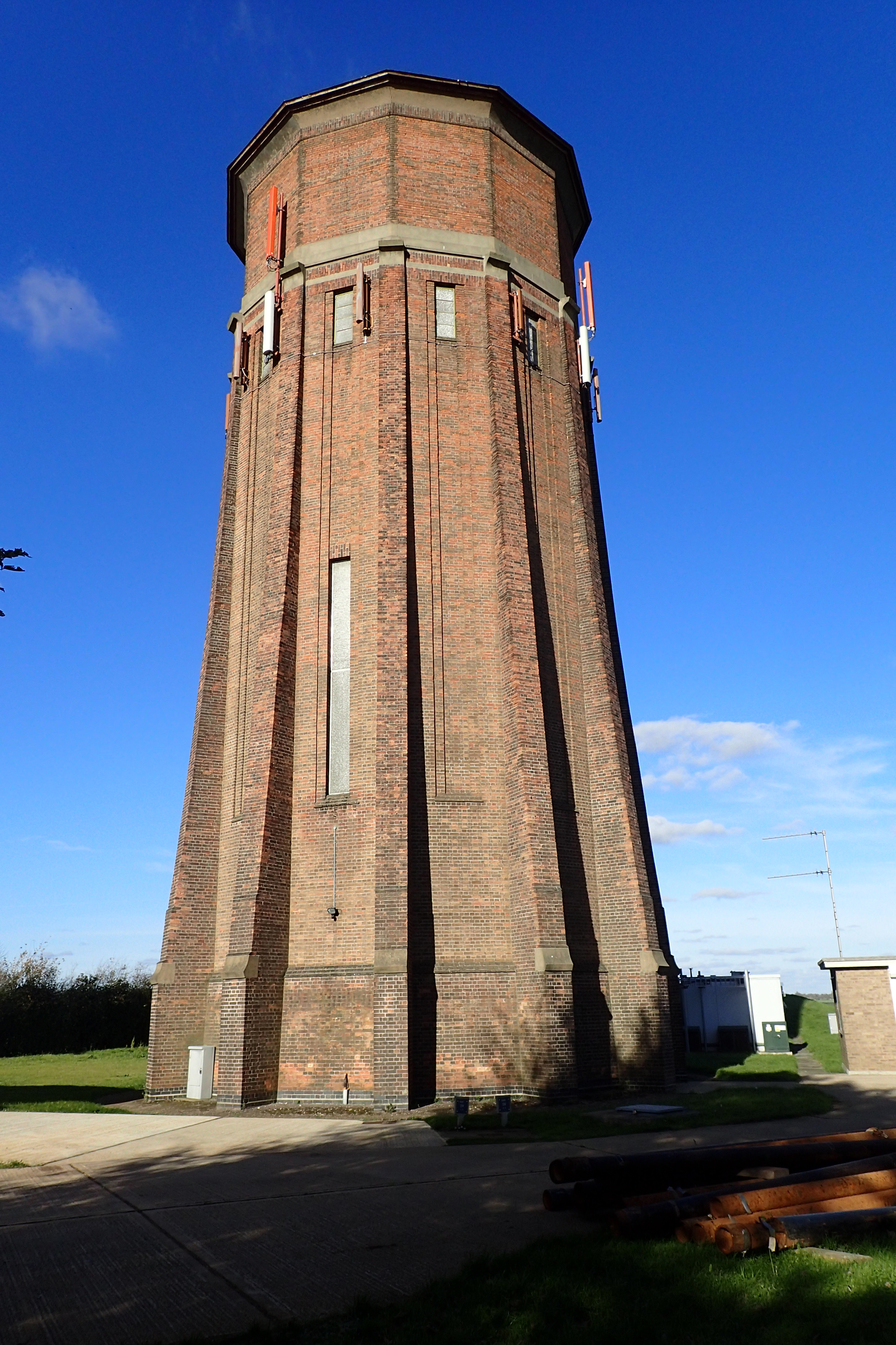
On Rivey Hill, Cambridgeshire, the Icknield Way skirts a substantial brick built, 12-sided, water tower. This Art Deco tower used to provide water for 5000 people in nearby Linton and neighbouring villages. Constructed in 1935-6, this is now a Grade II listed structure.
Despite being a marked route on O.S. maps, this is a little followed route. I only met two others walking the trail, and the two ladies were doing it together, in sections, over many months. There are few places to officially stay, be it camp sites or B&B. Purposely, I wild camped on each of the five nights on trail. None of my sites were planned. I would walk each day, look ahead on the map between midday and 14.00 and from around 16.30 begin to look for a place to hide myself away. At this time of the year, day light hours are few, light was failing at 17.30 and was dark an hour later. I was invariably up prior to dawn, packed and walking by seven. I stopped for a hot breakfast of porridge some two to four hours later.
I was disturbed on a couple of the nights. My halt on the first night coincided with a bunch of young lads from the nearest village turning up to let off fireworks for 45 minutes, what great fun… My second night had a pair of gleeful herberts hurtling up and down a nearby track (on the other side of the hedge in the image above) on a quad bike, lamping. Fortunately I remained undiscovered.
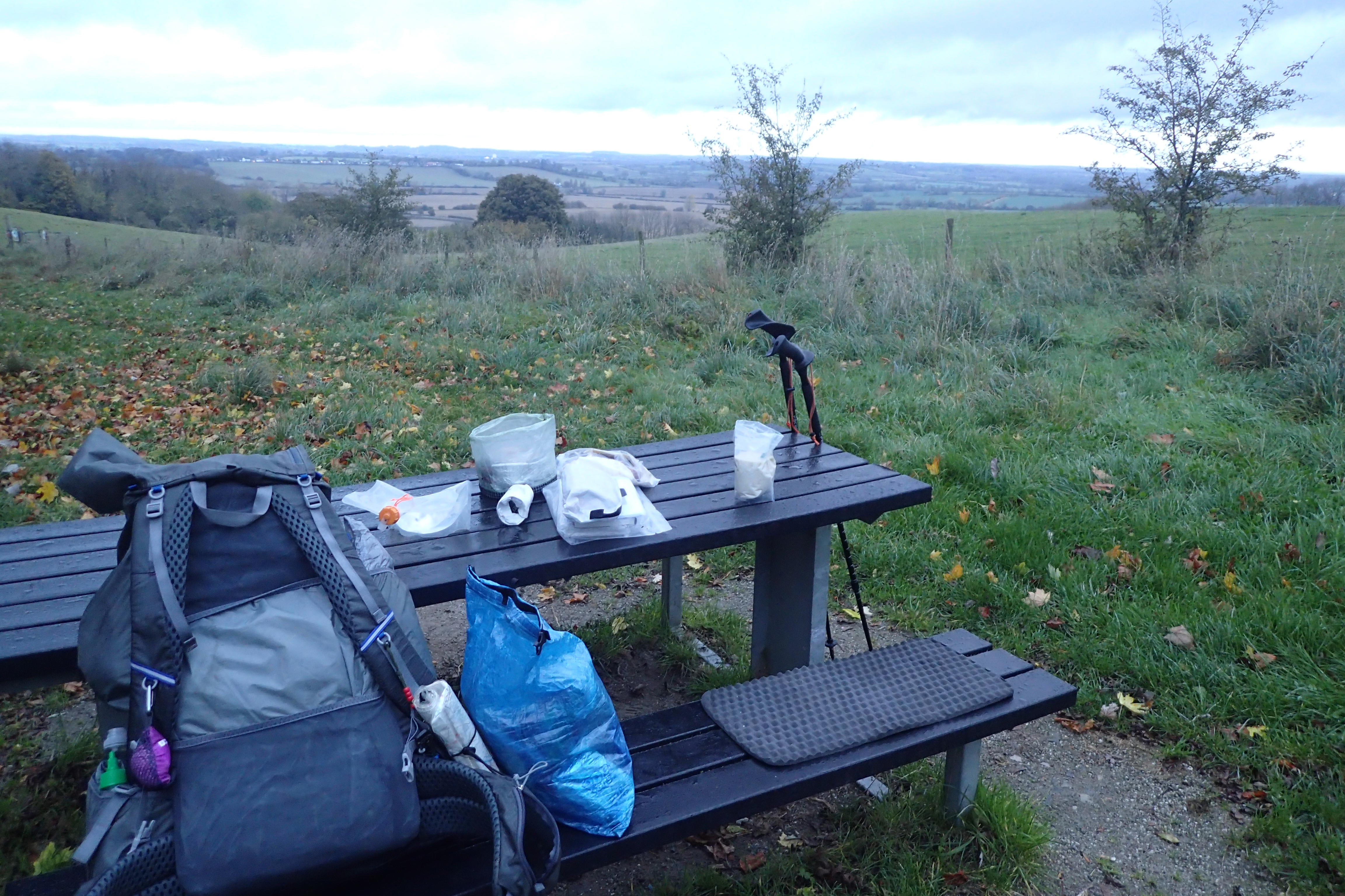
A halt for breakfast a couple of hours in to my days walking. I would try and stop where there was a view, a seat, or ideally, both
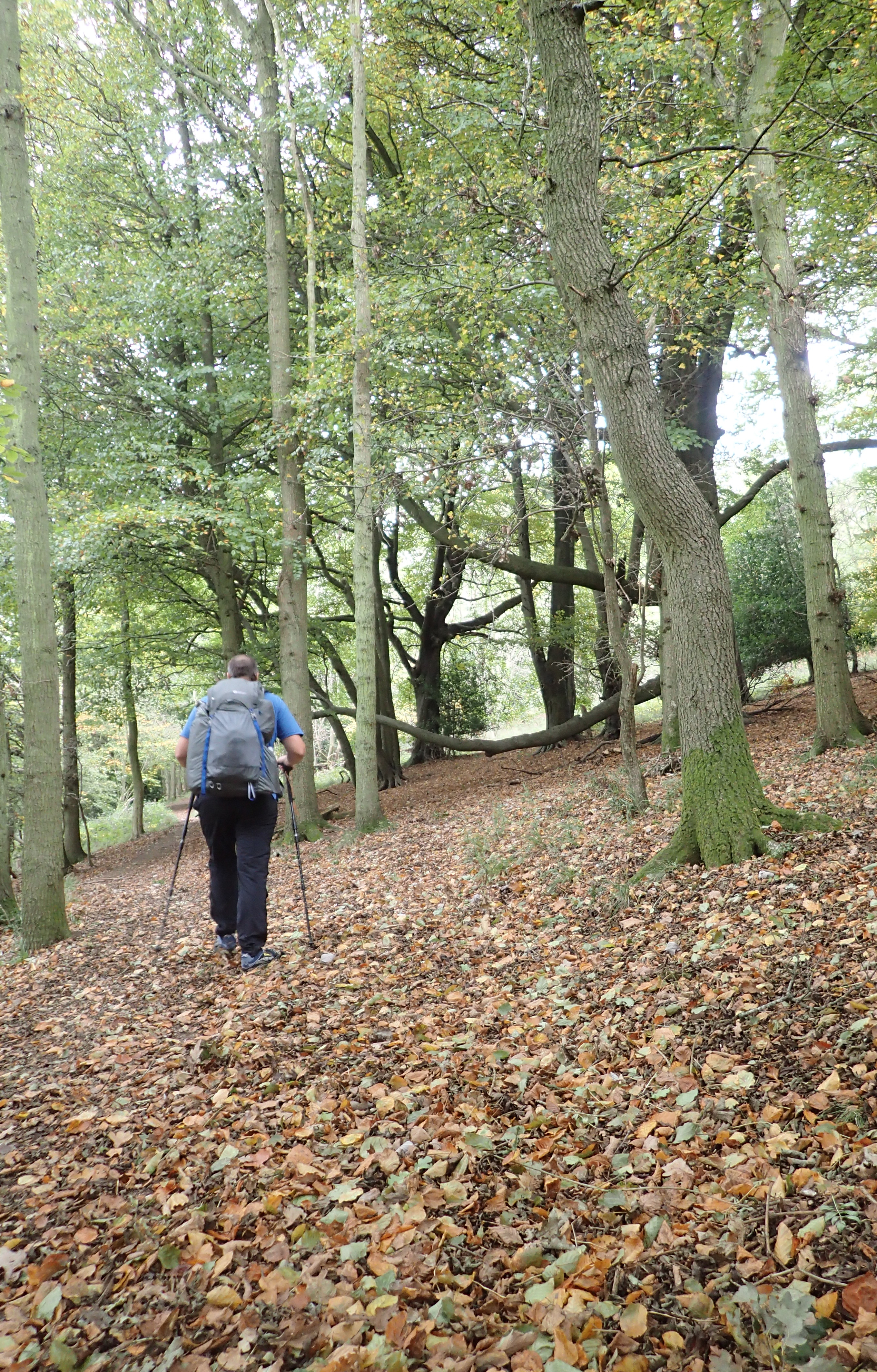
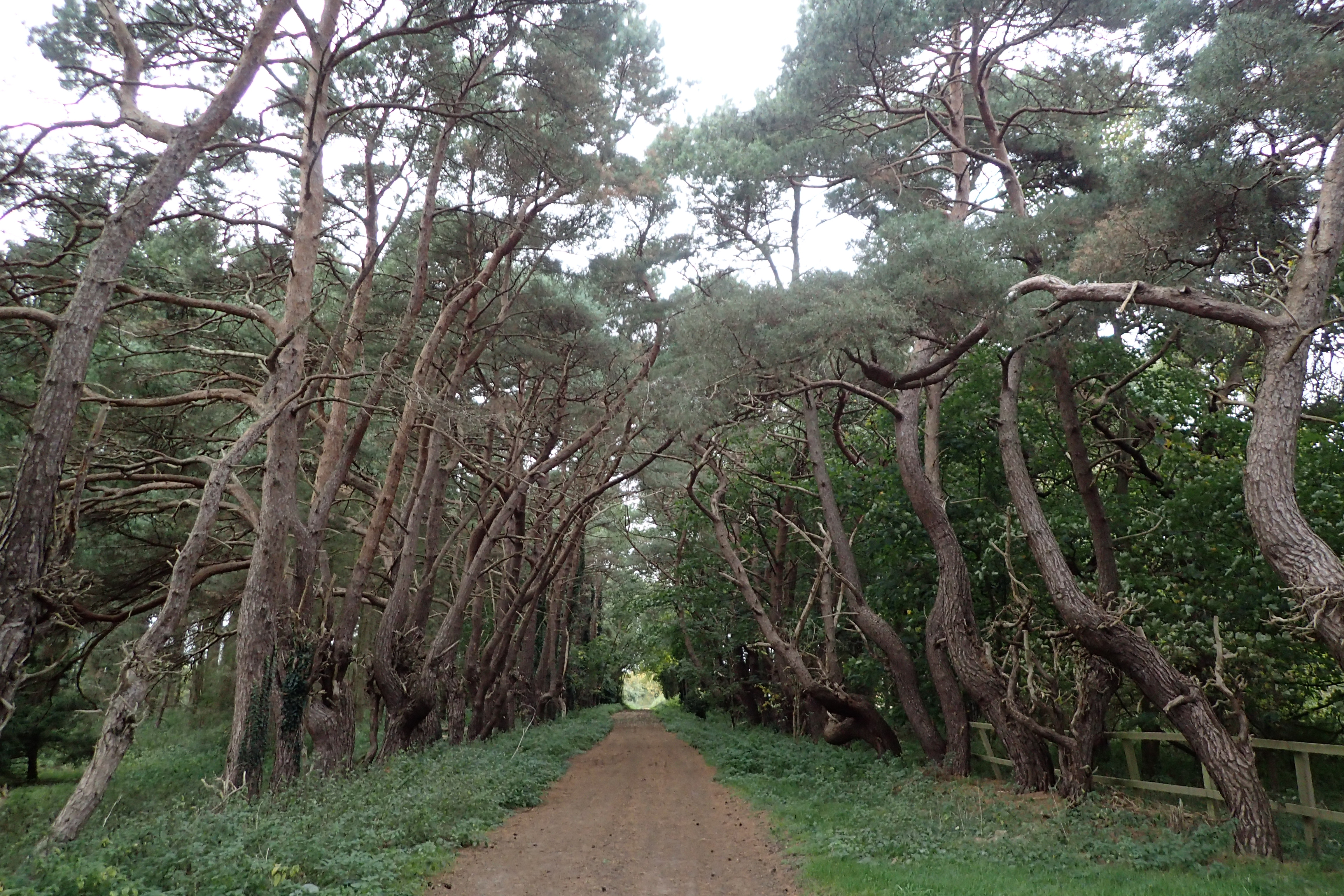
First days on the trail took in occasional beautiful woodland. Easy walking with little gradient
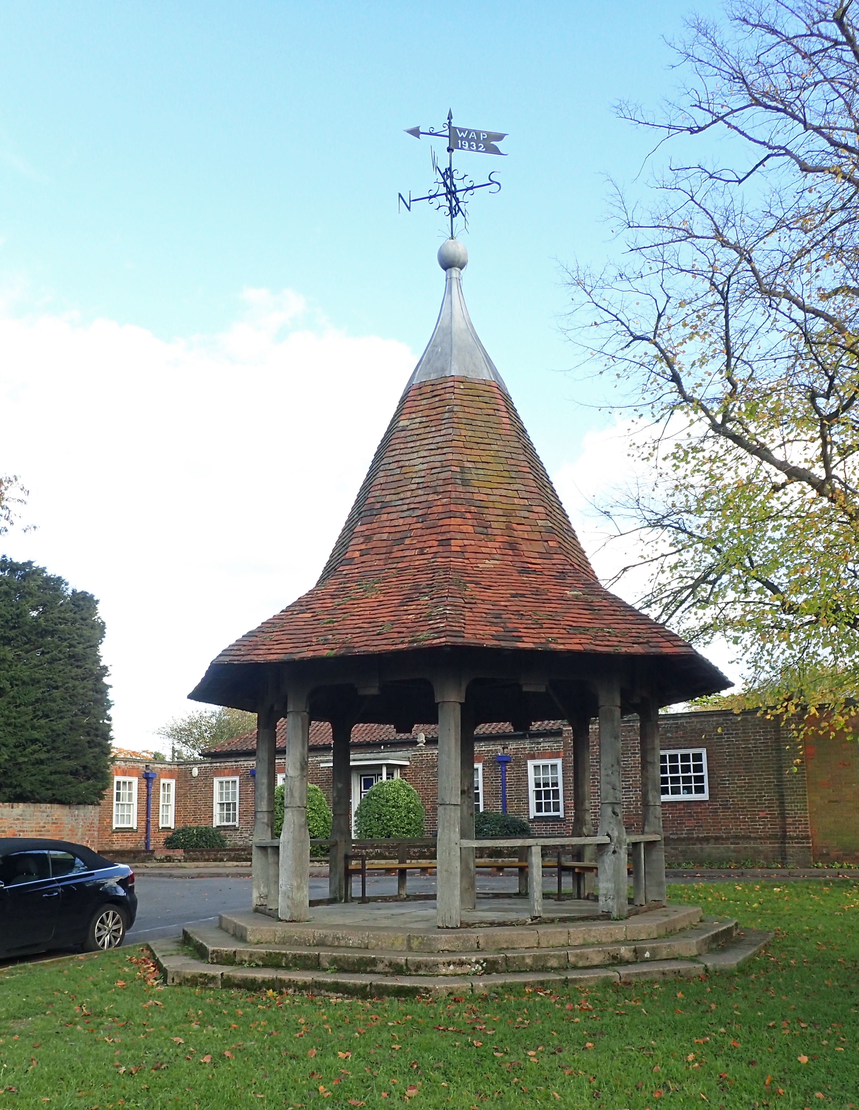
Village Green at Balsham
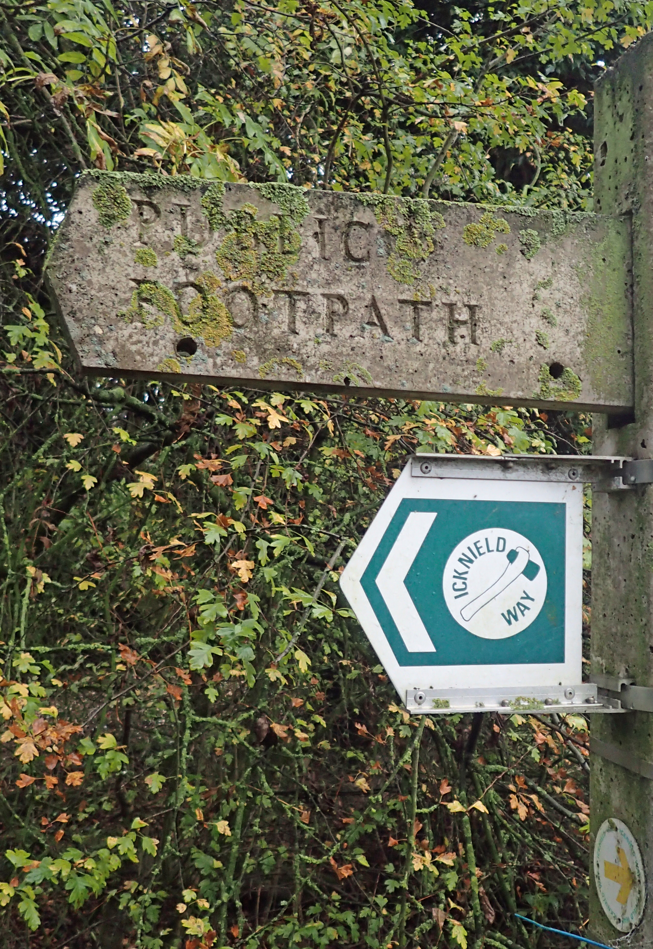
The Icknield Way Trail may be a little confusing to some. Most authorities would describe it as a collection of parallel track ways connecting Avebury in Wiltshire, with the north Norfolk Coast, around the Hunstanton area. The way follows the geology- a band, or spine, of chalk stretching across the country. Where the going became tough for our ancestors, usually due to thicker vegetation emanating from the clay covering of the chalk, they switched to a lower level. Much of the route is Ancient with some having been ‘improved’ by the Romans. For my section, much of the old route has now been consumed by the A505. Where it remains extant, some of the older track way is indicated on O.S. maps by Gothic lettering.
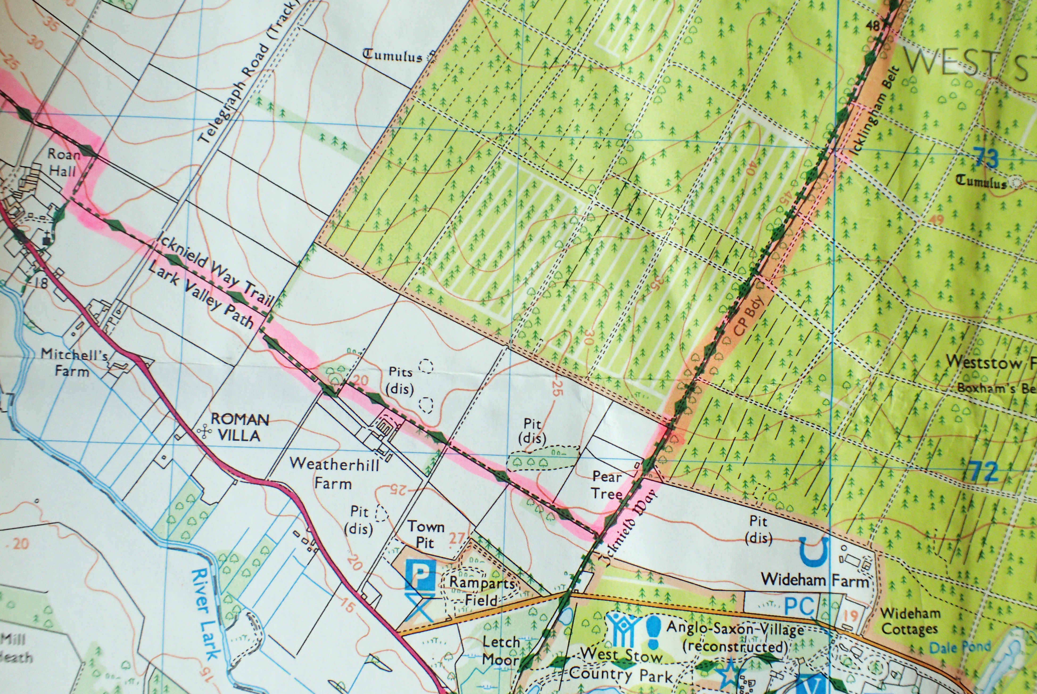
My pink highlighted route shows where I entered the King’s Forest. The Icknield Way is shown on many Ordnance Survey maps. Usually showing the presumed prehistoric route in ‘Gothic’ lettering, and the modern route for walkers in sans serif Roman. However there is little to indicate what is the Icknield Way Trail and what is the Icknield Way Path. Therefore, referring to one of the written guides is a necessity, or at least advisable
Today, we have a choice of routes to follow. There is the walkers route- the Icknield Way Path, as described by the Icknield Way Association, there are also occasional variants from the walkers route for cyclists or horseriders (the Icknield Way Riders Route).

An alternative route passes through Toddington
To further confuse the user, there is even the occasional choice of routes for the walker. There is an alternative route that takes the walker through the village of Toddington, I never followed that alternative. Also, there is a link whereby the walker can stride directly to Thetford with its transport links. Instead, I followed the path to Knettishall Heath so as to finish where I had commenced my Peddars Way walk.

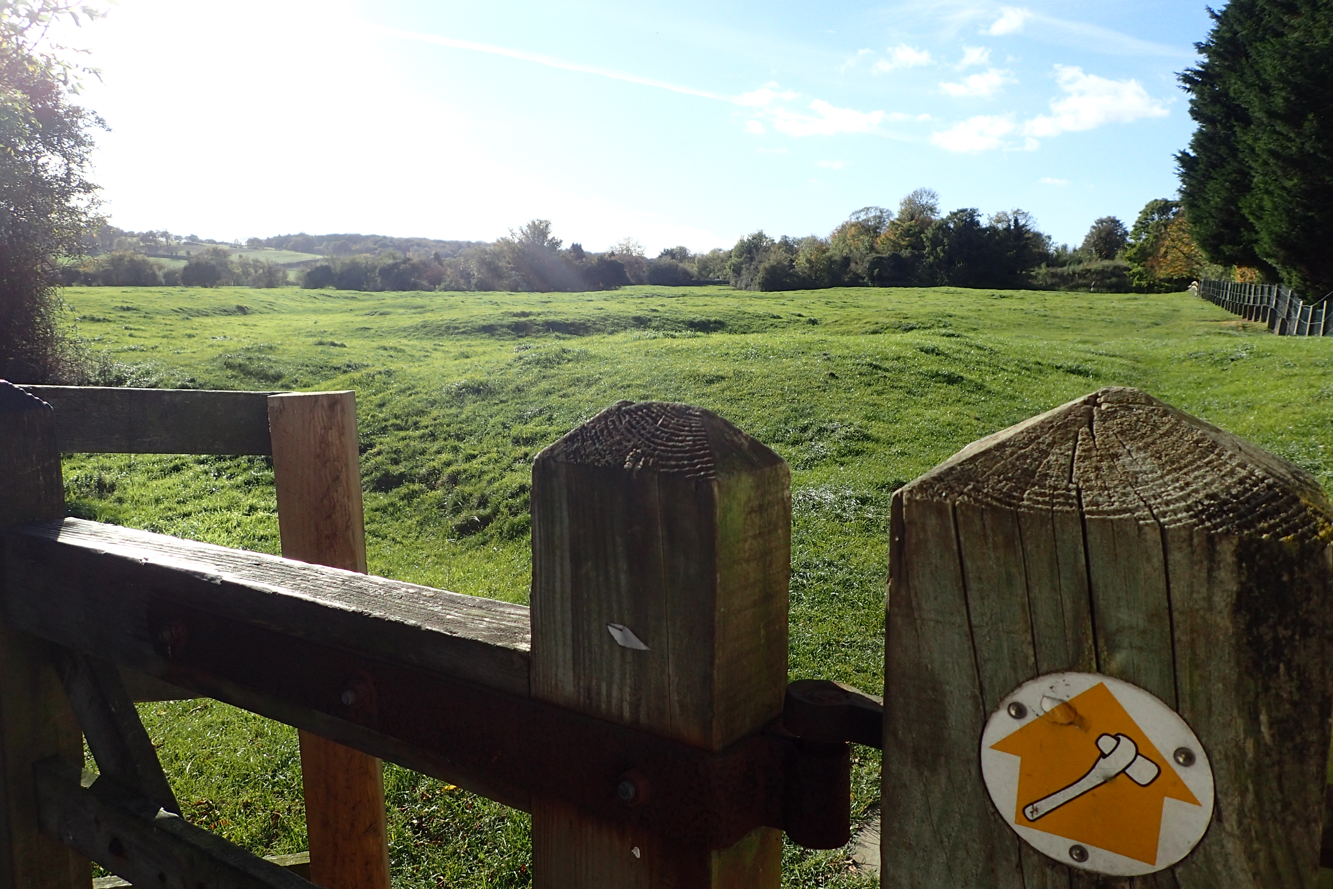
Finger Post on the Icknield Way Trail. The route is quite well signposted for most of its length. Signs seeming to only abandon the traveller when it matters most, or in towns. A map is advisable
 In 1992, the Countryside Commission designated the Icknield Way as a Regional Route, connecting The Ridgeway with the Peddars Way, it is this route that is shown on O.S. maps and is mostly signposted. My trail ran through six counties and some lovely gentle country, including the Chilterns and Brecklands.
Icknield Way Trail passing through Sundon Hills Country Park, one of the highest points in Bedfordshire
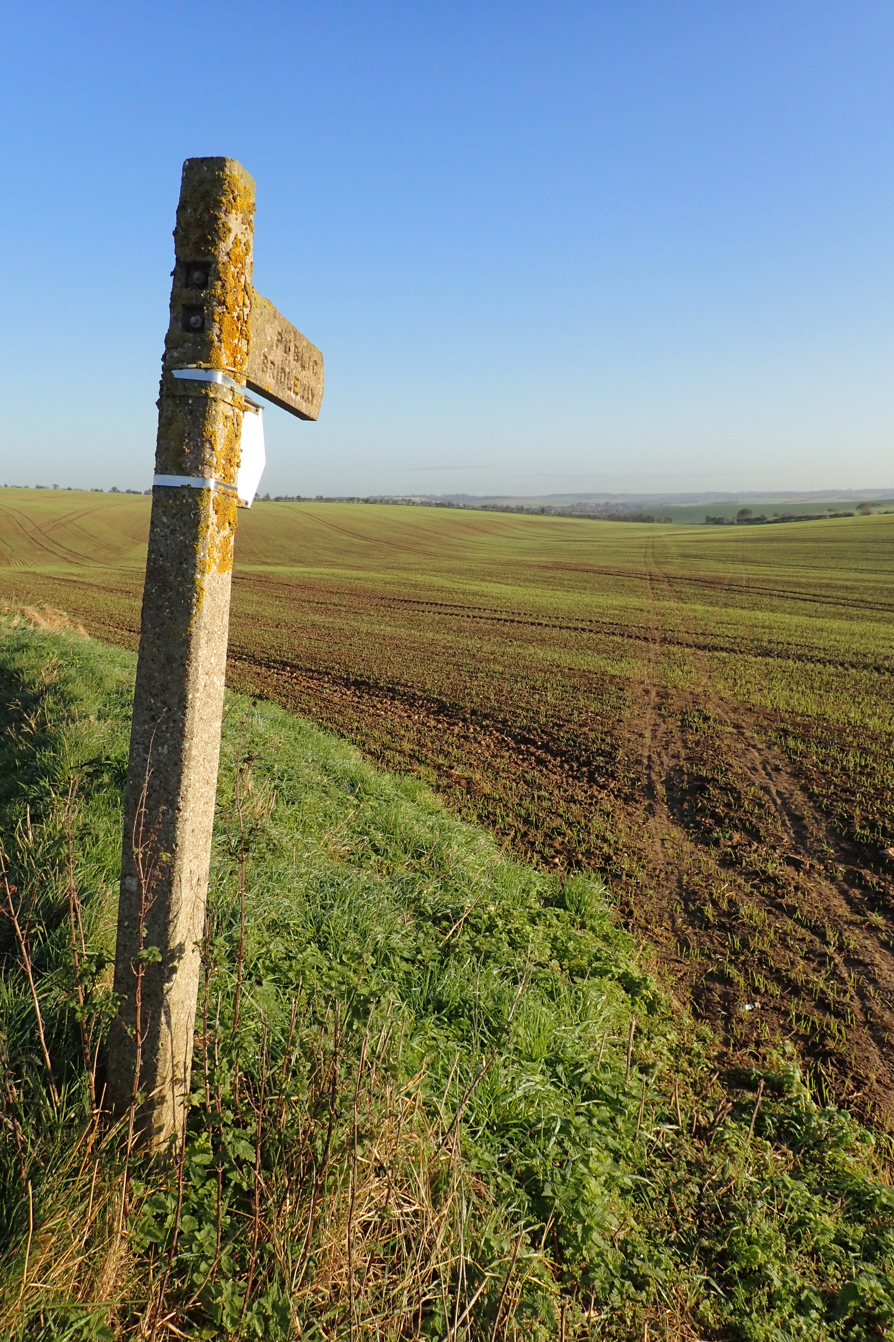
Finger Post indicates that I have half a mile of walking through sticky, glutinous mud to contend with
The weather was mostly kind to me. Day temperatures varied from 6°C to 20°C (43°F – 115°F), but dropped much colder at night after a warmer first night. However there was often a stiff breeze which dropped the temperature considerably. If it was blowing, my Montane windshirt over my Rohan polo shirt was always suffice to keep me warm.
I experienced little rain during the day and it rained briefly on just two nights. I found the trail underfoot almost always good with a few notable exceptions as a result of the farmers putting their fields to bed. It paid to keep an eye on the map where the occasional short detour meant that crossing a freshly ploughed field could be avoided, though that wasn’t always the case by any means.
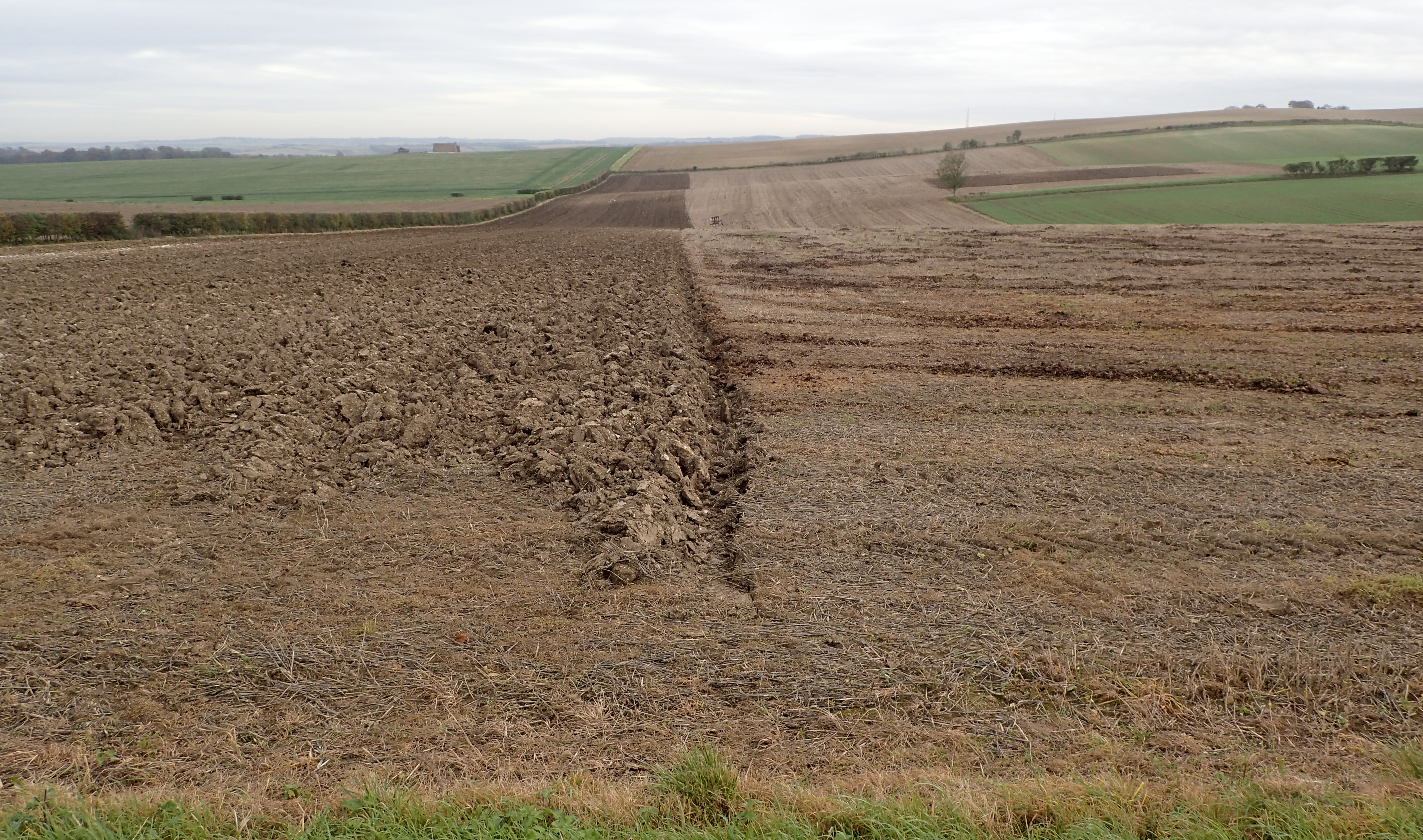
The middle section of the walk saw my trail passing through a mainly agricultural landscape. Farm vehicles were much in evidence and the fields were often being worked on
This part of the UK is pretty low lying. Here on Warden Hills, a Site of Special Scientific Interest and Open Access Land, three miles from Luton, I was 195 metres above sea level. Further east, there is nothing higher until you reach the Ural Mountains
As mentioned previously, this closely shadows a route followed by man for thousands of years. While I encountered far fewer tumuli and ancient sites than those seen on The Ridgeway, nonetheless, there were a few sites of interest passed. Burial Mounds were most prolific- there are over a hundred surrounding Royston. Near Stechworth, the Icknield Way Path briefly followed the Devil’s Ditch, a striking Ancient feature, up to 6m wide with a rampart some 9m above it.
Remains of 12th century Motte and Bailey castle at Pirton. The trail passes right by it and a pause to wander its circumference should be obligatory
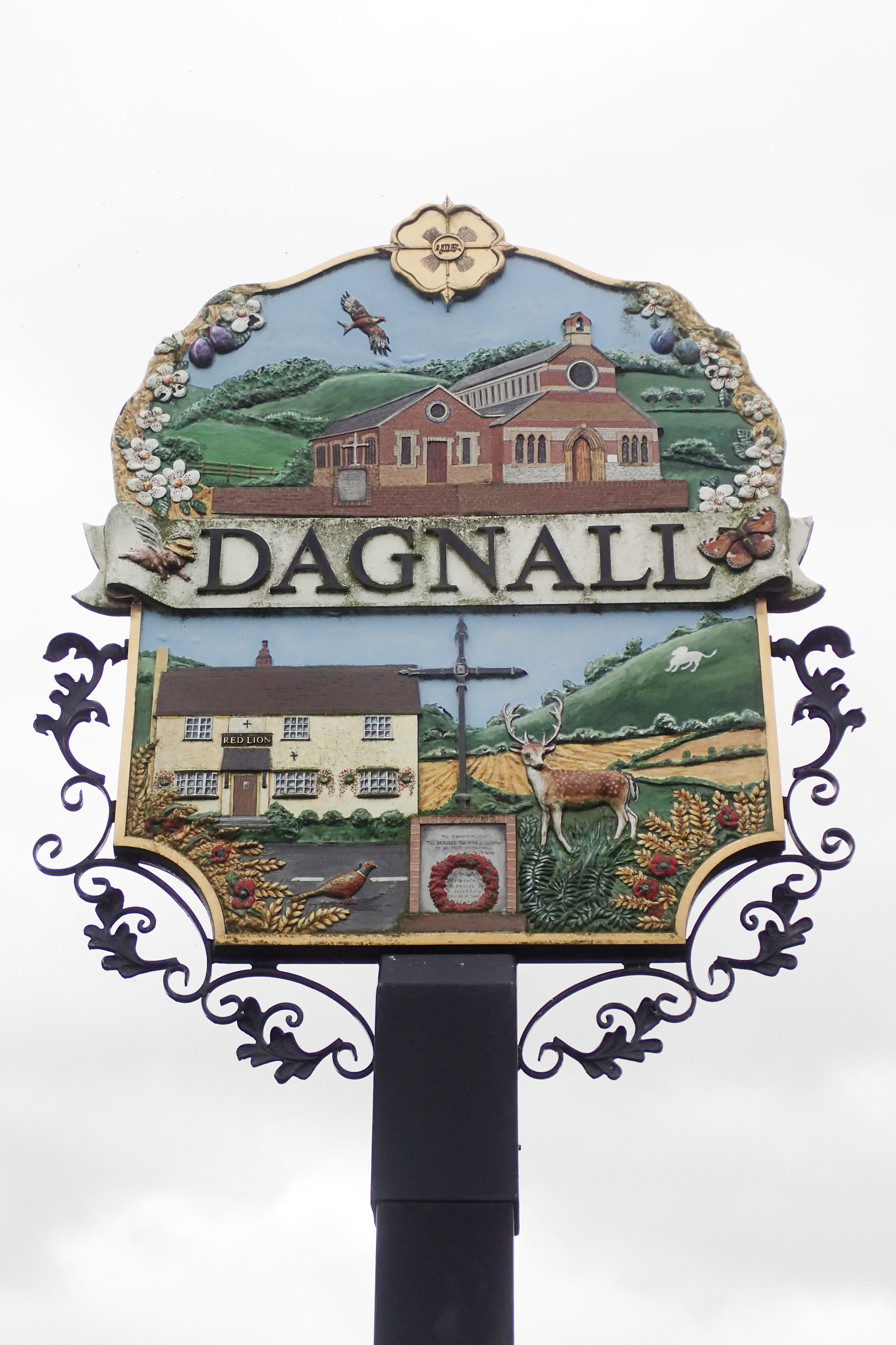
Village sign
Wild camping the whole way, needless to say, ablutions were at the most basic. Keeping up a decent pace and working hard, it is fair to say that I stank to high heaven when I finished my walk six days later. This was mostly due to the fact that, perhaps surprisingly, water can be a struggle to find. I never took a filter with me as agricultural run-off is rife and there was no way I was drinking anything that came from the many small streams. Instead I relied on finding somewhere, or someone, and filling up with water from midday onward and each nights camp meant there was enough to drink and cook with, leaving just the merest of amounts allotted for a cursory clean up of body with a cloth. The many villages passed offered no taps for travellers and little chance to fill up. I never had to resort to simply knocking on someones door, though in one town I did pop in to a motor mechanics garage and ask them for water. They were, of course, more than happy to oblige.
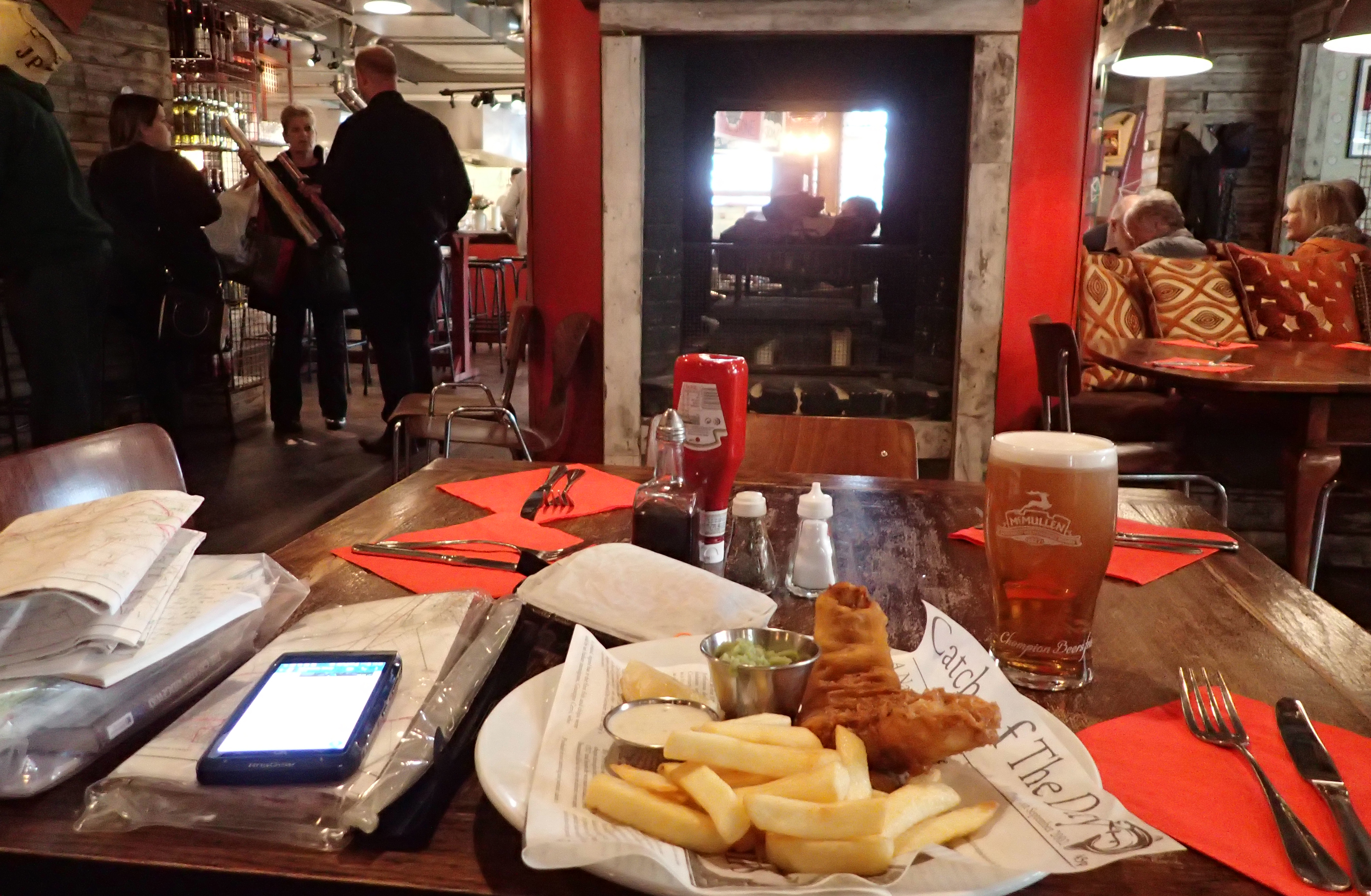
Three Points of the Compass paused for a pub lunch twice on the walk. The Jolly Postie in Royston provided excellent fish and chips and a couple of pints of beer. I could also top up my two litre Evernew bladder here, this was, of course, my true reason for popping in…
 The Icknield Way Trail follows grassy, leafy, stony or muddy paths, lanes, roads, bridleways and byways, and was never hard going. I found this particular route of less interest than both The Ridgeway and Peddars Way. But still, it was an excellent trail for a decent leg stretch over a few days and provided opportunity to try out a few pieces of my kit.
I suffered one particular piece of kit failure that resulted in some back pain. Painkillers (Vitamin I) were taken on one day but I never had to resort to them again. I’ll cover that particular problem and subsequent fix in my follow up gear report later.
At Burrough Green the trail passes the 17th century schoolhouse. Now given an appropriate new lease of life as a home for the village playgroup
Avenues of Pine welcomed me into the Brecklands
I always derive pleasure from walking in the Brecklands and the trail passed into these on day five. Deciduous mostly gave way to Coniferous, the paths became sandier and the air perhaps just a little more fragrant as I began to pass numerous pig farms.
Sadly, my time here also coincided with a large number of off-road motorcyclists and quad-bikers on the By-ways. The great majority showed great courtesy to a pedestrian, the minority seemed to want to kill me.
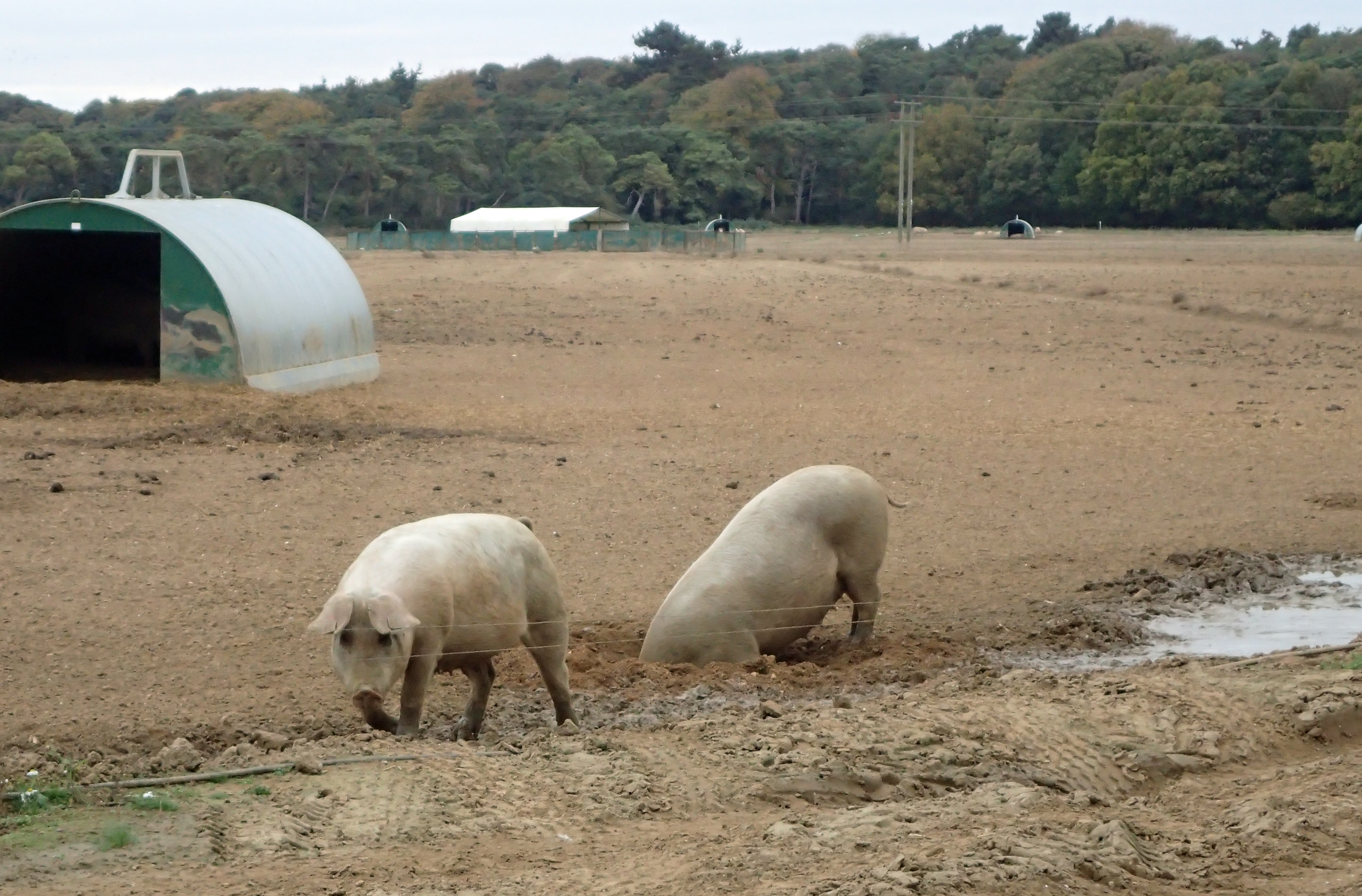
Pig Farm in Suffolk

Horses in the paddocks, nearby cameras bristling on poles, helicopters taking nearby owners to and from their business, another world
The economic disparity of the countryside was only too apparent on this walk. I passed horse paddocks where a few million quids worth of stud pranced. I was only a few miles from the famous horse racing town of Newmarket where James I was pivotal in starting the ‘sport of kings’.
Only a couple of miles distant, lonely hamlets vividly indicated a lack of employment and hardship. There was often a helicopter in the air on the final two days and I wondered how much of the overseas money filtered into the local economy.
Three Points of the Compass on his final day on the Icknield Way Trail. The track extends 6.5km into the King’s Forest. This woodland was afforested in 1935 to commemorate the Silver Jubilee of King George V. As I walked through it in the early morning, I was accompanied by the constant sound of rutting deer
Would I do the walk again? No. Would I recommend it to others? Again, no. Unless you are completing the entire Greater Ridgeway. In that case I think you would find sufficient of interest to make it worthwhile.

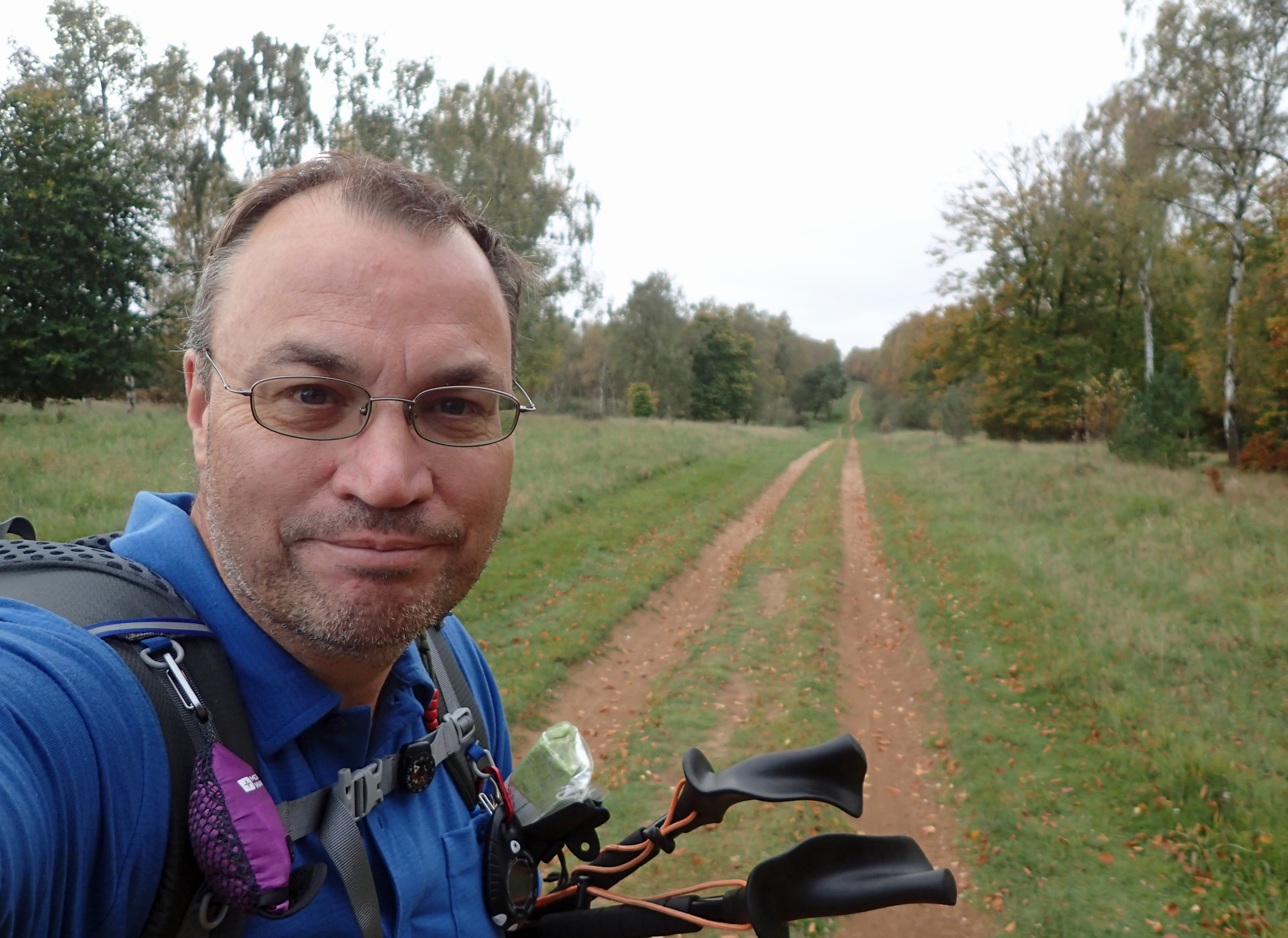
Final day on trail for Three Points of the Compass
Three Points of the Compass does not always blog on the trails walked. Links to those that have been covered can be found here.

You’re achieving impressive daily mileage. Are you planning the same for your long walk? btw, you may already know this but many churchyards have taps. Looking forward to the update blogs about the kit changes etc.
LikeLike
Hi Helegant,
I often have a brief explore of churches and churchyards. I am fascinated by their architecture and you can also usually find a quiet little corner, with a seat for a brief halt from walking too. A tap in the wall of one church on The Ridgeway is a particularly well-known water point. I wrote about it in a blog I posted on water sources on that trail. I never stopped at all the churches I passed on the Icknield Way, but I did have a poke around a couple in the hope of finding a tap. They are often provided for visitors who are watering flowers etc for graves they are tending. All I found though, were either no taps, or where they appeared to be emanating from rain water tanks rather than providing fresh potable water.
As to my daily mileage. That is partly because I was wild camping- leaving early and arriving late, which gave me as many hours walking as there were available, and partly because I did too much! I do not plan, at all, in maintaining that sort of mileage on my long walk next year. I need to play the long game, to keep my knackered old body functioning over a lot more than six days. I also want to take more time out to visit places, to enjoy the scenery, who knows, even paint or sketch a little in my journal. To stop and smell the roses…
LikeLike
Hi Jools,
I would like to the Icknield Way this summer.
I’ve read that not all of the Way is worthwile to walk; and pethps summer isn’t the best season.
Could you give me some advice as I’ve never done long walks before.
Regards
David
LikeLike
Hi David
I must confess that I would not pick the Icknield Way as a first long walk. Is it your intention to carry on to the Peddars Way at some point? If so, I could see some sense in continuing to the sea as it were. The Ridgeway itself is a more interesting and better walk I would suggest. That said, I have always felt that something like the Dales Way is a perfect introduction to long distance walking. That pretty and interesting trail is head and shoulders over what the Icknield Way has to offer.If you do choose to walk the Icknield Way this summer I am unsure of what overnight halts you may manage to arrange. With the current sad situation, few will be taking bookings at present and wild-camping opportunity is not exactly fantastic on the trail, but can be done with care. Best wishes whatever you decide- http://www.icknieldwaytrail.org.uk/
LikeLike
I lovedthe ridgeway for the scenery
OK its not the Dales or Lakes but I found it really nice.
It was part of a self imposed project to walk from Avonmouth to Lowestoft, a longer coast to coast.
LikeLike
Thanks for your comment Ray. It is five years since I walked the Icknield Way and what with world events and many hundreds of miles of other trails in the interim, it seems like part of another life now! You do remind me however that I need to revisit that little project of mine to complete the ancient Greater Ridgeway from Hunstanton to Lyme Regis. I only have the Wessex Ridgeway to complete, so I must try and fit in that 123 miles or so next year. As to the Ridgeway itself, I enjoyed that trail immensely and Mrs Three Points of the Compass has promised (sort of) to join me to walk it again in a couple of year’s time. Did you blog or vlog your Avonmouth-Lowestoft walk at all?
LikeLike