
A warm day was forecast. From experience on day one walking from Southwark Cathedral to Welling, I expected to pass few places to get water and in this Covid year I was limiting visiting shops, so I slipped a couple of extra Smartwater bottles into the day pack.
Day Two- Welling to Dartford
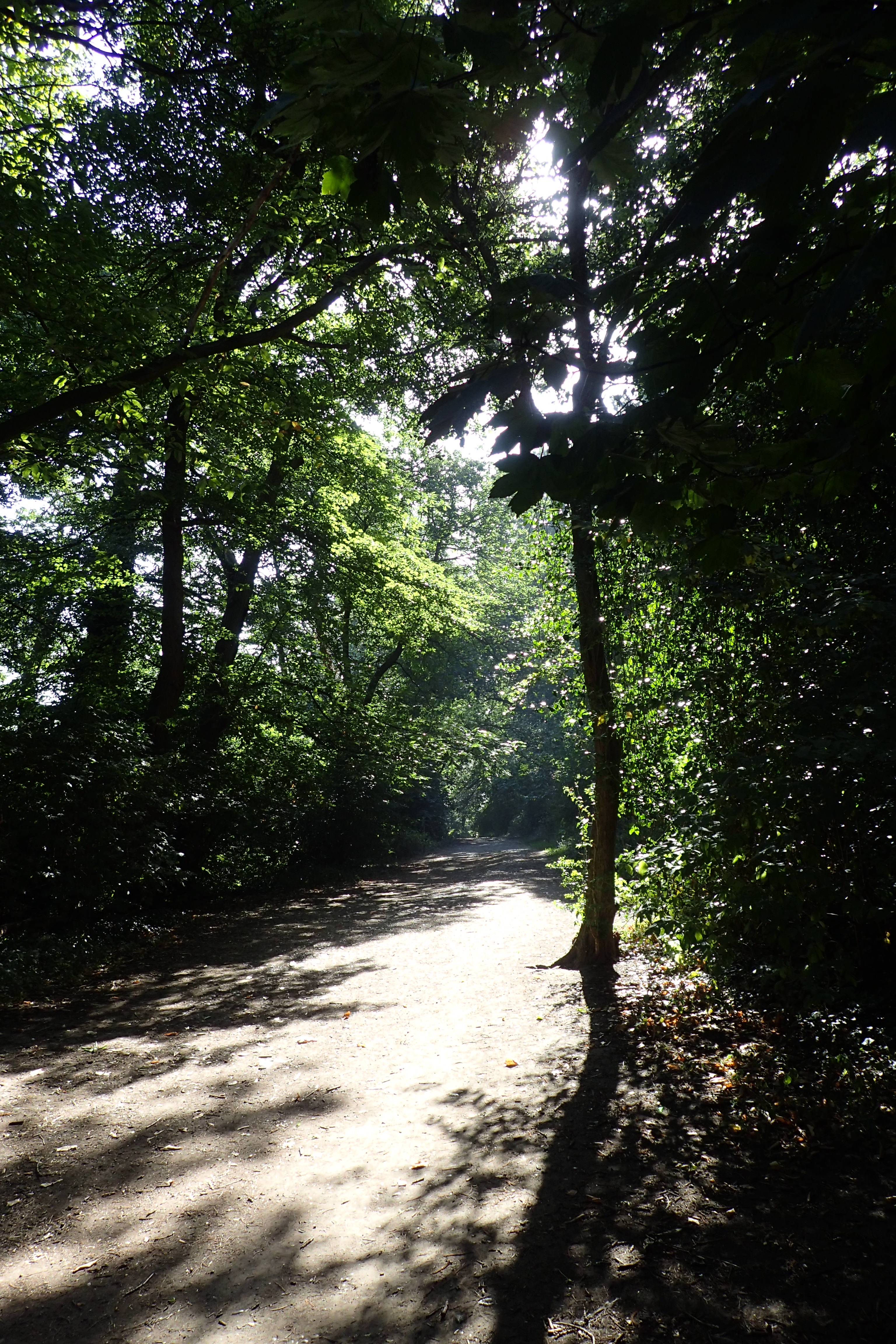
In an attempt to escape a little of the days heat I caught an early train and arrived at Welling station, where I finished the previous section, soon after seven. There was just a little wandering the back streets of a smart estate before entering Bostall Woods with its gentle shaded paths. There was almost no-one around, just the odd runner, though they probably though I was an odd walker…
It wasn’t quiet though, Ring necked parakeets flew in the canopy making their usual cacophony while doing so. These birds seem so alien to the British avian fauna but since becoming established in the wild (either escapees or deliberately introduced) in the 1970s, they have grown in numbers and thousands not only encircle London but now extend into the Home Counties and beyond. Despite the racket they make, Three Points of the Compass is quite fond of these little green parrots and will regret the inevitable cull in numbers when it comes.

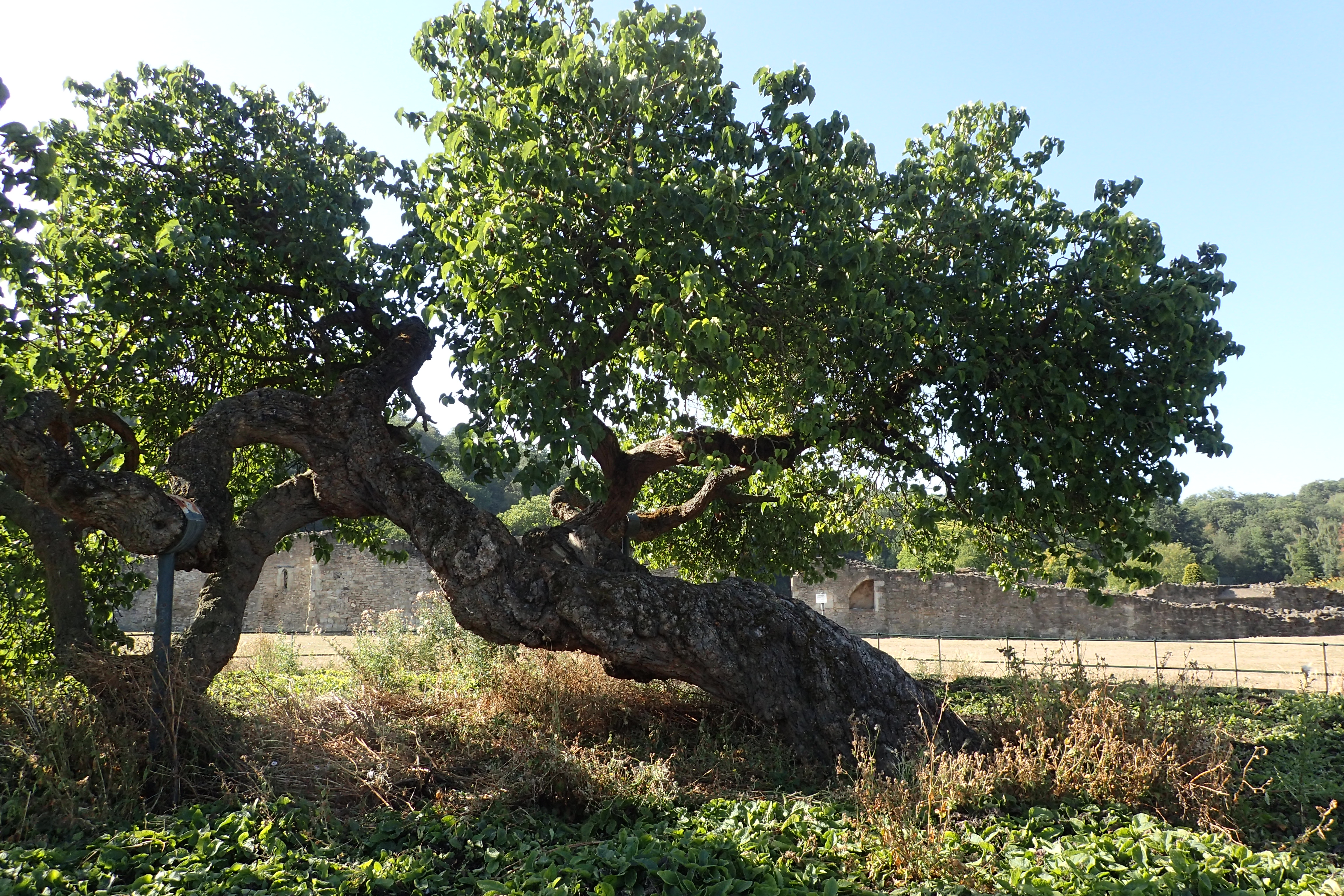
I was following the Green Chain Walk. A path I must find out more about as it seemed very well-routed on paths through parks and wooded areas as I headed toward the River Thames. It isn’t far, but after my road and traffic walk out of London, this was a pleasure. It wasn’t long before I reached the ruins of the 12th century Lesnes Abbey. A location that is very much linked to the Pilgrims Way.
The Abbey was founded by Richard de Luci, Chief Justiciar of England in 1178 as penance for his role in the murder of Thomas Becket, then Archbishop of Canterbury. Richard was an important chappie, second only to the King, so he had a bit of clout.

There were a fair number of people at Lesnes Abbey. Some runners, but mostly young mums with their charges in pushchairs. Some older couples wandering around. No-one other than a single young family had left the finely kept gravel paths to explore the Abbey ruins, despite it being both permitted and gently encouraged by signage. I stepped off the path and could immediately feel disapproving glares. It is a fascinating and freely accessible site. I ambled around the whole scheduled monument for half an hour then decided it was time for brekkie. My plan had been to find at least a mug of tea at the cafe here. However I arrived an hour before that opened. So I drank enough water to float a boat and wandered off through the landscaped paths to exit the grounds at the far end, munching an oat bar as I went, a poor substitute for a bacon sarnie I felt.

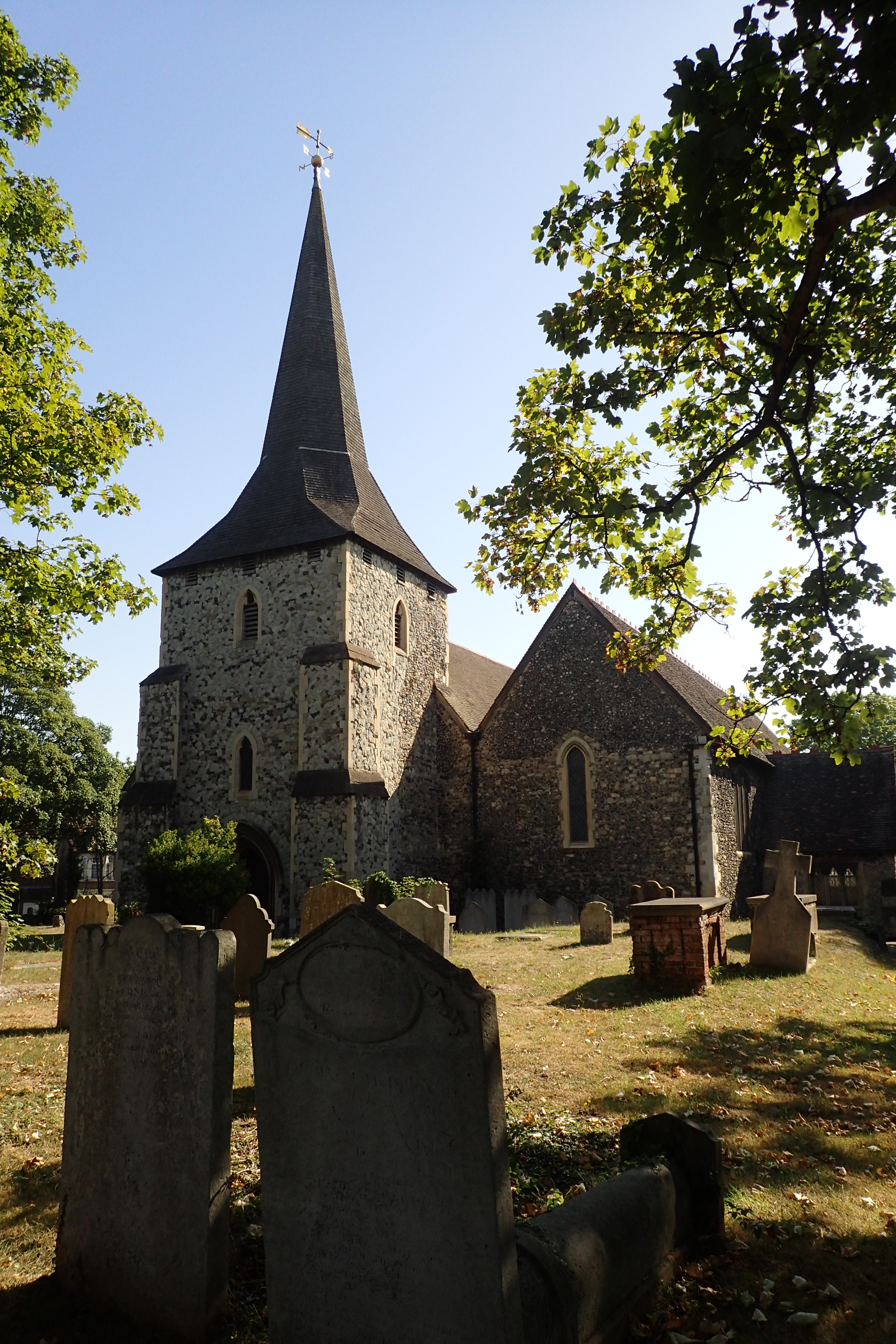
After the exposed 88 hectare site of the Abbey ruins, it was lovely shaded walk to Erith. I had hoped to stop in the St. John the Baptist church here to see the tiles that had been resited there from the ruined Abbey ‘back-in-the-day’ but the doors were firmly locked.
From there it is a short walk to join the Thames Path on the banks of the river. The tide was out, exposing the odd half-submerged shopping trolley and cycle in the mud. It was now all very warm and sweaty walking, very still, no-one around and I paused for a few minutes on a handy seat in the shade to cool off, rehydrate and make a few notes.
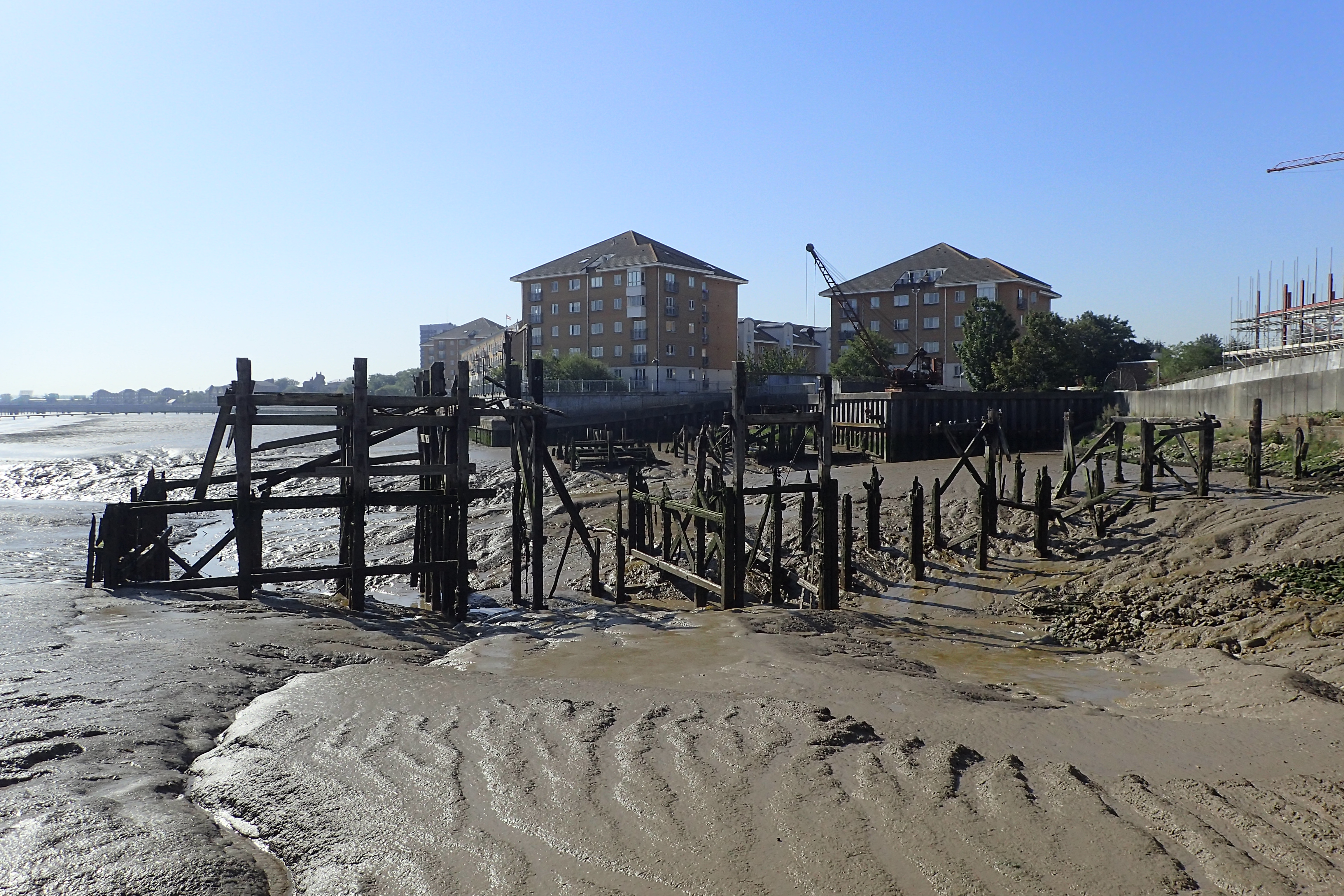

While the Pilgrims Way was now back amongst buildings, I had the wide river to my side for much of the remaining walk. Even when I left the Thames and headed inland, I was following the River Darent up the valley toward Dartford. This was familiar ground to me as I had come this way when I walked the London LOOP.
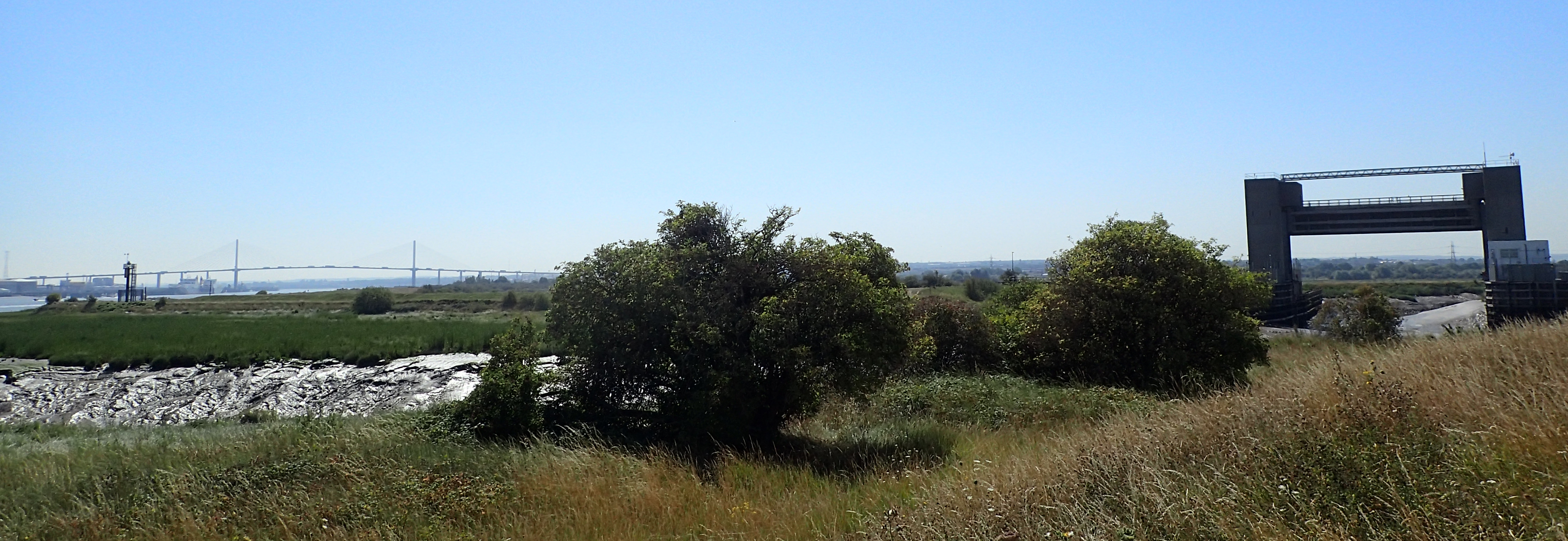
I walked past the Dartford Barrier, built in 1981. It forms part of the flood defence system for Greater London and has been crucial in protecting Dartford and Crayford from flooding. The raised gates weigh 160 tonnes each and can be lowered even if the power goes. Well, I found it impressive….
After a couple of km walking through scrubby thorny riverside paths, it changed to mostly uninteresting and brisk walking through the sort of tatty industry that always sits on the edge of towns, to days end at Dartford railway station. I had completed another short day, just 11.33 miles with 689 feet of ascent. Another early train to catch- the 12.58. It had been a warm day, reaching 35°C (95°F) for much of the morning. My next section would be the final day on the London link of the Pilgrims Way, taking me from Dartford to Otford. I had enjoyed today immensely. While it had been quite short, it was also mostly pleasant walking with a few interesting things en route. A good day, and still home in time for an afternoon pint in the pub.

Three Points of the Compass does not always blog on the trails walked. Links to those that have been covered can be found here.

A grand blog, thank you.
LikeLiked by 1 person