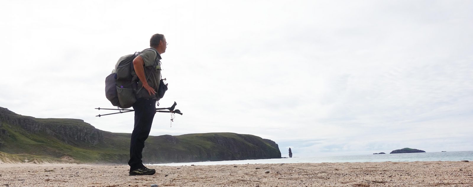
Three Points of the Compass completed the first half of the river Medway Valley Walk between Tonbridge and Maidstone over one day. The second day between Maidstone and Rochester completes the trail. Previous years saw the Romans crossing the river prior to thrashing the Brits at the Battle of the Medway, and lumbering Seaplanes taking off from the river to go in search of enemy submarines.

I slept well with no noise from outside. I like an open window in my bedroom but, typically, the hotel windows were sealed shut. Each time I had peered out the rain had been hammering down. But eating a decent breakfast (excellent bangers) beside a window in the morning light I could see that it was brightening up. So shorts and polo shirt attire was order of the day and it was blue sky, sun and humidity when I set off for the short walk from my hotel to the river. It was midweek and the town was busy with people going to work. I was happily smug wending my way down the hill to waters edge. I’m on holiday…

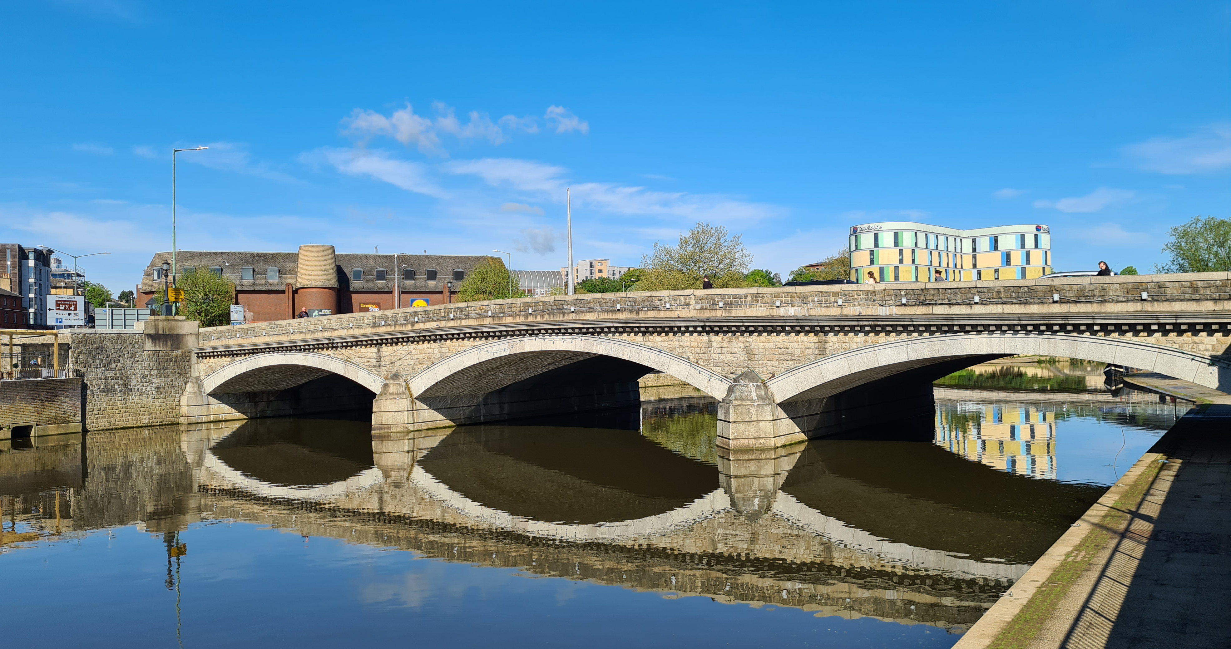
I paused on the lovely elegant Victorian bridge to take a couple of snaps of the Archbishops Palace upstream before continuing over and dropping down onto the clean, wide waters edge path, dodging large puddles and the considerable number of joggers. Beside me, the water was high, testament to the recent rain.
Perhaps surprisingly, the three arches of the bridge are not built of local stone, instead being constructed of Cornish granite. Spandrels and parapets are Kentish ragstone, capped off with more Cornish rock. It’s designer was Bazalgette, the man primarily responsible for ridding London of the ‘Great Stink‘. The spans had to be wide to permit the sailing barges to pass under. In 1834 there were fifty barges transporting goods and produce from here and upstream as far as Tonbridge. All of the Weald of Kent and much of Sussex got their groceries from Maidstone in the mid-eighteenth century.
Maidstone is an old town though little evidence can be seen of its earliest inhabitants however the scars from quarrying can be occasionally seen from the trail today. The Romans excavated ragstone from the valley sides and transported it by the River Medway (Fluminus Meduwaeias) and Thames to London to build their city walls. Still later, the rock was carried by the same river to build Westminster Abbey and Eton College.
The wharves and industrial premises that once lined the river are mostly gone today and it is pleasant leafy walking for the first few miles downstream from Maidstone and the river got a bit busier with boats. My first sightings were of skullers with accompanying small motor boat containing a loud man shouting at them, and a bunch of canoists who didn’t seem in any hurry to go anywhere.
I am not sure why, but I totally failed to notice Allington Castle on the other bank when I passed it. Perhaps one to return to another day though it is not normally open to the public and only the exterior can be viewed. Just past the unseen castle is a place that I took Miss Three Points of the Compass to see a few times when she was younger. The twenty-seven acre Kent Museum of Rural Life is now rebranded as Kent Life and by all accounts is very much aimed at the younger visitor these days anyway, so I passed it by.


If passing this area, it would be worth parking up in the vicinity just to walk this stretch of riverside path to Allington Lock. Not only is it quite pretty, with mature trees lining the sides, but there are a number of old and beautifully restored/maintained barges and other sailing craft moored along this stretch.
I reached Allington Lock, paused briefly to view it and carried on for a couple of hundred metres before realising I was supposed to have crossed the river at the lock and sluice. This is the extent of the tidal river here and expensive and ambitious works were underway to update the large and important lock.
Once over the river and past the works, I turned down the opportunity to stop for a tea in the beautifully situated, if small, stonebuilt riverside tearoom. It is a short climb away from the river to cross the railway and then walk over a bridge with the howling M20 below me.

I passed a well-worn trail sign at the far end of the footbridge. This was a bit of an indicator of how the rest of the walk was going to turn out. A bit tatty and battered in places.
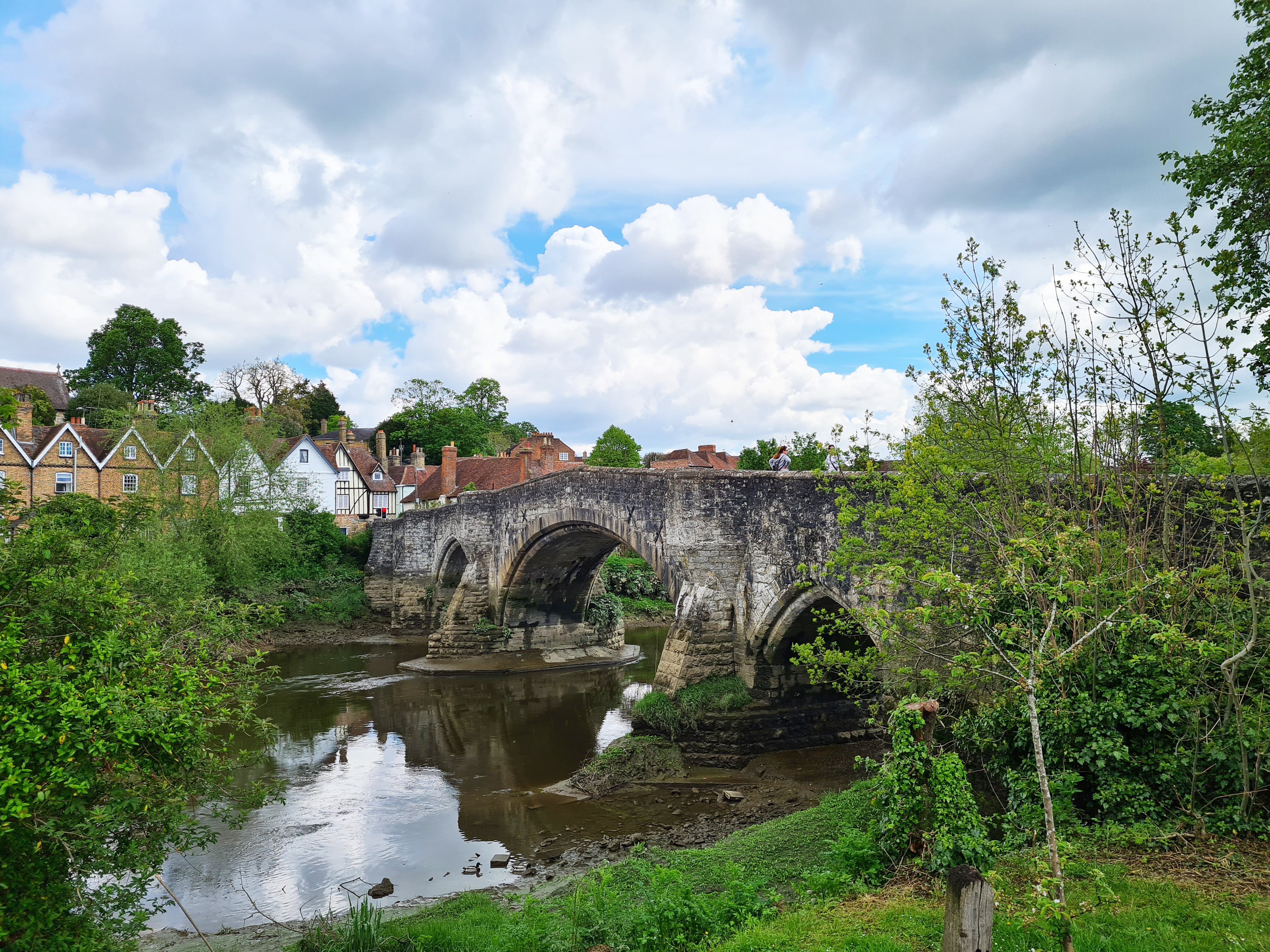
With just occasional glimpses of the river, the footpath took me to Aylesford. Once there, a brief dice with death crossing a road with impatient drivers, then a pause at what has to be one of the most delightful bridges to be seen anywhere. One of four medieval bridges on this walk, the bridge at Aylesford has been very heavily altered over the centuries but you would never think it. I just had to pause below its side for twenty minutes with pack off, rehydrating. There may have been another smug selfie sent to some family, just saying…

I took a few minutes out to read up on the trail in the one guide book I had bought with me, which is just about all there is curently available. This is the excellent Three River Valley Walks in West Kent, produced by the Kent Ramblers in 2018. I also have the beautifully illustrated guide book produced by the Kent County Council in 1996, but the design of that book is hopeless and I never bought it with me. Other than the guide book, I also carried two O.S. maps- 1:25 000 Explorer 136 and 148, on which the trail is shown. It is not often that a map has to be consulted on this walk, but I like to carry the necessary.
Below Allington Lock the tidal river was quite low and all of Aylesford bridge buttresses could be seen. Gulls pecked at debris on the exposed mud. The Medway is not the cleanest of rivers. Clear water is infrequent and weedy vegetation can suffer. Yesterday, my first day on this two-day trail, had seen me pass through the fruit belt- the ‘Garden of England’, from which there can be considerable chemical run-off into the river. This is combined with the inevitable run-off from many dairy fields on the slopes. The clay content from the Wealden clays it cuts through stains the water and it is not for nothing that when I was a squaddie, barracked further down the river decades before, we referred to the Medway as the Mudway.
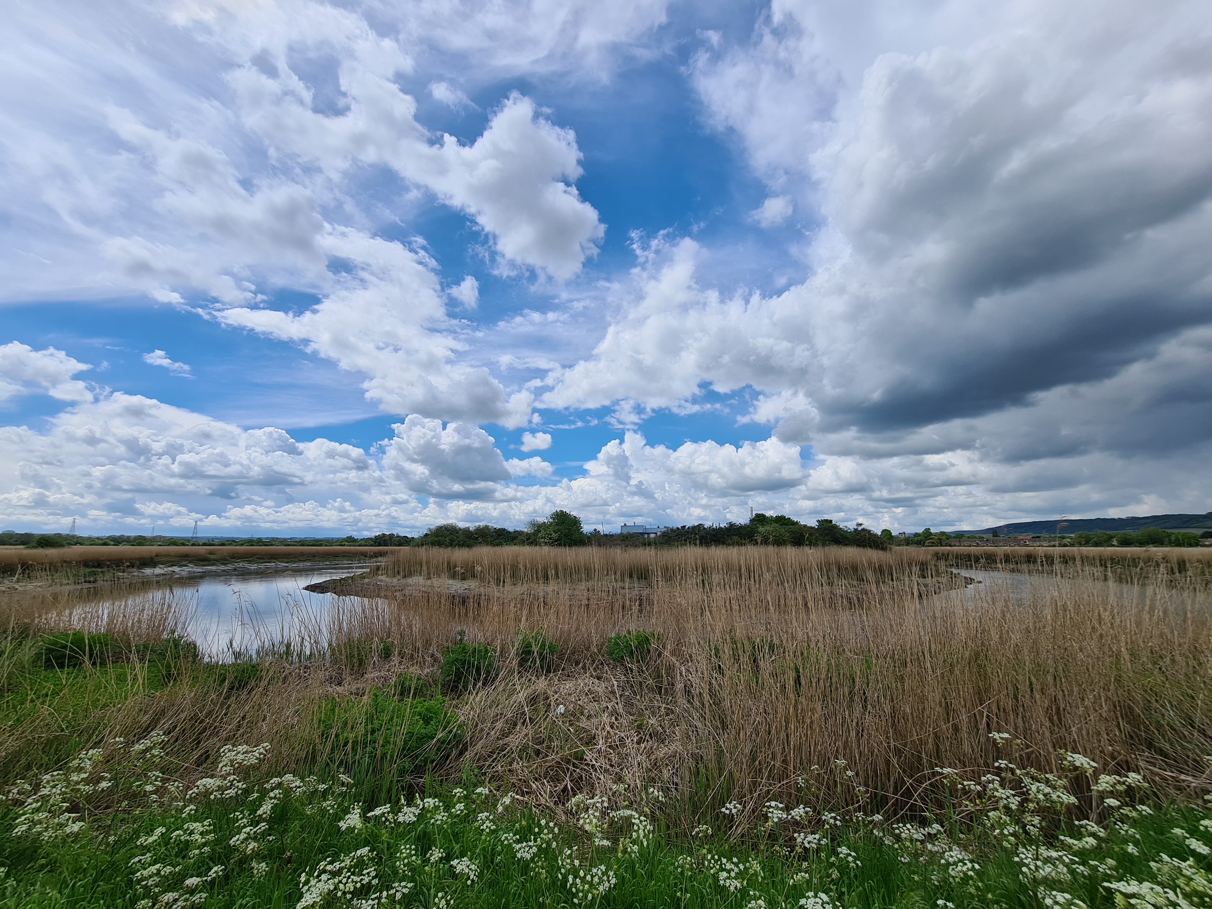
Not long after leaving Aylesford the route passes through a large sewerage works, sorry, water treatment station, before reaching Holborough and Burham Marshes. These are SSSI and contained fairly extensive reedbeds that gradually change through to carr and, later, tree covered stretches. I had never been here before and it really is a lovely stretch of walking. I think it would be fantastic for raptors in the winter, particularly as the footpath through the reedbeds is so well made and maintained. A single cyclist passed me on this whole section and I paused for ages trying to see just one of the many singing Nightingales. Needless to say, as always, I was denied. Lovely song though

I passed a large electricity storage station, pylons and neighbouring solar farm. Nearing the end of this nature reserve the map shows the site of a Roman Villa but I could see nothing on the ground beyond a possible site in overgrown ground on the edge of a cultivated field. I would be willing to bet that the metal detectorists are out here at times, if surreptitiously. Not the only illegal activity as there were a number of barriers with signs that the police were monitoring the area to catch dirtbikers and the like. Threats to crush confiscated machines may be having an effect as there was no sign of such activity and the ground was not torn up at all. Perhaps I was just lucky. From there it was a short walk to my next brief halt of the day. The Grade I listed Burham Church with its battlemented tower.
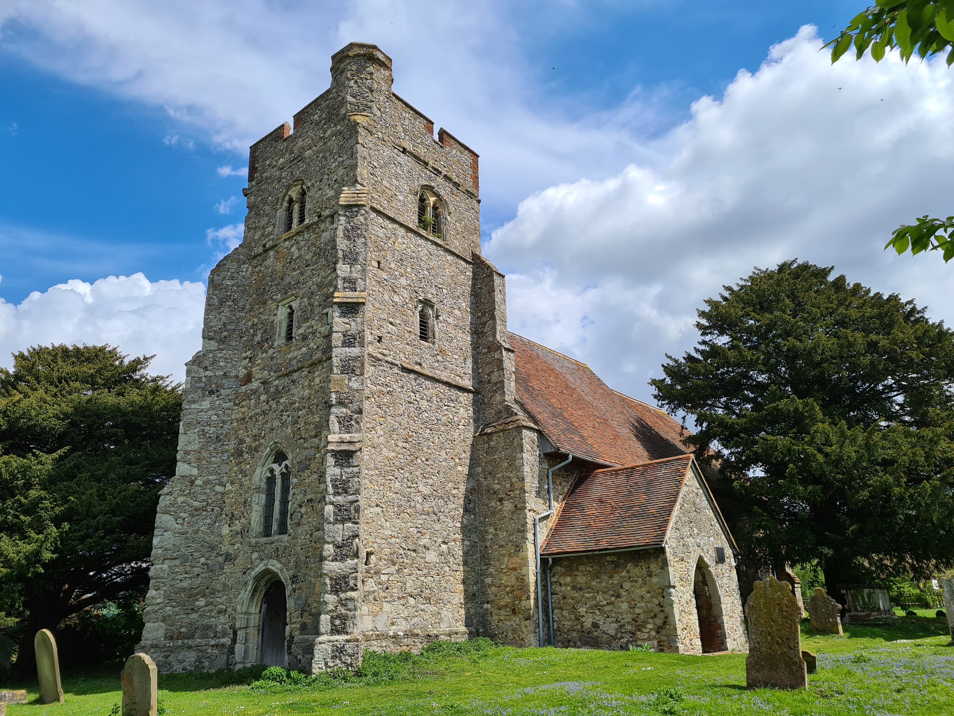

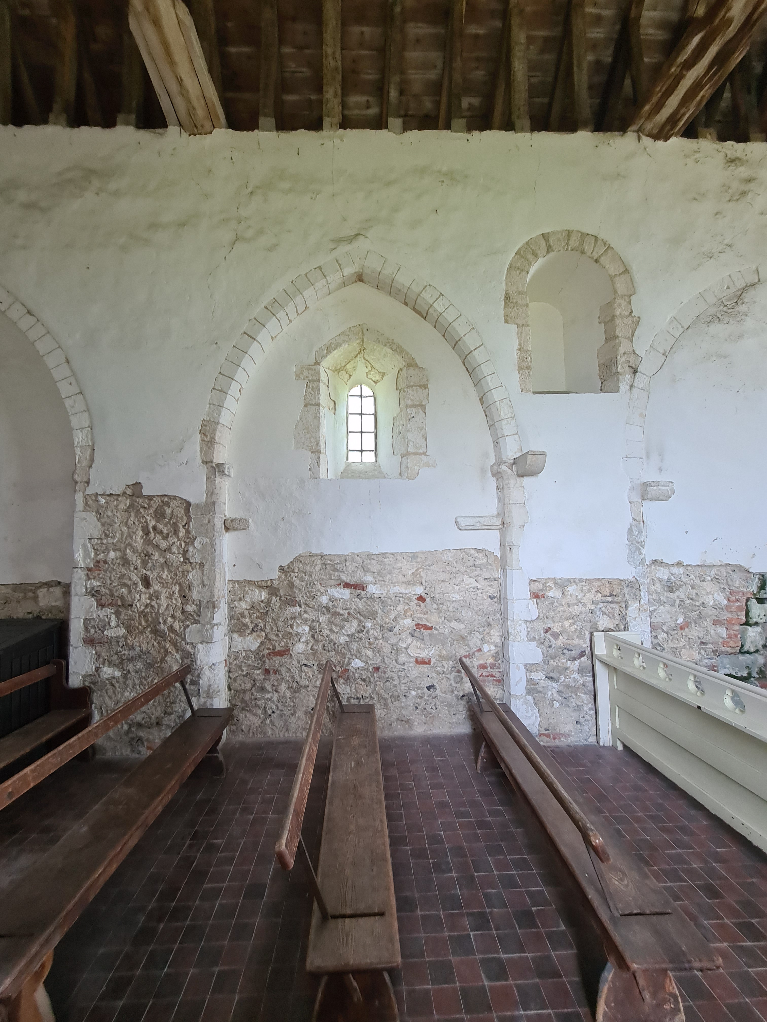


The entire village of Burham relocated in the 19th century due to the area becoming industrialised, the 12th century church was left behind and stands almost alone. It is now looked after by the Churches Conservation Trust and was open, so I obviously wandered in. The church boasts two Norman fonts and the tracery on the walls from removed and altered arches and aisles is evident.
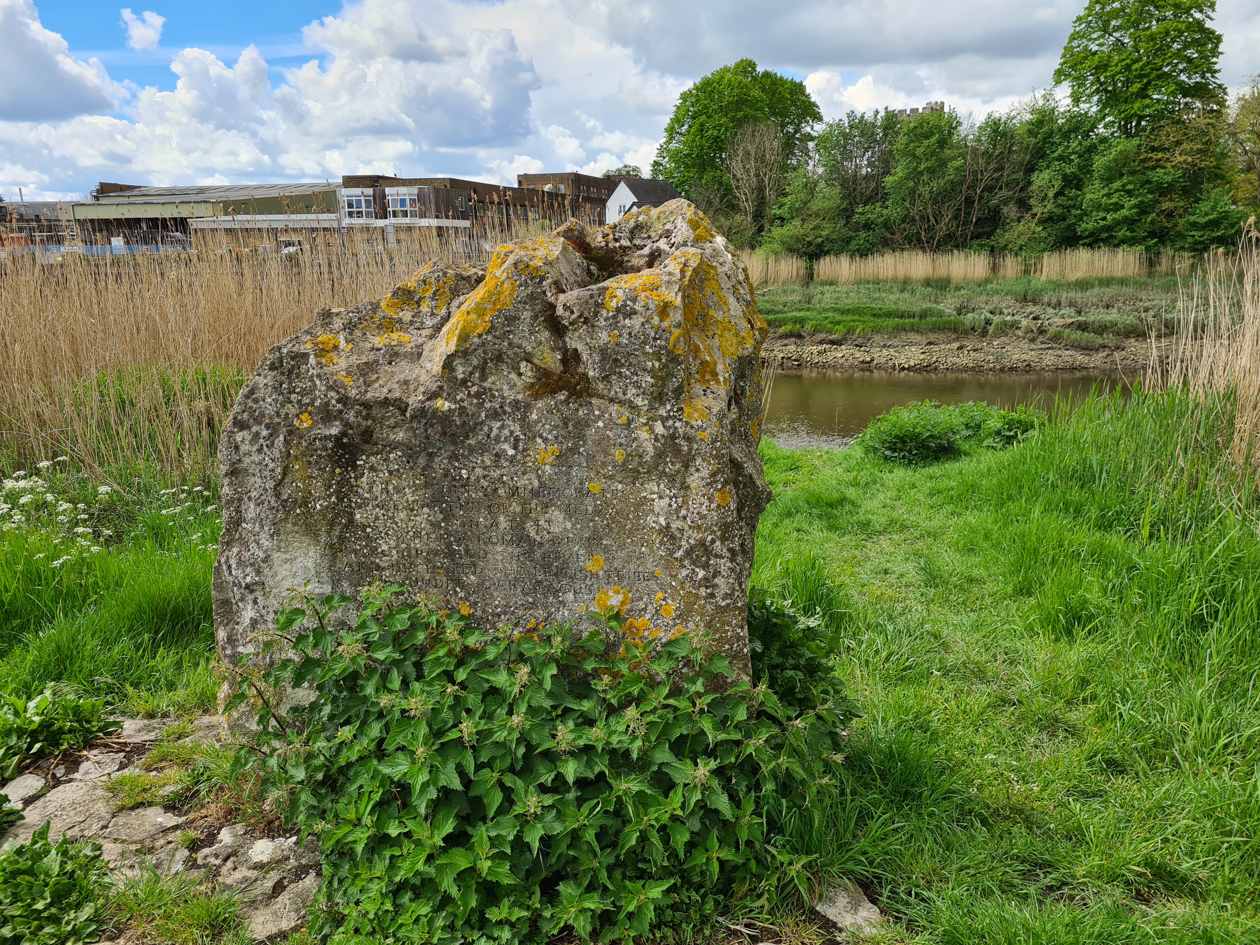
Leaving Burham Church there is an offical shortcut along a short stretch of lane, but to follow that misses out a lovely(ish) long looping walk out and round one of the tight bends of the River Medway as it nears the Medway Towns. There is a bit of reedbed here and Sedge and Reed Warblers were putting up a racket. That once hard to find but now increasing in numbers bird, the Cetti’s Warbler joined in as I neared a memorial stone just across the river from the huffing and puffing disaster of industrialisation that is the Smurfit Kappa paper recycling plant. This place has changed dramatically over the centuries. Awful unsightly works across the river today, but in 43 AD this is purported to be the site where an elite roman force found a way across the river to engage a large British tribal army at the Battle of Medway. The Romans won.
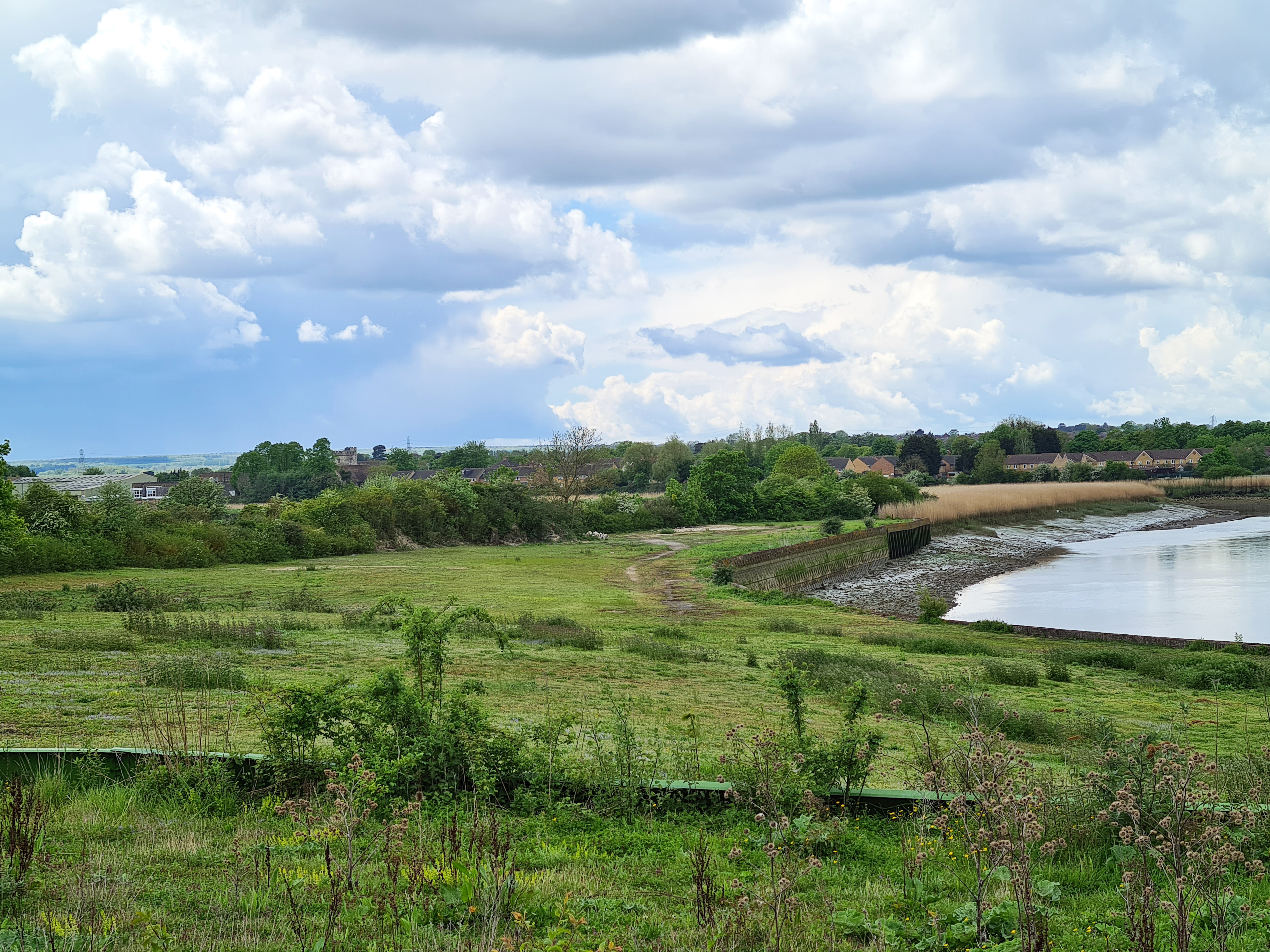
The remainder of this looping part of the walk passes the site of now long-gone industrialisation, but the rotting remains are all too clear beside the path. There used to be a large cement works situated by the river here. Lime Kilns of various types were installed and countless barges loaded at the wharves situated here. The eventual need to transport by rail meant that this site became unsuitable as there is no railway on this side of the river. So the whole thing closed down and moved to the other side further upstream. The concrete walls remain and many had toppled on to the path. Rabbits undercut the remainder and cracks and leaning multiple tons of concrete are destined to fall. I remained uncrushed however and emerged back on the lane, the church just a few hundred metres down to my right. I turned my back on that and, with a view over what remains of the cement wharves down to my left, walked toward Wouldham. But that was not my next village.

Wouldham village has less than 1000 residents. Years previous, they were asked to cast their vote on a proposed development of the village’s allotment fields. Ninety per cent voted against it. The parish councillors took a different view however and the development was approved and the first of 1000 houses at the new ‘Peters Village’ were occupied in 2017. I never paused there as there is nothing to see beyond new-build and wide paths overlooking the river.
As well as a pub, that I ignored, Wouldham was home to a couple of interesting buildings and a telephone kiosk withdrawn from service by BT. Communities are frequently given the opportunity to purchase unwanted out-of-service kiosks for their own purposes. Some house defibrillators, others can be exchanges for garden produce or act as local history points. Many are used for book swap purposes. The kiosk at Wouldham had been adapted for use as a local community lending library. This wasn’t one of the older cast-iron Post Office telephone kiosks, but a later KX100 model from the BT era. Three Points of the Compass looked at the different telephone kiosks that can be encountered on UK trails here
The trail leaves the course of the river at Wouldham, instead it climbs up the valley side, first by road, then on a sunken lane up the steeper wooded slopes until meeting the North Downs Way at the top and turning back northward to track the river below.


With such a vantage point, a view of the valley bottom below me stretching from far left to far right, it was time for a brief halt. I dug my brew kit out of the pack and soon a mug of tea made a two day old home-made peanut-butter sarnie a degree more palatable. I wasn’t stopping long though, I had another slightly off-trail ‘thing’ to look for.
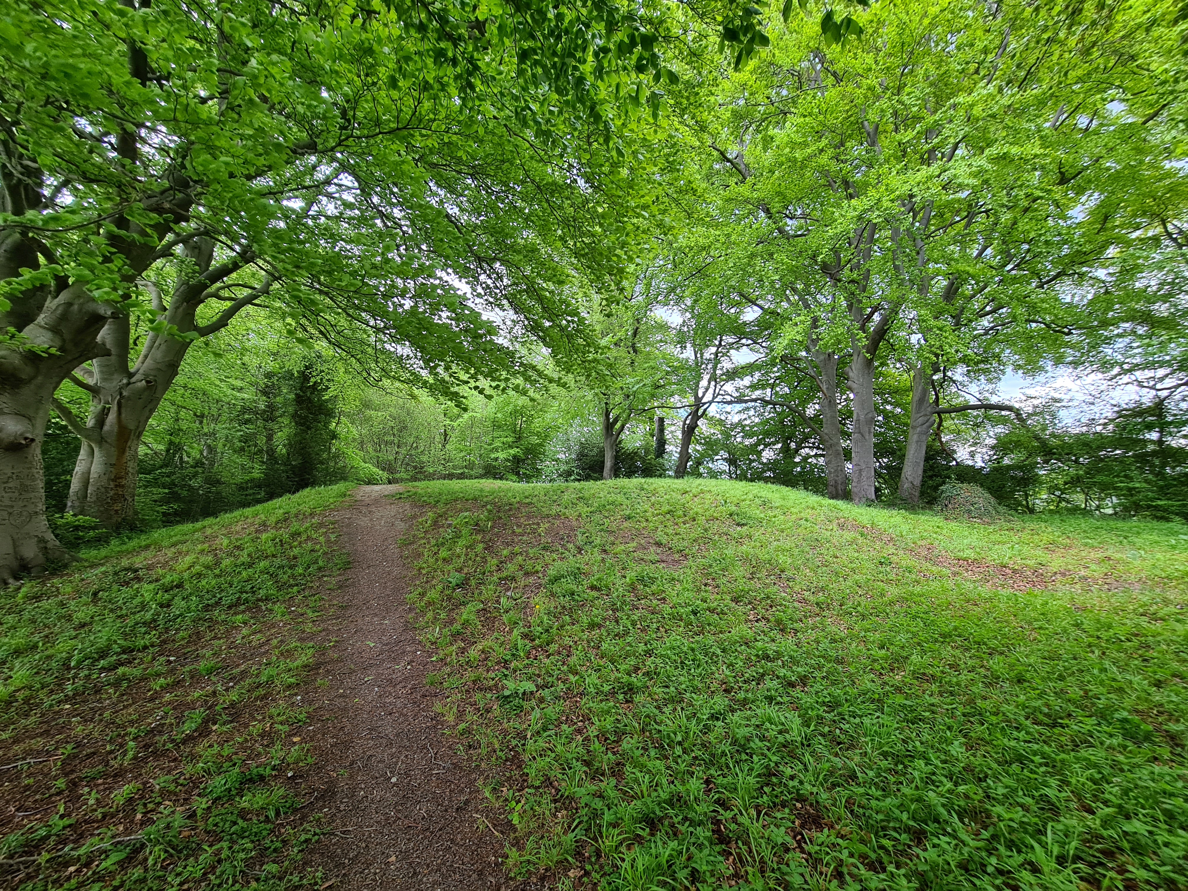
A tumulus (plural- tumuli) is a raised earthen, sometimes stone, mound over a grave or graves. Looking at the map I could see that one was located somewhere in the little strip of woodland to my right. Keeping an eye out, I was able to see it through the thin tree edge and clambered through the sparse fringe to see it better. There was not a great deal to view however. The sunken top, probably where the chamber had been excavated or given way, seemed to have become a favoured spot on which people had recently lit fires. Not only did I wonder if they actually knew, or even cared, that they were doing so atop an ancient grave, but also how many thousands of people walking the North Downs Way, contiguous with the Pilgrims Way here, pass by the tumulus unknowingly, just metres away.
My path dropped down the hill and over a railway bridge to pass through a farm and associated rural houses and emerge onto a road. This is followed for a short distance before ducking under the thundering M2. The bridge over my head is 3272 feet long and a 100 feet above the river. I then fleetingly passed through non-descript Borstal. Unremarkable it may be, but this village has given its name to one of the largest step-changes ever made in incarceration history. Sir Evelyn Ruggles-Brise vehemently disagreed with the practice of imprisoning young offenders alongside hardened adult ‘old lags’. The first purpose built ‘Young Offenders’ institute was built on the slopes outside the village in 1908, and the name ‘Borstal‘ was adopted for similar institutions subsequently built throughout Britain and further afield. I now find it impossible to see a roadsign for this village without thinking of the institutes. What does that say of me?
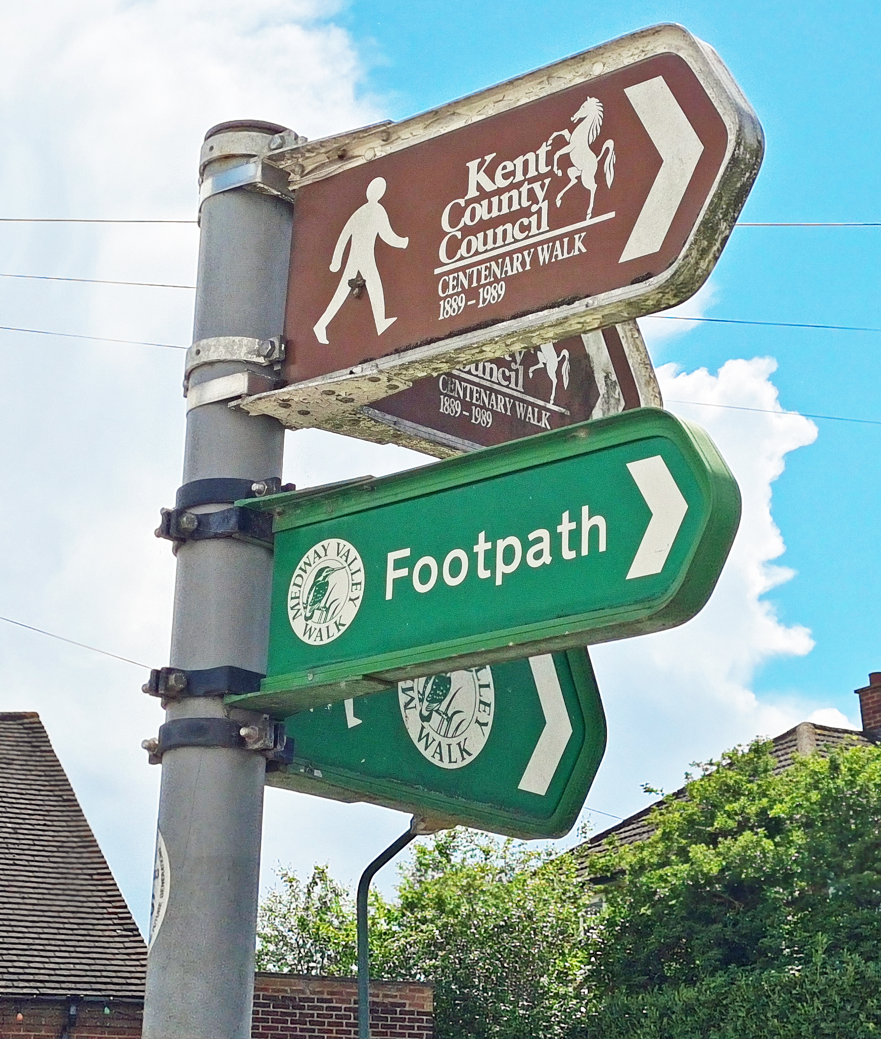
The trail leaves the main road and drops down a scrappy back lane, passing a sign for the Kent County Council Centenary Walk, what seems now to be a non-existant route as I can find no mention of it elsewhere. Having dropped down the valley side the path turns a sharp right and continues through Borstal Recreation Ground, Shorts Way Playing Fields and Baty’s Fields, which is actually riverside saltmarsh. This is all land gifted over to the people of Rochester and Borstal. Then it is out onto the Esplanade, following the riverside all the way to the end of the Medway Valley Walk at Rochester Bridge, on the site of where the Romans had built their bridge, to carry the important Watling Street across the river. But there was still something for me to see before the end.
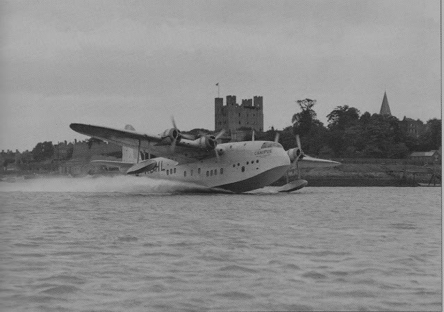
Shorts purchased eight acres of land in Rochester to replace their previous factory located on the Isle of Sheppey, not too far away down the coast. I explored that area on a walk last summer. This replacement site in Rochester provided almost direct access to the sea for the Shorts seaplanes they built here. Early in the First World War, they had completed the building of the first factory buildings, along with a slipway down into the river. During the war, the site produced over 900 Short Admiralty Type 184 planes and over 50 seaplanes. Following the first experimental launch of a torpedo from a Short S 64 Seaplane in 1914, it was one of the Type 184 that dropped the first ever air-launched torpedo against an enemy vessel (a Turkish supply ship) in 1915. After the war, Shorts were awarded the contract to build the Sunderland Flying Boat (the Flying Porcupine), possibly the most successful long range seaplane used in the Second World War, particularly on submarine hunting duty. Running out of space, Shorts tunnelled into the chalk cliff face behind them, creating a further 12000 square feet of workspace. The slopes here are still riddled with over three miles of brick-lined tunnels, now sadly closed off for the best part. After the Second World War Shorts relocated to Belfast prompting the largest workers protest march ever seen in Kent- 5000 of the 12000 factory workers employed took to the Medway streets, to no avail.
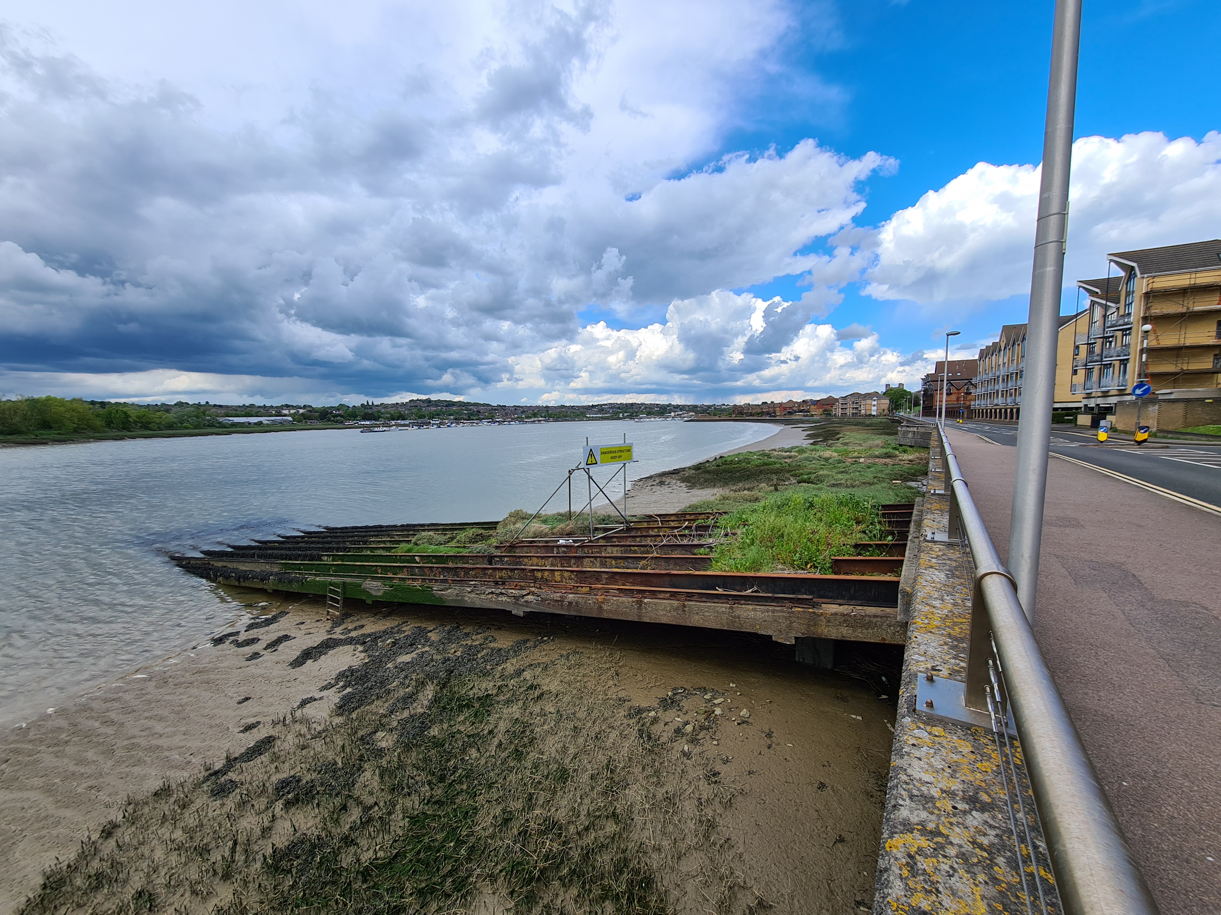

There is almost nothing to see of this aviation history when following the esplanade from Borstal to the trail end at Rochester. New housing has wiped it all away. The sailing club utilises ancient concrete slipways and a little further on huge and now rusting iron rails still drop into the river. It was from these that newly assembled aircraft were launched. Even a gyro-seaplane was experimented with, launched from this slipway. My Uncle once told me of the days when, as a child, he would visit the family allotment in Medway with his dad, the two of them would pause from their labours to gaze skyward as the thundering newly built seaplanes took their first practice flights. That would have been in the thirties. Years later, in the eighties, Three Points of the Compass lived on the outskirts of Belfast and would gaze skyward to see the newly built Short Skyvans (the Flying Shoebox) taking their own first flights.
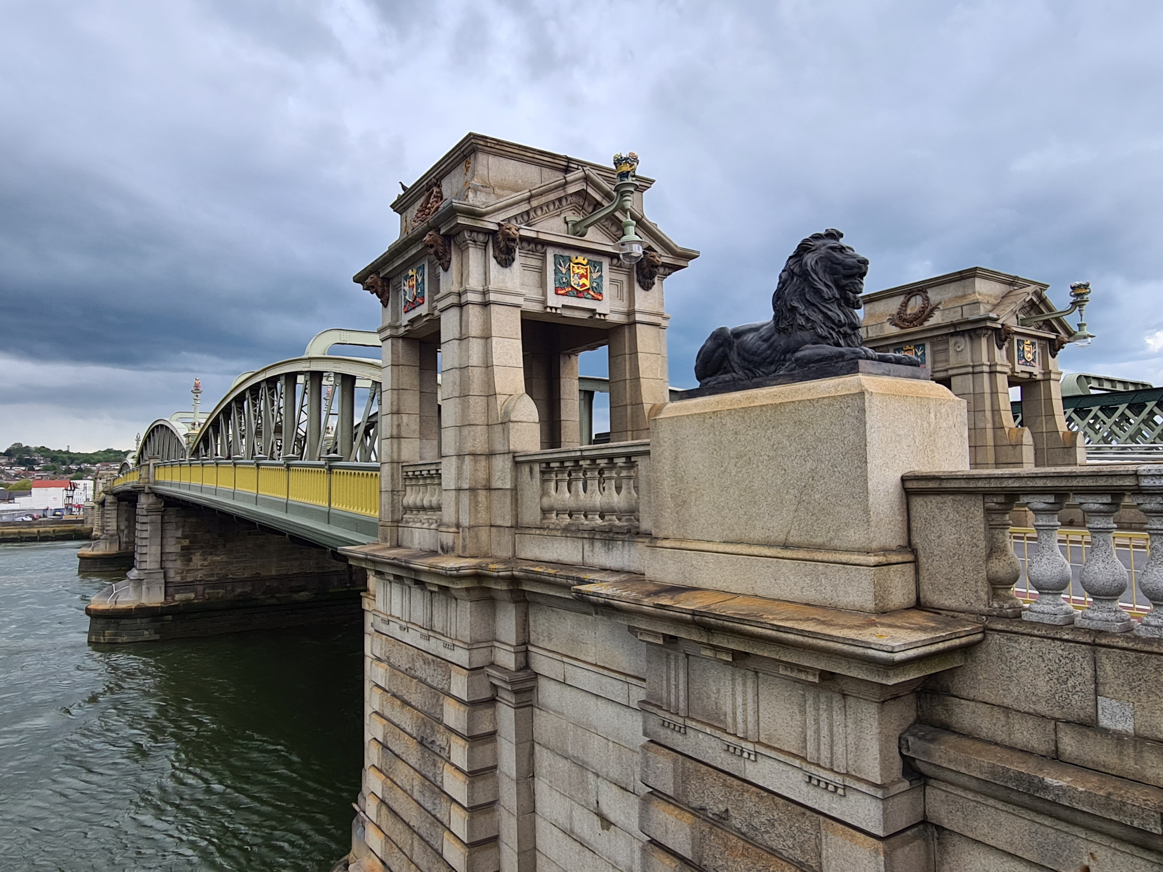
My walk was almost finished and I diverted to walk through the gardens closest to the river before nearing the castle high above me on the right. Rochester has been home to the ruling tribes or conquerers for thousands of years. The Romans ousted the British tribes, far later, the Normans did the same. In 1087 they built a castle to keep an eye over such an important river crossing and it has the tallest Norman Keep in the country. Outside that and next to the road, the walls are built in layers. Just prior to reaching the bridge, I stood in the road and gazing up I could see three courses of wall- Roman, Norman and 13th century repair. Climbing the steps to the castle grounds and standing atop the walls I could look down on the ‘modern’ bridge which stands about a hundred metres downstream of where the 14th century bridge stood.

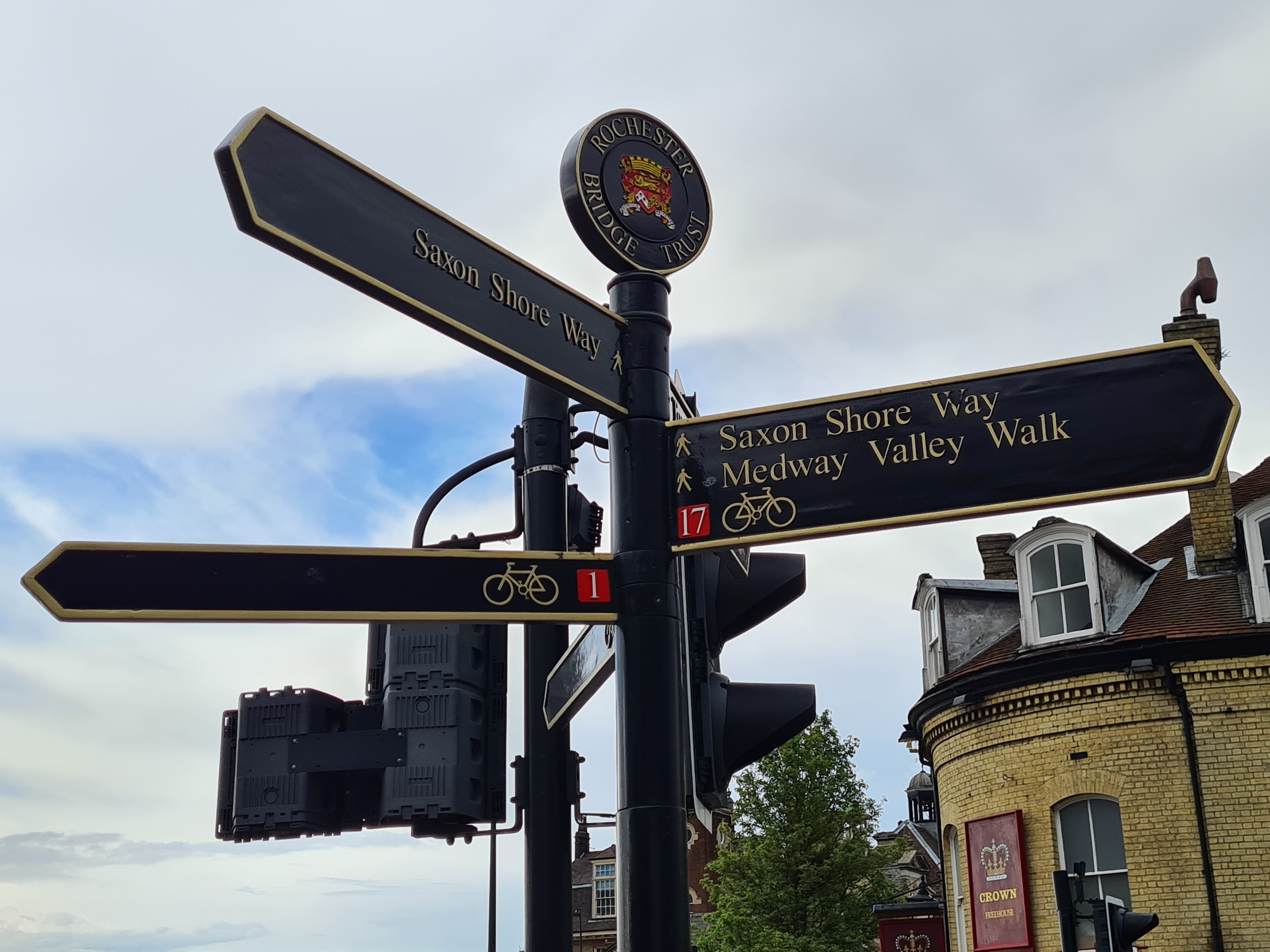
All that remains of the 1856 bridge, demolished prior to the present crossing being built in 1914, is the limestone balustrade (now Grade II Listed) which was moved to the river bank. The bridge at Rochester, crossing over to Strood, is remarkable in that it is maintained by a charitable trust. Maintenance costs coming from well-invested funds. The Rochester Bridge Trust were presumably responsible for the special Medway Valley Walk sign as their name is included on it. All that was left for me to do was walk the last few metres to the bridge, a few photos, then a short walk to Rochester railway station and home.
With the trail leaving the river for a while today, and climbing up onto the North Downs before again dropping down to rejoin it, there was a little more ascent than yesterday. Though it was still modest, just 1128 feet of ascent during which I walked 14.05 miles. While the Medway Valley Walk is purported to be around 28.5 miles in length in total, with a bit of exploring, I had covered 31 miles between leaving the castle at Tonbridge and reaching the bridge at Rochester. It had been a comfortable and relaxing two days of walking.

Three Points of the Compass does not always blog on the trails walked. Links to those that have been covered can be found here.

Hi Jools,
Thank you for a very descriptive view of your walk and the excellent photographs. Most enjoyable.
Bob
LikeLike
Thanks Bob, I am not sure why it has taken me so long to get round to completing this modest two day walk. Both ends are easy to access by public transport and it has a handy midway overnight. While not a high Ridge walk, or offering commanding views, it is as good a river walk as any other, with a touch of ancient, and not so ancient, history thrown in too. Glad you enjoyed it
LikeLike