
The Miner’s Way is a now largely forgotten trail that loops around the East Kent countryside, visiting the former collieries of the short lived Kent Coalfield. Once heralded as a fitting tribute to the miners who came to live, toil and die in brutal working conditions, local authorities now seem to be doing their best to ignore this trail.

It stands so proud, the wheel so still,
A ghostlike figure on the hill.
It seems so strange, there is no sound,
Now there are no men underground.
From- “Coal Not Dole” by Kay Sutcliffe
During the Covid lockdown in 2020 Three Points of the Compass spent some time looking at the history of guide books for walking in my home county of Kent, England. One of those guides intrigued me, this was for a now largely forgotten trail- The Miner’s Way. I recently found a couple of days to walk this little route and see for myself what remains on the ground after less than a century of coal mining in this corner of South East England.

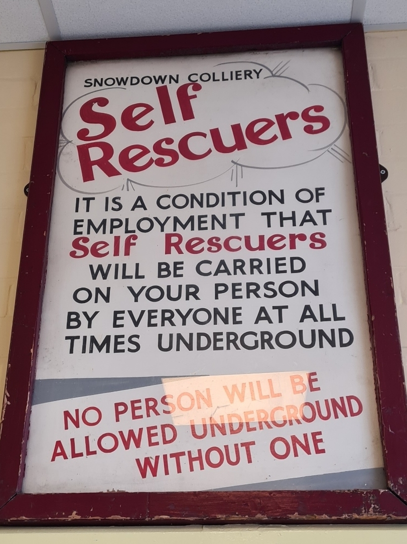
East Kent, in the South-East of England, had a fairly short-lived coal mining industry. Coal was discovered in the late nineteenth century during works on an unrealised Channel Tunnel linking England with France. Extraction of coal commenced commercially in 1912. Various mines were opened. Some were short-lived, others, such as the Betteshanger, Chislet, Snowdown and Tilmanstone collieries briefly thrived and then struggled on until closing in 1989, 1969, 1987 and 1987 respectively. In all, fourteen collieries progressed beyond the planning stage but it was the main four mines that produced almost all of the coal that fed the furnaces of power hungry Britain until it, and they, fell out of favour. The hoped for growth of the Kent Coalfield mostly failed due to the difficulty in extracting coal. This was combined with the divisive period in the mid 1980s when the Conservative Government sought to break the power of the unions and close the pits. In 1983, the whole of Britain had 174 working pits, all had closed by the end of 2015. In Kent, little remains to be seen of this industry, not even the pit wheel mentioned in Kay Sutcliffe’s poem. There are a few brief snippets of film showing the Kent workings in 1947 here.
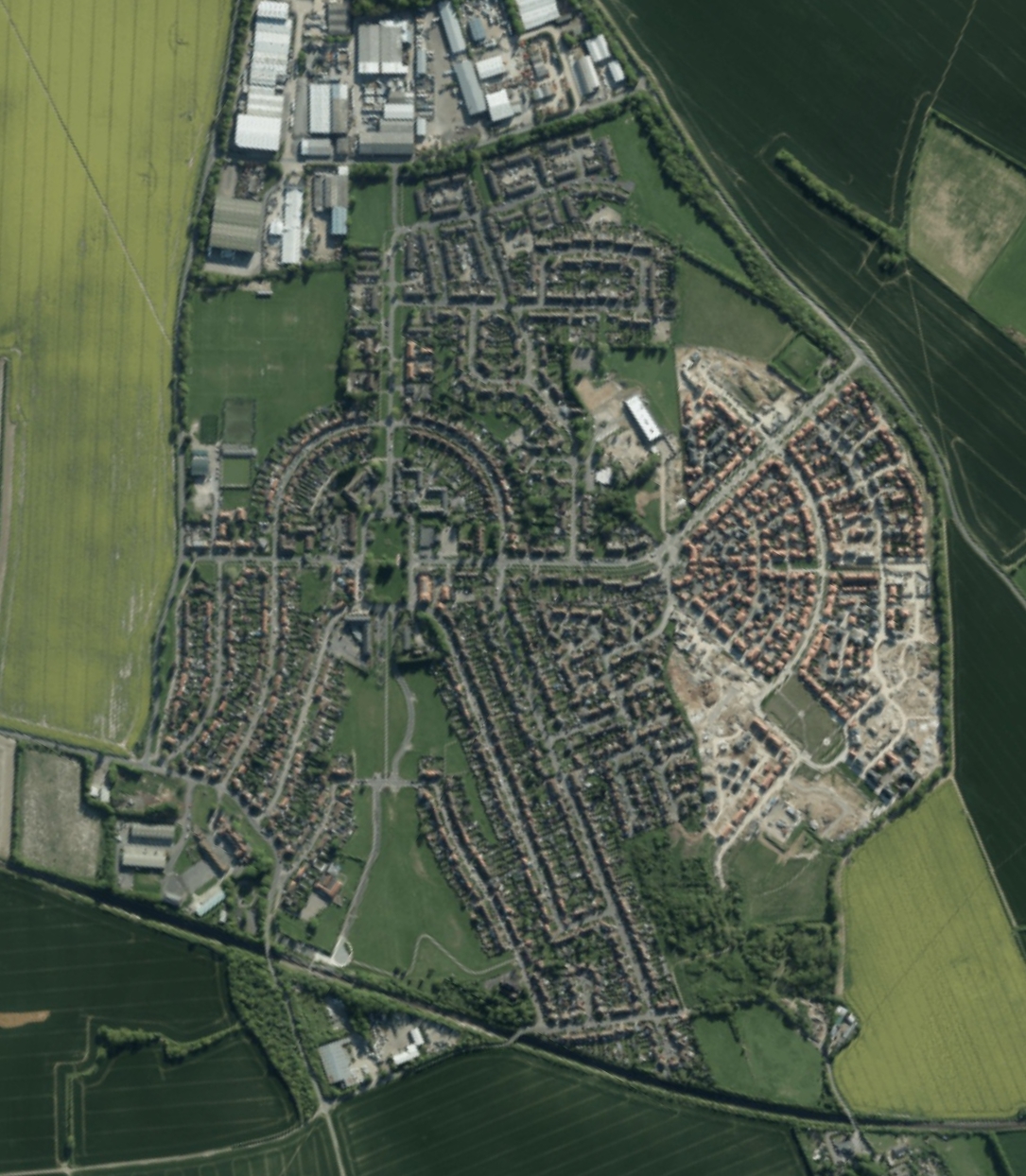
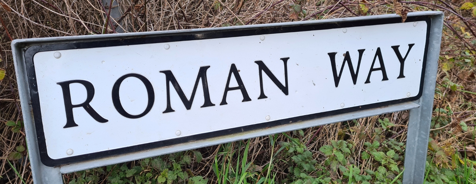
The trail walks from village to village, some purpose built to house miners and their families. Eight new villages for East Kent were designed by visionary Patrick Abercrombie of which Aylesham was the first. The coal industry collapsed before the others could be completed, even Aylesham remaining unfinished. It appears modern builders are intent on resuming these plans, if not for miners. There has been considerable modern building work at many of these villages that continues to irrevocably disenfranchise the resident community, proud of their mining and UK wide roots.
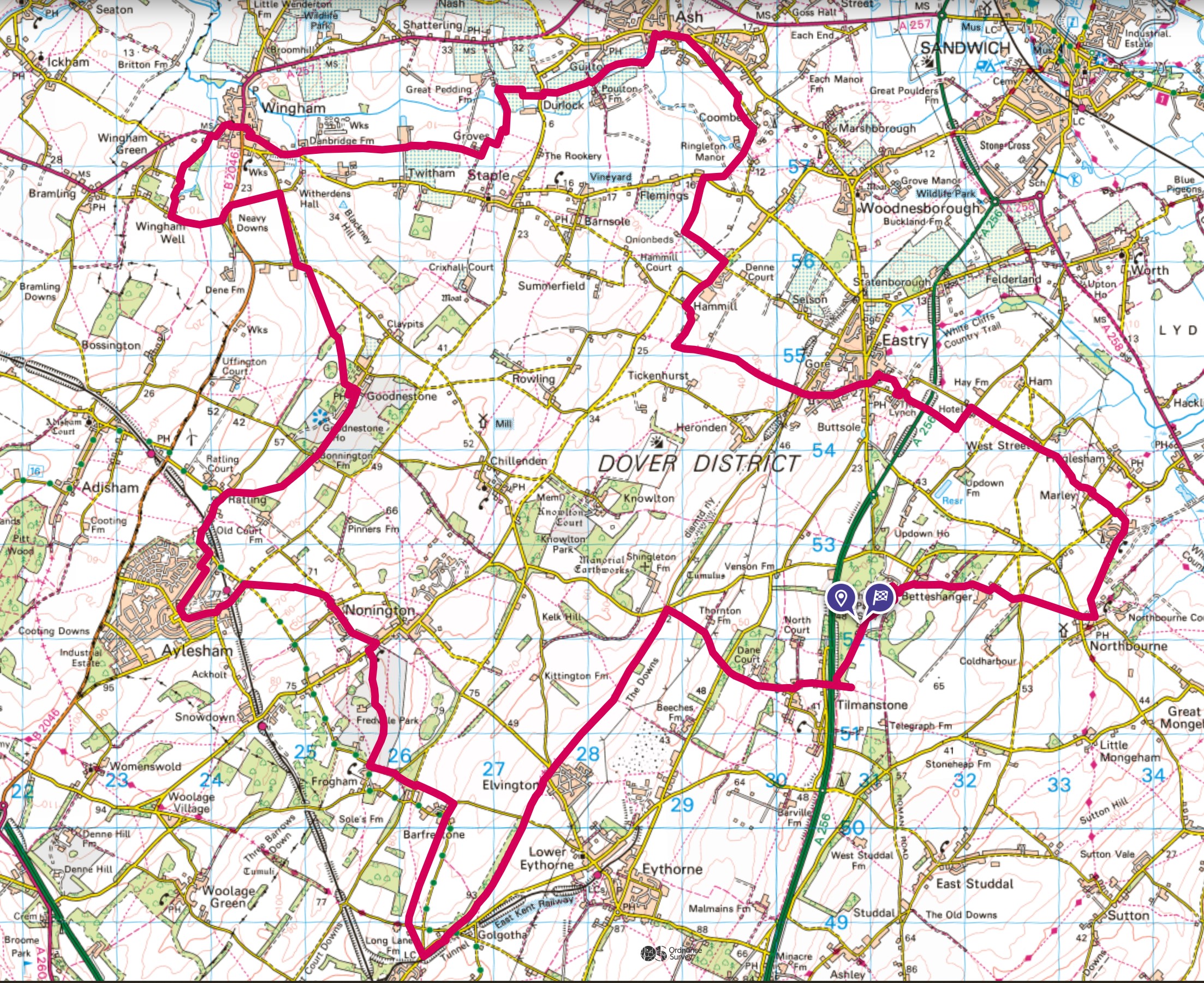
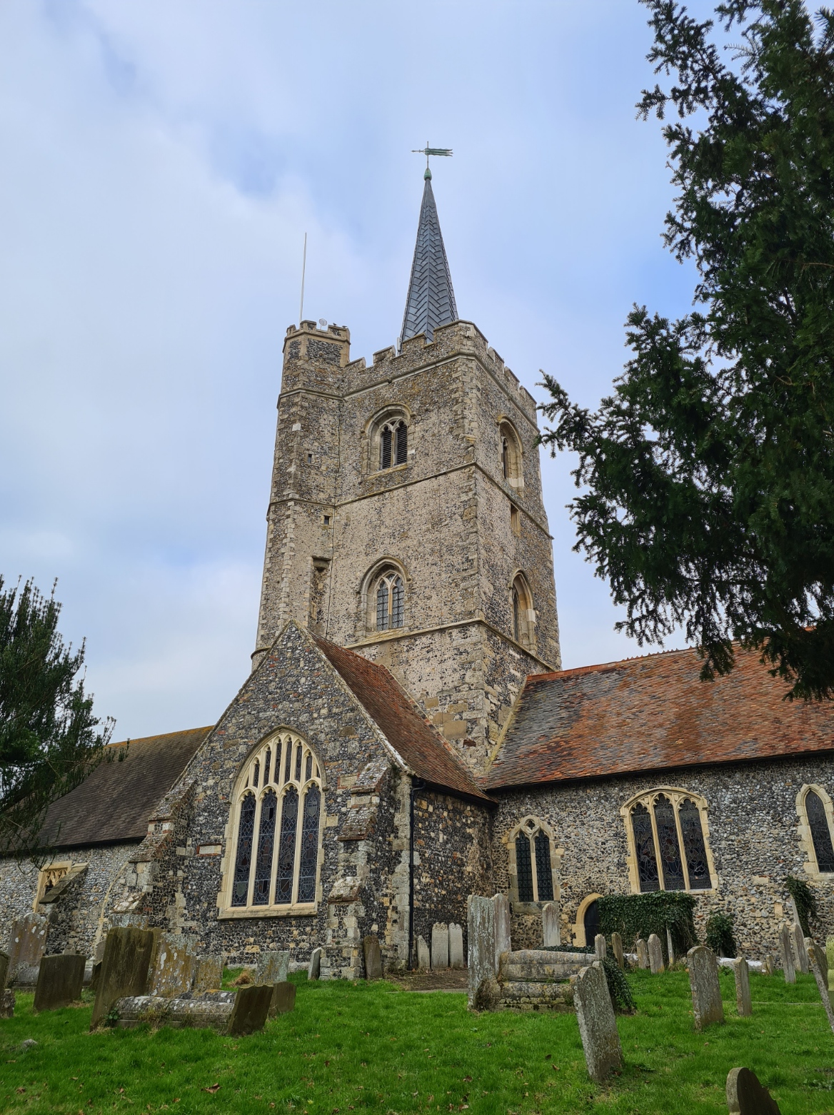
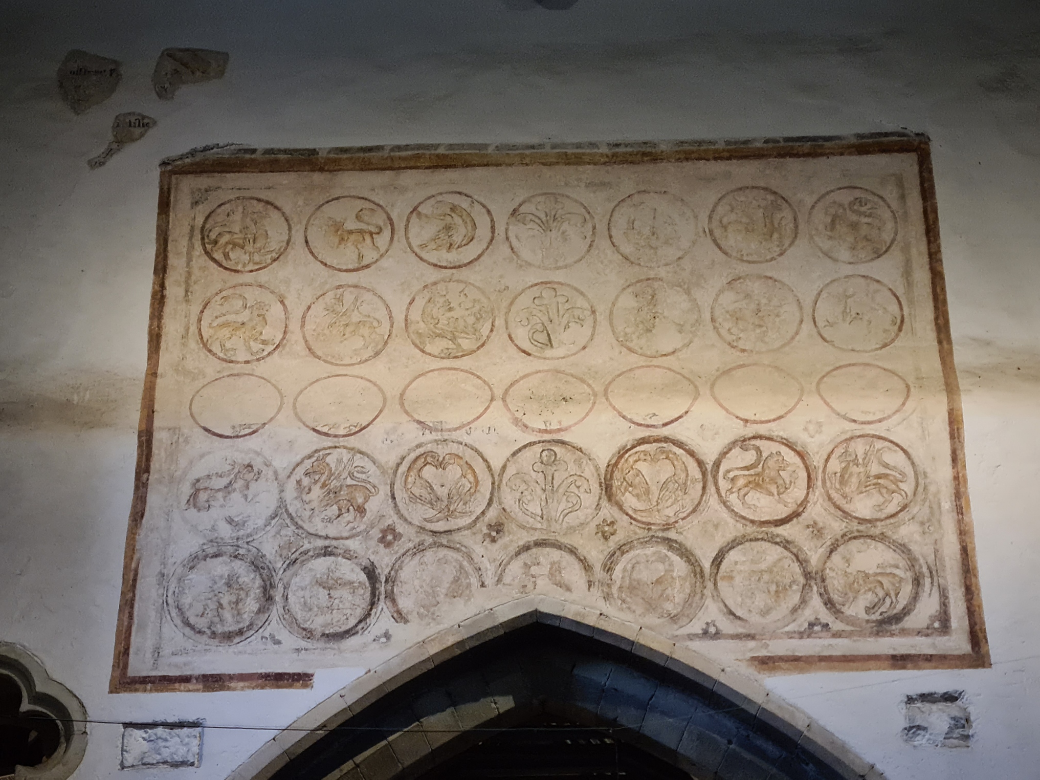
In January 2022 Three Points of the Compass embarked on a two day wander of the former Kent Coalfield via the Miner’s Way as a way to try and connect with this mostly agricultural countryside and trace the footsteps of tens of thousands of miners and their families who walked from Wales, Yorkshire, Durham and Scotland looking for employment with the mines. Many settled in the area, often in the new ‘pit-towns’ purpose built to house them. My trail passed through and past some of these and the 27 mile route for the Miner’s Way can be seen above and here. I am not going to go into detail on every turn and track encountered. It is mostly pleasant and easy walking across agricultural fields, paddocks and grazing, orchards, parkland, woods, Byways, tracks and very quiet country lanes, my route occasionally passing through or butting up against isolated villages. For those who like to pop into a church on a trail just to poke around and admire the history, and Three Points of the Compass does, there are also some lovely little churches passed. The history and industry of this area obviously far pre-dates and extends after the short-lived coal mining era but it remains mostly agricultural, at least in appearance.

I decided on a winter wander of this trail. I knew I would not be seeing the countryside at it’s best but I am, like so many others, still struggling to lose a few extra covid-pounds and a fairly gentle 27 miles over two days with no real climbing to speak of would permit me to make this a backpacking trip while also encountering quiet paths with few other walkers.
I stuffed a few extra insulation layers in with my standard backpacking gear and sat around hoping for snow to make it more interesting. That never came so I decided to squeeze this walk into late January to ensure I at least managed a wildcamp early in the year.
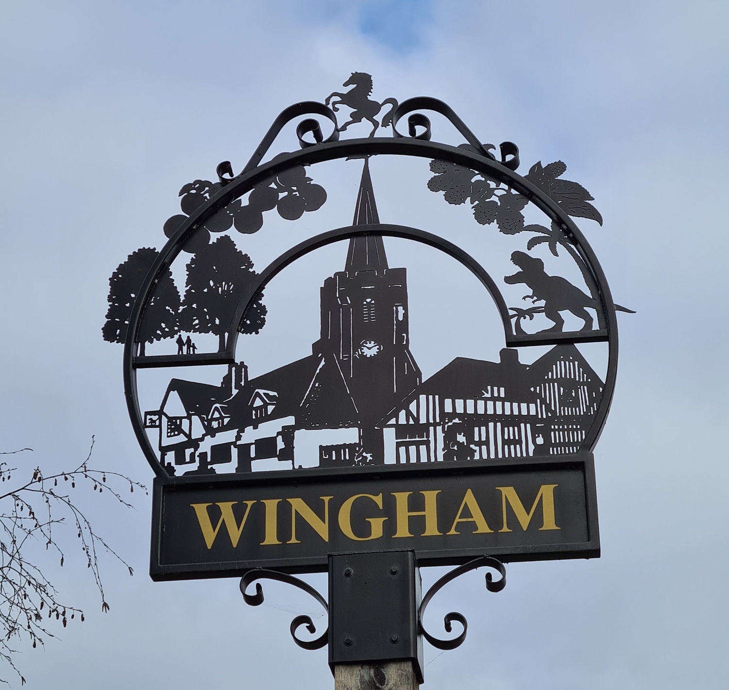
The Miner’s Way is a circular wander of the East Kent countryside and you can start at any of the villages that it passes through. For myself, a glance at a map pointed out where a surreptitious night’s halt would be best, and halfway round the route from there, both divided the walk into two days, and pointed at a likely village to park the car at. Handily, and possibly unique on this little trail, I found a free to use 24 hour car park in the village of Wingham.
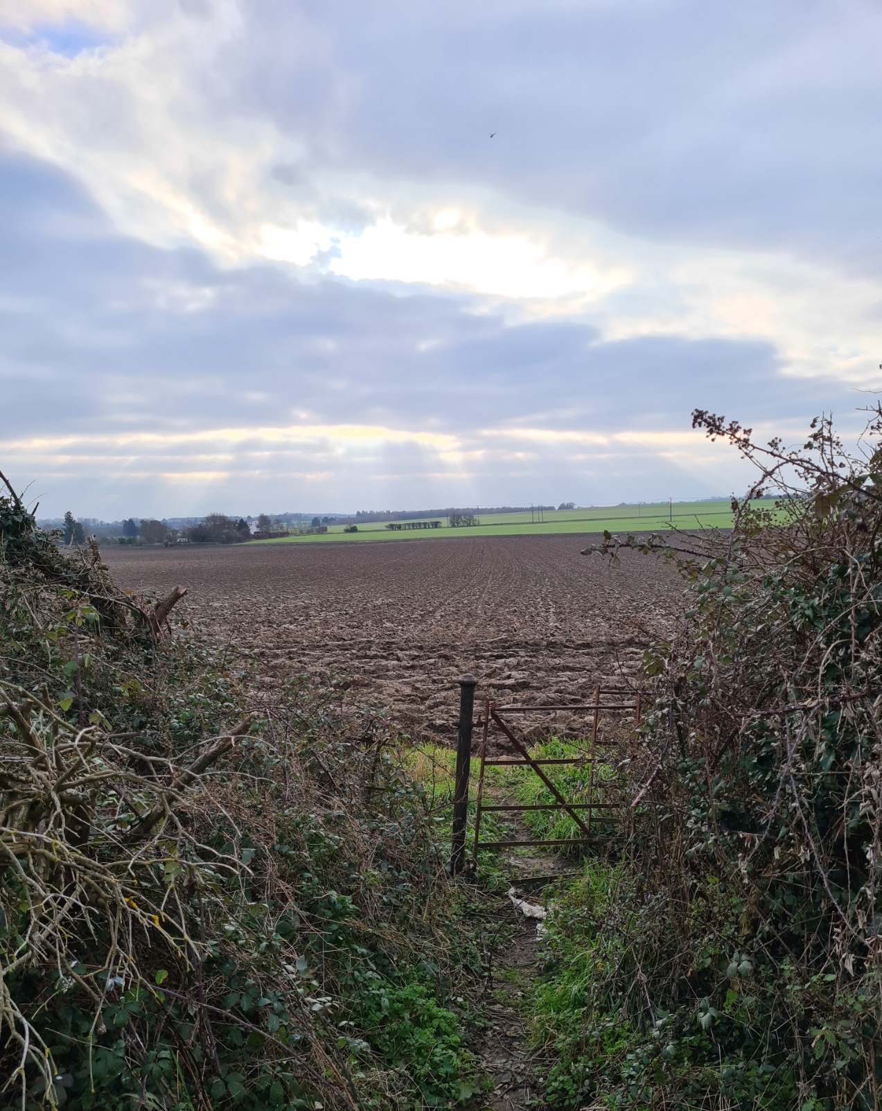

Many people are unaware that there ever was a coal industry in Kent. Walking the lanes and fields today you could be forgiven for remaining unaware as there are few obvious signs that there ever was almost a hundred years of such industry. That must have been similar to what occurred when the collieries first opened. Into a county with centuries of labour rooted in cereal crops, livestock, hops and apples, came tens of thousands of men and their families, skilled in the dangerous art of digging deep for coal. The tall winding wheels and coal spoil heaps altered the views as never before. Many of these new interlopers arriving from other mining strongholds of the UK were made to feel unwelcome in this traditionally agricultural setting. Seeking lodging in places such as Deal and Dover, miners that had walked hundreds of miles with the promise of work were frequently met with signs- “No Miners”. But new communities were formed. With the eventual collapse of the coalfields, as is often the case when a single large industry collapses, the entire local economy based around it also collapsed. Great hardship was invariably experienced and the repercussions are still felt today.

My first day was around 13 miles so I made a late start to get to my overnight wildcamp at dusk. As it was I lingered on my walk so much that it was headlight on and walk into the night. I was unsure of what facilities I might stumble across and am always reluctant to draw water from lowland sources in South East England due to agricultural run-off, so went entirely self-sufficient by carrying all my food and five litres of water for my two-day walk. Fortunately, the weight of water soon dropped.
Day one took me east from the large village of Wingham across the fields to Ash, then swung south, then again east to Eastry. I did find a small shop there but had no need of it. A bench in the churchyard made an adequate halt to brew up and consume lunch. Onward to skirt the site of the now gone Betteshanger colliery. South to Northbourne, then swinging back inland and through the little hamlet of Betteshanger, into the dark, with owls calling around me, to find an OK pitch at the edge of a field for my night’s halt.

Despite the temperature dropping to just above freezing overnight and a cold lazy breeze drifting around the Duomid, I was snug and warm and mostly slept well, even through the intrusive traffic from the nearby A256, but that noise lessened considerably as it got late. I briefly woke when a badger began snuffling round the edge of the shelter but I muttered at it to go away. He went off foraging, I went back to sleep.
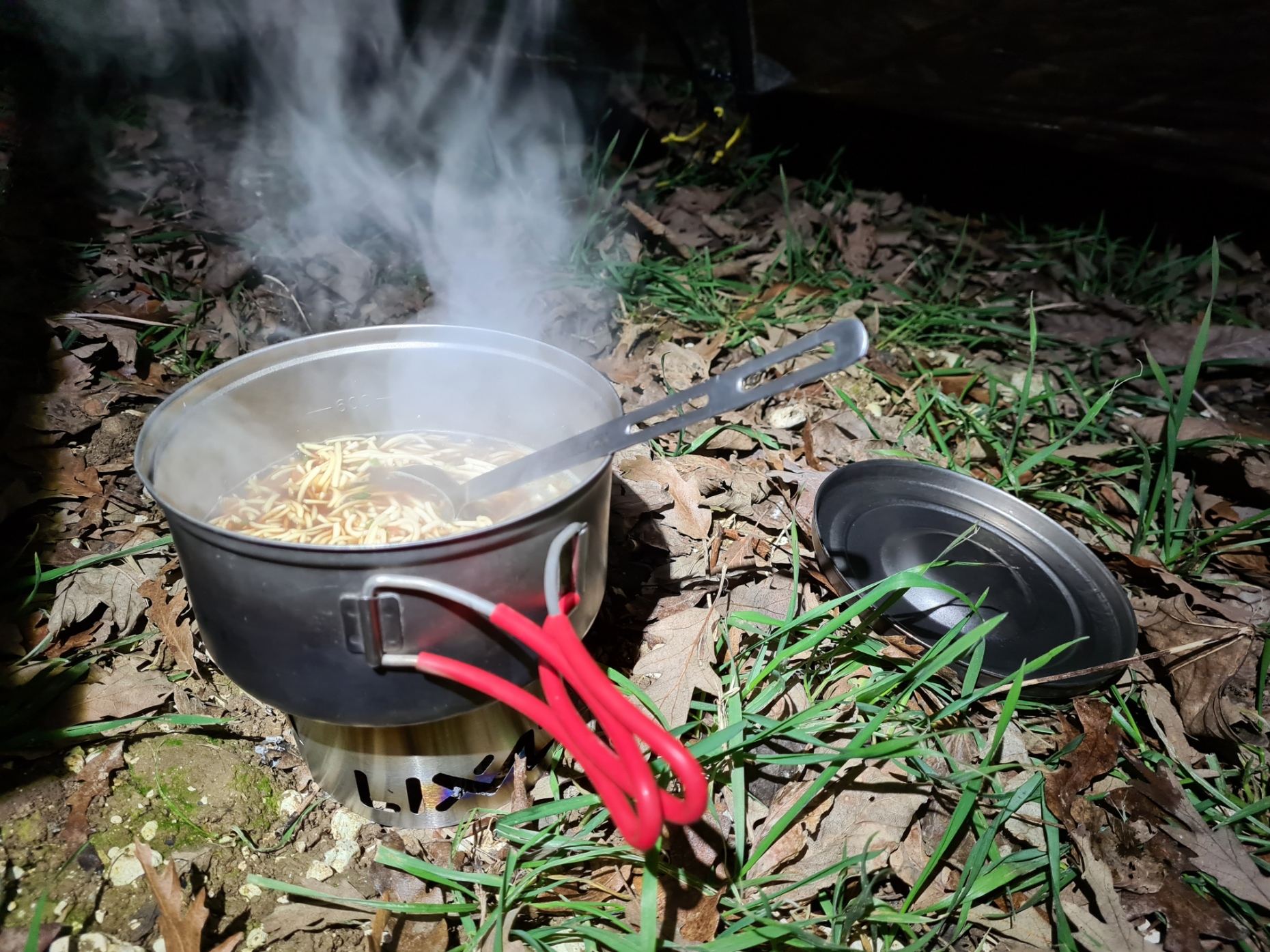

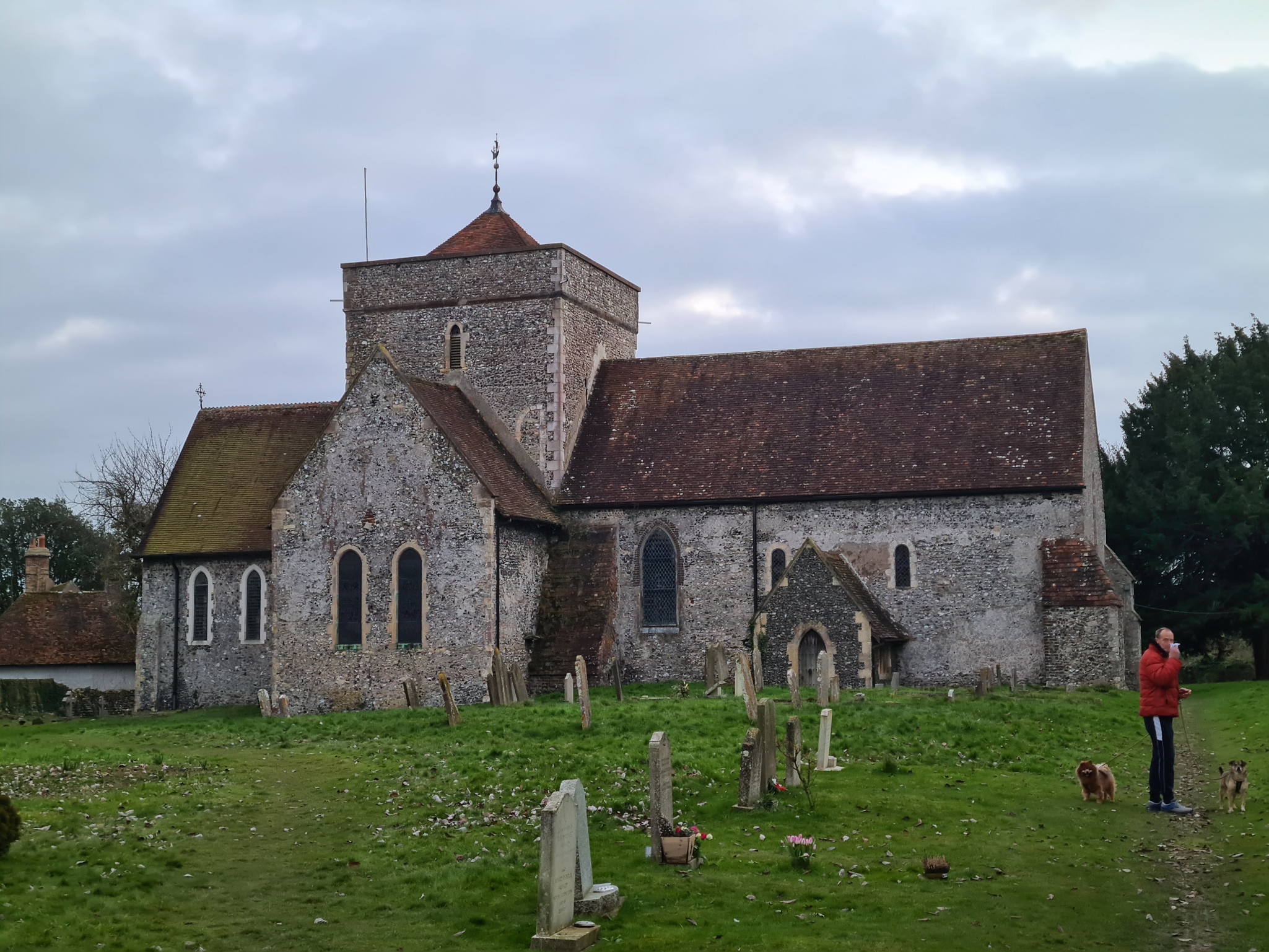
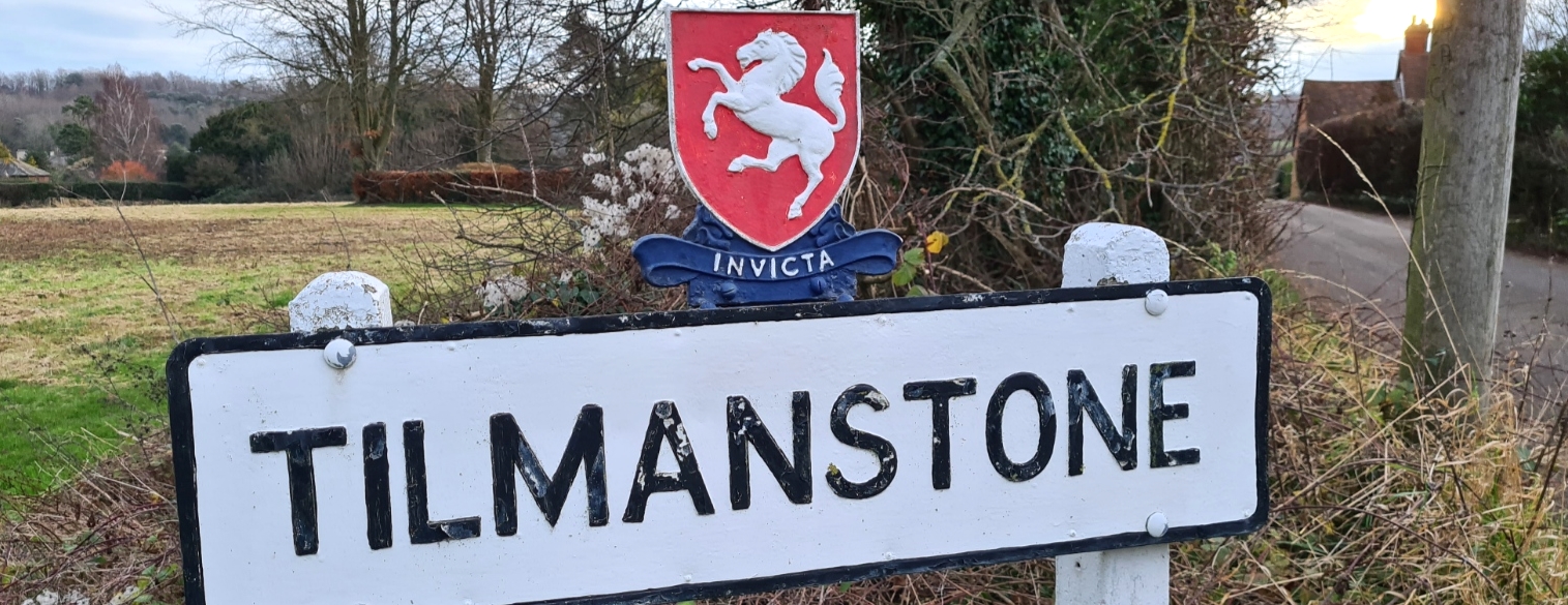
Up with the dawn and a welcome pint of tea. I was using the Vargo Triad stove on this overnighter and having another go with Firedragon gel. I remain mostly unimpressed with this fuel. It works, but barely so. More on that in a future blog. Packed and away, I stopped on a handy bench for something to eat in the churchyard of St. Andrews at Tilmanstone. Parishioners occasionally leave bottles of water, biscuits etc. inside this Norman church for visitors but it was shut while I was there. I understand there is a water tap in the churchyard but not only did I not see it, but had no need for it as I still had over two litres of water with me.
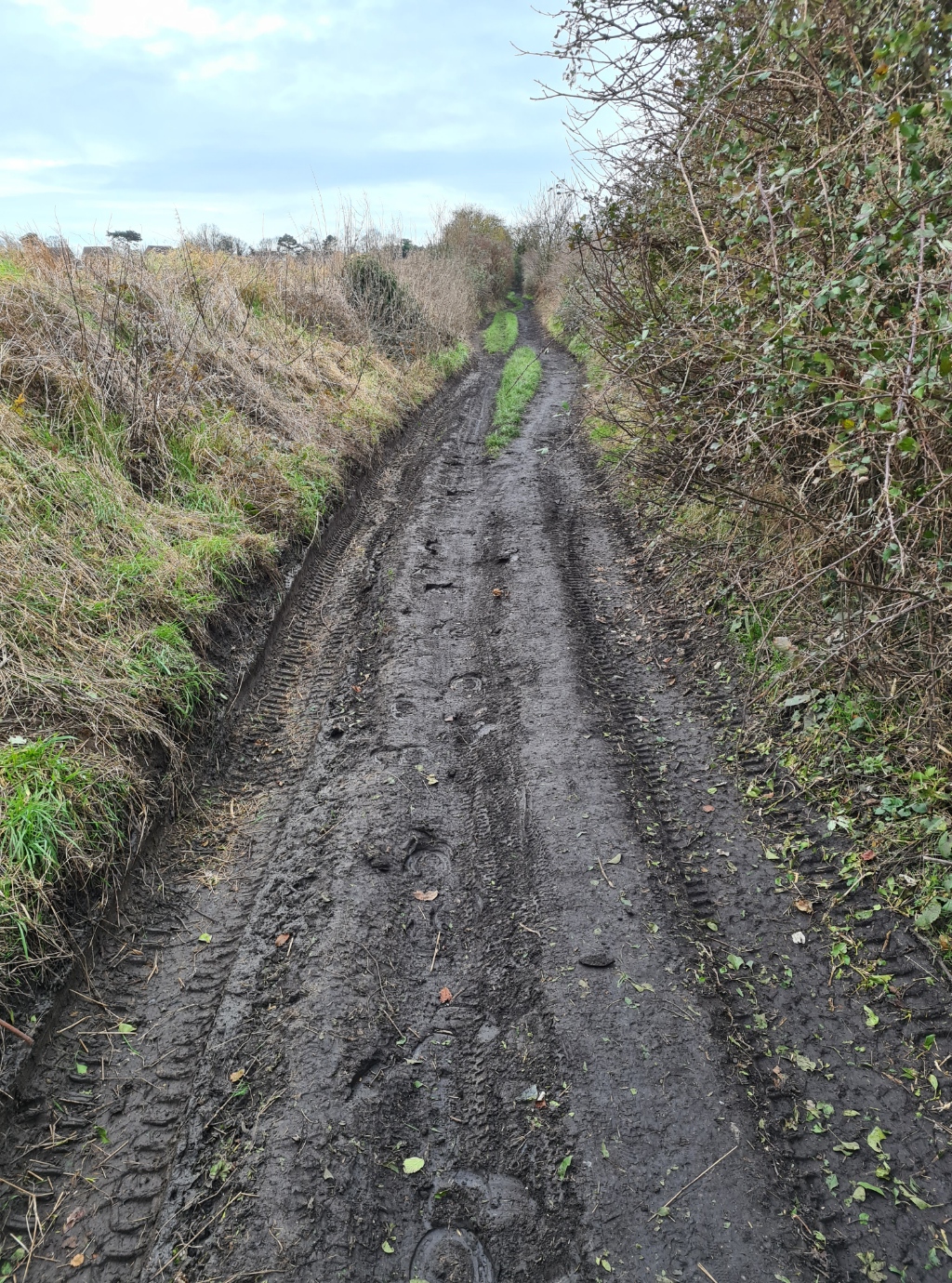
My second day on the Miner’s Way was around 14 miles back to where I left the car. Soon after leaving Tilmanstone I joined a lovely old Byway that ran south west for a few miles. There is plenty of opportunity for wildcamping along here, despite evidence of many off-roaders. I met just one person the whole length of this ancient path. I never saw anyone else walking the Miner’s Way over my two days. I didn’t even meet anyone out for a daywalk. All I met were numerous dog walkers and a couple of horse riders out for a hack.
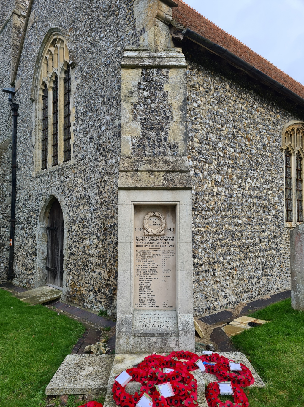
The Downs Byway, called a Roman road but actually dating from Saxon times, skirts the miner’s village of Elvington with its pit head gear road design before meeting the extant East Kent Railway at Shepherdswell. Before reaching there I diverted off in the hope of viewing the Golgotha Tunnel through which the coal trains used to run but that requires not only uncomfortable trespass but possibly also straying onto the now unused rails themself. I decided that was a step too far. The trail then swings completely round and begins heading northward. More fields, through the villages of Barfrestone, Nonington, again skirting or passing through small farmsteads, to reach Aylesham.
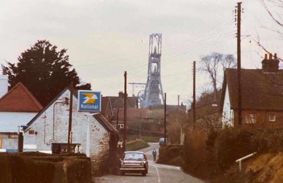

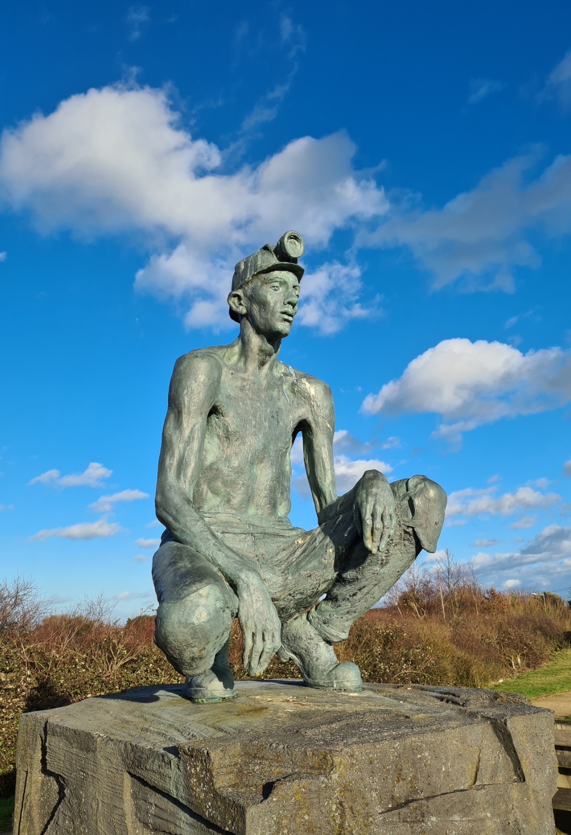
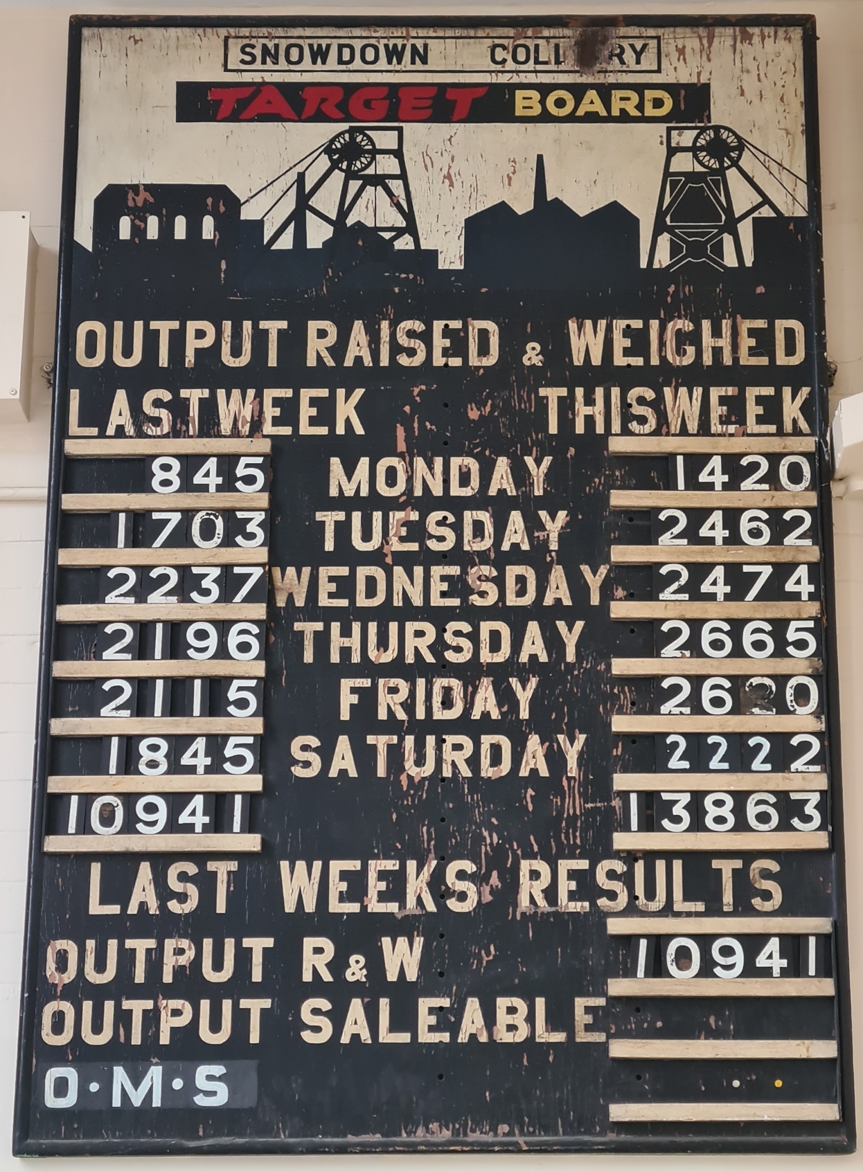
At Aylesham I walked beyond my trail turning to view the ‘Payday at Snowdown Colliery‘ statue by Steve Melton that sits outside the Aylesham Community Centre and Business Park. Various small businesses and community concerns, library, boxing club etc. are now situated in what used to be the school, where hundreds of children from the mining families that lived just across the road opposite once attended.


A cafe was advertised inside. It was past midday, I positively had to go in to the building. The three young staff were eager to please. Also attentive to the gaggle of old dears that had congregated across the room from me for their regular weekly natter. I caught fragments of ribaldry and wished I could hear more. I enjoyed a pot of tea while waiting for my ham, egg and chips. I had watched staff batoning fresh spuds and had high hopes. Cafe signage proclaimed that food was Cooked With Love. That may be so, but sadly not With Care. They managed to not only burn my chips but also serve them largely uncooked, quite how they managed to do that I am unsure. But it was cheap, I was hungry and ate them anyway, along with a second pot of tea. I didn’t have the heart to complain as the staff were so pleasant.

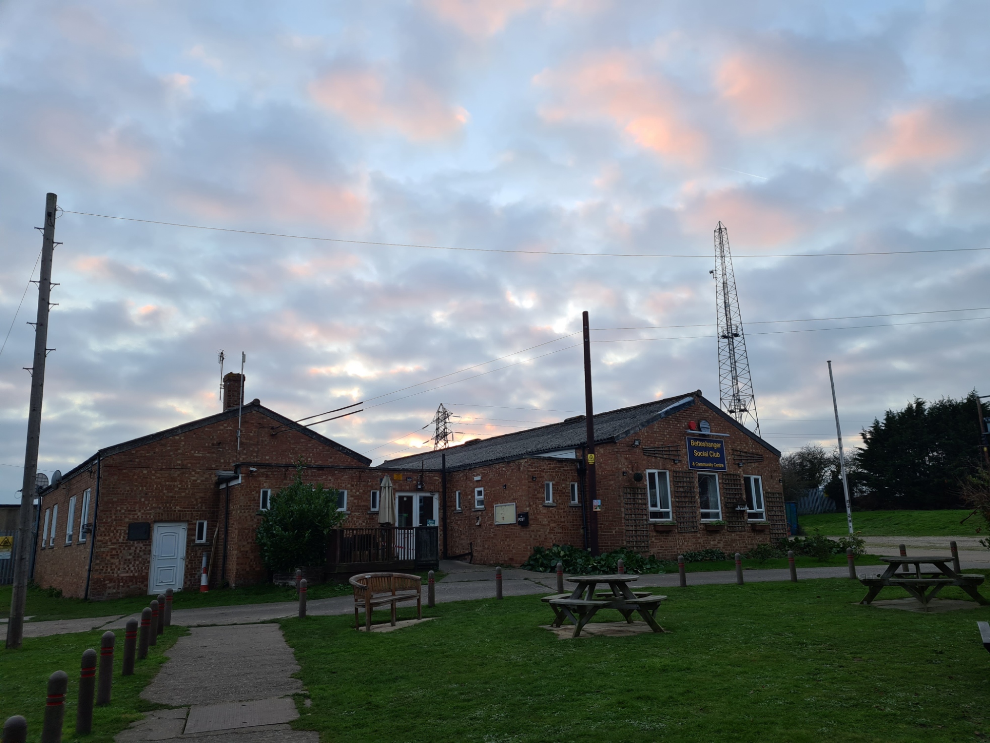
It is an intriguing piece of detective work walking the Miner’s Way. Is this straight piece of farm track an old Saxon or Roman road, or is it where the East Kent Railway used to run between collieries? Any of these can be true on different parts of the trail. Is that building ex-colliery, or is this village or street layout associated? There are Kent Coalfield survivors throughout, not least the old working men’s social clubs that survive.
The simple fact is that much of what was above ground has been removed, worn away, collapsed, overgrown or hidden. Much of the industry obviously took place below ground. Even the waste heaps are largely removed, reused or landscaped. It is very much a story of people as well as a landscape and industry and this simple walk mostly fails to really get to grips with it.
Passing through Nonington, I found yet another seemingly sleepy little village. Other than a couple of dog-walkers and lone horse-rider, through-traffic on the roads was the busiest feature and I noted that the buses still run here.
Nonington used to be an almost self-sufficient community. There was a seed mill, corn mill, butcher and blacksmith. The village had a doctor’s surgery, district nurse and vet. Chemist, photographer and taxi service. Clothes and shoes were made locally. Today, even with ‘work from home’, most residents now commute to work and shop elsewhere.

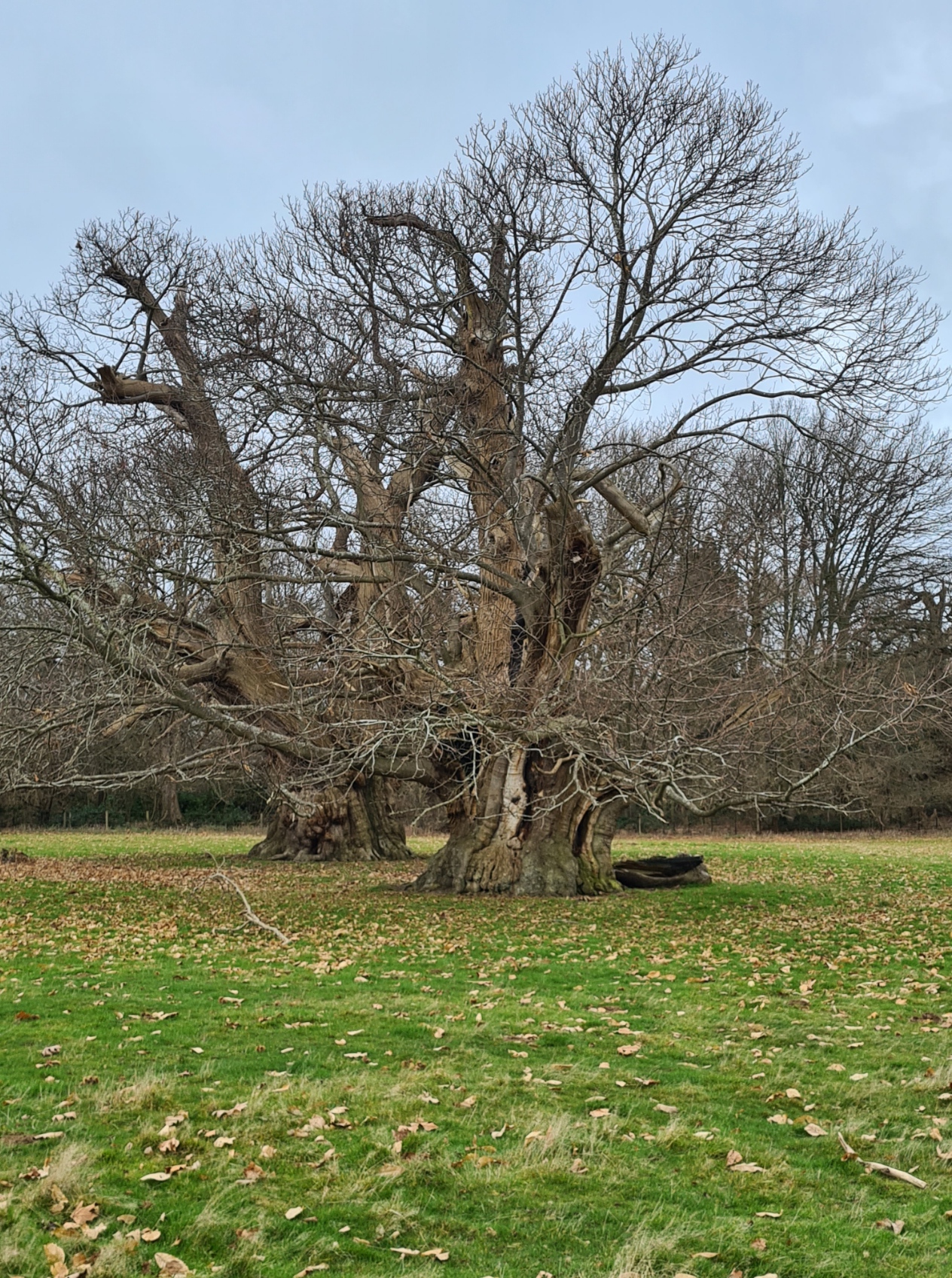

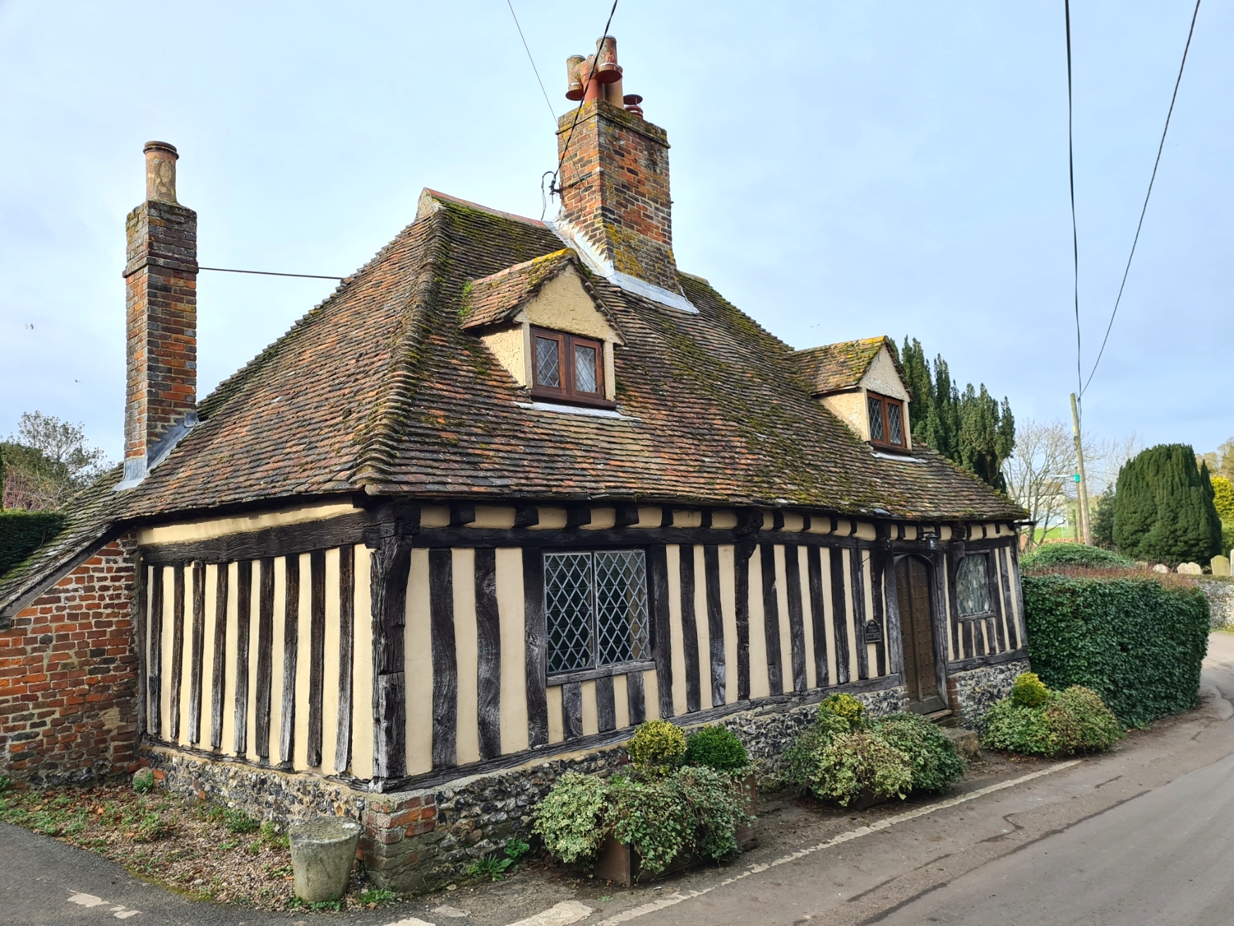
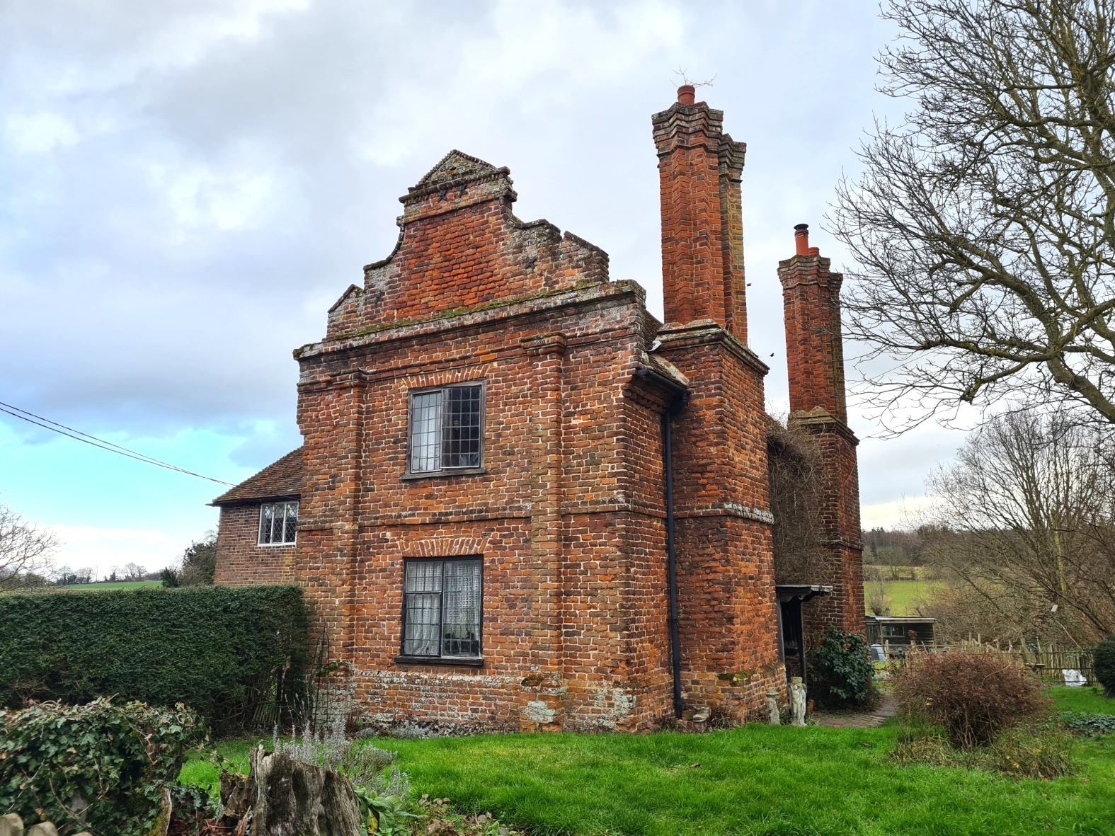
The afternoon section offered up something a little different. Leaving the farms behind, the trail crosses through the three-hundred year old Goodnestone Park, with grazing sheep (a lone deer trying to remain inconspicuous amongst them) and fantastically broad and ancient trees. Grand Goodnestone House peers disapprovingly at those walking past the walled garden that surrounds it. I never bothered calling into the cafe it provides as I had trail end (almost) in sight. I was now walking in the footsteps of Jane Austen, who frequently visited her brother here and walked the grounds. She subsequently slipped the life of the gentry into her letters and novels. There is a wide range of older buildings on this days walk. From Nonington and into Goodnestone there are various architectural styles of building and I passed a series of buildings that all have peculiar rounded brick windows, said to bring good luck.


While the Miner’s Way is around 27/28 miles in length, there is also a link route that makes it easier for people to break it up into two separate circular walks of around 14 miles in length. There is a closely aligned 30 mile route for cyclists too that commences at Sandwich. For just a handful of miles, the Miner’s Way also holds hands with the North Downs Way, that in itself part of the Via Francigena leading to Rome. I even saw that one pilgrim had left a route sticker for the Jerusalem Way, now there’s a walk and a half!

From Goodnestone it was a fairly short walk remaining. With good sweeping views around, it is a steadily descending walk across farmland, with the spire of St. Marys in Wingham visible ahead to the north. There is then a pointless dogleg to pass some overgrown watercress beds and cross a boggy field to finally enter Wingham from the south west. That had been a feature of the past couple of days. There are many places where a simple detour would knock off anything from 1/4 to a mile or more from the mapped route and, more to the point, negate crossing a claggy field. But what is the point of walking a trail if you don’t actually walk it? I had followed every turn on the trail and was back at my car a little before four. A tad past my 24 hours allotted carparking but who’s counting?
This is a trail where it pays to do some research prior to walking it. If you don’t, then it is simply a wander round some fairly pretty fields in Kent. A guidebook was produced by the White Cliffs Countryside Project in 2007. It comes with a map to the route, directions and is designed within an inch of its life. It is a terrible guidebook, not at all easy to read as the information within is disjointed and all over the place. Lovely snippets of oral history are unattributed and undated. But, that is all there is and it pays to hunt down a copy if planning to complete the walk, but they are getting increasingly difficult to find. For those interested in all things steam railway, there was one of these closely associated with the mining area. However the line for much of the East Kent Light Railway is long gone. A section of preserved railway survives and is worth a visit. However that is off-route.
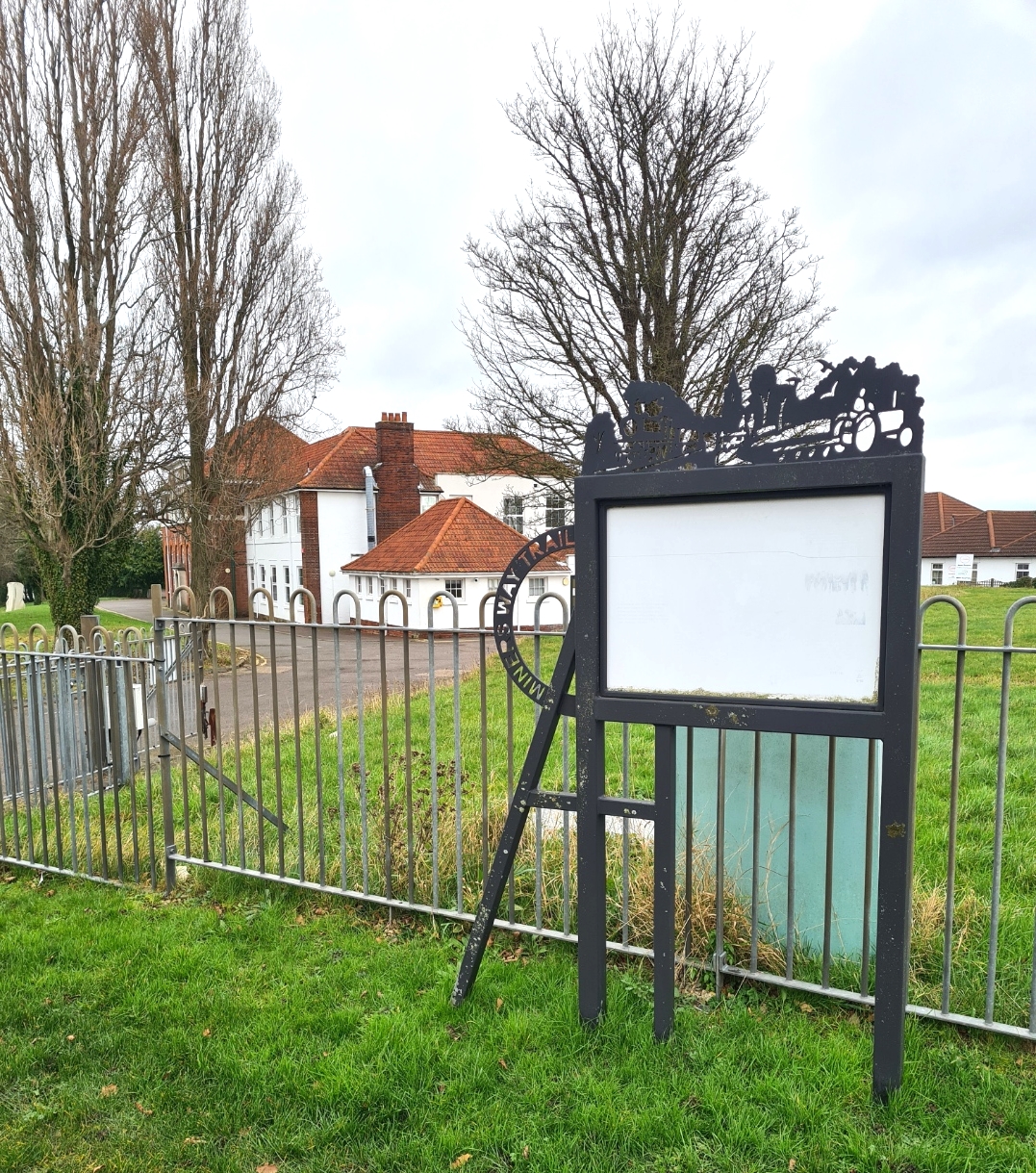
This is a perfectly good undemanding wander of the Kent countryside. It would be far more enjoyable in spring or summer. Autumn would probably be a bit too muddy and slippery. While I will visit the area again I cannot see myself walking the whole of this route again. There are too many other places to visit. I also cannot see many people visiting to specifically walk this route either as there is so little information to be found about it. I find it shocking that the earlier enthusiasm demonstrated by local authorities to preserve the memory and legacy of the former Kent collieries and the people who lived and worked here, via this trail, has dissipated so quickly. Seek out the various web pages set up to give information and a series of depressing broken links and obsolete initiatives are encountered. Dedicated signage for the Miner’s Way is woeful. Each of the larger villages or towns on the trail had a smart information board on the history freshly erected on the first opening of the trail. These panels are almost all faded and now illegible. Unloved and forgotten.
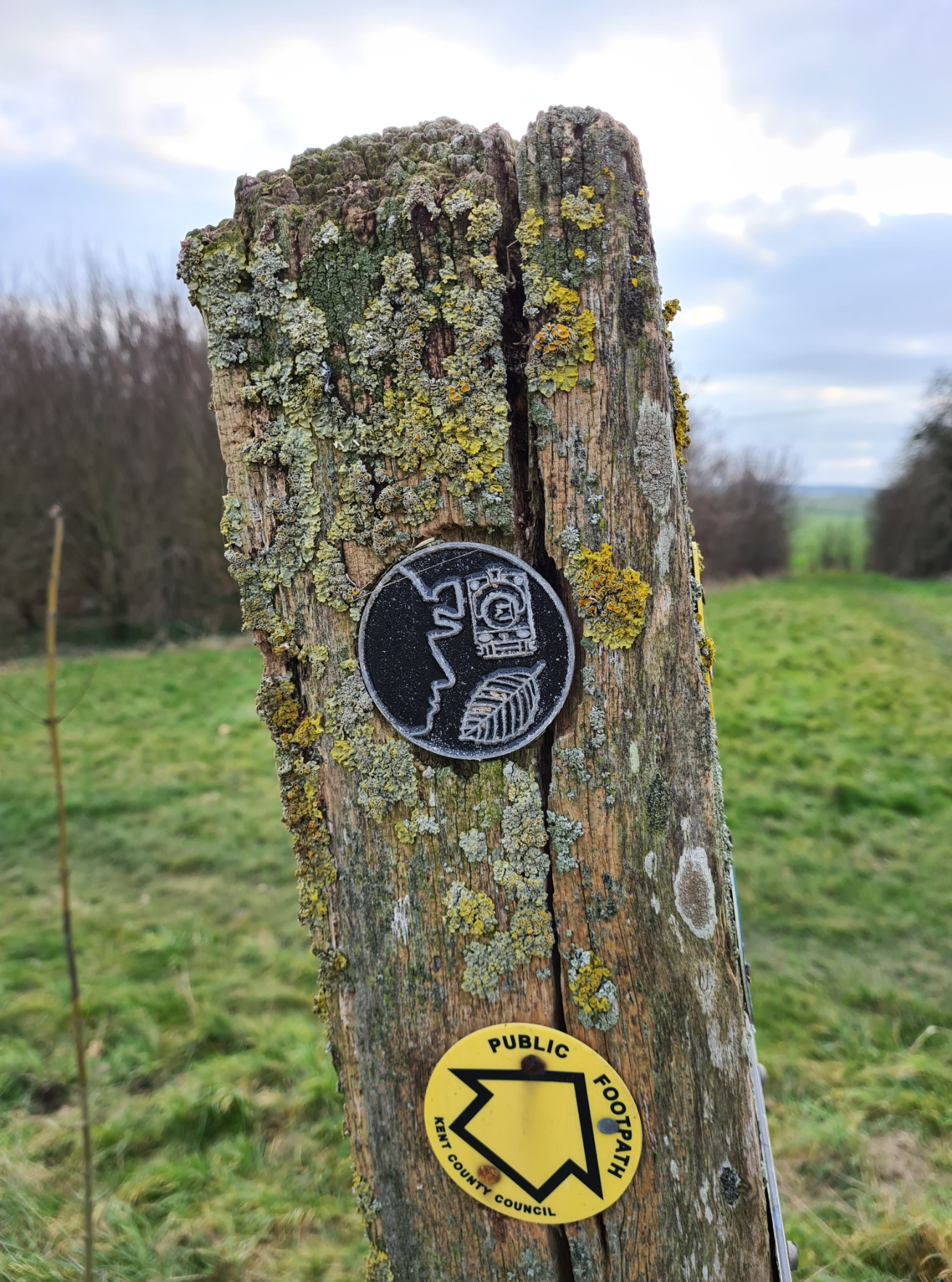
The project that created the Miner’s Way was funded by the Heritage Lottery Fund, Single Regeneration Budget and other local partners. Specially designed ‘logo discs’ were placed all round the trail when it first opened. All well and good, I counted nine of these surviving over the 27 miles. While this is an average of three per mile, two can be placed each side of a lane crossing at places. It is doubtful many have been replaced or renewed in the years since the Miner’s Way was first proudly announced. The route does not appear on O.S. mapping and it looks like the trail is being largely forgotten. No council or ‘local partners’ appear to be spending any effort in either promoting or maintaining the trail as a specific guide to the one-time coalfield.
Resources:
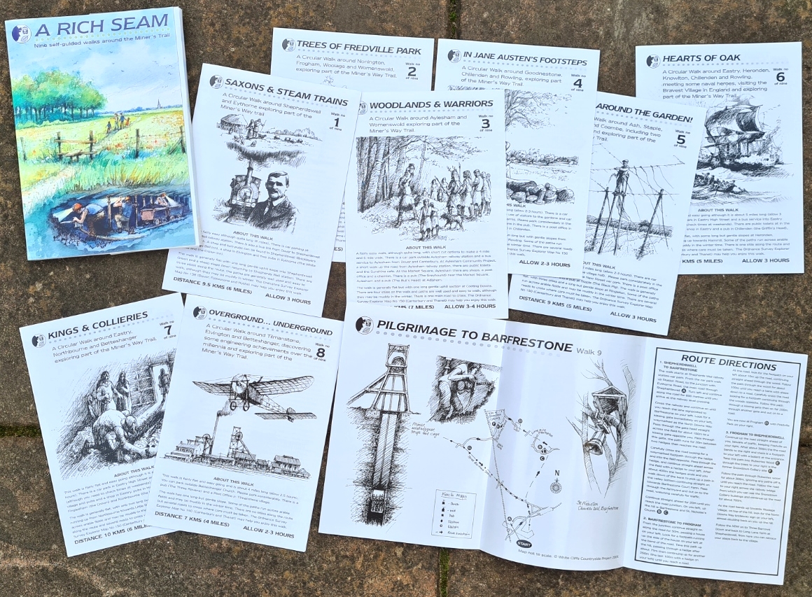
Other than the sole out-of-print guidebook for the Miner’s Way, with it’s accompanying pull out map sections, a set of nine self-guided walks cards were also created and formed a pack entitled ‘A Rich Seam’. If you can locate any of these on the second-hand market, any of the nine would provide a short circular walk (4-7 miles) introduction to parts of the countryside taken in by the full length trail. Various museums and interpretations have been mooted over the years. There is the Betteshanger Country Park with grand plans for the future. Online there are various resources though all a bit disparate and can be hard to track down. For example there is a busy Facebook group who maintain a decent digital archive of photos and memories of Aylesham, in particular their earlier industry, childhood and sporting life. There is a little more information here.
In the meantime, the The Kent Mining Heritage Foundation was created in 2016, working in partnership with Betteshanger Country Park and others to collect and promote the story of Kent’s mining heritage but it is doubtful that a 27 mile walking trail around East Kent will form any part of that.
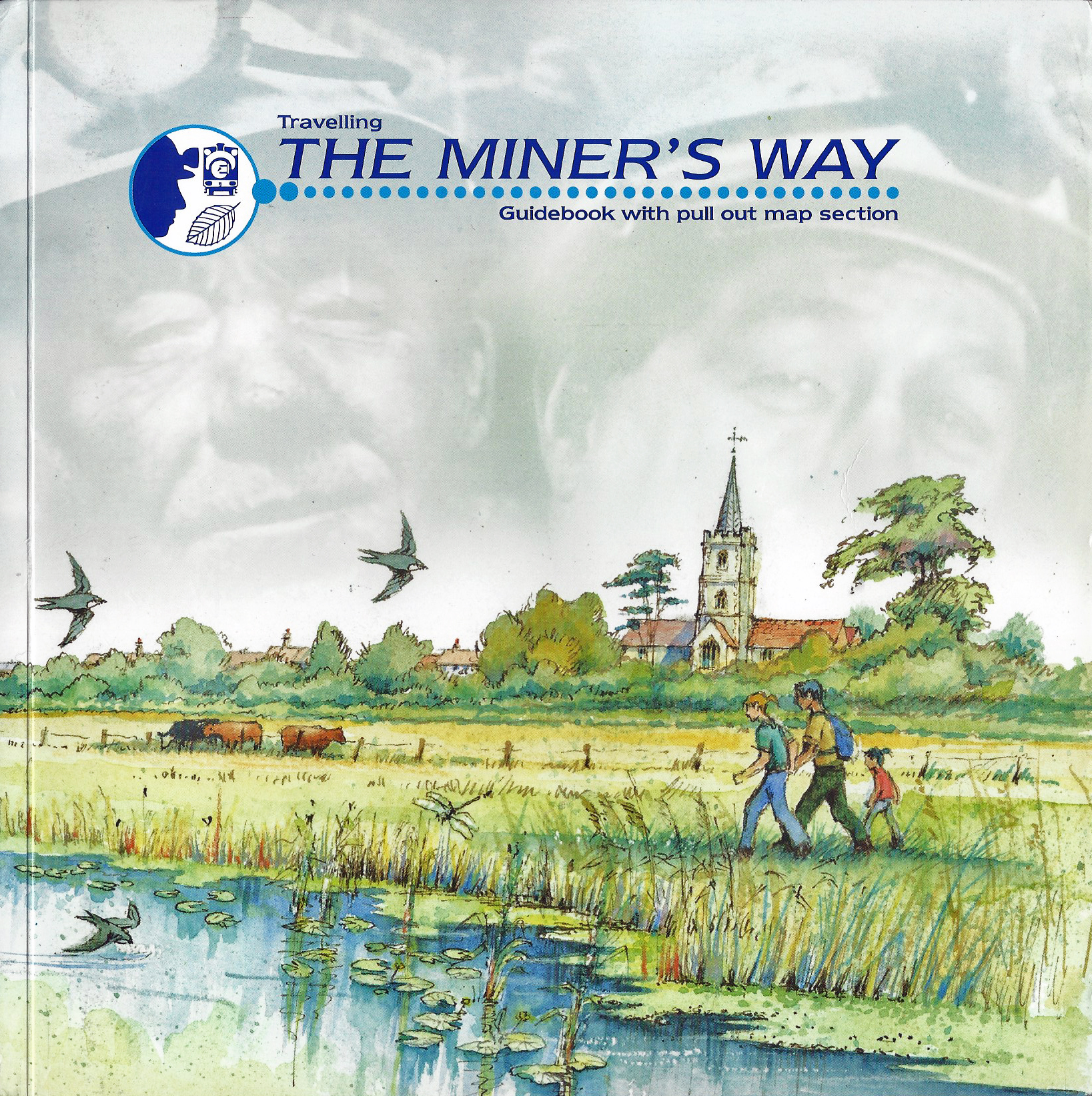
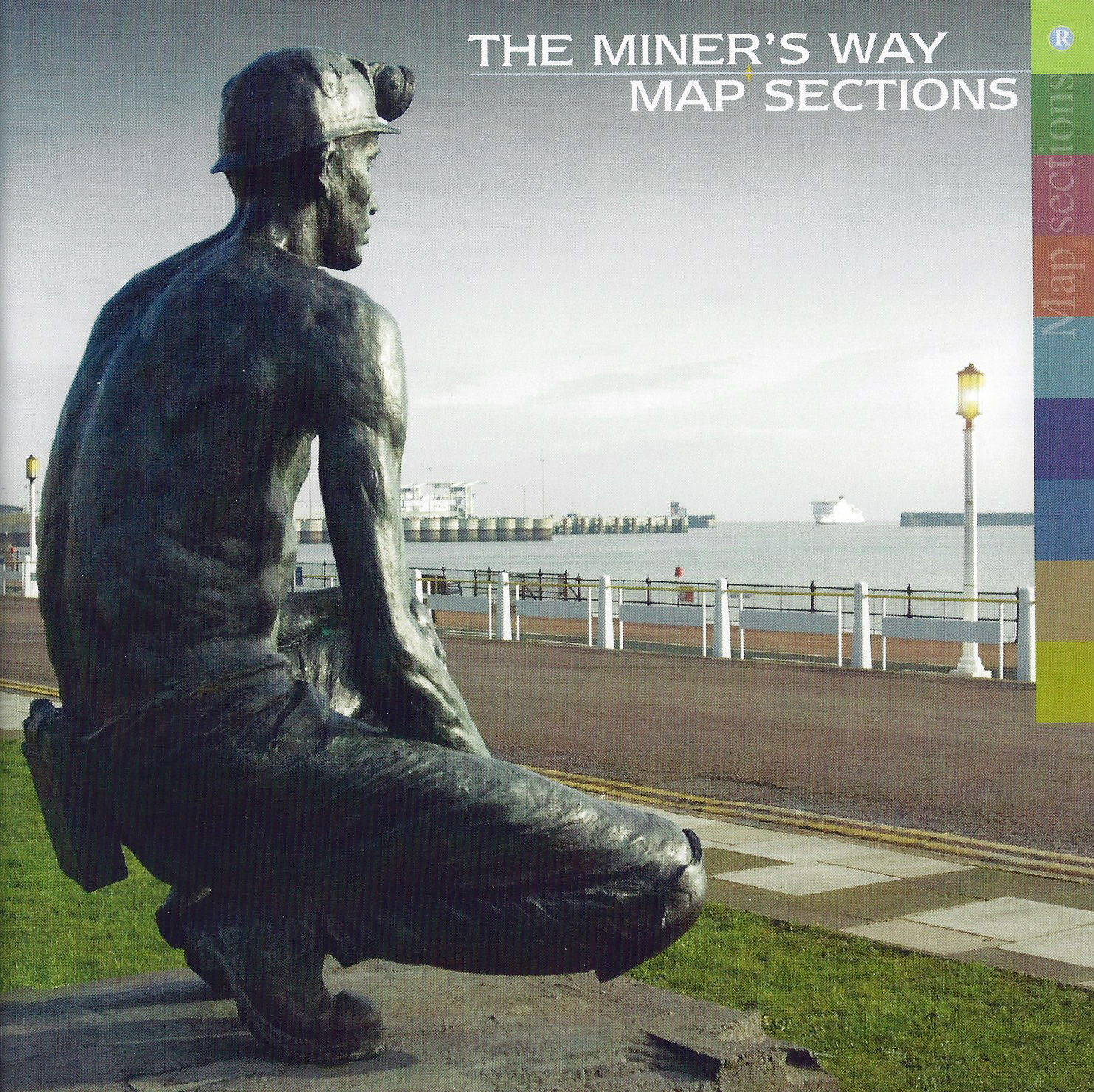
Guidebook with pull out map section: Travelling the Miner’s Way. White Cliffs Countryside Project, 2007. ISBN 0-9517577-2-5
Self-guided walks cards: A Rich Seam. White Cliffs Countryside Project, 2006
Long Distance Walkers Association page here. Includes GPX (members only), also found here
Poor information on White Cliffs Countryside Partnership website (formerly the White Cliffs Countryside Project) here
YouTube hosts a few old but informative films of the East Kent collieries and local history including the fascinating and now lost aerial ropeway that carried coal high above the fields from colliery to Dover port (British Pathe film here)
In Black and White, Peter Williams, 2019. ISBN-10 : 1916193609, ISBN-13: 978-1916193604. The story of a century of Kent coal

Some names from my past there as I worked for a mining industry supplier in 1982-83 as my sandwich year. The focus was mainly on the South Yorkshire coalfields that were being merged underground to improve efficiency. The Kent coalfields provided some work but I never got to visit any of the pits mentioned in your piece.
LikeLiked by 1 person
A lot of the miners on the Kent Coalfield came from Yorkshire. Some had been sacked from their former mines due to their militancy and the Kent miners became known for their hardline attitude. The Betteshanger mine was (I think) the only mine to go on strike during World War II. An illegal act at the time. The miners certainly had some fair grievance though. When the government realised they couldn’t imprison 1000 miners, a Royal Pardon was granted to those that had been imprisoned
LikeLike
Nice write-up! I remember learning of the East Kent coalfields at school but had forgotten about them until the early 90s when we were looking for a place to live while at the university. We checked out an ad for a house in Aylesham and were surprised to find ourselves looking unmistakably at a mining village, at which point I remembered about the coal mining. Maria is from South Yorkshire so it was like a flashback for her! Alas, the house didn’t work out but I’ll never forget Aylesham, and if you haven’t heard Kay Sutclliffe’s awesome poem sung by the Oysterband, I highly recommend checking it out.
LikeLiked by 1 person
Thanks Andy, fortunately for all of us, YouTube delivers!
LikeLiked by 1 person
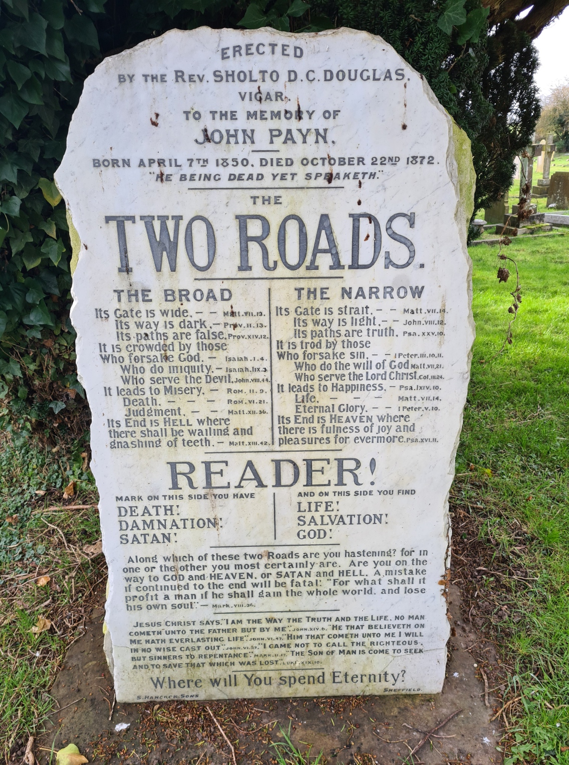
As always, your blogs are full of interesting information. Loved the picture of the tombstone. A real “Hellfire and Damnation” preacher!
LikeLiked by 1 person
Thanks for your comment Jen, pleased you get something from my ramblings
LikeLike
Thanks for all this information, I do a lot of walking and had noticed the faded dilapidated signs, and wondered where the trail went. I agree it’s a winter project, somehow thinking about coal mining the weather needs to be cold and wet !!! Looks like I have a new route to follow, wonder who would be interested in renovating the info….. I belong to Canterbury Ramblers may have an ask around .
LikeLike
Thanks for commenting. I hope you enjoy the trail Elizabeth. Do report back on how you got on. The biggest issue with winter walking is claggy trails of course. Not sure about the cold analogy, most period photos from the Kent Coal Field I have seen, many of the miners are in extreme states of undress due to the hot working conditions below. This reminds me that I need to get along to the ‘new’ mining museum to see how they have settled down since opening
LikeLike
Perhaps the cold comes from my NE roots 🤔
LikeLiked by 1 person