
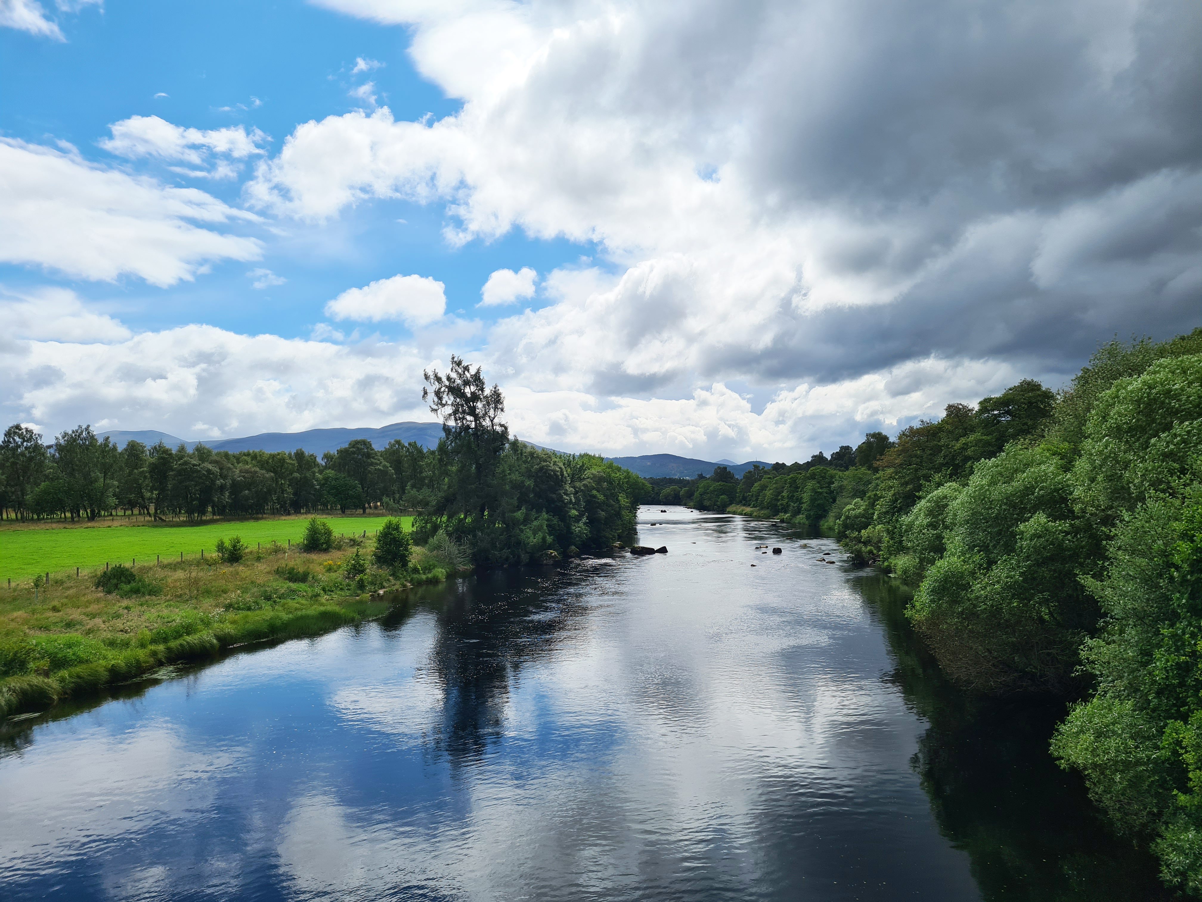
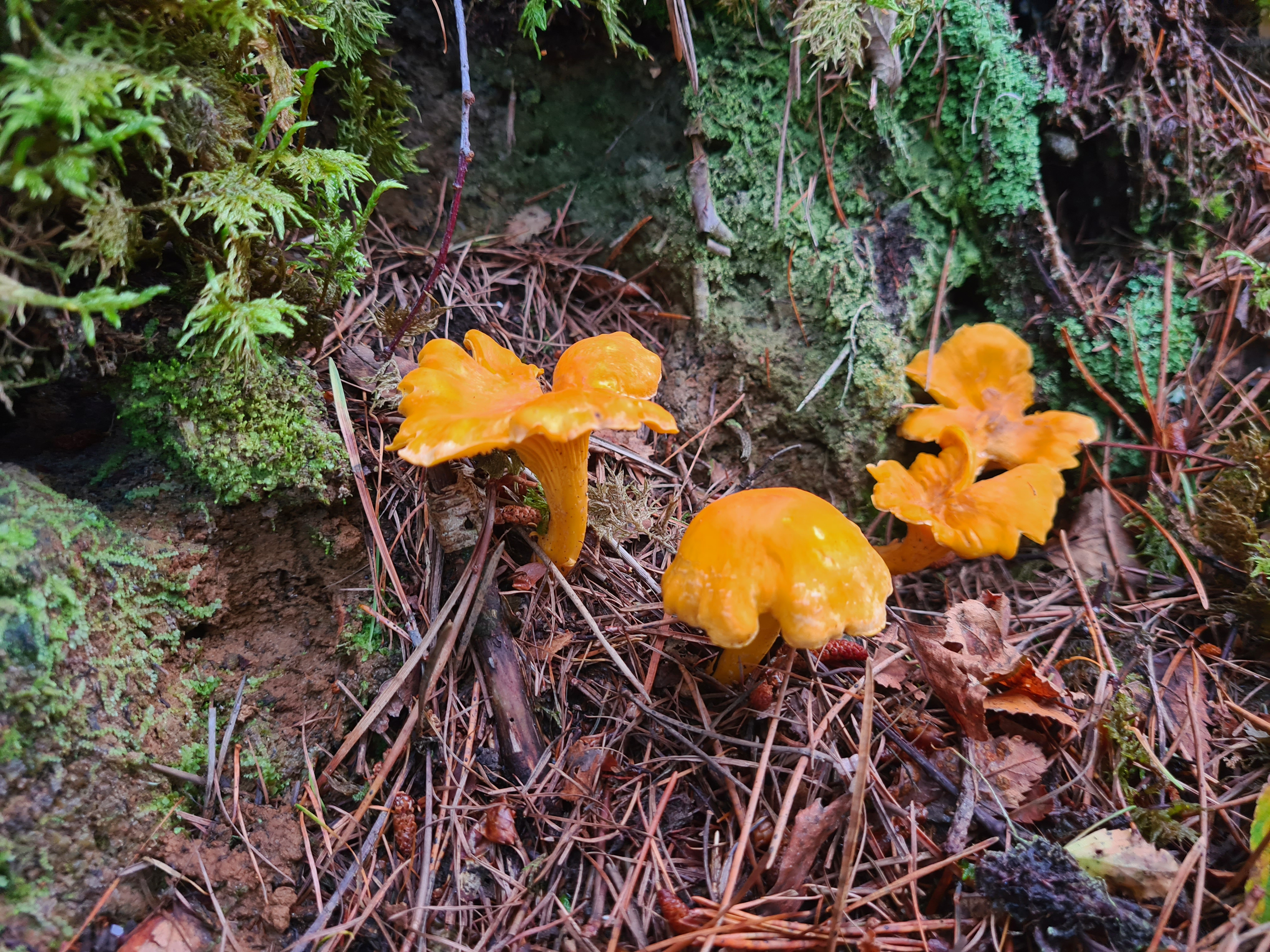
The Speyside Way provides a mostly undemanding wander alongside the second longest river in Scotland from Newtonmore to Buckie. Famous for it’s Salmon fishing, the river valley was once home to more than fifty whisky distillieries. All used the local railway to transport their wares. The ‘Whisky Line’ is now long gone, as are most of the distilleries. Those distilleries that survive and thrive here today still draw their water from the fastest flowing and largest near-natural river in Britain- the River Spey.
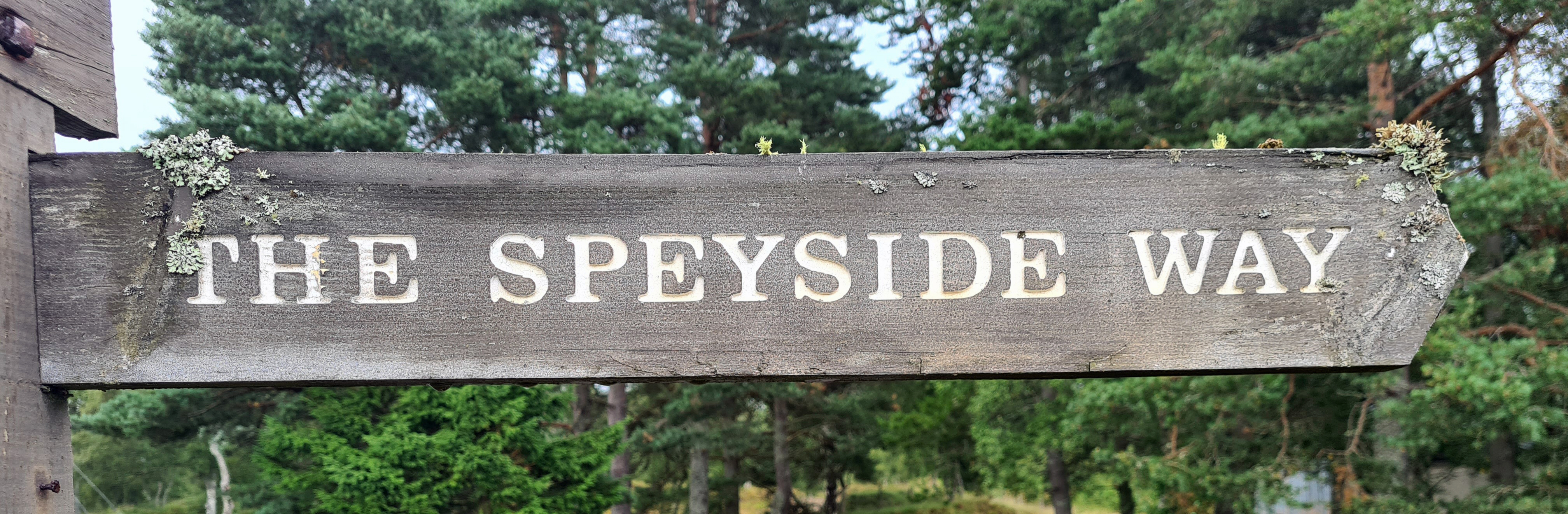
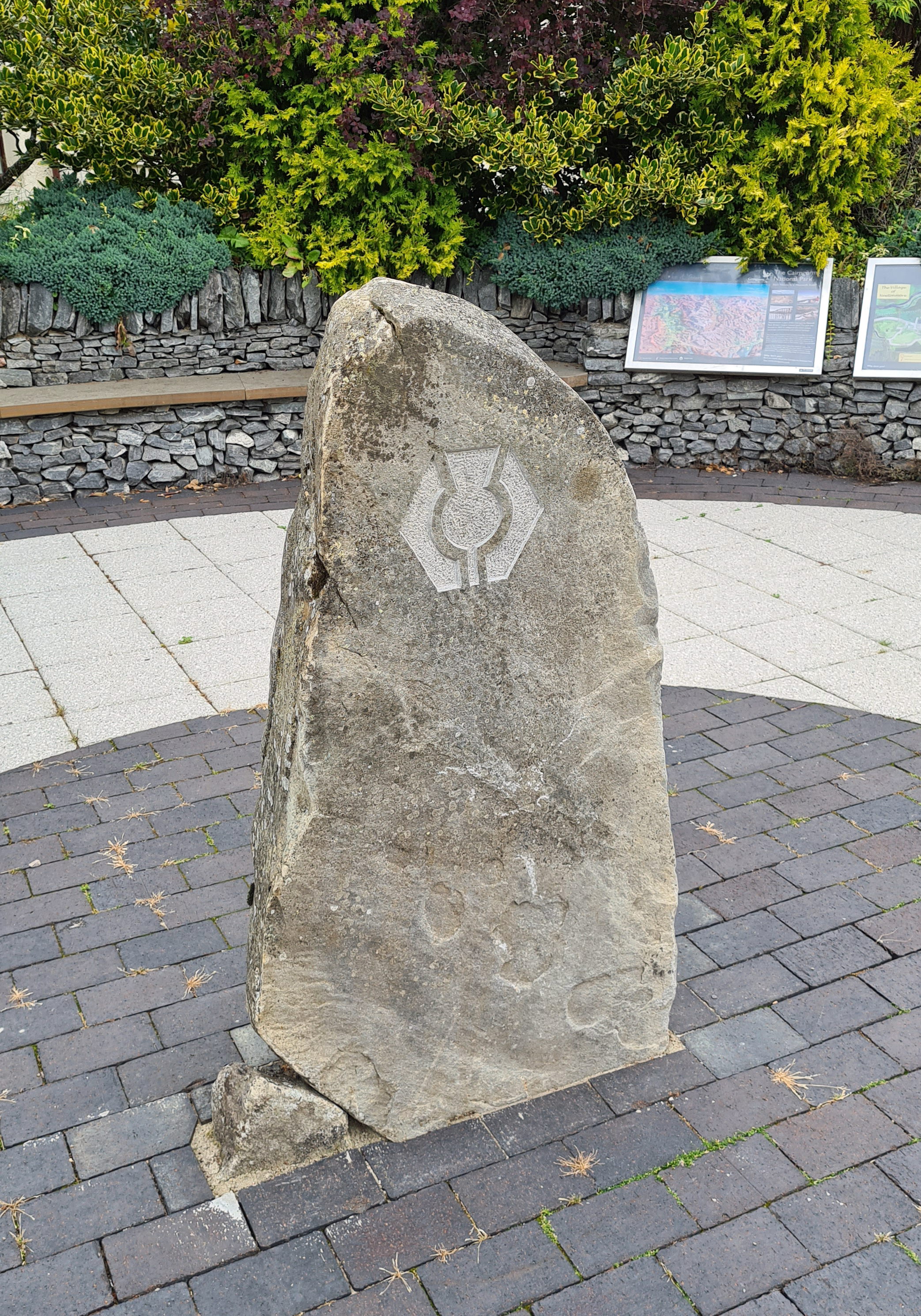
The Speyside Way is one of Scotland’s four ‘Great Trails’. It first opened in 1981 and then ran between Spey Bay, on the coast, and the old Strathspey Railway station at Ballindalloch. The railway once ran the length of the Spey Valley, transporting people and goods, particularly whisky. So much of the ‘water of life’ was carried that it became known as the ‘Whisky Line’. The railway closed in 1968 and the Speyside Way makes use of many miles of surviving track bed. An optional spur for the trail from Tomintoul was added in 1990, then the coastal section was extended in 1999 to Buckie. The following year the trail was extended further inland to Aviemore making the Speyside Way 66 miles long at that time and many walkers still only walk that length. In 2015 it was extended still further to Kincraig, then in 2020 to Newtonmore. The Speyside Way now runs 87 miles from Newtonmore to Buckie and it was this route that Three Points of the Compass walked in August 2021. I decided not to include the optional 15 mile Tomintoul spur as I wanted to maintain a constant linear walk.
Wednesday– Newtonmore to Insh Marshes: 4.5 miles
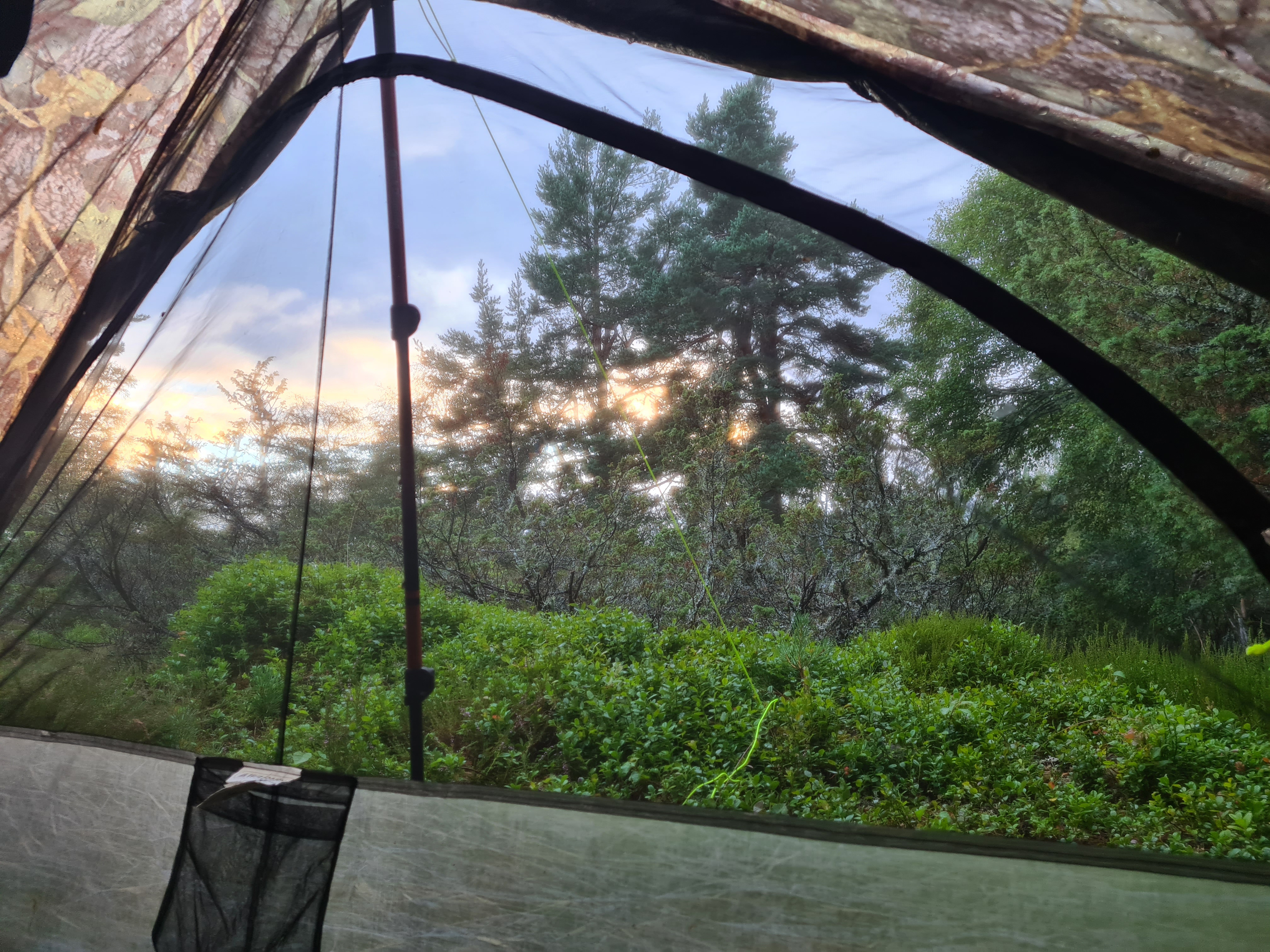
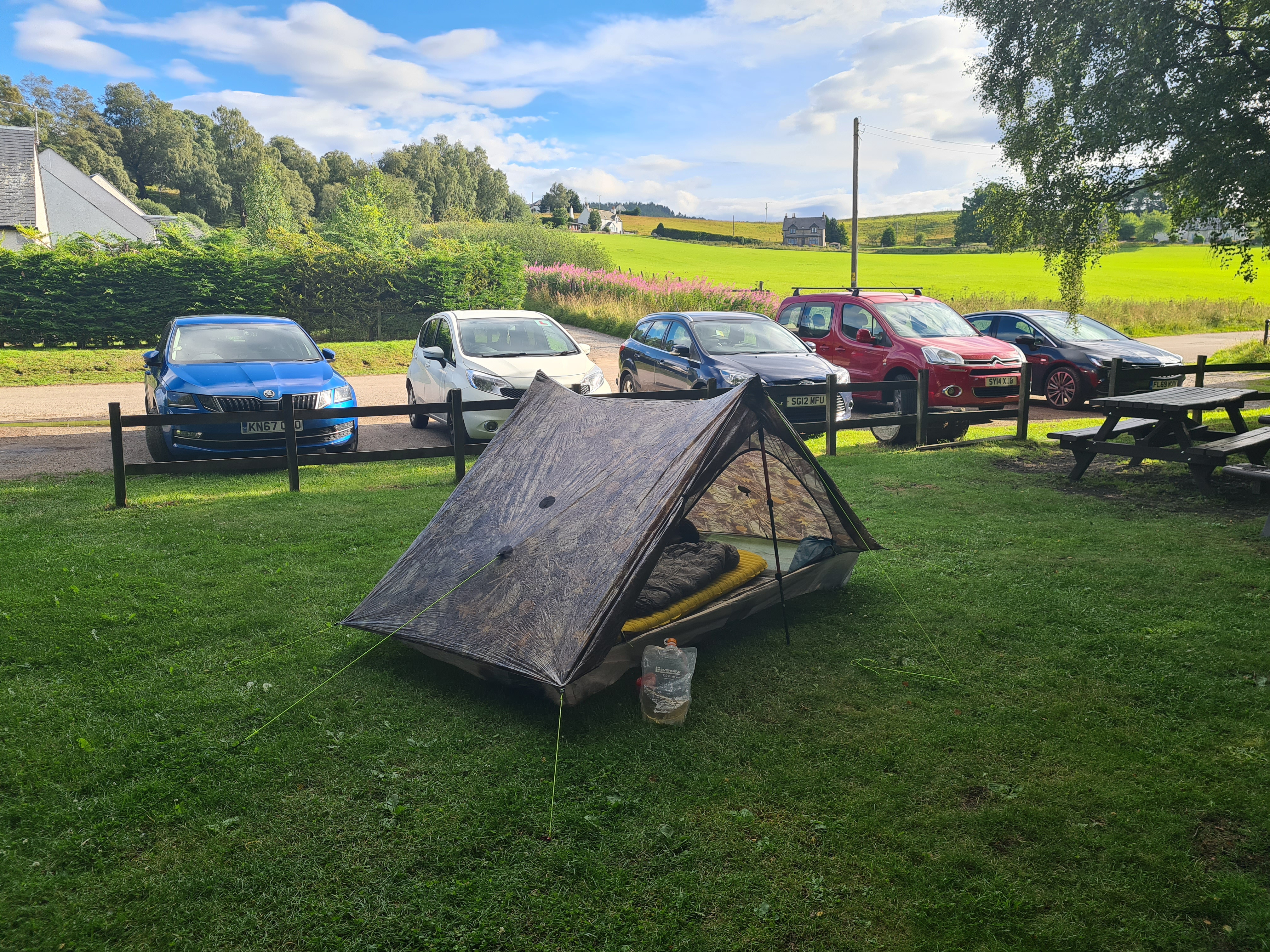
After my 15 hour rail journey up from the South-East of England, my final train deposited me at the quiet little station at Newtonmore in the early evening. There was nothing to delay me and I was soon heading toward, well, anywhere. I had nowhere particular in mind and was winging it. Just as I intended to do for the majority of the hike. I hadn’t even committed to how long I was going to take to complete the trail and had not booked a return train home. It was a lovely evening, the low sun cast long shadows and I felt truly content striding out at the start of another walk. The Badenock Way is the concurrent path followed to Kingussie and it was simple walking on the cycle path with only one wheeled user on its three miles between the towns. No sooner are you into Kingussie than you are turning right and out of it. Another half mile had me passing the busy shinty pitch and then crossing the young River Spey. It looked spectacular and had really inviting grassy banks. I was sorely tempted to spend a first night here as it would be a fitting start to my then following the river to the sea. However the A9 runs far too close, the noise was intrusive and I walked on a further mile and a half, pausing to briefly view the ruined Ruthven Barracks and consider camping there. Instead I followed the trail that soon turned off into the Insh Marshes Nature Reserve. There was a small clearing not far from the reserve’s car park, overgrown and secluded, that shouted first night halt at me. My Z-Packs Duplex was up in five minutes but the midges had found me in two and I dived inside and zipped up the bug netting. Evening tick check revealed one of the little buggers. For evening meal I carefully heated up pre-soaked soya protein chunks inside my shelter, added instant mash and yeast flakes, finally dumping a handful of dried fried onions on top. Then a little wander up to the reserve’s hide to check it out, chatting to Mrs Three Points of the Compass on the phone in the gathering night, bats hunting above my head. Back to the tent, a walk through the scrappy grass entailing another tick check with another found. A hot chocolate finished off the day before sleeping well after a long day travelling with just four and a half miles of the trail completed.

Thursday– Insh Marshes to Aviemore: 15 miles
It rained heavily during the night which didn’t disturb me much beyond briefly waking me. I rose around seven. I packed mostly inside the shelter before striking camp and going up to stand at the viewpoint on the roof of the RSPB hide. I brewed up a pint of tea but it was too midgey so went down below, into the hide proper. I took my time as I knew I had a fairly modest day on easier terrain and enjoyed looking out over the largest natural floodplain wetland in Great Britain. Tits, chaffinches and other birds were visiting the feeders outside the windows and skeins of geese flew in to the pools beyond. The clouds lay over the Monadhliath mountains in the distance. It was a good start to the day.
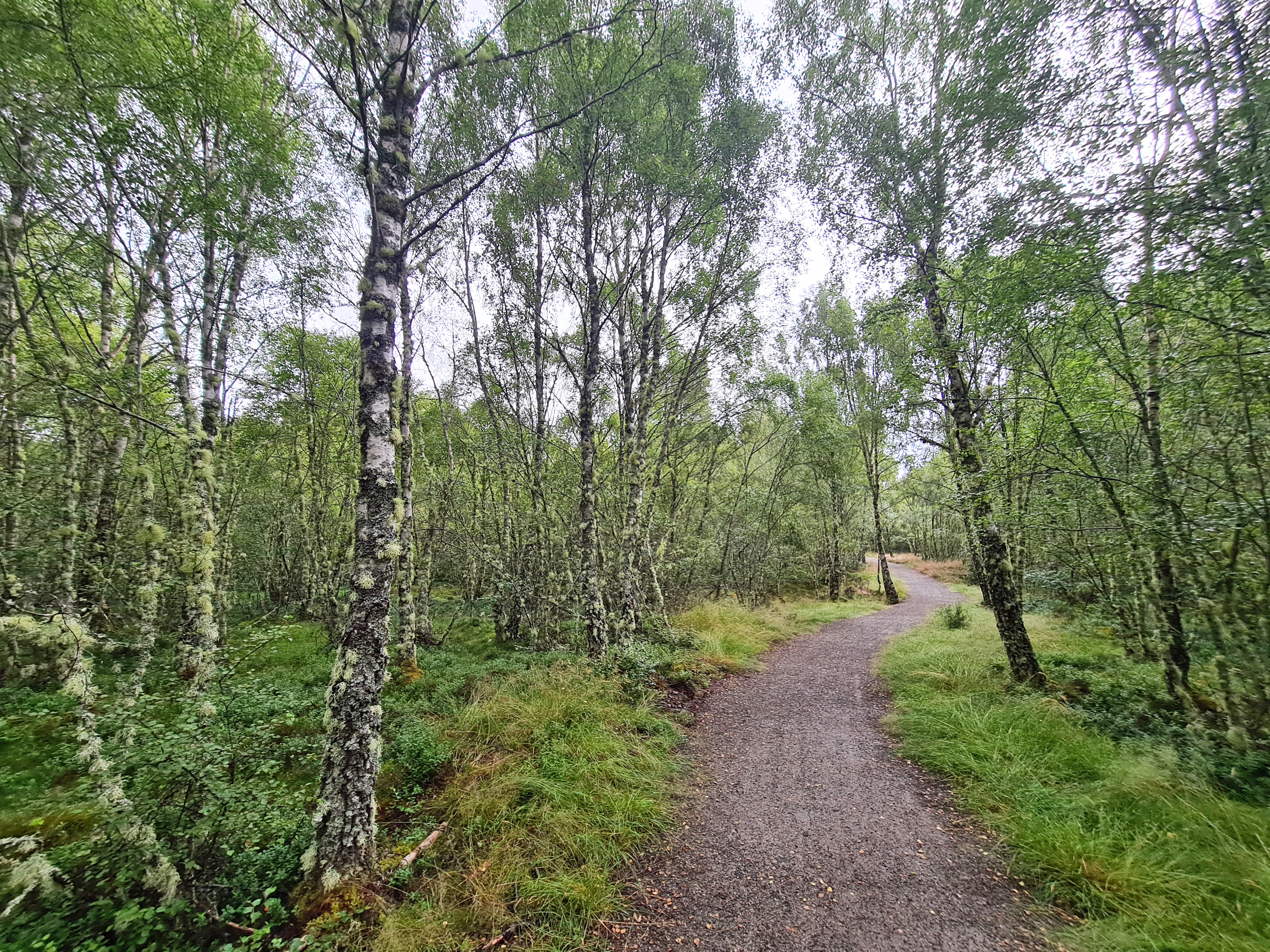
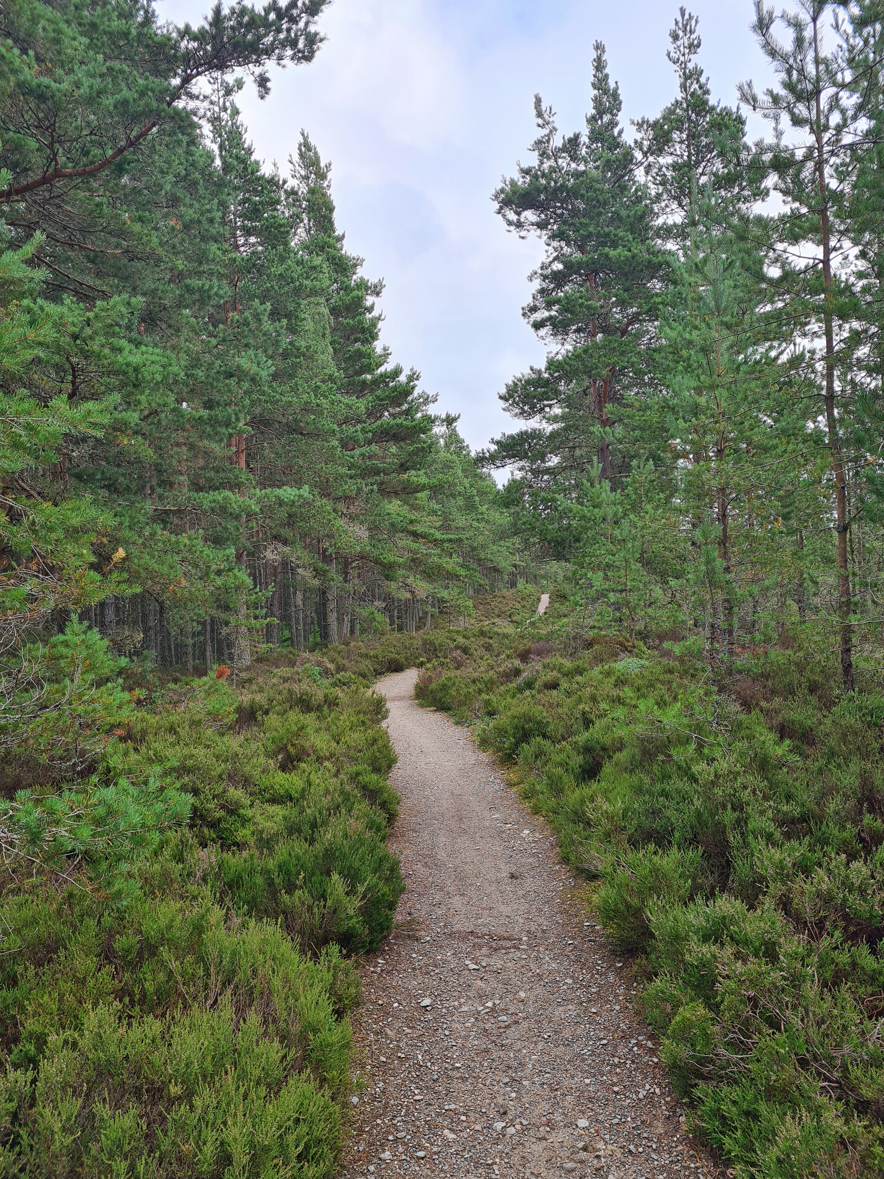
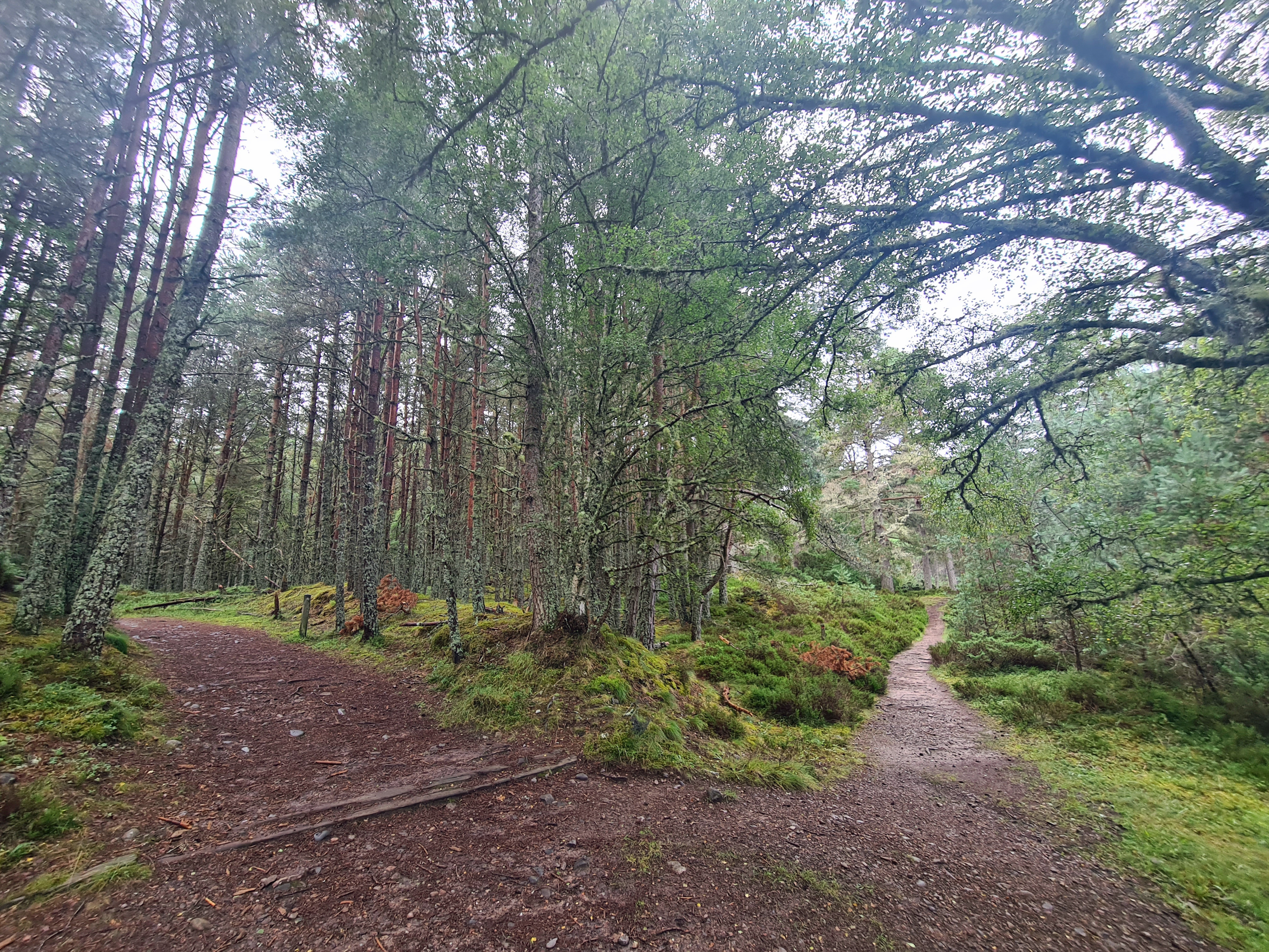
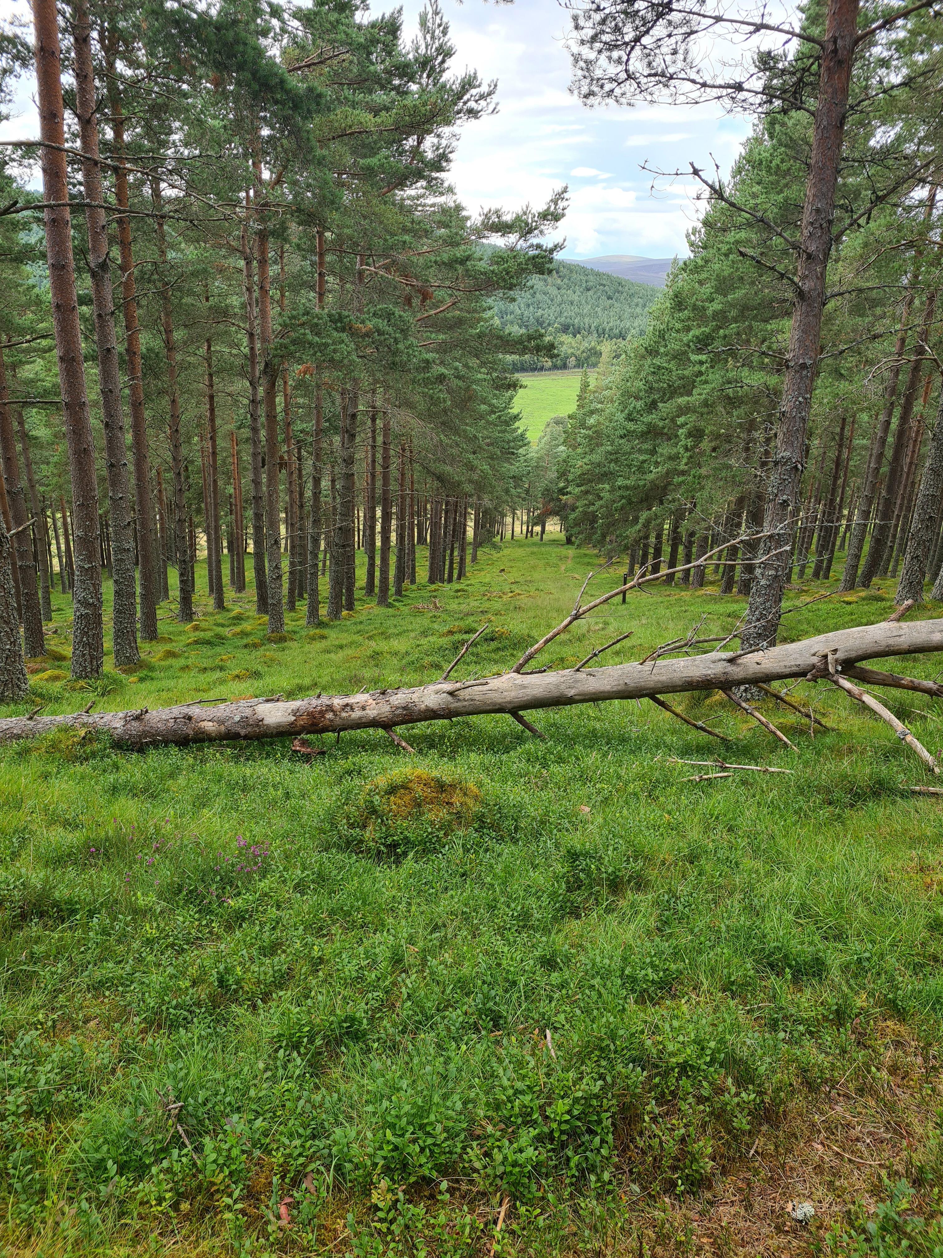
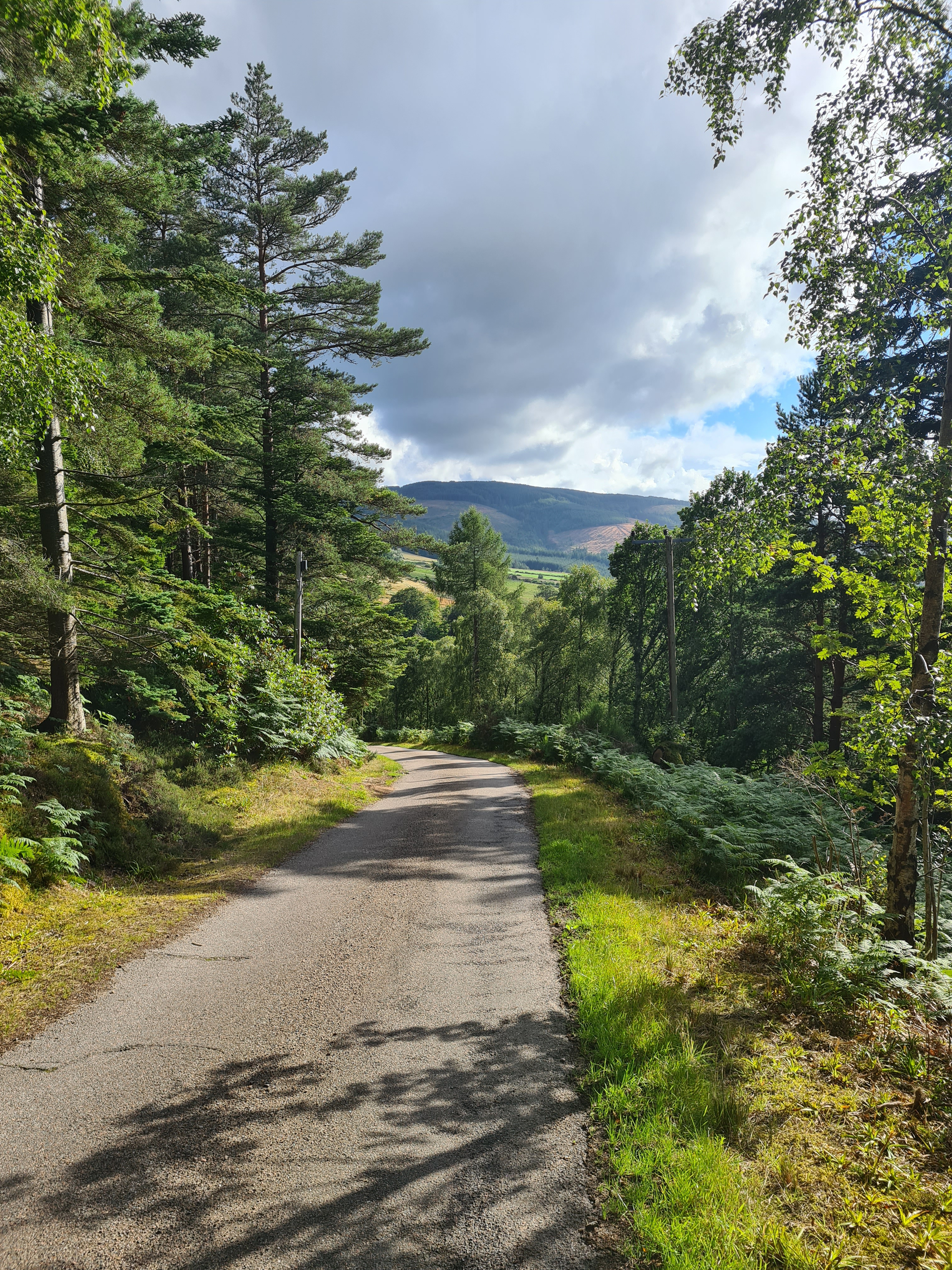
The first few miles are on easy tracks through one of the finest and most extensive stands of Aspen in Britain. These eventually changed to equally as lovely Scots Pine woodland, the trail also passing through a couple of isolated hamlets

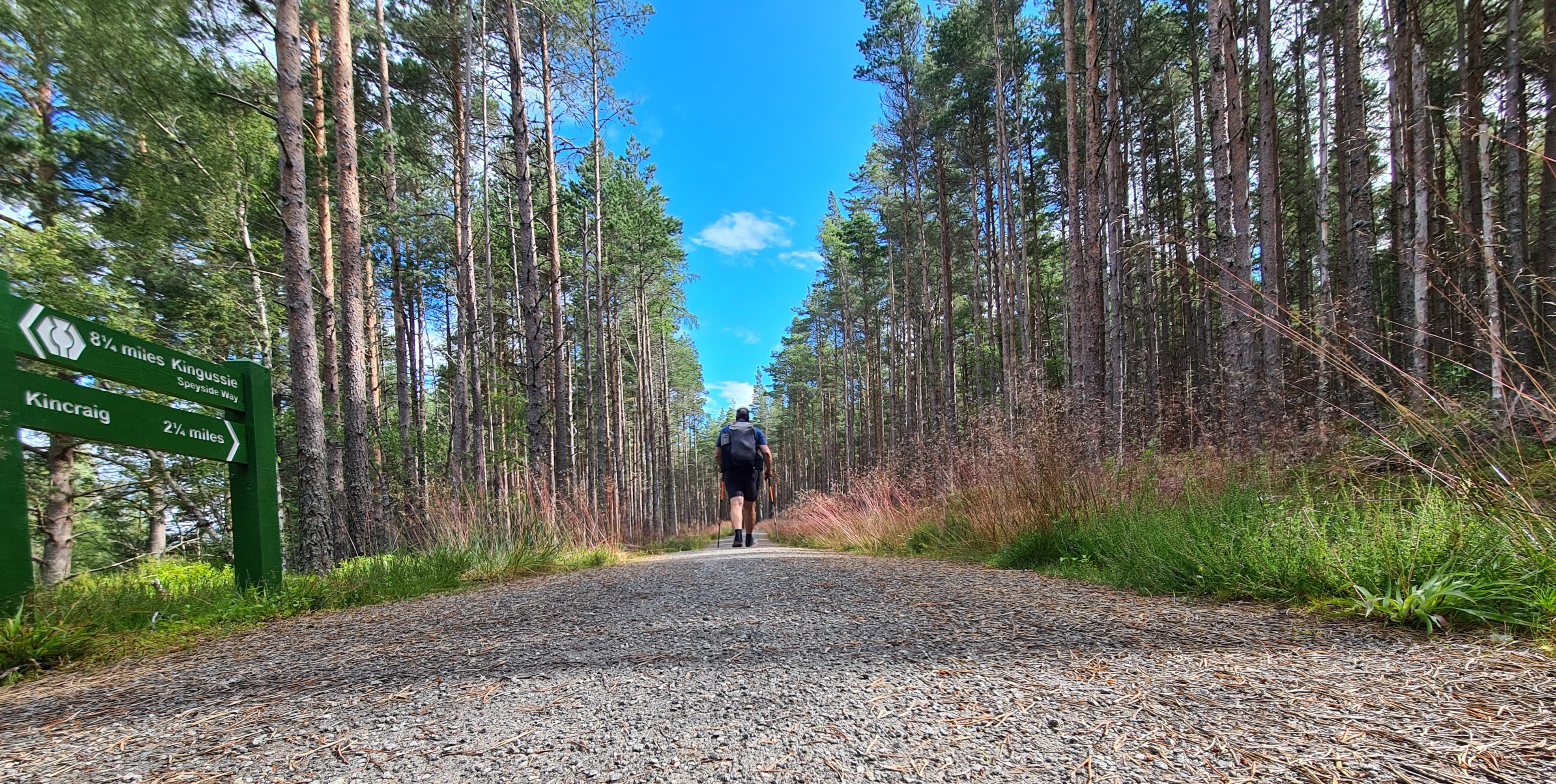
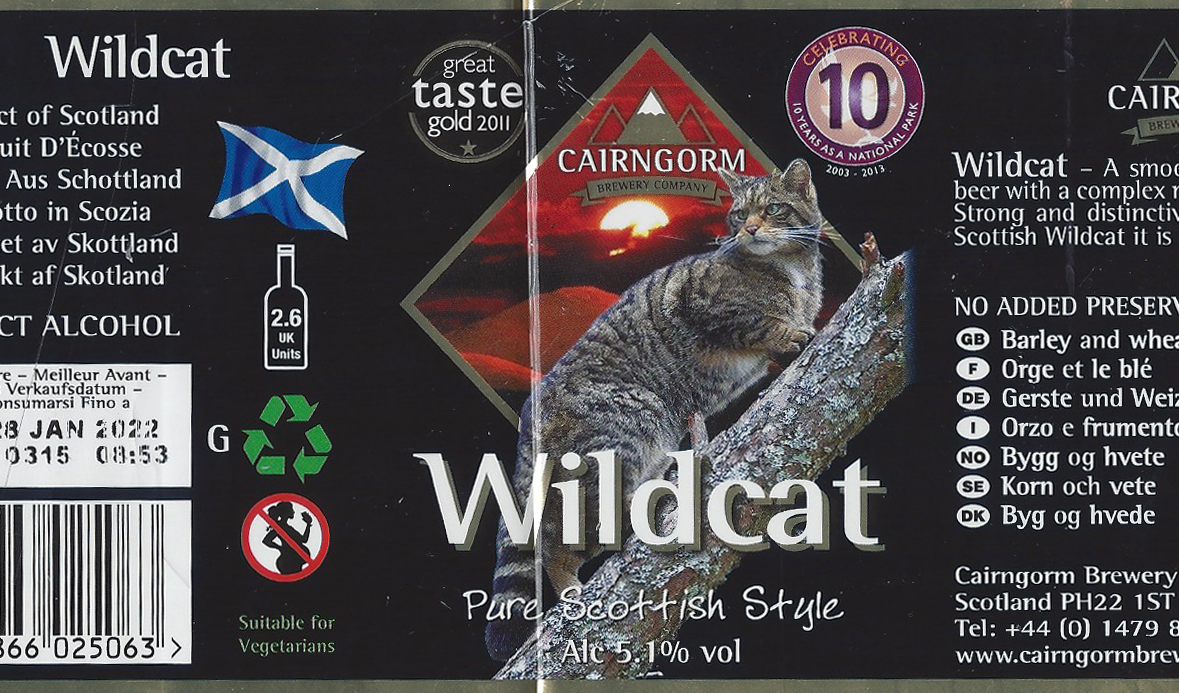
Lunch was pretty luxurious. A smart looking cafe was open in Kincraig. They very obviously didn’t want an already grubby sweaty hiker sitting inside so I ordered quite superb parma ham and mozzarella in toasted focaccia which I enjoyed, along with a large tea, on the sunny, grassy bank opposite. Then it was simply a bit of wiggly, up and down path, with occasional views of the river or railway all the way to Aviemore. Early afternoon I stopped to brew up, wasting time a little as I didn’t want to get in to town too early. Lots of Scotch Argus butterflies and large dragonflies along this stretch. As it was I reached town mid afternoon so pottered along to the Cairngorm Hotel and was happily accepted inside to the comfortable seating interior of the bar, there to enjoy superb pints from the Cairngorm Brewery, the titular hills outside the window still with patches of snow visible.
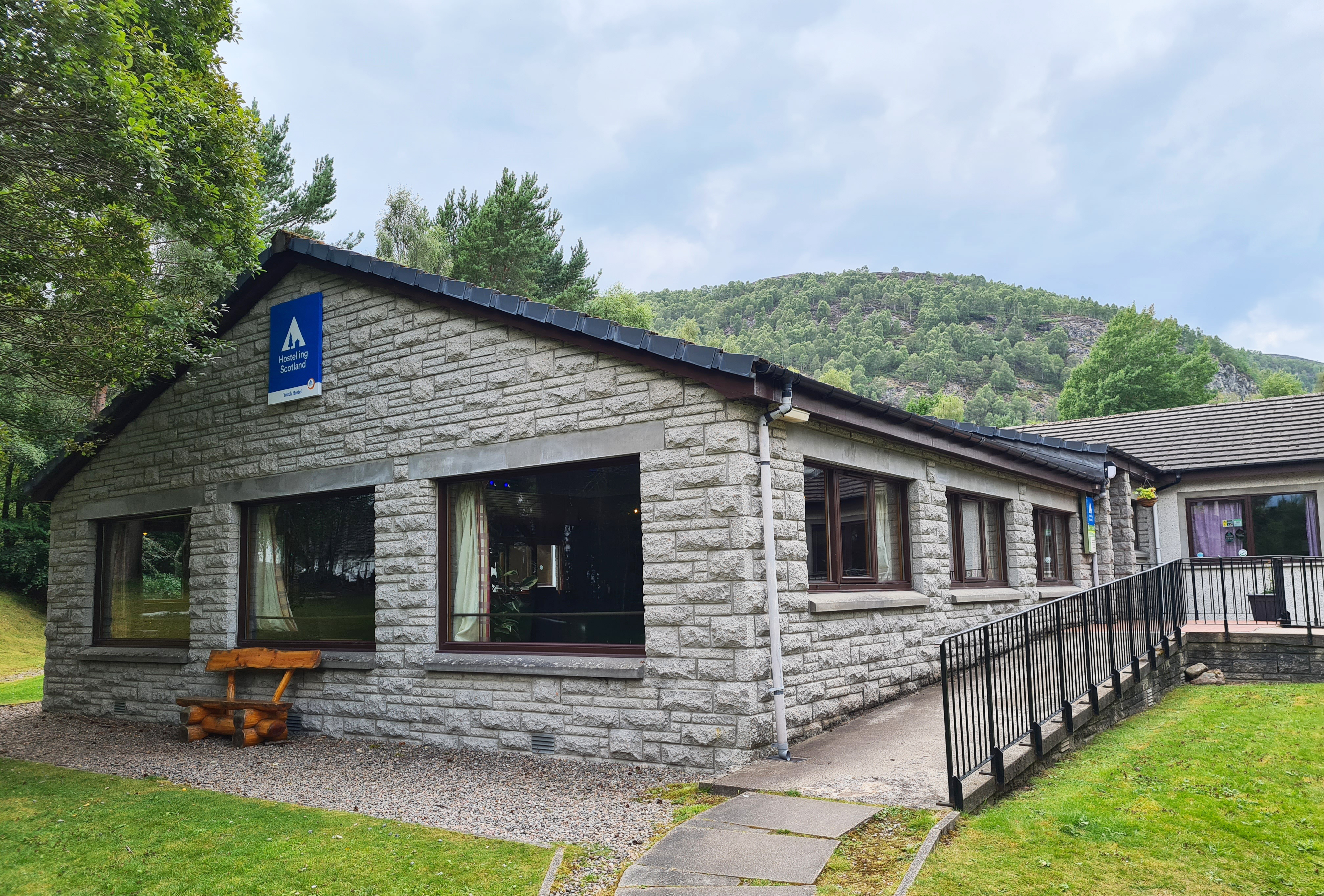
Aviemore was my second night’s halt and while this was primarily a backpacking trip, I had included a night at the Youth Hostel to give opportunity to charge electrics, enjoy a shower and help, in any way I could, this organisation in its financial struggle out of the Covid economic mire. Booking in at the hostel was from four o’clock so after three pints, it was back the way I had come to check in to my single occupancy private room, a Covid requirement at the moment with the SYHA. I chatted at length with the Warden, Hamish, on his difficulties in opening a hostel during Covid times.
I had passed a curry house on the walk into town so had booked a table for later that evening. As soon as I went there and they were reluctant to sit a lone diner, despite having accepted my earlier booking, I should have turned away. As it was I was subsequently presented with the worst Indian meal I have ever eaten, or attempted to eat. I left four fifths and they never queried this as plates were cleared. Having read a few online reviews since, I now know I should have gone to the Fish and Chip shop next door. It was a big mistake and a bad end to the day.
Friday– Aviemore to Grantown-on-Spey: 18 miles
It had rained heavily during the night, though not disturbing me in the slightest. It was still raining as I rose. I had other things to worry about. I made a mug of tea and sat cradling it in the hostel lounge, looking out at the teeming rain and trying to ignore a churning stomach. I returned to my room, finished packing, had a third clear-out of the morning, donned waterproof, rain-kilt (I’m in Scotland, I can call it that) and Tilley hat and strode though an increasingly water-logged town, successfully restraining myself from chucking a brick through a certain window. I felt lousey but once out of town the weather cleared and brightened. Remarkably, I began to enjoy this section of trail, my stomach eventually settled a little and despite feeling a little wobbly, my feet kept moving me in the right direction. The sun came out, it dried up. I even got a puffing, whistling steam train passing me at one point.

At Boat of Garten the trail passes one of the stations on the tourist line- the Strathspey Steam Railway. With my earlier dodgy stomach, I hadn’t eaten anything so far this morning. Now hungry, I ventured in suspecting the presence of a cafe- result! I fancied a bacon roll or pasty but they were only offering cakes. Armed with a huge slice of excellent Coffee and Walnut cake and a pot of tea, I sat at one of the tables, to be rewarded with both a steam train huffing in to the station in front of me, and also a sugar rush headache that accompanied me for the next three miles out of town.

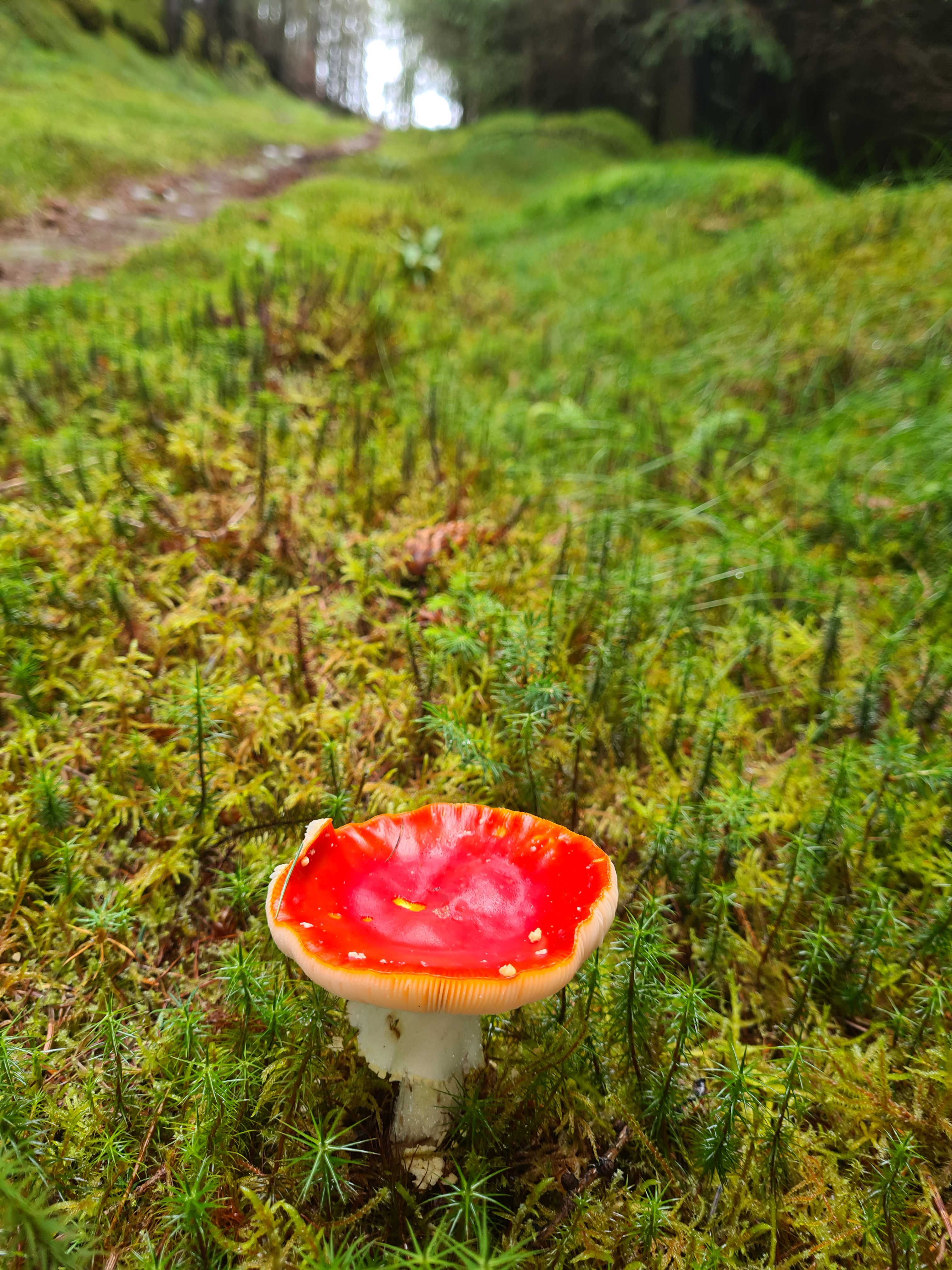
There is a fair amount of forest walking on the Speyside Way, but the stretch following Boat of Garten must be amongst the best in the country. Other than just a little road walking, the paths take you through the Abernathy Forest. This is cracking walking and is over far too soon. I was last in this area over twenty years ago when I visited to see the Ospreys nesting at nearby Loch Garten however this walk was pretty late in the year and I held little expectation of seeing any Ospreys this week. In fact, as with my earlier forest walking, the trees were pretty quiet of bird life. I would occasionally come across small mixed parties of roving Long-Tailed Tits, Blue Tits and Coal Tits, but sadly no Crested Tits, one of the special birds of this area. Nor did I see any of the native Red Squirrels or Pine Martin that I have seen on other visits. I really was a tad late in the season and wildlife was pretty quiet and inconspicuous. The occasional deer still crossed my path though. Plenty of those around here.
The path skirts Nethy Bridge but does pass the door of an open cafe, I was drawn in… Two pots of tea were welcome though the accompanying bacon sarnie was a bit poor- two burnt rashers between ‘cotton-wool’ bread. Then it was a case of following the disused railway to the A95 next to the Spey Valley Smokehouse. I wasn’t even sure if this business was even still operating as it was locked up, windows covered and a For Sale sign at its entrance. There was lots of short cut grass around its perimeter and I was tempted to pitch up here for the night but I had another destination in mind. I crossed the Spey via the Old Spey Bridge, pausing for photos of the river far below mid-crossing. Much to the annoyance of a fly-fisherman who shouted angrily at me from the river- probably poaching, or sans permit. The map shows an alternative route that follows the river bank until rejoining the official route at Cromdale. It looked a great proposition for a nights wildcamp and I chatted to an arriving fisherman about the prospect and asked how busy it got with evening walkers- “well, its not Princes Street, but there will be a few”. More to the point, he told me that estate workers would occasionally move wildcampers on from the cut riverbank, telling them “if you’re camping on cut grass, its not wildcamping“. I couldn’t be bothered with any of that so continued with my original plan which was to search out a place in the extensive Anagach Wood to the east of Grantown-on-Spey.


There are a number of trails through the woodland beside the Speyside Way, and I followed the hopefully quieter red trail midway through, before leaving it for a secluded clearing on a higher bit of ground. I had a bed of berries and heather to pitch on and it made a cracking nights halt, the only downside being the expected midges and flies. Headnet went on while putting the Duplex up and I dived inside for a decent clean-up and tick check (one) before forcing myself to eat my cold-soaked evening meal wishing I had made a lentil curry instead. The feet had a good massage with moisturising balm before merino sleep socks were slipped on as they had been wet for much of the day. Then I chatted to Mrs Three Points of the Compass on the phone as the sun went down, while I drank a welcome pint of strong tea accompanied by good dark chocolate. It had been a good days hike.

Saturday– Grantown-on-Spey to Ballindalloch Station: 14 miles
I dropped off pretty quickly as night fell but I had obviously annoyed the local deer. He stamped outside the shelter and ‘barked’ at me for ten minutes before leaving to join his pals further down the slopes to continue making a racket off and on until I again dozed off. I slept well despite heavy rain and was in no rush to get moving on today’s short stretch. I had a leisurely two mugs of tea before reluctantly packing and leaving. This was another cracking piece of forest walking. I saw no one other than deer. Sadly, no Capercaille either as the Red Trail passes through a few good sites for them. I rejoined the Speyside Way and the grand woodland walking continued.

Exiting the wood and stopping to filter water from a small burn, I paused hoping to glance inside the small church at Cromdale but the door was locked, so onward…
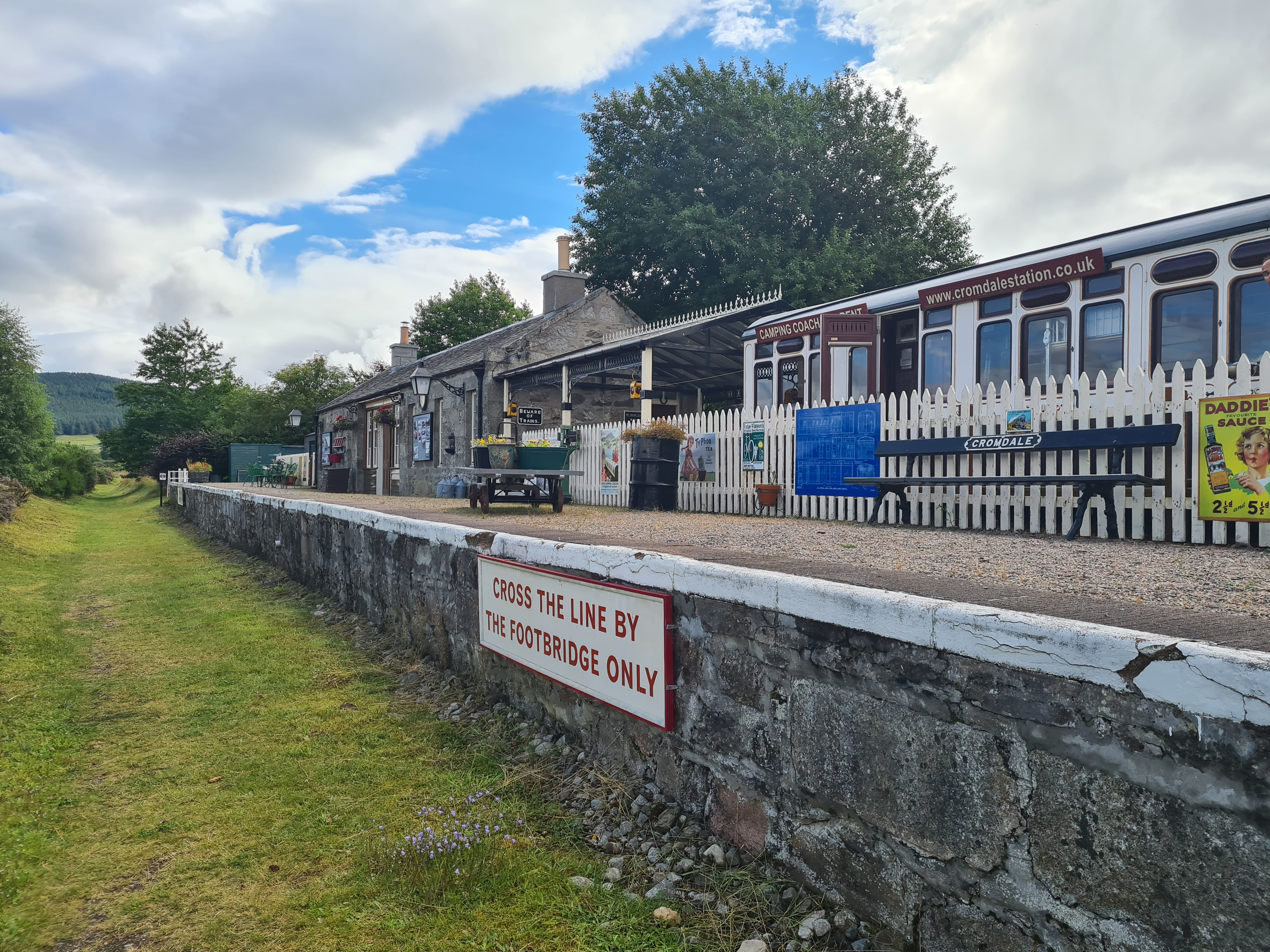
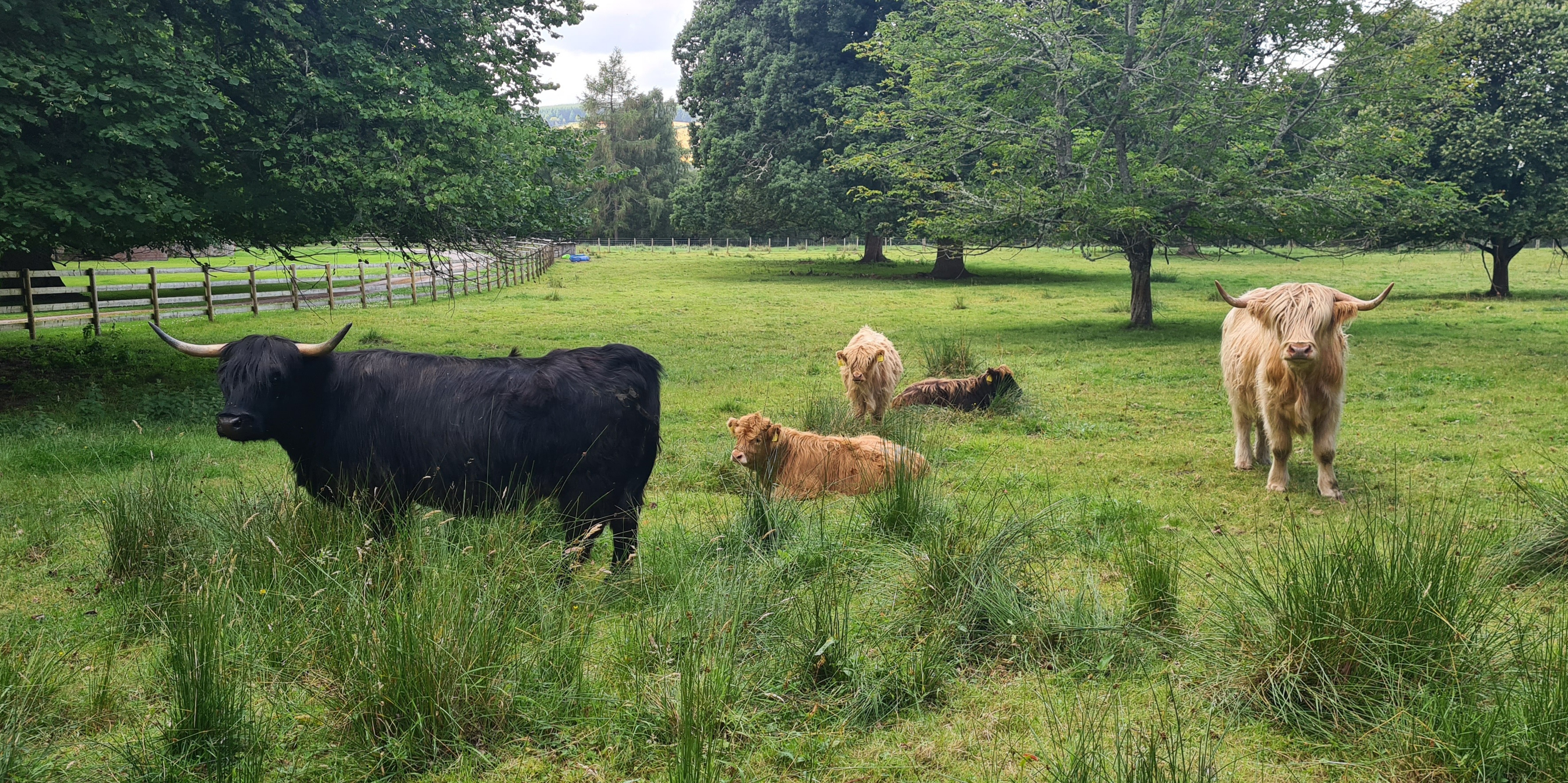
Some of the stations on the old Whisky Line survive to this day. None are still operational as stations of course. Some are just overgrown platforms alongside the railway trackbed, others are converted to other purposes. The one at Cromdale is now posh ‘glamping’ for those after something different. I stopped and chatted to the current owner, of seven months, trying to convince him to put over another small and unused carriage he had over to bunkhouse accommodation for Speyside Way walkers. He wasn’t having it, preferring to charge many hundreds of pounds for week-long bookings. Rejoining the railway trackbed and passing through fields of grazing cows and horses until doubling slightly back on myself on reaching the A95, crossing over and climbing up the hill, through forestry works, into the woodlands below Tom an Uird.
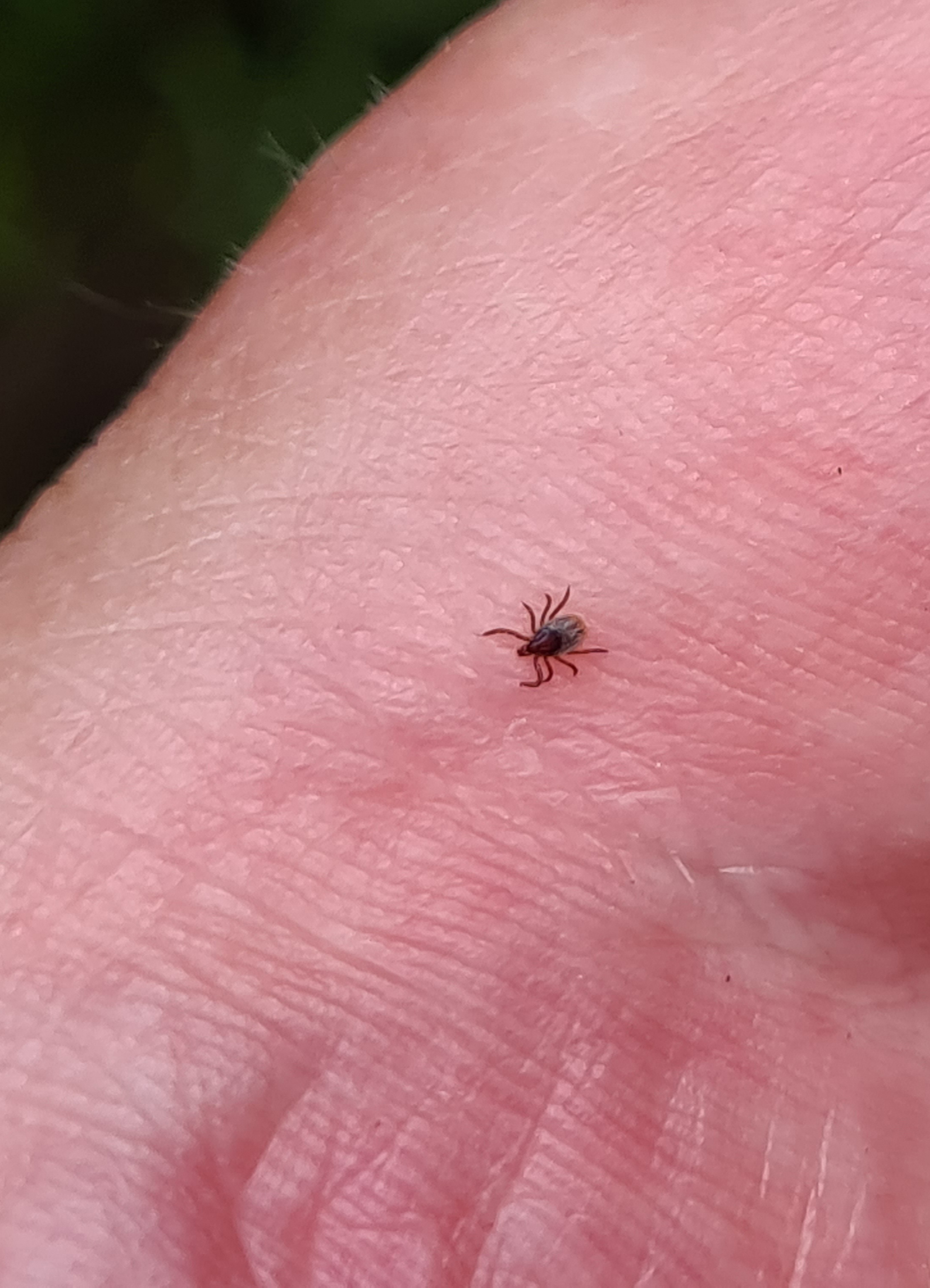
It was very obvious that few people pass this way. Scrappy taller vegetation had grown on the track and this, combined with a damp day, meant halting every ten minutes or so to check bared legs. Sure enough, I wiped many minute ticks from my calves on this stretch. Even just standing for five minutes watching a couple of newly fledged Sparrowhawks loudly calling as they awkwardly flapped in treetops above me entailed clearing another three of the little buggers from my legs.


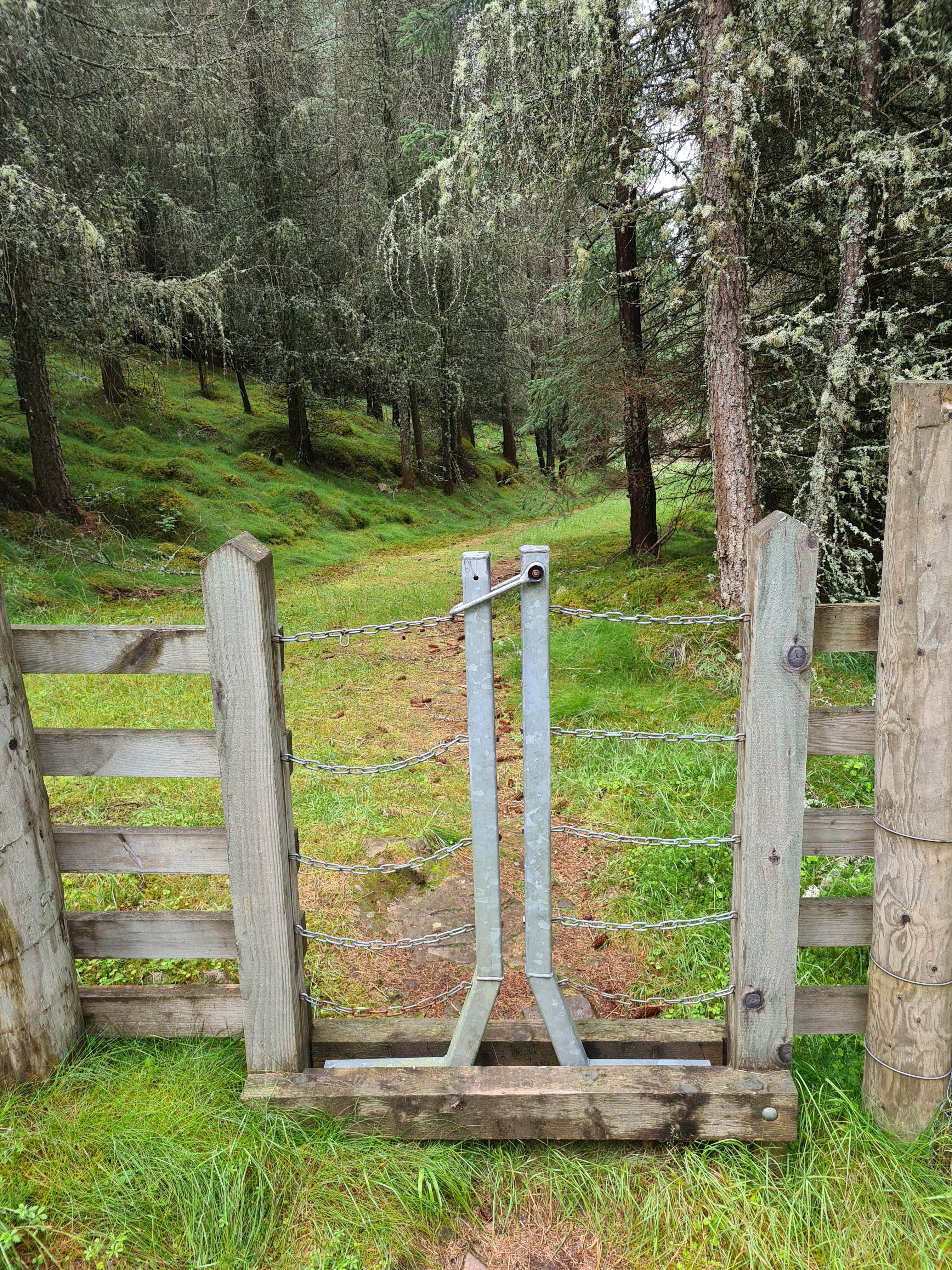
There were far too many squeeze stiles for my liking in this afternoon section. Many not performing any useful function that I could see. The afternoon entailed quite a bit of up and down, crossing unkempt farmland with destroyed fencing and abandoned loops of barbed wire poking from the grass in places. I stopped beside a handy burn, first to watch a Dipper for ten minutes, then to filter water for a decent hot lunch, followed by a somewhat tortuous climb up through forestry until dropping down again to work my way back over to the River Spey and rejoin the railway track for a last few miles up to Ballindaloch Station. Along this stretch a weasel suddenly bounced into the middle of the path from the bordering vegetation. He stopped and rose himself up the better to study me, unsure, he lolloped nearer until some twelve feet way. That was close enough for him and he dove into the Rose Bay Willow Herb to the side and was gone.
Ballindaloch station is now private residence but a neighbouring patch of grass has been reserved for Speyside Way walkers. It was like pitching on a showcase lawn. Not only that but the tiny adjacent carpark, populated by day walker’s cars, also had a portaloo. The latter provided soapy wet paper towels for me to properly wash my feet before moisturising them again. No ticks, and just a few midges drifting around. Tent up, I brewed up and sat supping hot tea while watching the hares in the fields above me. Cars left as walkers returned to them, a couple more turned up as dog walkers visited for an hour or so. I video called Mrs Three Points of the Compass and chatted to her. Two lads turned up for a loud kick around of a football in a nearby field but they cleared off, it all got very quiet and despite gentle rain beginning to fall I drifted off and slept well. It had been a good day.
Sunday– Ballindaloch Station to Earth Pillars: 23 miles
Today was going to be my longest on trail as I had a particular location in mind for the nights halt. I never hung around in the morning, rose, made a pint of tea and drank that while packing. The portaloo was made good use of then it was off down the wet and cobweb strewn railway trackbed to cross the nearby Ballindaloch Viaduct. The previous night I had been in two minds whether to stop at the official site provided at Ballindaloch Station or another official campsite provided for Speyside backpackers just a couple of miles further on at Blacksboat Station. I had definitely made the correct choice as there was little at the latter.


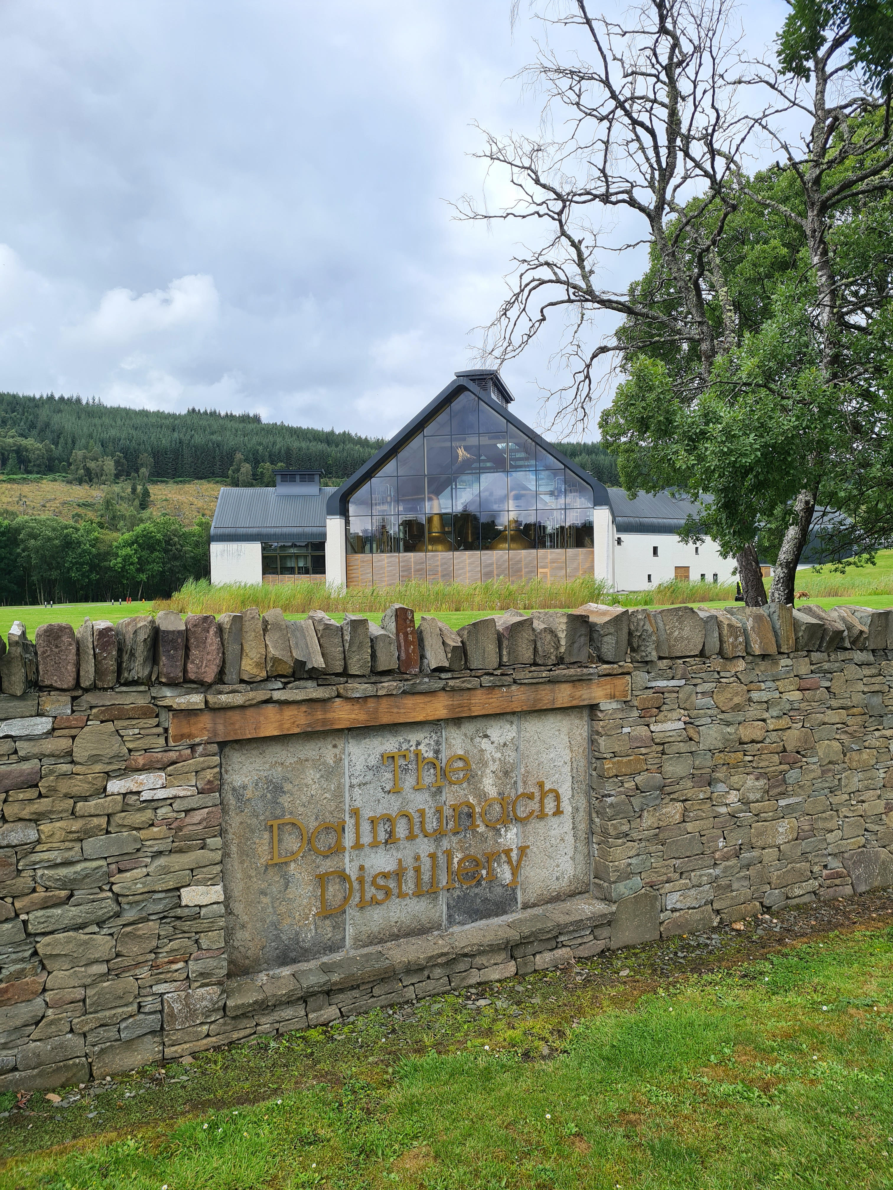
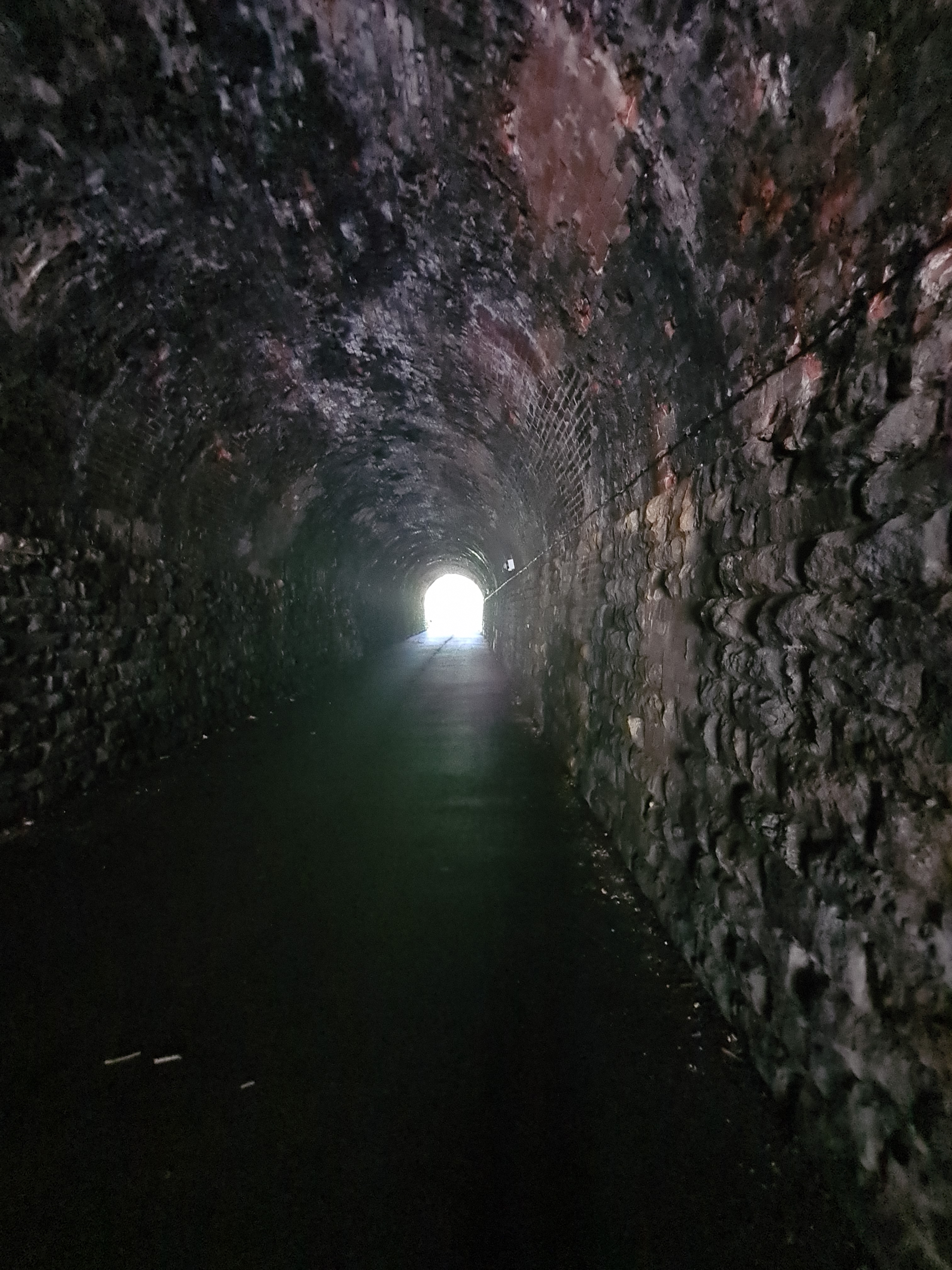
Today was a day of distilleries. I had held out just a glimmer of hope prior to walking this trail that I may be able to step inside at least one of the plethora of distilleries still found in the Spey Valley, it wasn’t to be. Cragganmore, Tamdhu, Knockando, Dulmunach, Dailuaine, Aberlour, The Macallan, all on trail, all passed by. Others close by but off trail remained unseen. I wouldn’t get a taste of one of these until Buckie. While [Charlestown of] Aberlour never offered any ‘water of life‘, and its Speyside Visitor Centre was closed (Covid), there was at least a decent cafe where a good burger, chips and salad was enjoyed alongside a couple of pots of tea. This set me up well for an afternoon of forest walking. A final bit of trackbed walking led me out of town, through a short tunnel approaching Craigellachie, across the Bridge of Fiddich and soon a turn off and into four miles of up, down and around the Wood of Arndilly and Woods of Knockmore.
It looked like there was a bit of money in these quarters. Cameras, big gates, fences, walls and curious livestock kept the riff raff away from the impressive houses and I walked on. Unsure if I would find water, I had been lugging along two litres for the nights camp, but passed a decent burn not 300 metres from my nights halt, so filtered a further litre giving me not only enough for meals and drink, but also enough for a ‘reasonable’ tent wash later and hydration for much of the short day to follow.
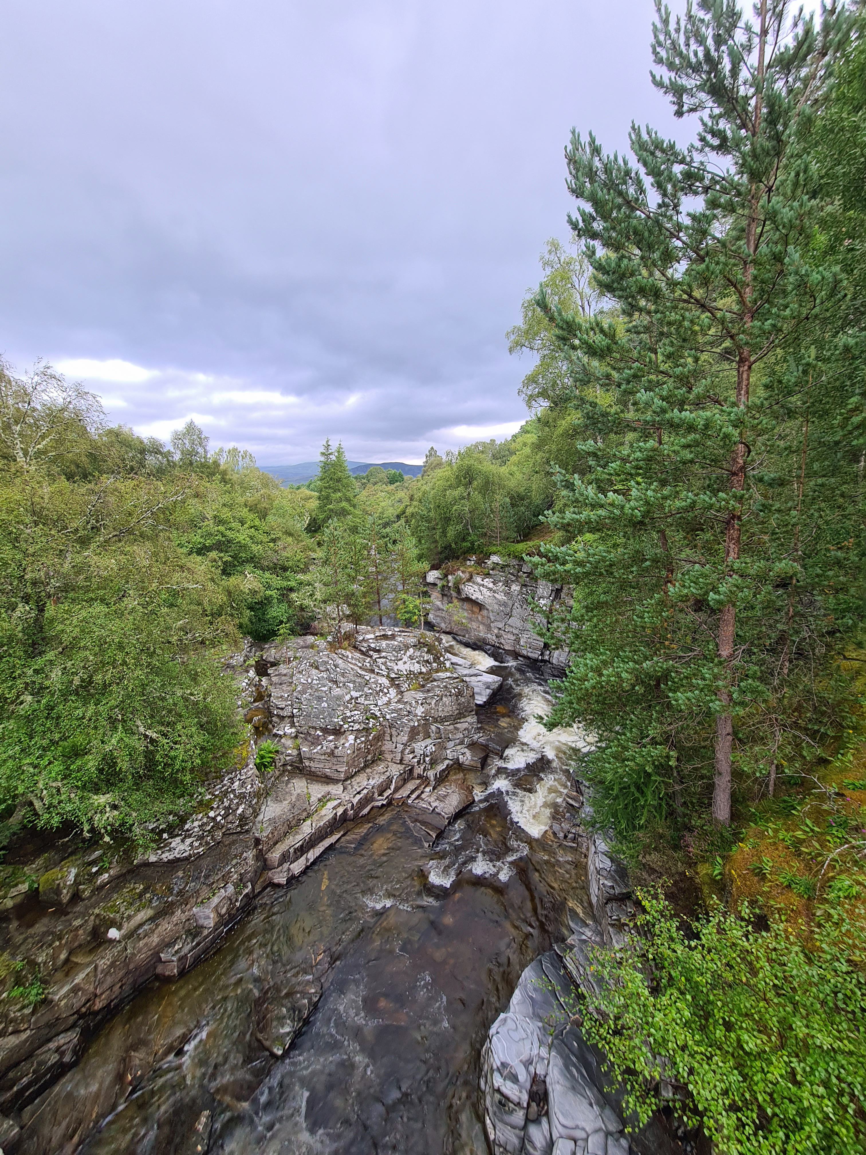
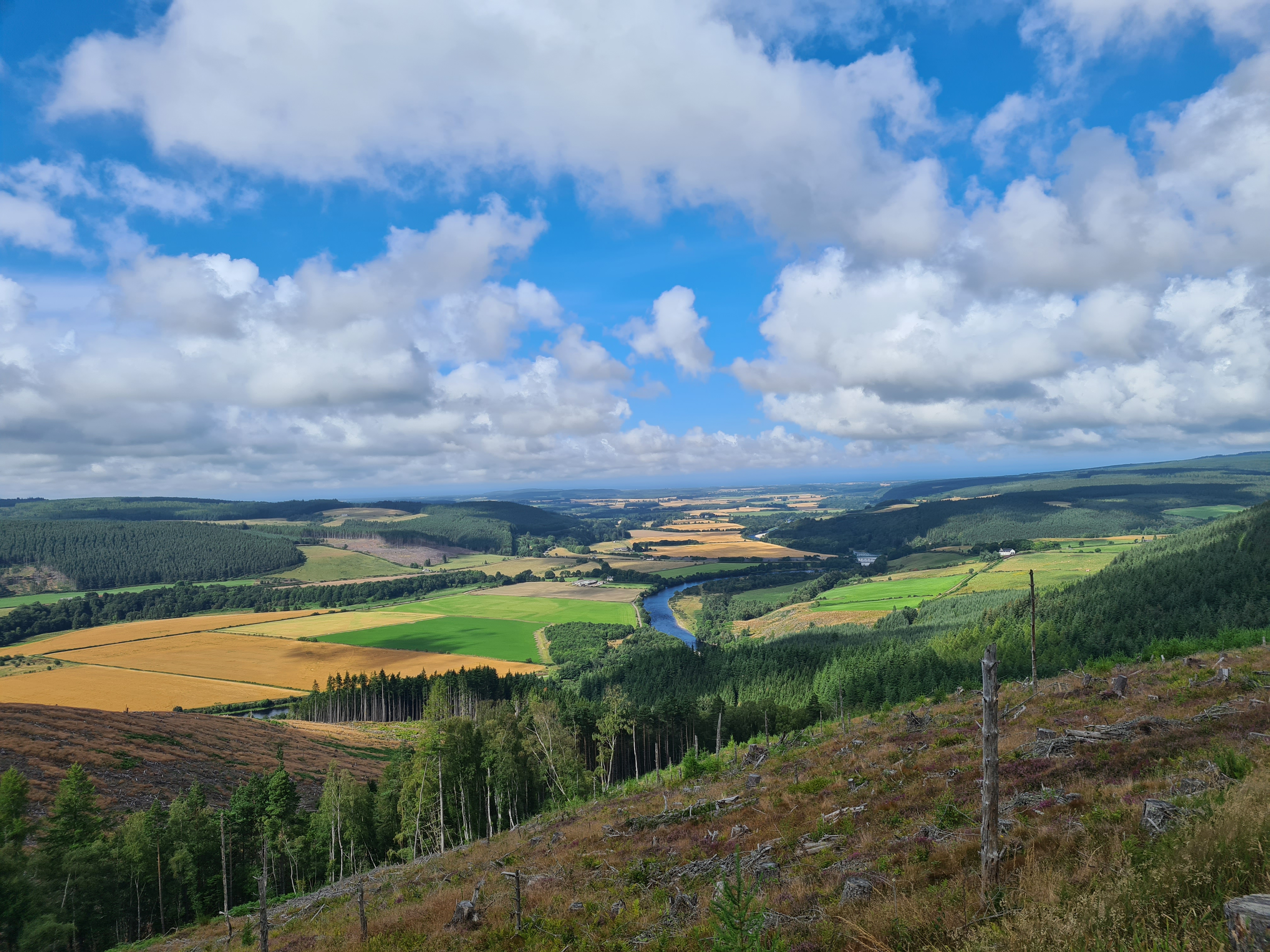
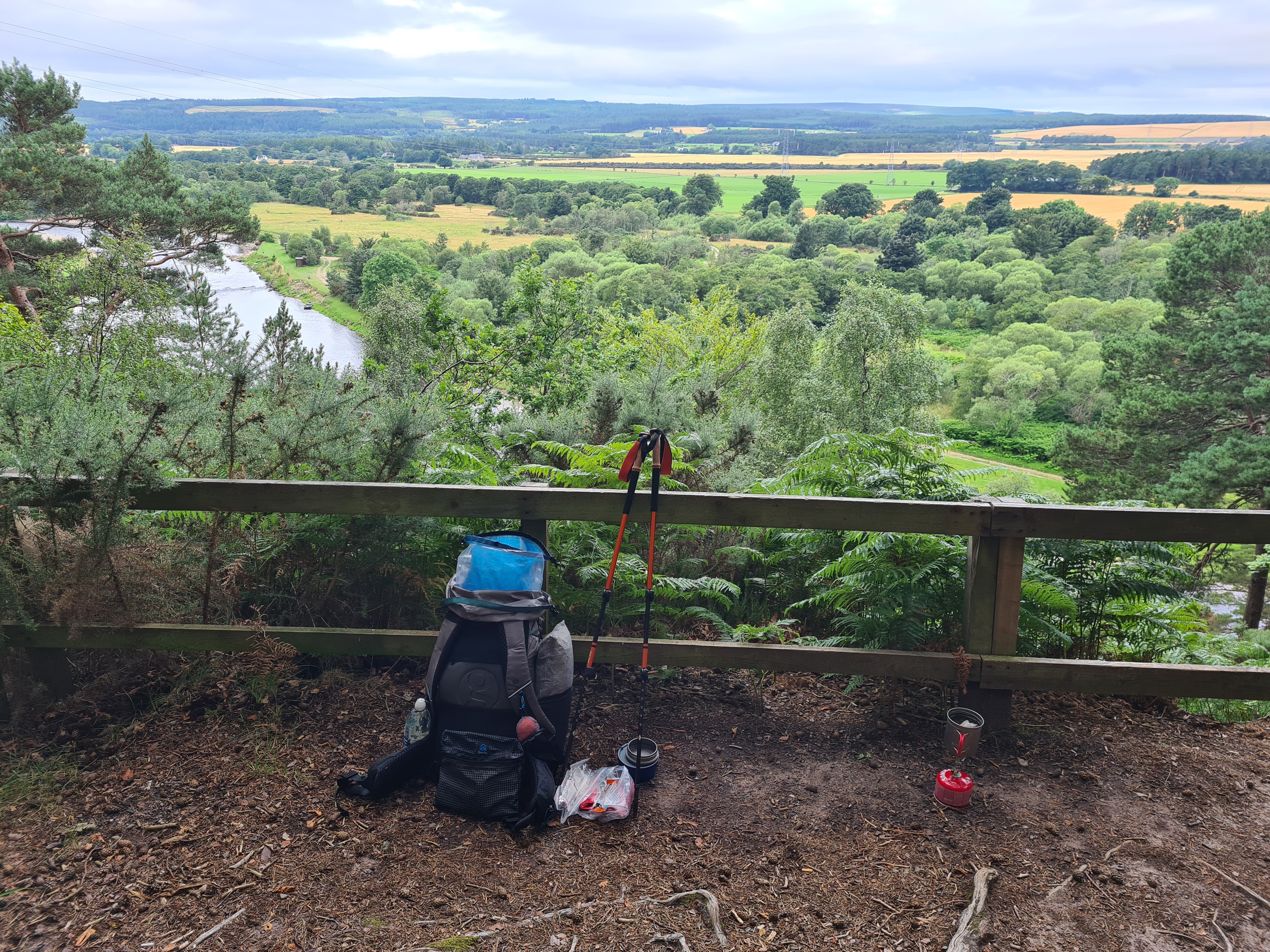
Earth Pillars is simply a decent viewpoint of the valley with the Spey snaking through it. By the time I had arrived any visitors there might have been were long gone and it was simple to find a quiet clearing in the woodlands above the viewpoint. Tent up, a good tick check with none found, a wash and scrub up, followed by hot oxo with heated dehydrated vegetable protein with mash and curry powder to follow. I then got to polish off all my remaining dark chocolate with mugs of strong tea and hot chocolate. Caffeine and sugar rush from these was insufficient to prevent me sleeping well, the last thing I heard being Tawny Owls calling to each other in the trees above. Another good day.

Monday: Earth Pillars to Buckie: 12.5 miles
I slept well and took my time in the morning. Once packed I walked over and down to the viewpoint to brew up and enjoy my morning cuppa, watching deer visiting the Spey far below. After a breakfast of oat and Kind bars I rejoined the quiet road leading into Fochabers where I somehow marched into town instead of turning off to the riverside path. No matter as a bacon sarnie wouldn’t have gone amiss. Needless to say, nowhere was open to provide one. I paused to look at anything that was remotely interesting as I was really in no rush today.
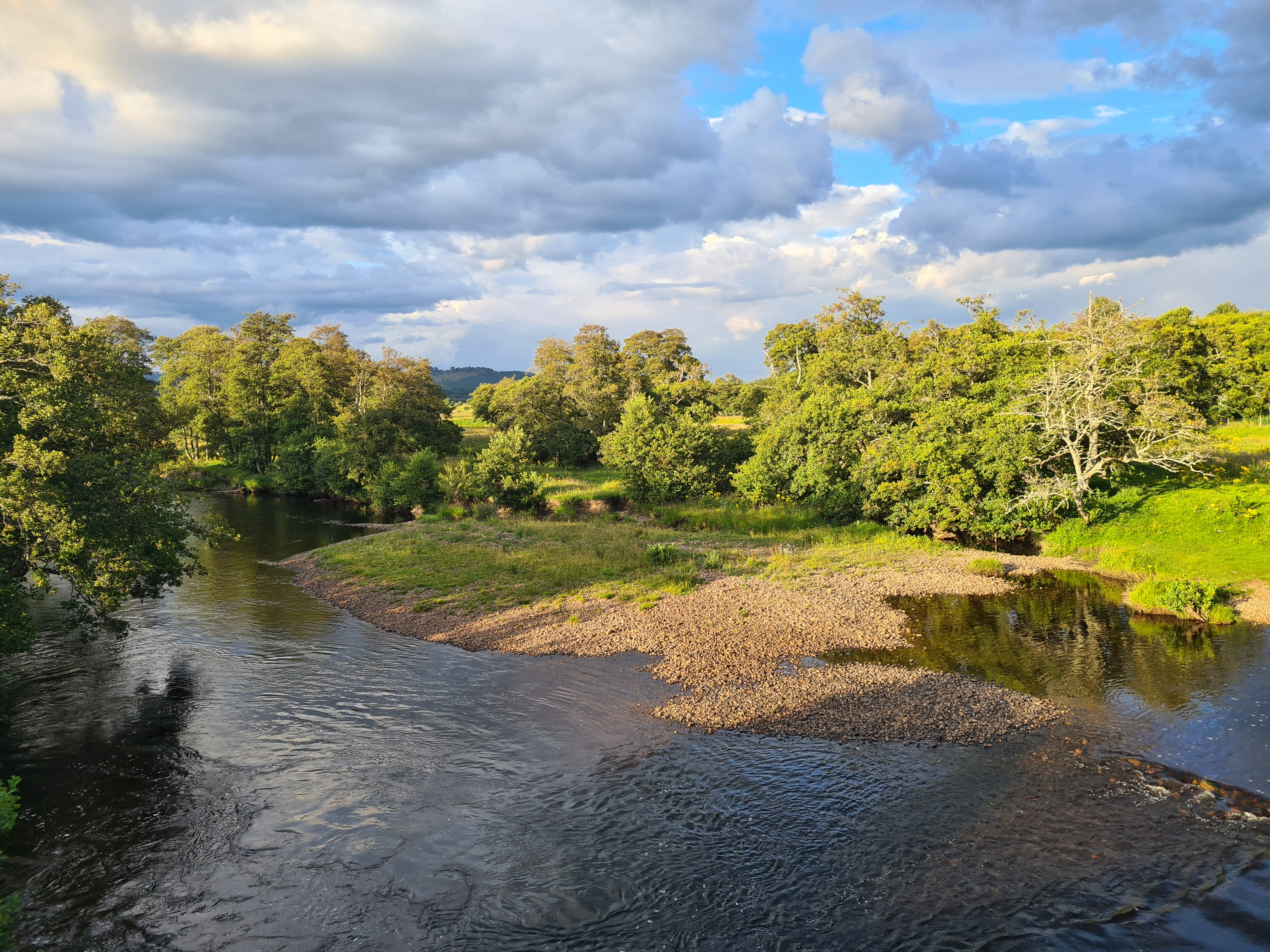
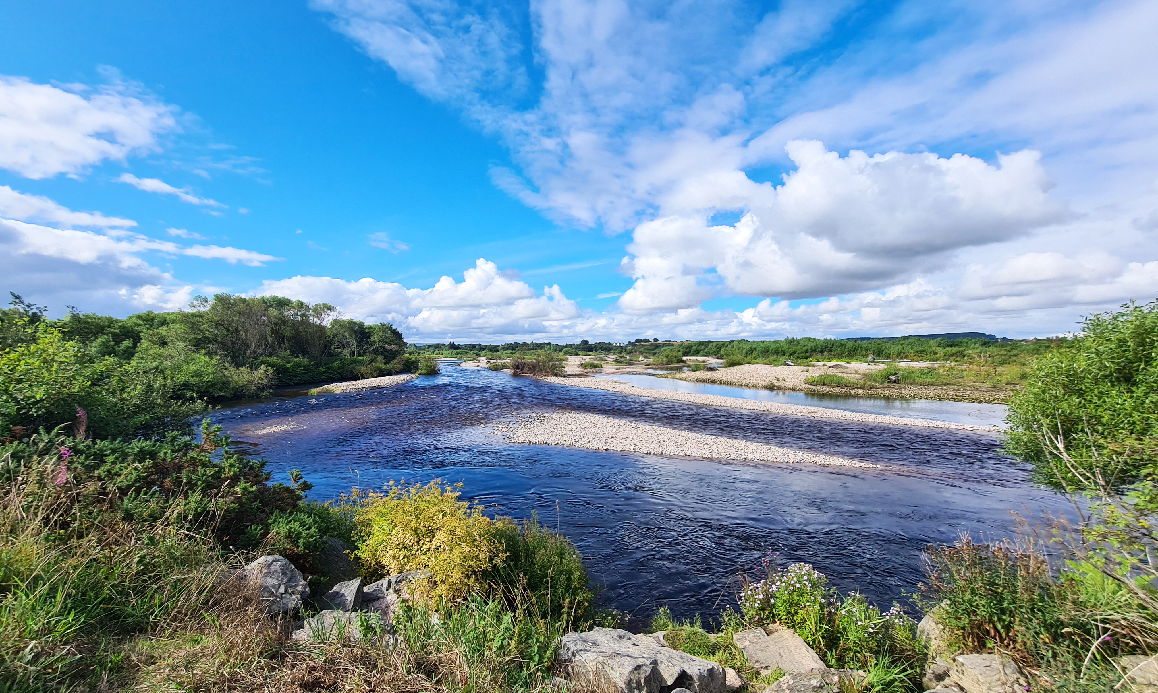
I startled three none-too-alert deer in the woodland walking from Fochabers. My dawdle along the path was accompanied by buzzards overhead and frequent views of the Spey and its thigh deep fishermen and, later, a very brief glimpse of an Osprey flying upstream. Woodland changed to cereal crops and nearing the coast I frustratingly missed the side turning to go and view the Spey Viaduct at Garmouth- “worth seeing” I had been informed. Instead, I reached Spey Bay where the wide, shingle-divided river empties into the sea.
It was midday and having poked my nose into the small but good Scottish Dolphin Centre (worth a visit) I was able to buy an ‘OK’ chicken and bacon sarnie from the cafe to take outside and eat. I had been carrying a large bag of fearsomely hot-flavoured Dorittos throughout my walk and the last crumbs in the bag were shared between my sandwich and a friendly Jackdaw who seemed unfazed by the strong flavour. From there it was simply a little more road walking, a little more forest walking and a little more railway trackbed walking almost all the way into Buckie, via it’s neighbouring Buckpool and Seatown, though all three towns are now moulded into one entity. I was pleased to see large numbers of Eider and a raft of Goosander on this coastal stretch. I was also accompanied by the mournful calling of the many seals in the water along here, each watching me pass before flipping and twisting in the water, diving, to reappear further on.
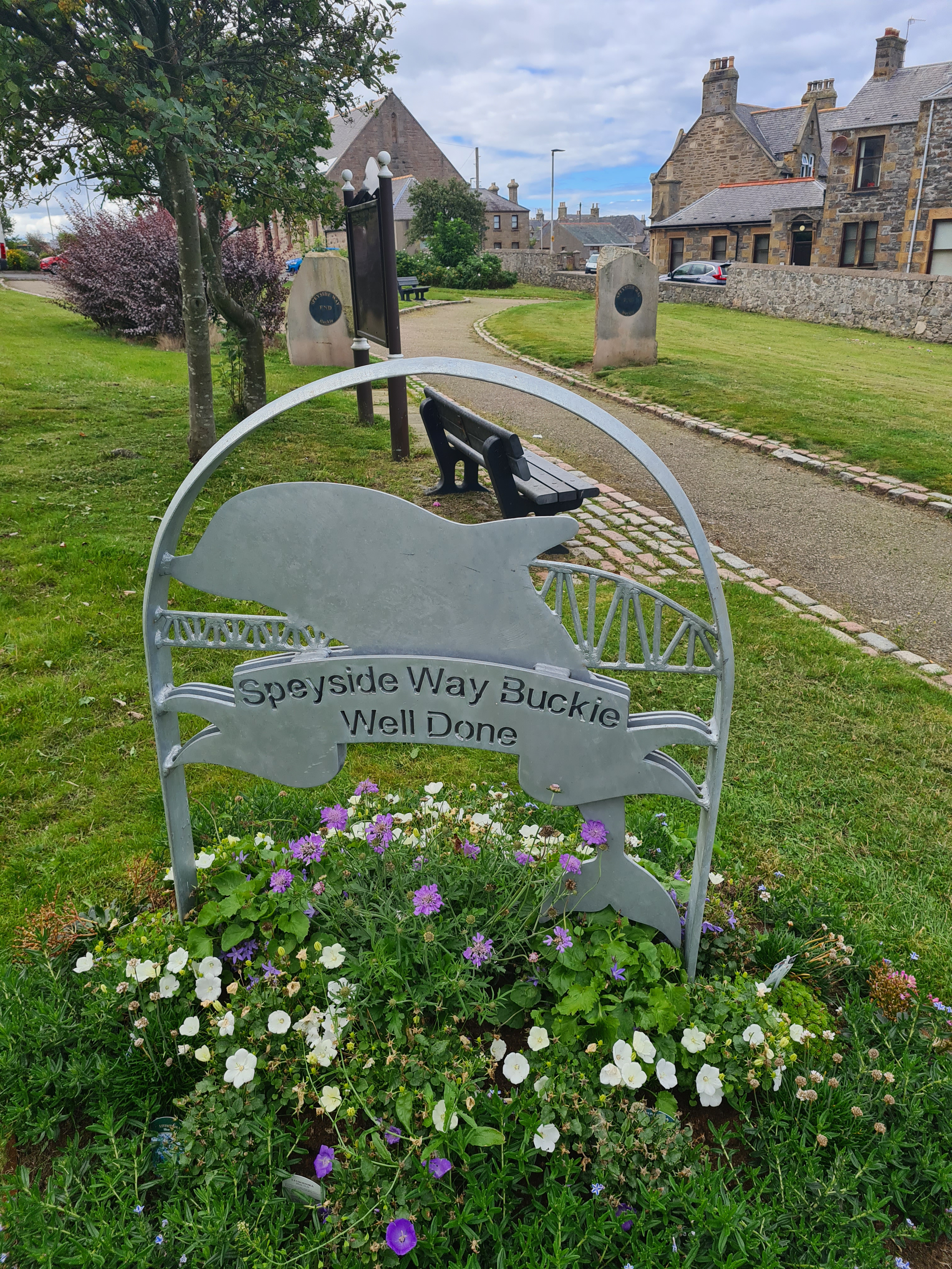
On reaching Buckie I held off from simply turning inland to the end point, instead walking along to see the harbour and quite large ships moored there. Pedestrian entry to the harbour wasn’t permitted so I turned and began the steady walk uphill to the town set above the harbour, wet fish merchants and sea associated industry below. The end of the trail is a little green park just off Cluny Square- cue obligatory end-of-trail photos. My nights B&B, only booked two days earlier, was also situated on the square but it was only two o’clock and I had a couple of hours to kill before booking in. Handily, also on the square were both my bus stop for the following morning and a pub. The latter was the ideal place to pass a couple of hours, raise a glass of Aberlour Speyside Whisky to myself and sink a couple of pints while completing my journal record.
Finally(ish):
Struan House, my final night’s halt was spotless and welcoming, also cheaper than my Aviemore Hostel. After a terrific Fish and Chips supper in town, I slept well, breakfasted well, followed by a two bus, four train, seventeen hour journey home.

There are not a lot of people walking this trail. In 2018 it was calculated that there were 52,750 visits, including 2,750 end to end users. That was pre-Covid of course. Over my five days I met no more than a dozen people actually walking the ‘whole’ trail. All were walking from town-to-town, either accommodation to accommodation or from car to car. None were backpacking. None were covering the whole distance between Newtonmore and Buckie. Most were finishing or starting at Aviemore, and one couple had commenced their walk at Spey Bay. The ‘recent’ extensions to this trail do not seem to have trickled down to people’s perception of the current termini.
The Speyside Way is in Scotland so despite walking the path in August I expected rain and wasn’t deprived of it! It frequently rained at night, often heavily, not that it bothered me in the slightest. I had torrential rain one morning and light showers on two other days. I took a very necessary pack liner which kept everything in my pack dry. My lightweight if fragile Frogg Toggs rain jacket was perfectly adequate when combined with my rain kilt. The phone lived in a zip lock bag in my front chest pouch from Z Packs, along with the Cicerone guide book, which admittedly was seldom read during the day. However the waterproof strip map from Footprint simply shrugged off frequent soakings.

So how would Three Points of the Compass rate the Speyside Way? It would make an excellent mostly gentle introduction to those venturing out for either the first time on a longer trail or to give a flavour of walking in Scotland. There are no dramatic climbs or stunning views. It is a pretty ‘safe’ route throughout. With a modicum of care and a decent map, the route can be easily followed. If being mindful and discreet, wild camping is easily achieved throughout though sourcing water can be a challenge at times and a filter or similar is essential to my mind. I also got the distinct impression on a minority of stretches that landowners and farmers are either not happy, or barely tolerating the Speyside Way passing through their land. Paths are sometimes coralled in with wire and high fences keeping the walker moving along. That said, I enjoyed the trail but wouldn’t walk it again, there are better alternatives elsewhere.

Three Points of the Compass does not always blog on the trails walked. Links to those that have been covered can be found here.


Never have I been so riveted to your blog! Then all the distilleries were shut! They are an odd bag to be honest. Dewars is worth a look because you need someone leaving the country to get you a bottle of that. The thing to remember is we drink Bells (Yuk) and the rest of the world drink Dewars (:)). Best distillery visit is Jamesons in Dublin taste testing and a free-ish sample.
The ticks sounded like a nightmare on that walk, something new to add to my hiking routine.
LikeLiked by 1 person
I spent a couple of hours on a tutored tasting at the Talisker Distillery on Skye a few years back. The good ‘ol days when they still had 18yr old. One of the best afternoons of my life.
I should point out that some of these distilleries don’t accept public visits, regardless of Covid.
LikeLiked by 1 person
Beautiful pictures , informative and entertaining as always, but…… the ticks and midges had me scratching in sympathy.
LikeLiked by 2 people
Thanks as ever for your blogs. I’m sure hundreds read them even if only a few comment. Once again a great balance of inspirational description, practical advice and real-life experience. Quick question: any particular reason for using the Z-Packs Duplex rather than the MLD Duomid you used recently on the Yorkshire Wolds Way (both US imports I note)? Better integration with midge protection?
LikeLiked by 2 people
Thanks for the comment and question Peter. The Z Packs Duplex is a big favourite of mine. As a two-person tent it provides a huge interior for the solo hiker. I was very aware that I might run into quite a few midges and the bug netting on the Duplex is very efficient. Climb inside for a long evening and night and there is plenty of room to move around, wash, change, cook, eat and sleep. The single person Duomid inner I have, while equally as well made, simply doesn’t provide the same amount of space. Also, the Duplex is a lot faster to put up. Both are good shelters though.
LikeLiked by 1 person