“Kent includes within it every variety of scenery which can be found in the south country; its historic heritage is as splendid as its scenic legacy. If the routes described in this book show the wayfarer something of Kent’s wealth of interest and beauty, the author’s purpose will be fulfilled. All the rambles are easily accessible from London and Surburban Kent, for there is no need to go far afield to discover the county’s significant scenic types, its sequestered villages and its historic places“
Preface to Kentish Rambles, Harold Shelton, 1939
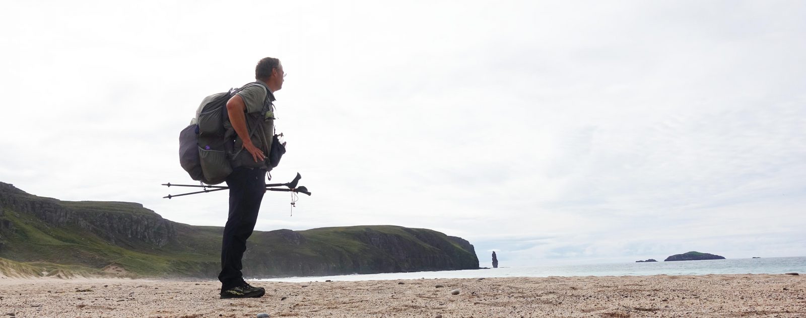
2020 is a strange, dangerous and disturbing year. Covid-19 has affected us all in some way or another. Of minor inconvenience to myself was first the government restrictions on movement, followed by a reluctance to stray far from my ‘home turf’. As a result, I found myself revisiting some older guide books, comparing many interesting routes to modern maps with the intention of exploring their changed circumstance next year. Three Points of the Compass takes a brief glance here at some of the guides to rambling across Kent. By no means definitive, it lays out a simple history of the development of these over the past hundred years and more.
Three Points of the Compass was born in the south-eastern county of Kent, England. Despite having moved around considerably and internationally in the following years, I subsequently returned and live there still.
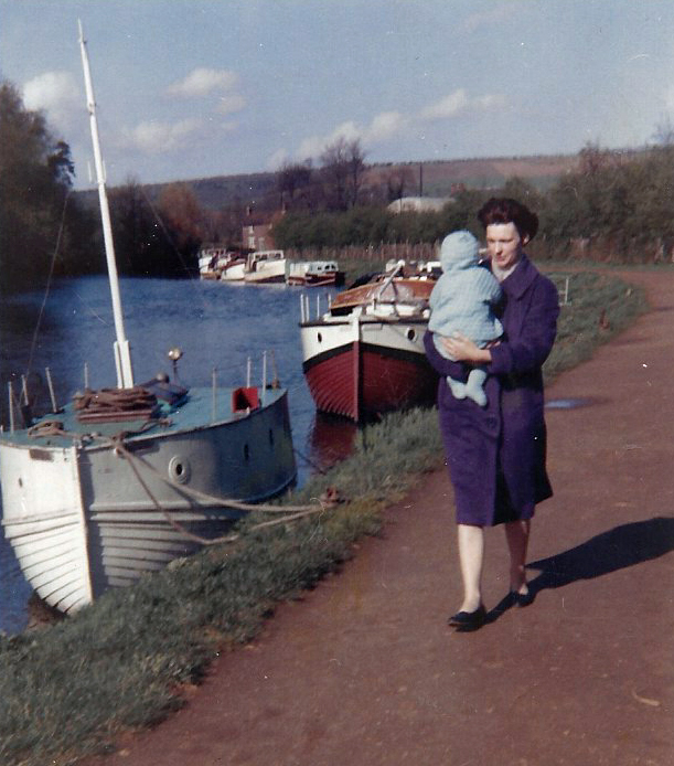
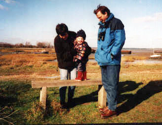
From the earliest age my mother took me exploring the North Kent shoreline at Sharps Green near Gillingham. I doubt she required any map or guide book for these trips, she had explored the area as a child herself and knew the area intimately. I did the same with my own daughter in her younger years.
When I moved to the North Kent town where I still live, some of my earliest purchases were maps and guide books to the trails across my county. I still buy these and have walked many minor and most major Kentish routes in the intervening years.
Kent enjoys a varied landscape. However there are no moors, no mountains, just fairly low tops. There is also very little Open Access land. Pressure on land is intense and to this day new build continues. Green spaces decline in both size and number and many places that generations of my family used to roam are no longer available to future generations. Older guide books and maps bring this loss into sharp focus. The preservation of, knowledge of, use and enjoyment of more than 3500 miles of footpaths and 665 miles of Byway across the county is dependent on many people- landowners, residents, local and national governance, mapmakers, outdoors associations and charities, users and those who promote the trails and walks that can be enjoyed. Within these fall the many who have produced rambling guide books over the years.
Early mapping
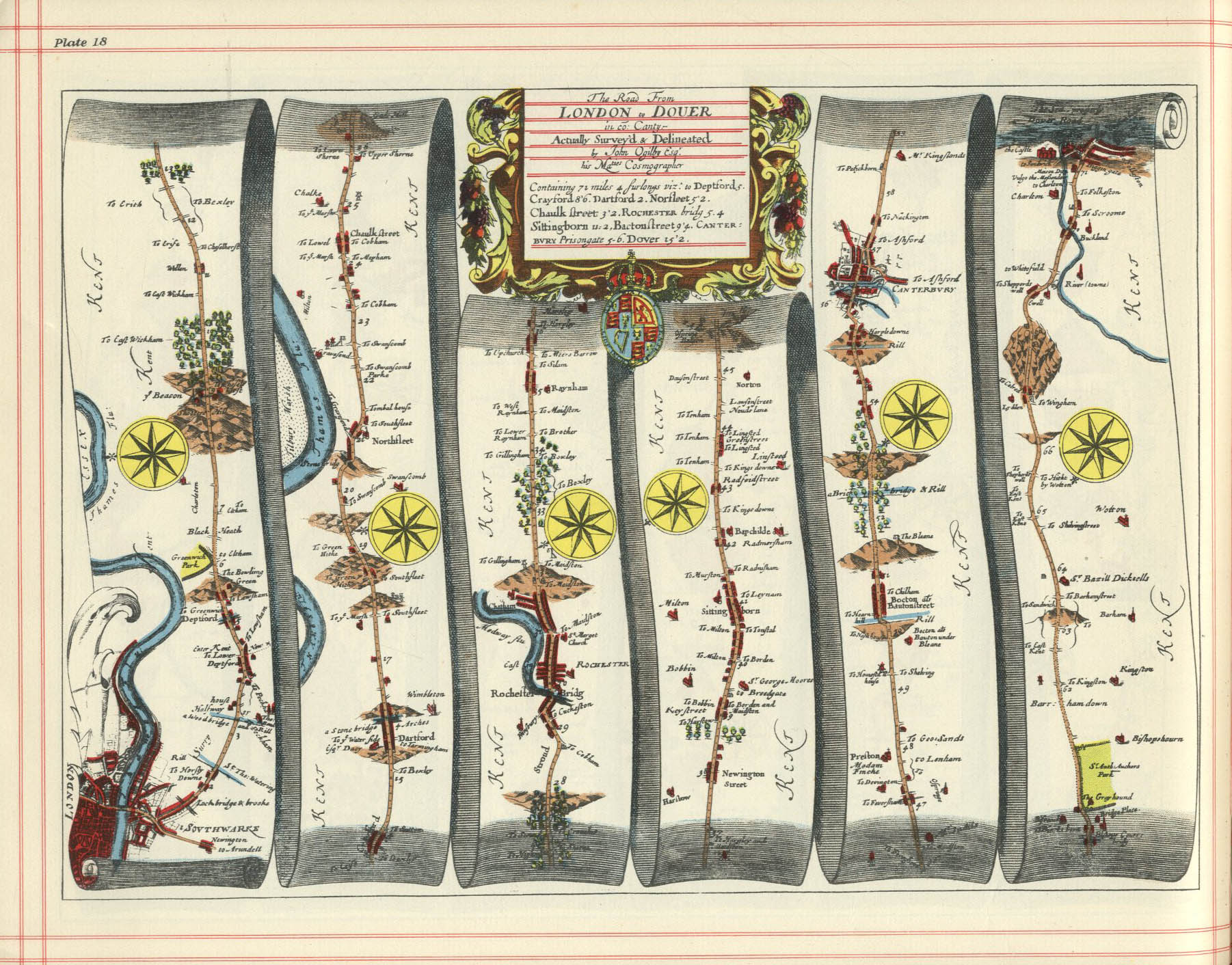
Britain is fortunate that it has been mapped since before the Romans chose to expand their empire and take on a few extra troublesome tribes on the little isles sitting just off mainland Europe. For centuries, any map produced, be it the rudimentary c1250 Scema Britanie of Matthew Paris, through to the ‘Gough Map‘ of 1360, which includes the ‘Old Way‘ between Southampton and Canterbury, to John Ogilby’s 1675 Britannia, none were intended for the merely curious seeking to explore. The adventurous explorer mostly seeks to explore off the beaten track whereas those notable cartographic triumphs sought to map the beaten track itself. With few walking, or more accurately, riding, the land, much of it was un-enclosed for the landowners felt no need.
Geroff my land!
There have been many acts passed that have sought to limit common access to land. Formalised by the Inclosure Act 1773 through to the Acts of the 1860s and in particular the Inclosure Act 1845. Prior to these Inclosure Acts most land was regarded as ‘common’ or ‘waste’ land. Between 1604 and 1914 over 5200 individual enclosure acts were passed. Over 6.8 million acres of land, previously regarded as commonly held and used, was taken under control, usually by the lord of the manor. This meant that many people who had previously farmed as individuals, now became subject to, and employees of, the owner of that land. Anyone who did not have such employment became the wandering poor. Great injustices were committed through dubious legal mechanism. In 1786 there were still 250 000 independent landowners, within thirty years this had reduced to just 32 000. Some areas, primarily poor farming land such as on cliff edges or measuring less than a metre wide, were regarded as wasteland and could be farmed by peasants without land or employment.
“When I turned off the road to Maidstone I travell’d through Lanes and woods which were very ffine but hid ye sight of the Country about being so Close; yet it was ye privatest Road I have travell’d. About 10 mile short of Maidstone you ascend a very steep hill which discovers the whole Country at one view 40 mile off backward from whence we Came”
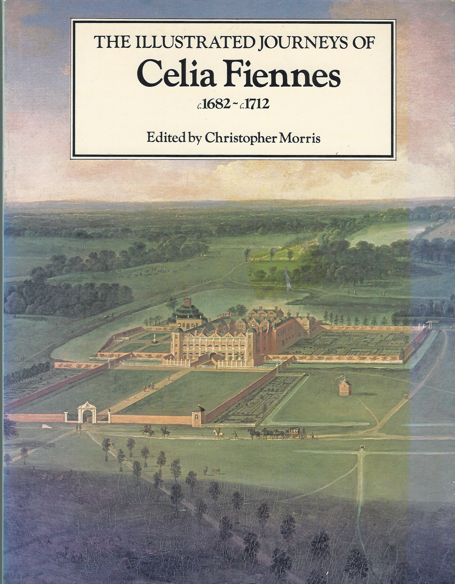
Celia Fiennes
The likes of Celia Fiennes were exceptions to the wandering poor. From 1684 until about 1703 that dauntless lady sallied forth determined to explore her country by horseback. As the daughter of a politician she had the social standing that, just, permitted her entry to the estates and country houses of her peers. In 1697 she travelled through Kent to Canterbury and Dover. These destinations and route are unsurprising given that this was the centuries old trading route to the continent, the ‘Great Dover Road’. For guidance, Celia Fiennes would have turned to Ogilby’s Britannia for route finding.
Due to the Inclosures Act, there wasn’t much in the way of general public access to the countryside. The very idea of taking a walk for pleasure was mostly alien to the poor and working classes. Change first occured due to altered attitudes to nature and the countryside amongst intellectuals, associated with the birth of the Romantic Era, peaking around 1800-1850.
Land Owners, their family and employed workers would cross enclosed lands, Surveyors would map roads and railways and there were almost no canals in Kent. Poachers and gamekeepers took to the lonelier paths, pastors tended their flocks by foot and a mostly localised workforce ventured no further than the towns, fields, industry, factories, mills and docks where they worked, other than church on Sunday.
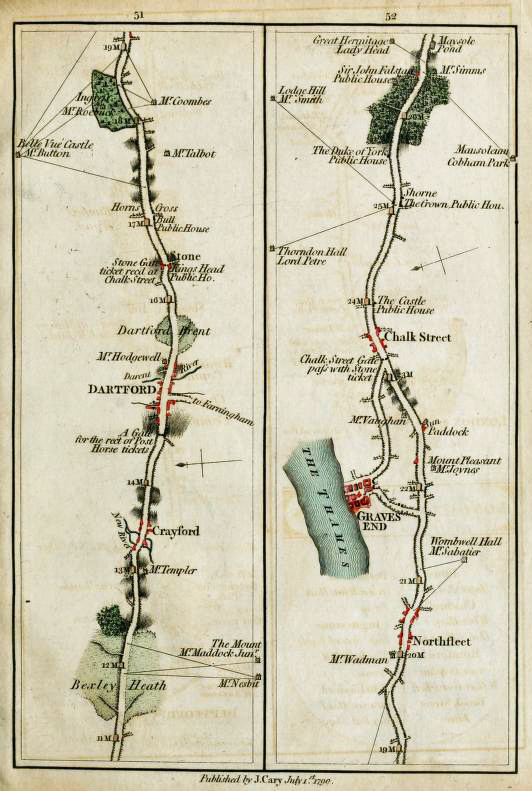
The famed cartographer John Cary was a prolific producer of maps for different purposes and audiences. Having produced a map of the county of Middlesex, in 1786 he followed that up with a survey of the country fifteen miles around London. Perhaps the first and best maps that he produced for exploring the county of Kent were those included in his 1790 survey of the turnpike roads.
Survey of the High Roads from London not only informed the traveller of the principal roads linking towns but also included arrows drawn on to each map showing ‘Every Gentleman’s Seat‘. With these suggested sightlines, the inquisitive traveller could view from the window of their carriage the great and the good as they passed. Did anyone also venture out on horseback with this guide? Or, were any pedestrian pilgrims also similarly armed, all the better informed to seek a nights shelter if distant from a place of worship? It is not surprising that much of Cary’s survey work was improved and compiled into a Traveller’s Companion– a collection of fold out maps in a leather case that Carey deliberately aimed at the independent traveller, explorer, or should we say- tourist?
Printed descriptions and engravings of the various grand country houses were aimed very much at the entitled travelling classes. The architectural and landscape draughtsman John Preston Neale produced drawings forViews of the seats of noblemen and gentlemen, in England, Wales, Scotland, and Ireland in several volumes from 1819, the first series, in six volumes, was completed in 1824 and was immediately followed by a second series. But these sought more to illustrate and describe the houses themselves rather than the lands surrounding.

Beyond these indications of where country residences could be seen from the road, there were no guide books being published for pleasure walking. But there was an increasing number of well-produced maps available, albeit, to principle roads rather than tracks and paths. Smith’s road map is typical of what was generally available to the explorer, and, importantly, far cheaper than Britannia or anything produced by Cary. Smith’s guide was simply to the major routes and Cross Roads between the capital, London, and the major Kent ports at Dover, Folkestone and minor ports of Sheerness, Margate, Ramsgate and Deal. No local footpaths are included. The traveller was usually riding on the main roads, by horse or carriage, seeking local guidance and lodging as required.

In the early nineteenth century those walking the roads and lanes were regarded with suspicion, looked on as unemployed, thieves or beggars. This suspicion has lasted longer than it should have. Current day law is unforgiving. Under the Vagrancy Act 1824 it remains an offence to sleep rough or beg. In 1988 around 573 people were prosecuted under the act in England and Wales, though it has been repealed in Scotland. Despite this, people have continued to walk the roads, lanes and paths and the twentieth century saw the greatest of changes in public land access experienced in the UK since it all started going wrong over three hundred years previous.
‘Walker Miles’ and early guide books
Partly as a result of industrialisation, primarily in the north of England, people would ramble in the countryside to escape the cities and larger towns. Rambling clubs sprang up, mostly in the north of England but the Sunday Tramps were formed in London in 1879. Indeed, the first national grouping of rambling clubs was formed in London in 1905. There was a growing audience for rambling guides. Publications such as the popular and iconic Ward Lock ‘Red Guides’ (1870s – 1970s) filled a tourist niche however guides to the paths and lanes surrounding early holiday destinations were thin on the ground. Even Black’s Guide to Kent kept to the briefest of occasional recommendations:
“The walk from River to Alkham, 2 1/2 miles, across Minnis Heath, is a very pleasant one”. Black’s Guide to Kent, 1879
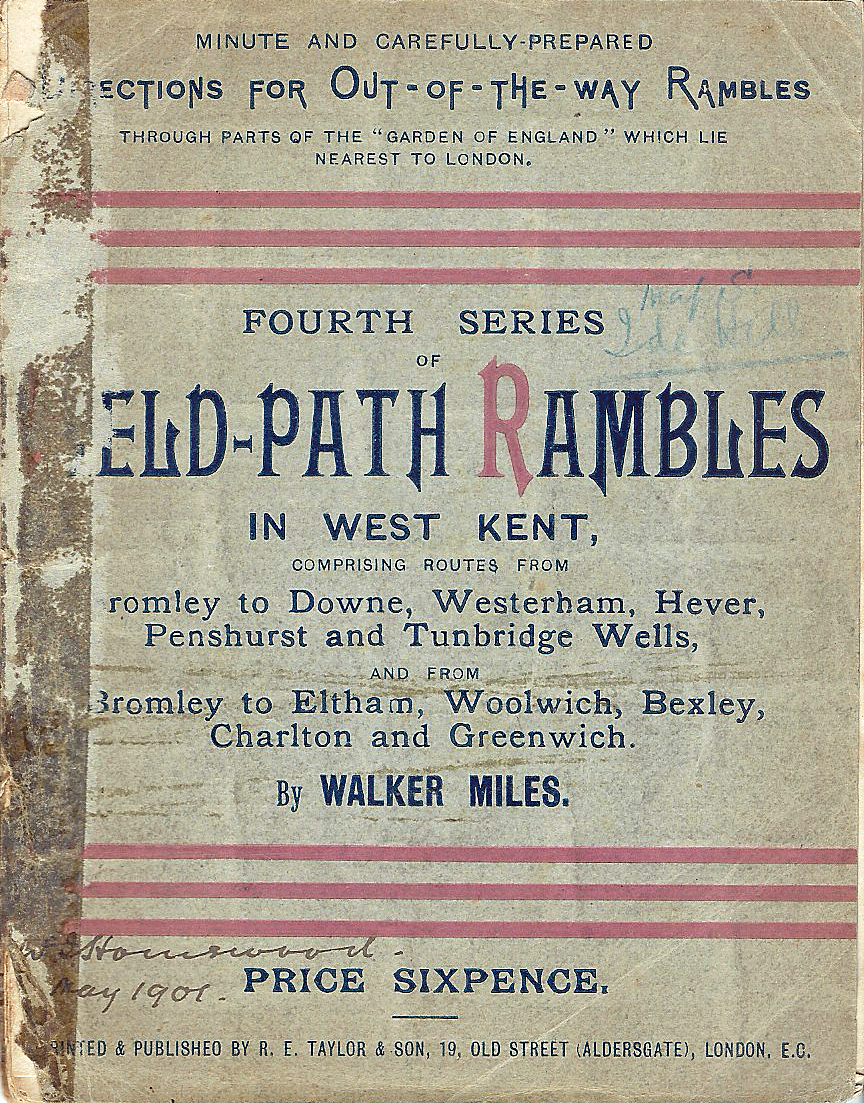
One individual associated with the Federation of Rambling Clubs was Edmund Seyfang-Taylor, more popularly known as Walker Miles.
Born in 1854, Walker Miles was the founder of the Croydon Rambling Club and was associated with the Federation of Rambling Clubs, the Forest Ramblers and the Commons and Footpaths Preservation Society. His guides were published by the printing company- R E Taylor & Son, which he inherited from his father. Almost single-handedly, Walker Miles saved many countryside paths from oblivion. Where maps failed to show them, he investigated, explored and walked them. He recorded these in minute detail in thirty-seven rambling guides published by the printing firm he worked for and eventually took over. It is perhaps not merely coincidence that public Rights of Way found in the Kent Downs Area of Outstanding Natural Beauty today are four times the national density average.

The coming of the railways opened up areas outside the main cities and larger towns that excited interest and curiousity by new and potential ramblers looking for enjoyment, yet deprived of guidance. Historians, often those interested in churches and architecture, published written acounts of what there was to be discovered, only occasionally remembering to include detail on how to get to it.
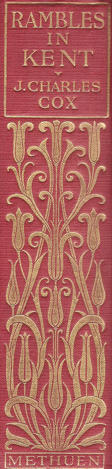
Published in 1913, J. Charles Cox researched and wrote Rambles in Kent to accompany others in a series- Rambles in Sussex, Rambles in Surrey, Rambles in Somerset, all with the same lofty ideal. These guide books chose not to simply concentrate on ecclesiastical wonders, but look more broadly at what could be enjoyed moving from one location to the next.

Other than suggested ways in chapters ten, thirteen and sixteen, there are few laid down, proscriptive routes included in Rambles in Kent. Instead, it is mostly left to the walker and cyclist to determine exactly how they will progress from one location to the next. Locations are frequently a railway station where it is expected that the rambler would either commence or end their journey.
Regional newspapers
While rambling had been building in popularity, mass unemployment in the 1930s resulted in the ‘hiking craze’ as more people had increased time to go walking. These disaffected and resentful people were also clamouring for increased access to lands previously denied them. Many routes were published in the huge number of local newspapers published at the time. Publishing walking routes was cheap copy- the public could send in their own routes, a junior member of staff could be sent out of a weekend to devise a route, or, just occasionally, there was an enthusiastic and knowledgable walker on the writing staff.
For over 150 years the true wealth of selected and suggested walks in Kent originated from the pages of regional newspapers and magazines. Periodically a number of these would be collated, perhaps updated (though invariably not) and published in a dedicated volume- a guide book.
Harold Skelton was the president of the Out of Doors Fellowship and the London Antiquarian Society. He authored a number of walking guides such as Upland Rambles in Surrey and Sussex and the Tourist’s Handbook as well as Kentish Rambles in 1939.
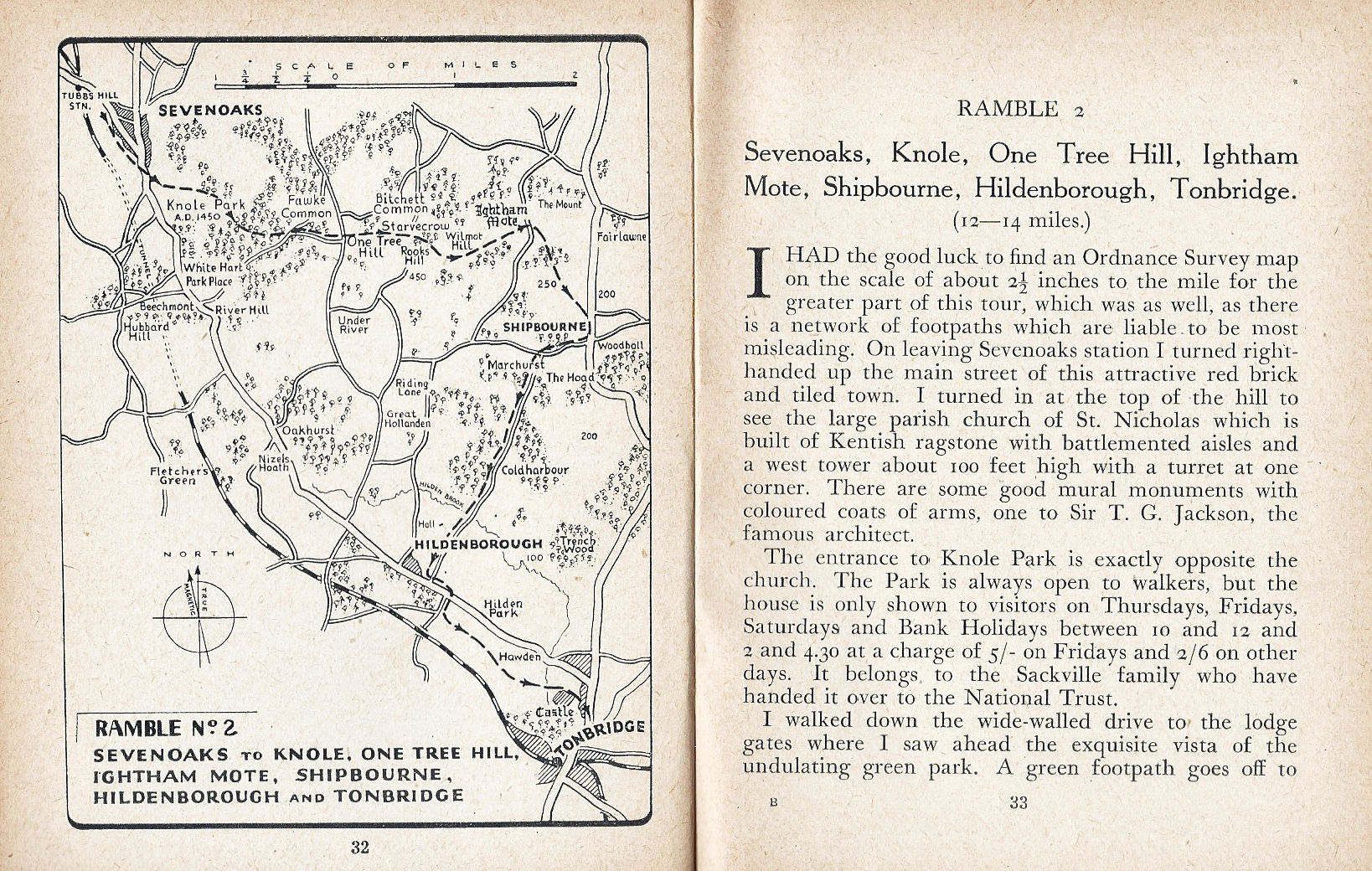
Kentish Rambles was a collection of twelve rambles between the then outer suburbs of London and the Medway Valley. They had all originally appeared in the Kentish Times, originally comprised of nine separate and local newspapers published in north Kent.
“… thus we enter Borough Green by a little used lane. Whichever way we take we shall have in our memory a store of pleasant scenes typical of the best that Kent can offer”
from walk nine, Kentish Rambles

No maps are included in Kentish Rambles though relevant Ordnance Survey map numbers are included with an outline of each walk. Distances range from eight to sixteen miles and there is little in the way of historic information, instead looking to provide ”an outline sketch”- easy to follow walks with a variety of terrain and scenery and hopefully tempt the rambler to explore and investigate further. Experts in their field, or simply enthusiasts who an ability to engage with a reader, were either commissioned or sat within a newspaper’s staff and wrote on the seasons, the wildlife, the history, the views… whatever took their fancy. Harold Skelton was proficient in striking a balance and awakening a curiousity in the readership through his teasing observation. How many preferred to simply follow a route vicariously from the comfort of their fireside seat is not known. If the descriptions of some rambles could be a little flowery in style, it should be remembered that the more prosaic description can be totally uninspiring. The ‘turn left here, walk down the lane, turn right there’ type of guide may be efficient but is never going to tempt many out of that chair.
“it remains for the rambler to fill in the details of that picture by exploring the hundreds of footpaths and byways which do not find a place in this collection”

The Kentish Times newspaper, publishers of Kentish Rambles, continued to publish many of the rambles that appeared in its pages and thirty were collated for Rambling through Kent, published in the 1970s. Route detail is succinct, maps are included but are diagrammatic and no reference to relevant O.S. maps included.
The included walking routes originated from V. W. Morecroft. He was also the author of the 1970 guide to The Cornish Coast Path before it was extended to create the 630 mile long South West Coast Path.
Morecroft knew how to distill required route information and the ‘rambles’ could no doubt be followed, at the time, with relative ease. I would be less confident doing so today but with the diagrams provided a fair stab can be made at transferring these over to an O.S. map. Such was the success of these compilations that the newspaper repeated the exercise many times in subsequent years.


It wasn’t only Kent newspapers from which rambling guidebooks were originating. London lies on Kent’s doorstep and it is not surprising that the capital’s newspapers also offered their city dwelling readers a suggested escape from the conjestion into the ‘Garden of England’.
Henry Bridges Fearon (nephew of P. H. Fearon, the Evening News political cartoonist) walked and recounted numerous tramps across London, the home counties and Thames Valley in the pages of the London Evening News (1881-1980) as well as in other newspapers and magazines. He wrote under the pen name ‘Fieldfare’ and his rambles appeared weekly from the 1920s to the 1960s and encouraged thousands of people into the countryside.
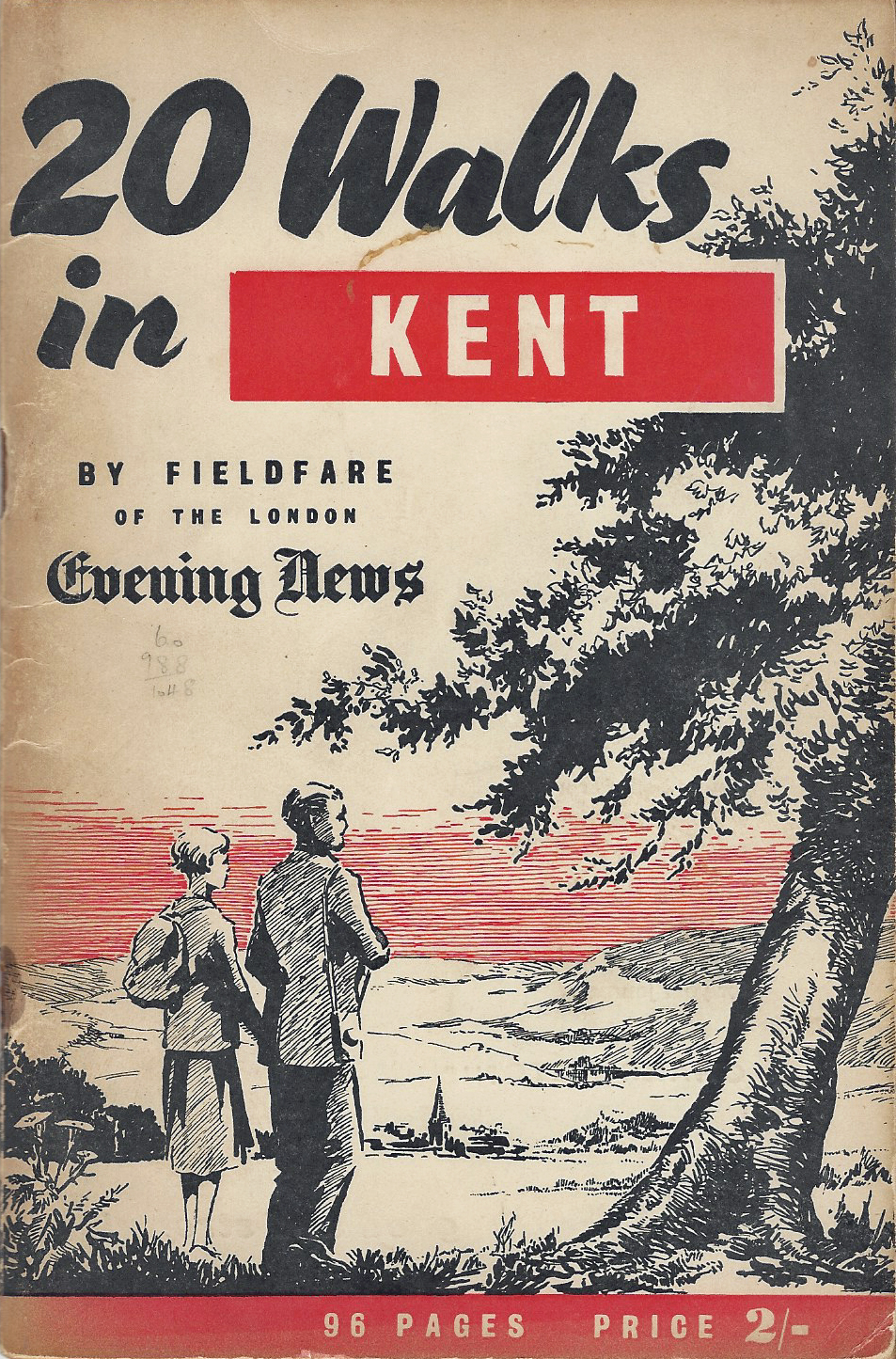
Many of Fieldfare’s walks were collated and published as discreet guide books between 1933 and 1967. Dating from 1955, 20 Walks in Kent was part of a series that appeared that year, each cost two shillings. It included diagramatic maps with black and white photographs. Published by Associated Newspapers Ltd. the cost was supplemented by advertisements in its pages, these included clothing, mints, beer, maps and the Bux map measurer.

As well as the printed media. Radio was getting in on the act. In 1979, W & J Mackay and BBC Radio Medway published Walkabout, a guide to ten walks across Kent. But it was to the transport companies that most ramblers were looking for new guides as these were being produced by them in increasing numbers.
Travel company guides
Train, bus and coach operators were keen to extend their paying travellers beyond the morning and evening commuter. For much of the day between those busy periods their seats were empty and one way to fill them was to encourage those with new-found leisure time to strike beyond their usual local bounds. Waxing lyrically on walks to be found just a short (and ‘easily affordable’) ride away tempted thousands into the countryside.
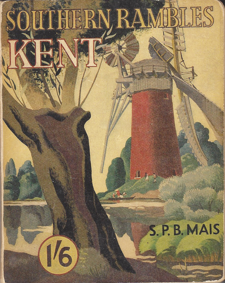
Prior to the 1921-grouping, there is little evidence that the various disparate railway companies were doing much to encourage people to visit the countryside to walk or ramble, despite both the South Eastern Railway and the London, Chatham and Dover Railways encouraging people to travel by train to holiday on the coast and other places in Kent. Not even the Big Four produced much in the way of county guides. That all changed in 1948 when British Railways was created. They were responsible for numerous guide books to all areas of the United Kingdom and in 1950, S.P.B. Mais walked and authored Southern Rambles Kent for the British Railways Southern Region. Only walks in north-west Kent were included. Close enough and long enough (rambles were 4.5 -16 miles) for a traveller to catch a morning train, escape to the country, enjoy a good days walk and still return home by train in the late afternoon/evening.
The National Parks and Access to the Countryside Act 1949 increased access to the countryside for the walking public. The Peak District became the first National Park in 1951, despite there being no national park in Kent, rambling continued to gain in popularity.
“things get a little staid “
Despite this, there seems to have been little new published in the 1960s and early 70’s that adds to the guidebook genre. Guides were certainly appearing, but nothing particularly creative or exciting was occuring. For those seeking to stretch their legs over an enjoyable days walk, things get a little staid. The big publishers and motoring organisations settled into a format of national guides to satisfy a motoring public that were gadding about the whole country. Cherry picking a walk or two in each county or popular walking area and collating these seemed to suffice for most publishers
A series of Spurbooks footpath guides appeared in the 1970s. Mostly aimed at families wanting to venture out on short day walks, volumes covered much of England. Their second volume published was Walks in the Hills of Kent. A slightly odd title for a county not particularly known for its hill walking opportunity. Enthusiastic ramblers Janet Spayne and Audrey Krynski authored the Kent guide published in 1976. It must have been popular as, following updates, it continued to be reprinted right through to the 1990s.

Very much of its time, the choice of 15 circular walks in the Spurbooks guide are excellent, if mostly aimed at locations easily reached from London

There was also a growing interest from hikers in walking longer trails. The final section of Britain’s first long distance National Trail- the Pennine Way, had opened in 1965 and others followed close on its heels.
In the 1970s and 1980s Constable published a number of guides to longer walks, though not all of these were National Trails. Some of these trails simply crossed in to Kent. Drawn maps were minimal yet functional, historical content was abridged yet fascinating and directions precise and helpful. Not only that, the guides fitted easily into a pocket.
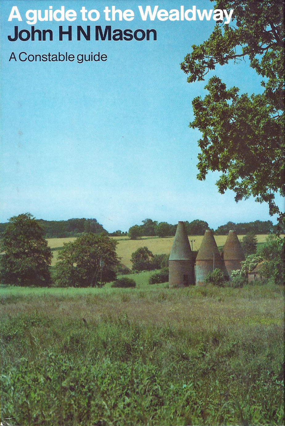
Guides published by Constable & Company Ltd included their in-depth and well-written 1984 guide to The Wealdway, a route stretching eighty miles coast to coast- from Gravesend in Kent to Eastbourne in East Sussex. Other guide books published by the company covered subjects such as battle field sites.
In the late 1980s and 90s there was more experimentation in walking guides. It could be seen what had been published in the past and consumers wanted better. Many of the consumers were also the very people out exploring the lanes and paths of Kent. Some of these turned their efforts to ‘building a better guidebook’ and it is not surprising that the publishing houses eventually cottoned on to what was occuring and began to counteract.
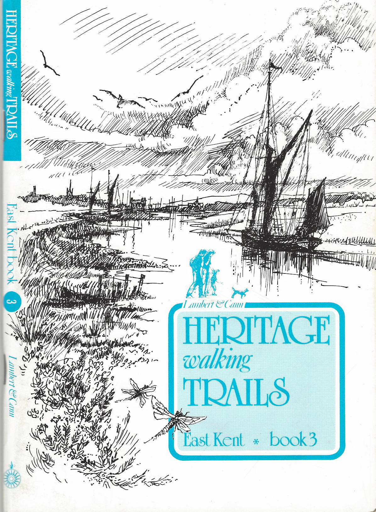
One of the better amongst the home grown independent talent was a best selling and award winning series of ‘nostalgic and evocative guides’ walked, researched, written and illustrated by Roger Lambert and John Cann. The history briefly recounted in each ‘Heritage walking Trails’ guidebook is impeccable and excites the rambler. Artwork is ‘interesting’ however woe betide the individual that sallies forth without a decent map to accompany one of these guide books. Their diagramatic style is frustrating on the ground and the rambler must be prepared for numerous wrong-turns.
While it is unsurprising that the writers of the Heritage walking Trails received a Carnegie Award for outstanding Interpretation of Britain’s Heritage, these guidebooks were more a catalyst in demonstrating to publishers what could be achieved when entertaining and exciting a walking public, if not how to actually go about it.
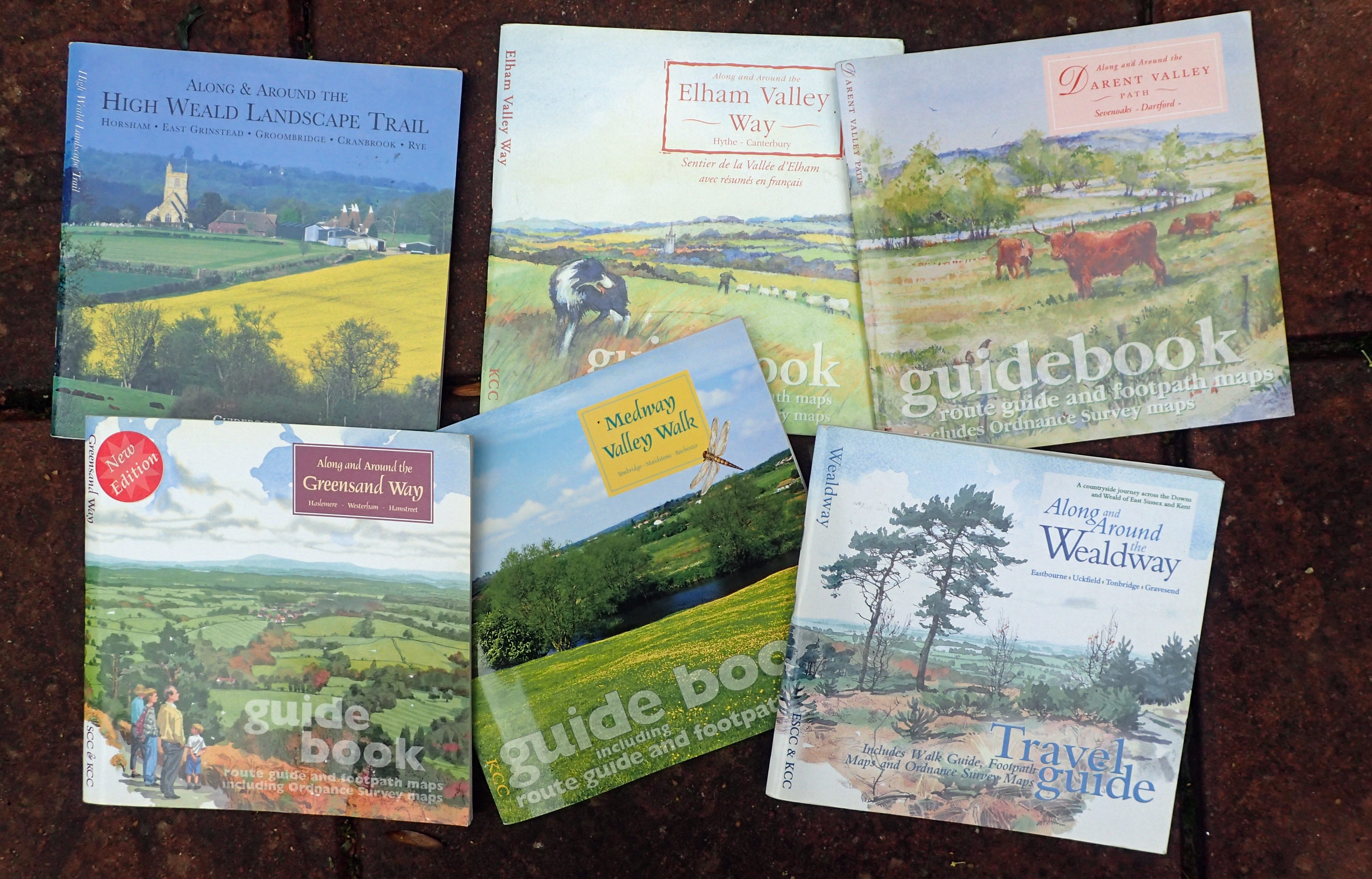
In the late 1980s and 1990’s it seems as though the Kent County Council finally woke up to the realisation that they not only had responsibility for a wealth of existing paths and routes through the county, but also a duty to promote these. With the financial assistance of the Countryside Commission, a house style for a number of guides was developed by The Design Studio, Kent County Council. Almost square in format, each guide included well researched notes on geology, natural history, land use, history, archaeology and architecture. Written route guides were complemented by evocative photographs. Various authors were commissioned- Bea Cowan, Helen Livingstone, Eila Lawton and others. Illustrators included John Cann, Philip Rutt and two favourites of Three Points of the Compass– Matthew Cook and Sandra Fernandez. These two artists truly caught not only the countryside but also representative wildlife and flora in their delicate watercolours. Sadly, despite being beautifully designed aesthetically, this series of guidebooks falls down badly in one important respect. They are almost unusable in the field. Each has a pull out weather-resistant route guide that can be used either with or without the more informative encompassing guide. With dimensions of 215mm x 210mm you cannot fit either in a pocket and the maps, despite being based around Ordnance Survey mapping, are frequently overburdened with a plethora of additional symbols, lettering and numbering. They must have been a reasonably successful series however, as some were updated and expanded and were republished in second editions.
The birth of modern day excellence in guides…
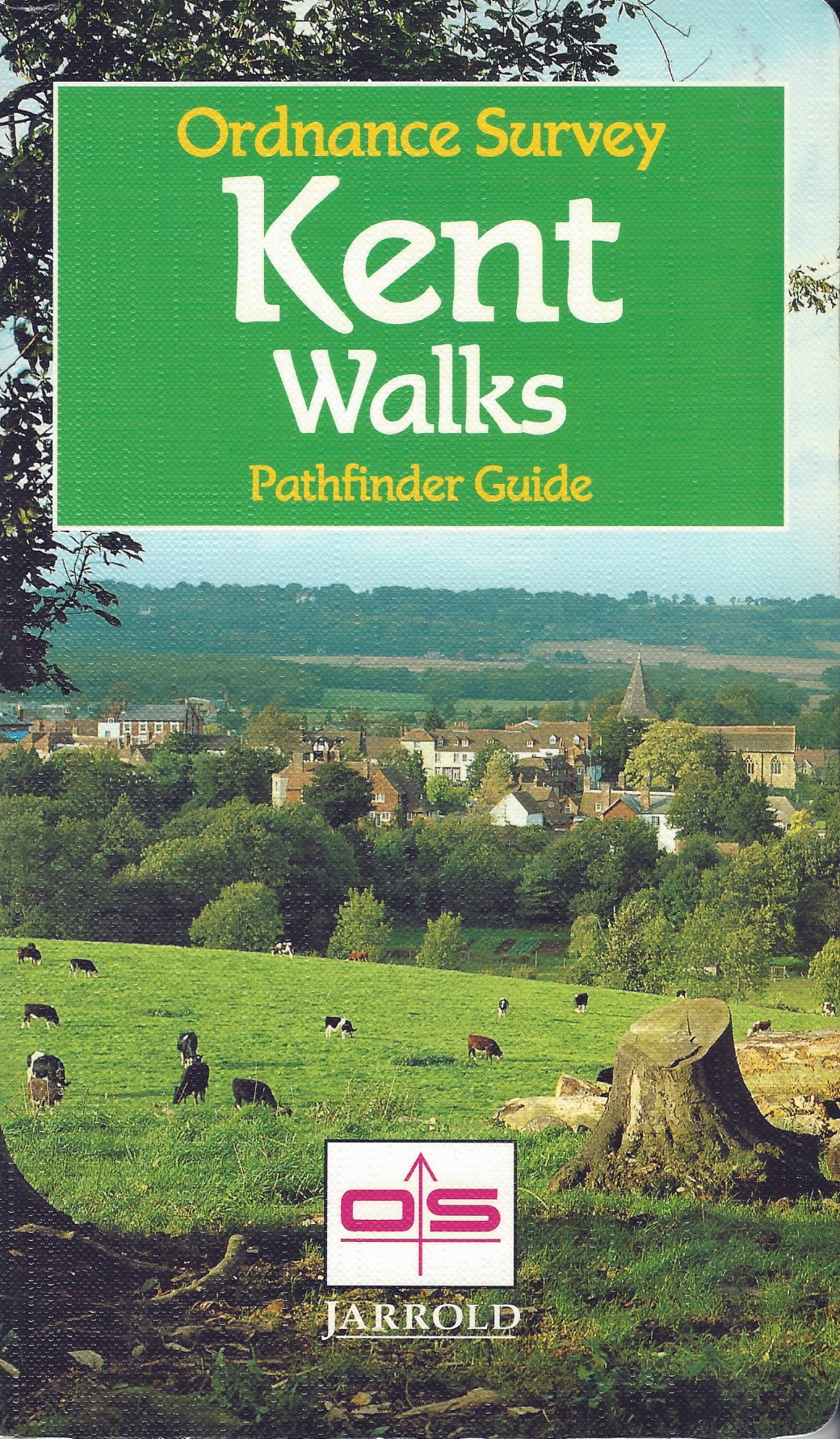
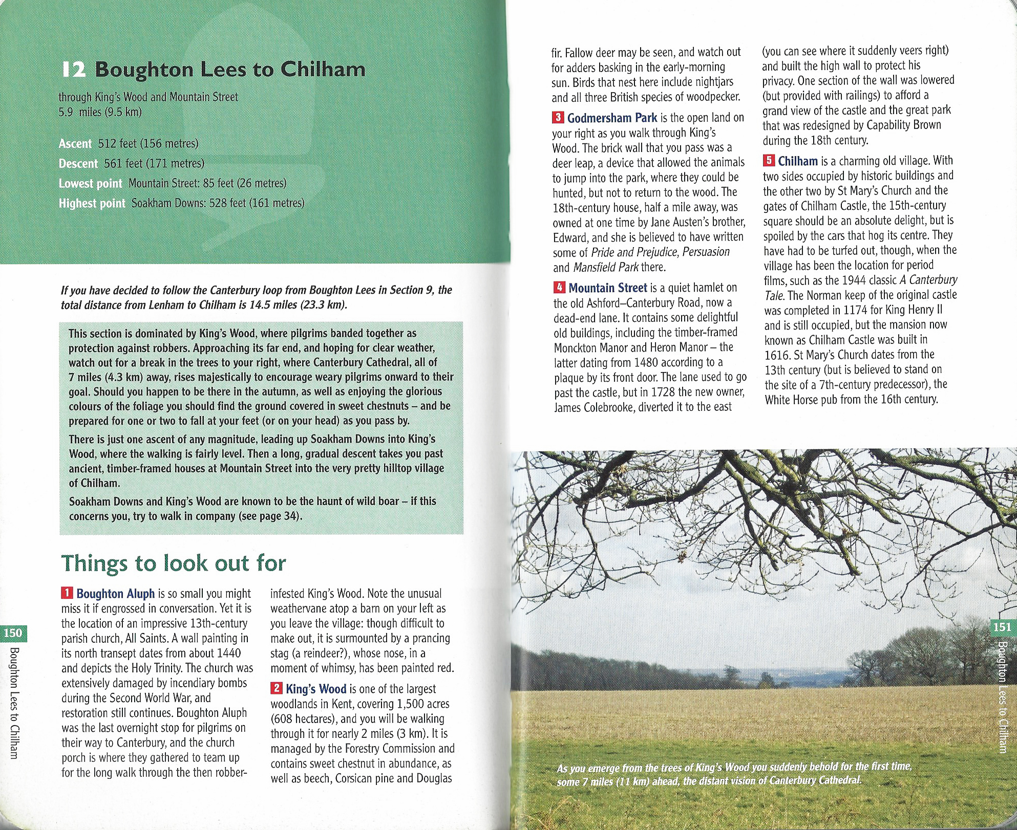
Despite the first of the Pathfinder Guides being published in 1989, they were very much THE walkers guidebook of choice in the 1990s. Their central ethos- combining well researched routes clearly mapped out on included Ordance Survey 1:25,000-scale Explorer and Outdoor Leisure map extracts, led to their becoming market leaders and over 70 guidebooks covered all of Britain. Needless to say, Kent was amongst them.
The 1993 guide book shown here is typical of the genre. Three grades of walk are included: nine short and easy walks (4-5.5 miles), 14 walks of moderate length which included moderate climbs (6-9.5 miles), and just four more challenging longer walks (10-12 miles).
A lot is crammed into these guides. Along with a well-written descriptive introduction to Kent, the walks themselves are workmanlike. Beyond a short paragraph description at the commencement of each walk, there isn’t much beyond ‘turn left, turn second right, cross over, go up, go down...’
Each walk includes clear O.S. mapping and usually a colour image of a scene on the respective walk. These are very good guides with a house style that crosses all volumes, but sadly lack much in the way of personality. That said, Pathfinder Guides are amongst the new tranche of guidebooks that were truly excellent. The best walking guides produced since Celia Fiennes looked at Ogilby’s Britannia, and said, ‘now I can do it’, but things would get better still.
The Oxford English Distionary description of the word ‘Cicerone’ is guide, and since their foundation in 1969, Cicerone Press established their reputation as one of the best publishers of guides for exploring not only the UK but across the globe.
“for walkers and climbers, written and produced by walkers and climbers”
Cicerone
Guidebooks are well researched, clear to follow and UK guides are accompanied by quite tightly cropped Ordnance Survey mapping with overlain routes. Ownership changed in 1999 but the quality of their guidebooks continued and improved. Cicerone have built an enviable stable of authorative and able authors, amongst these is Kev Reynolds.
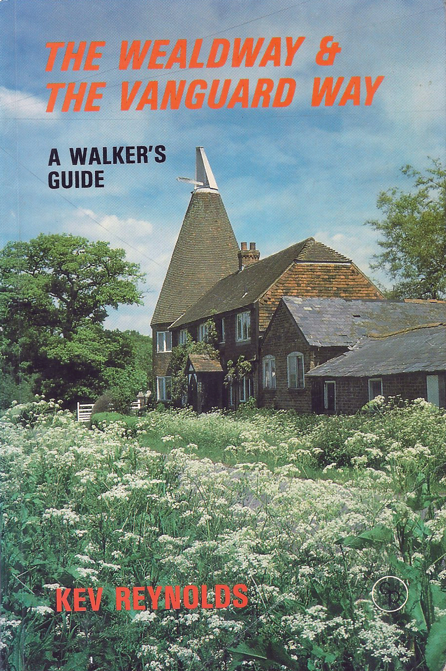
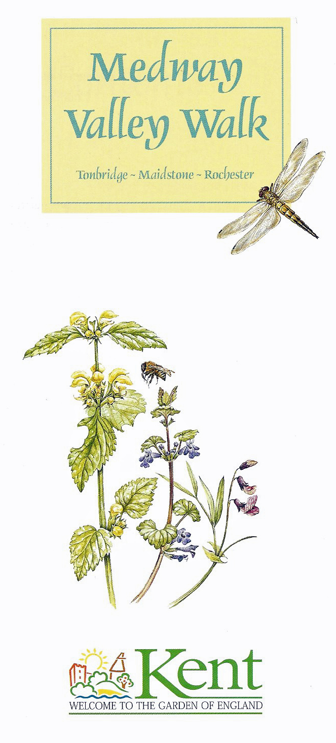
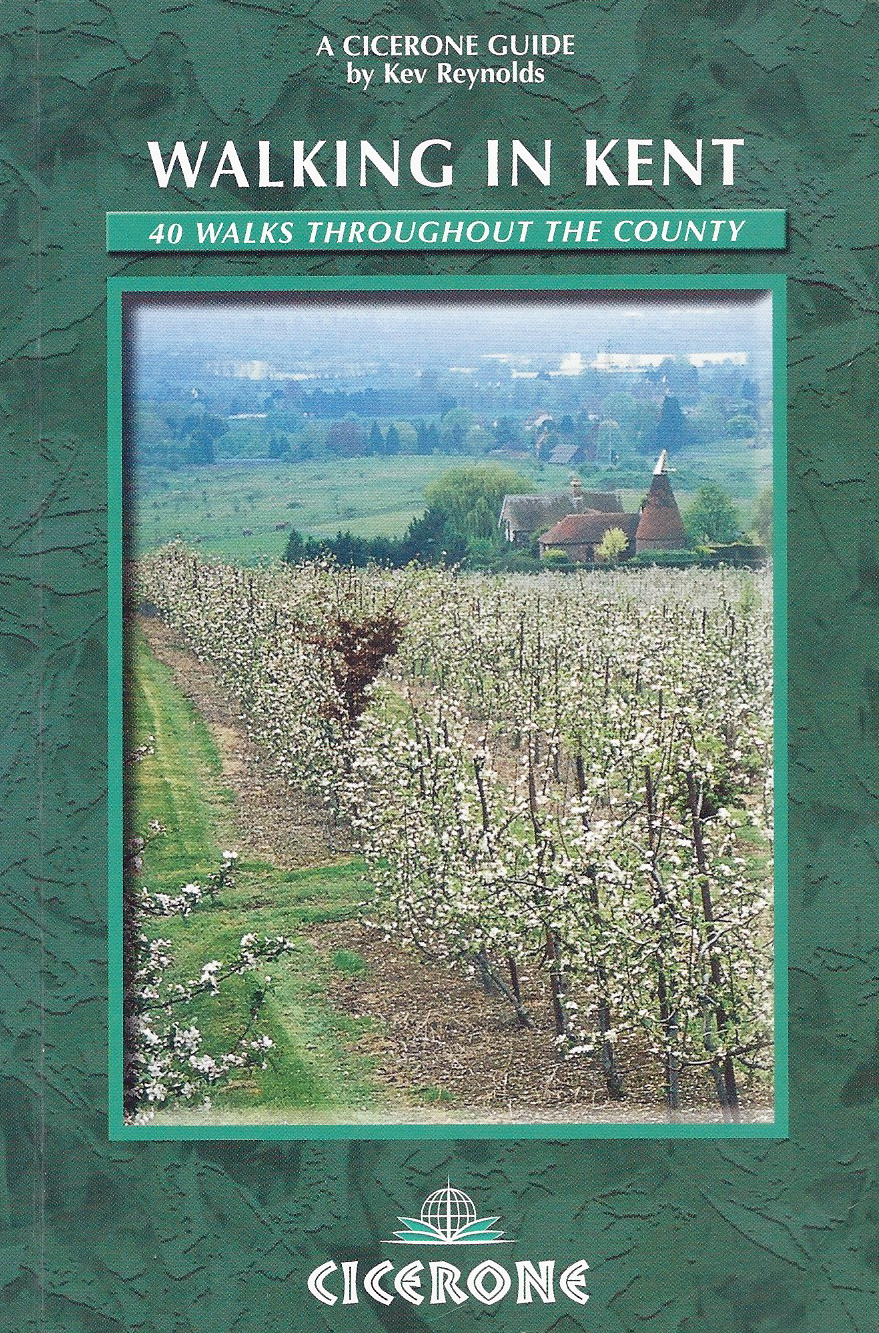
While living in Kent, Kev Reynolds has explored, written about and photographed trails across the World, however he has never forgotten his home county. He has explored and written of countless paths and routes across Kent. As well as guide books to other regions and for other publishers, he has authored- Walking in Kent volume 1, Walking in Kent volume 2, Walking in Kent, The Wealdway & The Vanguard Way, and Walking the North Downs Way. Unsurprisingly, he is also a member of the Outdoor Writers’ Guild. He was also the photographer and one of the authors of the Medway Valley Walk for the Kent County Council, shown above.

Special interest guide books
In the last two decades there has been an unprecedented appetite for walks of every nature. It seems as though if you have an interest, there is a ‘themed’ guide that will endulge your passion. Be it Ghosthunters walks, teashop walks, pub walks, ‘kiddiwalks’ (sic), walks for families, walks for dogwalkers, battlefield walks, nature walks, walks around churches et al. These are very much a return to what John Cann and Roger Lambert had shown was possible with their Compass Guides.
The list of guides centred around a particular interest is almost endless. Sadly the quality is not always present in either the writing, the research or, most importantly, even the walk itself. That said, there is also the good amongst the indifferent. You pays your money and you makes your choice.
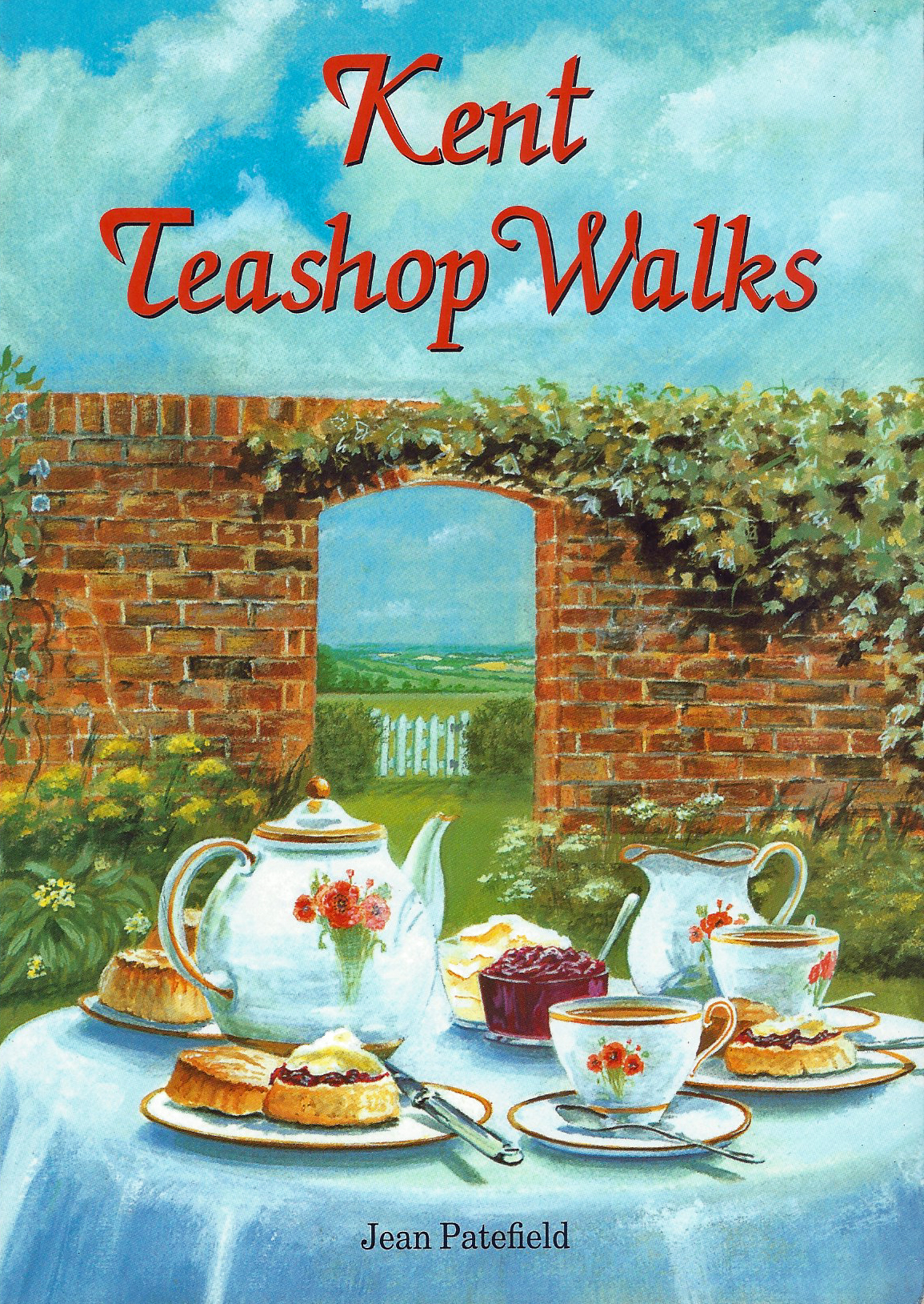
“let me urge you not to overloook the pleasures of a good walk in winter. The roads and paths are quieter and what could be better than sitting by an open fire in a cosy teashop scoffing crumpets that you can enjoy with a clear conscience due to the brisk walk to get them”
Kent Teahop Walks, Jean Patefield
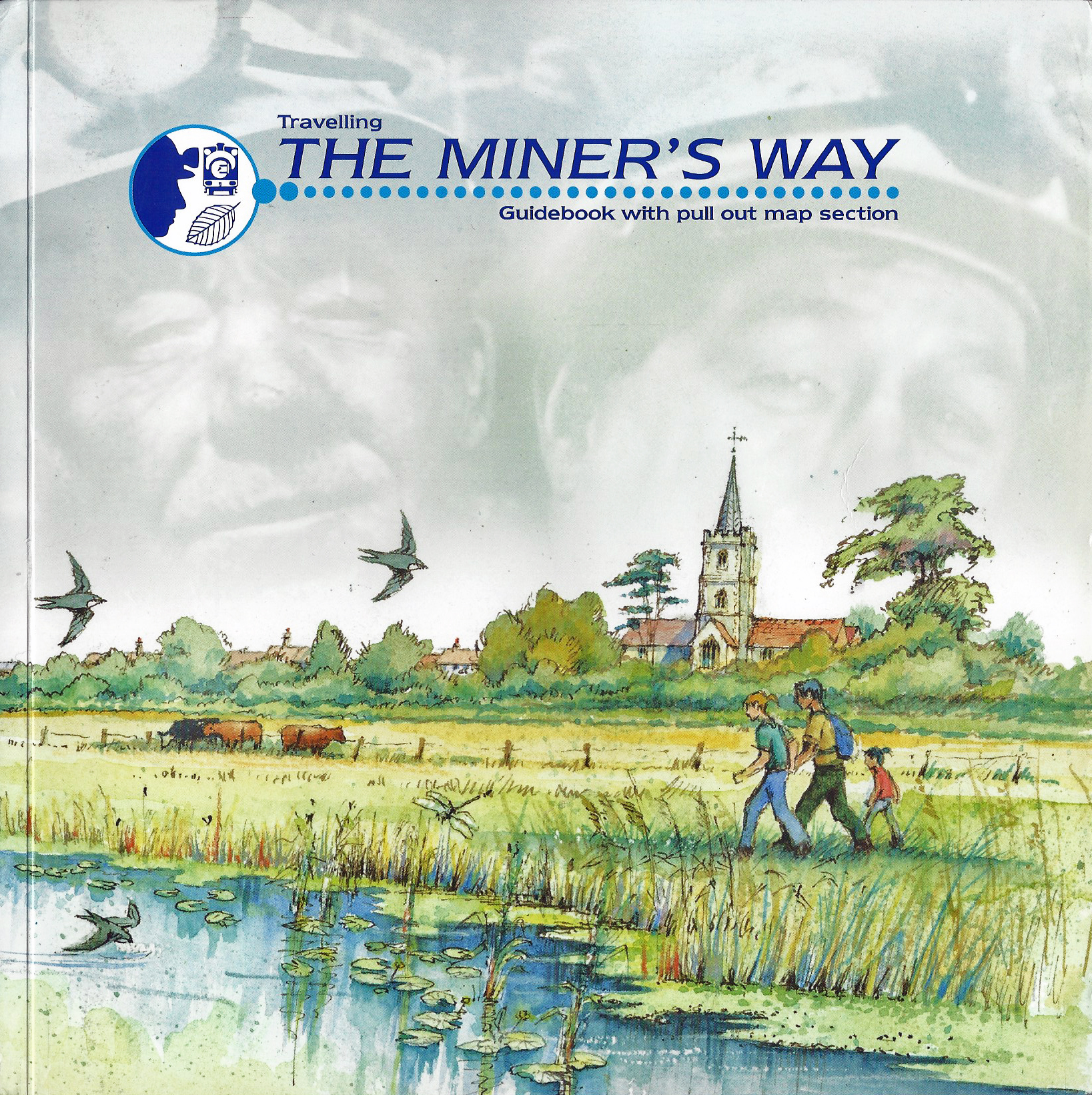
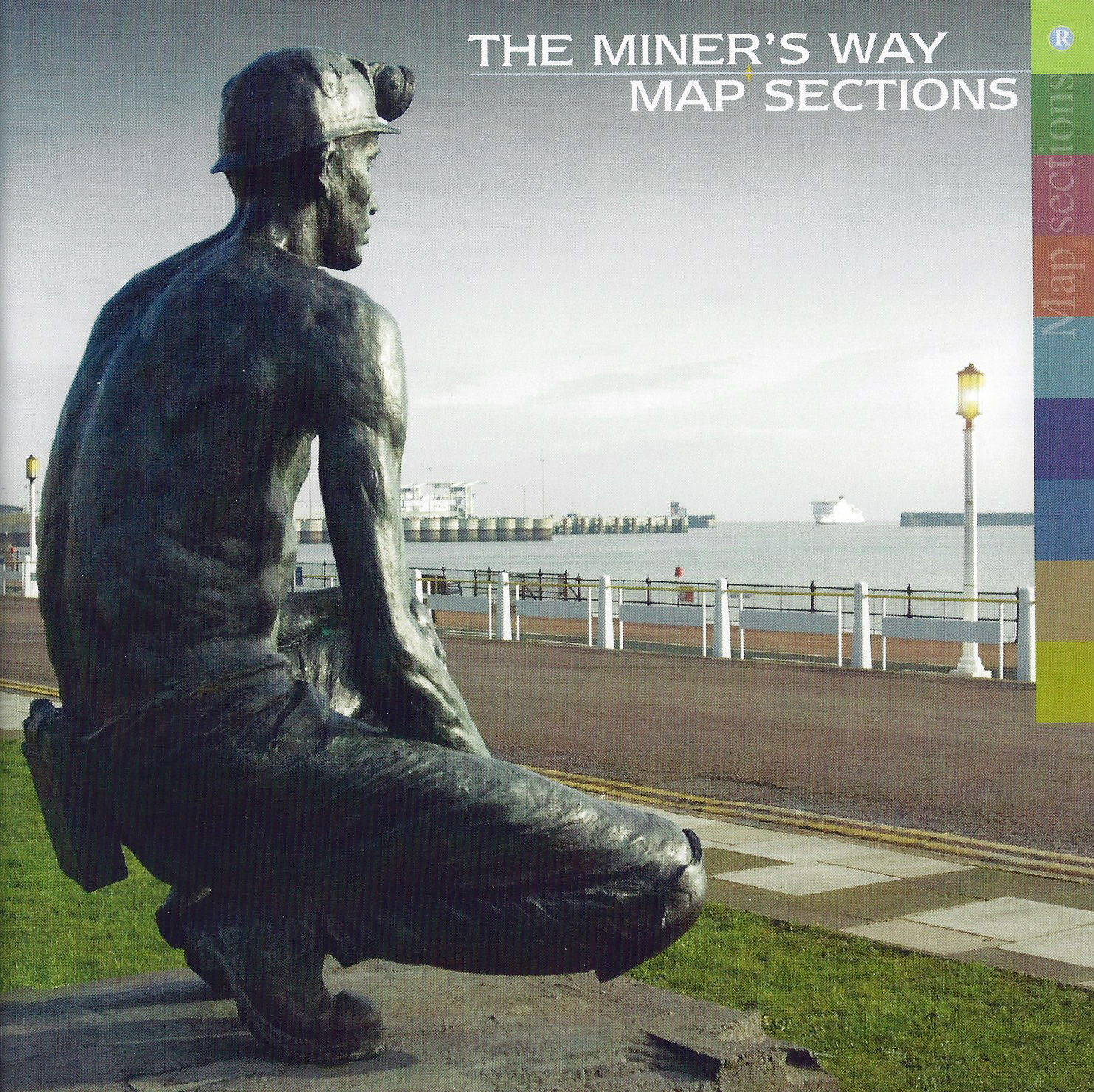
Many of the traditional industries of Kent have passed. In 2001 Dover District Council launched the Coalfields Heritage Initiative to record and preserve East Kent’s mining heritage through a digital archive of photographs, documents, stories, oral history and video. Some of these were drawn together in a guidebook to a newly created Miner’s Way, a 28 mile trail exploring East Kent and former colliery sites. Authored by Paul Hadaway and published by Dover District Council in 2007 and incorporating Ordnance Survey mapping the guide book and pull out map section drew on the County Council design from twenty years previous but has been vastly improved through simplification of maps and added historical content to the guide book.
Climbing
“… the newer and softer formations to the south and east has left the south-eastern climber with the considerable problem of how to practice his craft and where to fulfill his mountaineering needs in between trips to real mountains…the many who live and work in that part of England closest to the Continent find themselves amidst green rounded hills almost completely lacking any exposure of bare rock”
E.C. Pyatt
The south-eastern corner of England is not one of the best destinations for climbers however there are always a few challenges. The noted Victorian mountaineer A.F. Mummery practised his craft on the perilous soft chalk cliffs at Dover. The alpinist lived at Dover and contributed his thoughts on chalk for inclusion in W.P. Haskett Smith’s detailed 1894 guide – Rock Climbing in the British Isles- England. Mummery concluded- “as a whole, it may be regarded as a treacherous and difficult medium, and one which is likely to lead those practising on it to be very careful climbers”.
One of the earlier noted and classic climbing guides which included Kent was published by The Climbers Club, their volume was simply called- South-East England. Written by Les R. Holliwell in the 1960s, amongst other locations it also covered the well-known Bowles Rocks, Bulls Hollow Rocks, Eridge Green Rocks, Harrison’s Rocks, High Rocks and Stone Farm Rocks.
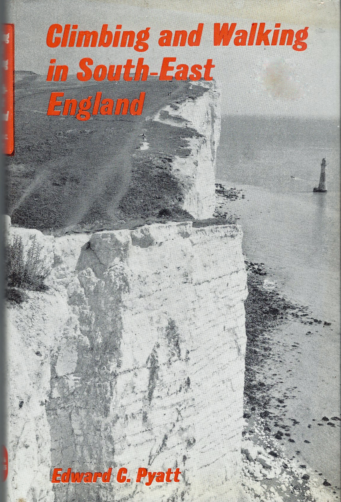
Mere walkers were not forgotten, there was also a guide book that covered both climbing and walking- Written by Edward C. Pyatt, Climbing and Walking in South-East England was published in 1970 and covered the above destinations and many more, for the author was all too clear that while living in the South-East, the climber had plenty of opportunity to board a train to more favourable climbing destinations. But Pyatt does remind the reader:
“we come to walking, still the most used activity in all mountaineering wherever it is done. We walk for preference on hill ridges, with wide valley views… walks can be turned into fiercely competitive exercises, taking slopes by their steepest ways. The climber can make long-distance marathon walks from point to point, or link together a series of hill tops or a series of features of the same type, in expeditions which demand considerable endurance”
His guide does list, admittedly cursory, routes that the walker could take on the North Downs and Greensands. Pyatt includes quotes from Hilaire Belloc and Celia Fiennes to further his tempered enthusiam for the area. However a climber will always be frustrated in Kent.
National and Regional Trails
A number of well-established and popular longer distance paths either include or fall entirely within Kent and most of these have encouraged numerous guides over the years. Some have already been mentioned- The Greensand Way and the Wealdway and other routes have also been covered over the years.
Two lines of chalk hills extend across South East England- the South Downs to the south, obviously, while a long distance trail follows the northern range- the North Downs Way stretches from Farnham in Surrey to the Kent port of Dover. The trail was officially opened 30 September 1978. Aurum are the official publishers of a route guide book but numerous others have also appeared. The Aurum Press Trail Guides are of uniformly good quality. Impeccably researched and well-written. 1:25 000 mapping is included along with information on flora, fauna of the downs, some social history and transport links. Along with Cicerone, they lead the way in produced excellent guide books for walking.


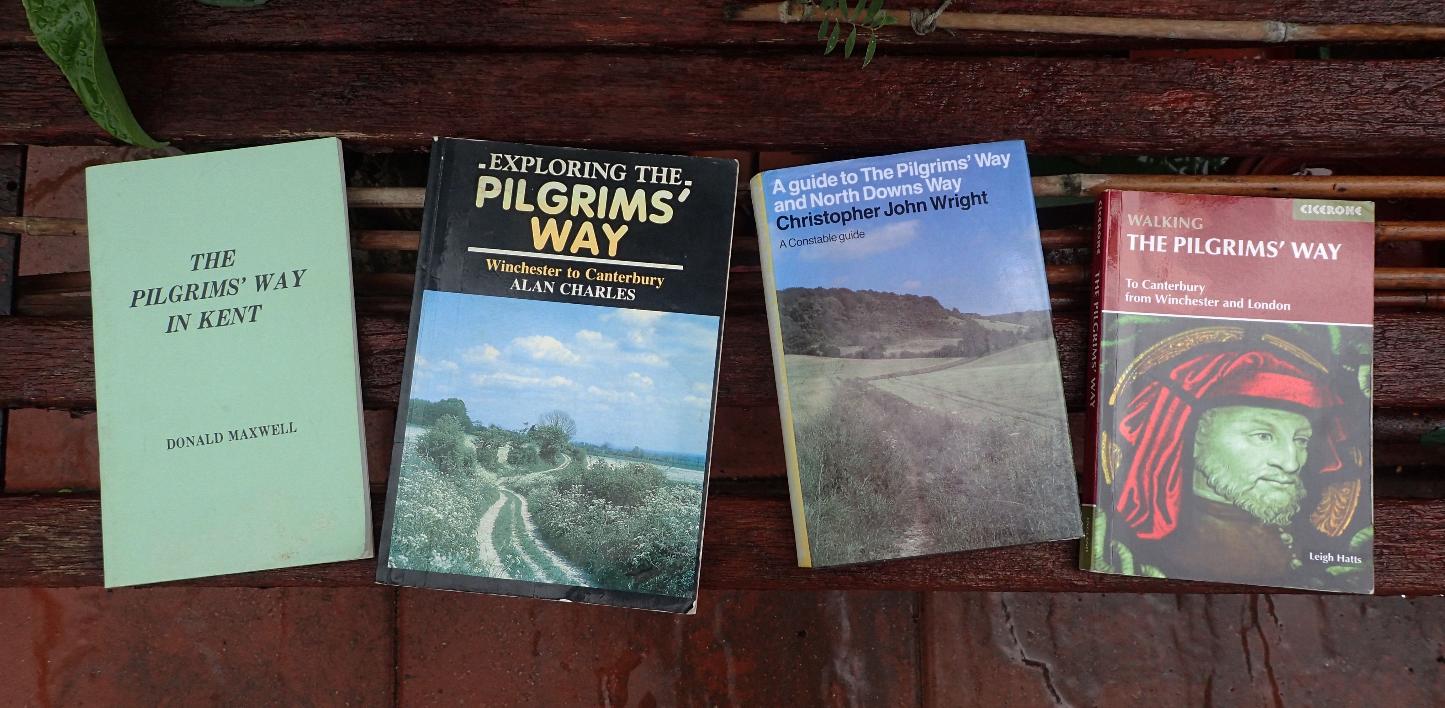
Hilaire Belloc was a great walker who travelled extensively. The Path to Rome (1902) followed his pilgrimage across the Alps from central France to Rome. The Old Road, published in 1904 and recognised as a classic in both literature and travel writing, recalls another pilgrimage- from Canterbury to Winchester via the Pilgrims Way. This ancient route is possibly the oldest of the longer pedestrian trails in Kent, however the rough route that tracks across the county today certainly predates the Christian Pilgrim. The Pilgrims Way follows the foot of the downs while the North Downs Way frequently takes the higher ground, though the two are coincident for many miles. Chaucer’s Pilgrims took this path from Southwark to Canterbury, but of course, Canterbury Tales is a work of fiction.
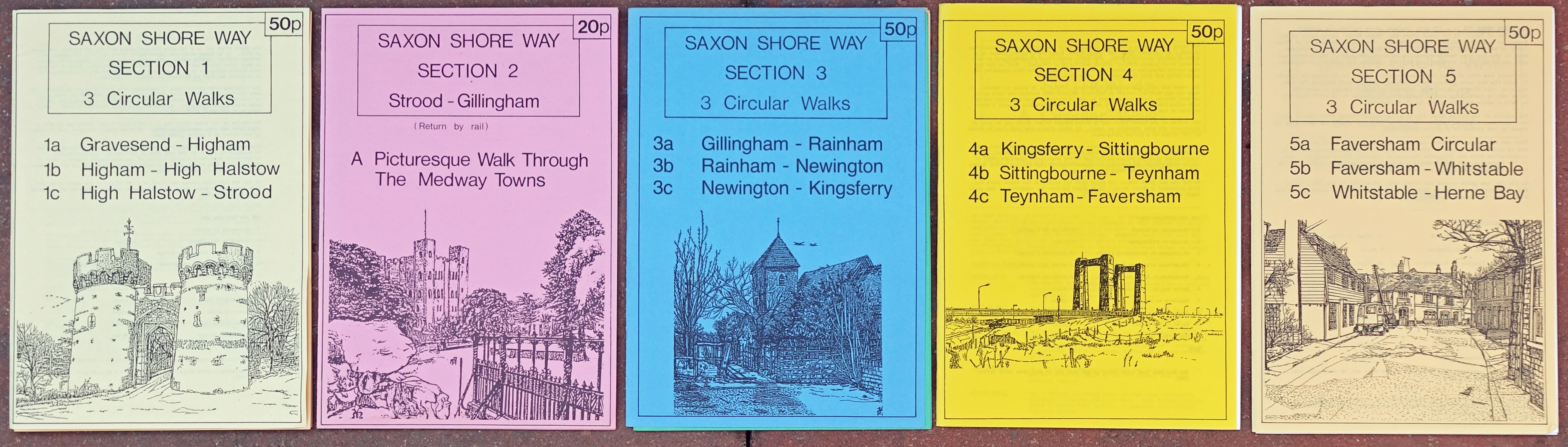
In contrast to the popular and well known longer trails. Some longer routes across the county and even extending beyond its boudaries have received scant attention. The Saxon Shore Way is just such a trail. Originaly 140 miles and subsequently extended to 163 miles in length and tracing the old saxon shoreline of the county before it was dramatically altered by both accretion and erosion over the centuries, this trail attracted few written guides. Bea Cowan, who also authored Along and Around the High Weald Walk for Kent County Council (shown above), wrote an official guide published by Arum Press but that has long disappeared. The author Alan Sillitoe added to the published account but there remains a suspicion that he never even visited much of the route. So much for guide books from authoritative writers.
The England Coast Path
Following the Coastal Access Scheme introduced by the Marine and Coastal Access Act 2009, the creation of a coastal path stretching around all of Englands coastline continued apace with a completion date delayed and stretched, not least as a result of the Covid-19 pandemic. The stretch around Kent’s coast is just part of one of the longest continuous paths in the World.
“To walk the Kent Coast Path is to experience a glorious variety of landscapes and to walk through history”
The work of the Kent Ramblers over the years has been impressive. Not content with improving signage and access to many of the county paths, they have been responsible for many rambling guidebooks. In 2016 the stretch of coastal path between Camber and Ramsgate became one of the first parts of the England Coast Path to open. Needless to say a guidebook was produced. Authored by Robert Peel and Peter Smith, the guide is an almost indispensible companion.

Anyone who has walked a coastal route is aware that some stretches can be monotonous and this guide book does an excellent job of teasing out fascinating snippets of information on the history and natural history of a changing coastline.

Despite an ever increasing amount of information online, there is hope yet for the printed medium when in comes to guide books for rambling in Kent. This pleasing fact is duplicated nationally and while there remain those amongst us who want to get out and explore territories new to us, it looks as though the future for excellent guide books is assured.

I was sent a link to this very interesting post by Robert Peel (who was clearly pleased with your very complimentary comments on his guides!). Robert is the Secretary and I am the Chair of Kent Ramblers – I thought I’d just “touch base”, in the hope that you might be prepared to “engage” with us, so that we can use your clearly extensive knowledge / try to assist you anywhere we can! (I am also the co-ordinator for Kent for the “Don’t Lose Your Way” project looking for unrecorded Rights of Way – for which you might also possibly have some useful information). Hope to hear from you soon! Many thanks, Colin.
LikeLiked by 1 person
Colin, thanks for your comment. Not sure about the ‘extensive knowledge’ element however
LikeLike