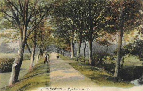
Sandwich Rope Walk, 1915

Oyster Bay House, Faversham. A three-storey nineteenth century granary store built beside Faversham Creek. A contemporary ‘sprit sail’ barge was moored alongside
A second week on the Saxon Shore Way comprised of four days of walking between Sittingbourne and Dover. The trail follows the north Kent shoreline before branching off inland along the old dividing line between mainland and what was once a separate island- the Isle of Thanet, then reaches the coast a little beyond Sandwich and its famous golfing links, finally following the coast round to Dover. These are four easy walking sections each with a very different character. Actually it was only three days of walking as I had already completed the Sittingbourne to Faversham part earlier in the year and that blog was published on the Cicerone website. I was looking forward to the three days that would take me to Dover.
Continuing from where I had finished the first three sections, the fourth section on the Saxon Shore Way reaches along the coast from Sittingbourne to Faversham. Earlier in the year, prior to lockdown really clamping down, we had been permitted one form of exercise a day and I took the opportunity to isolate myself from others on that lonely stretch of shoreline. I had been considering early retirement from work and this day walking alone provided an ideal opportunity for solitary thought and decision making.
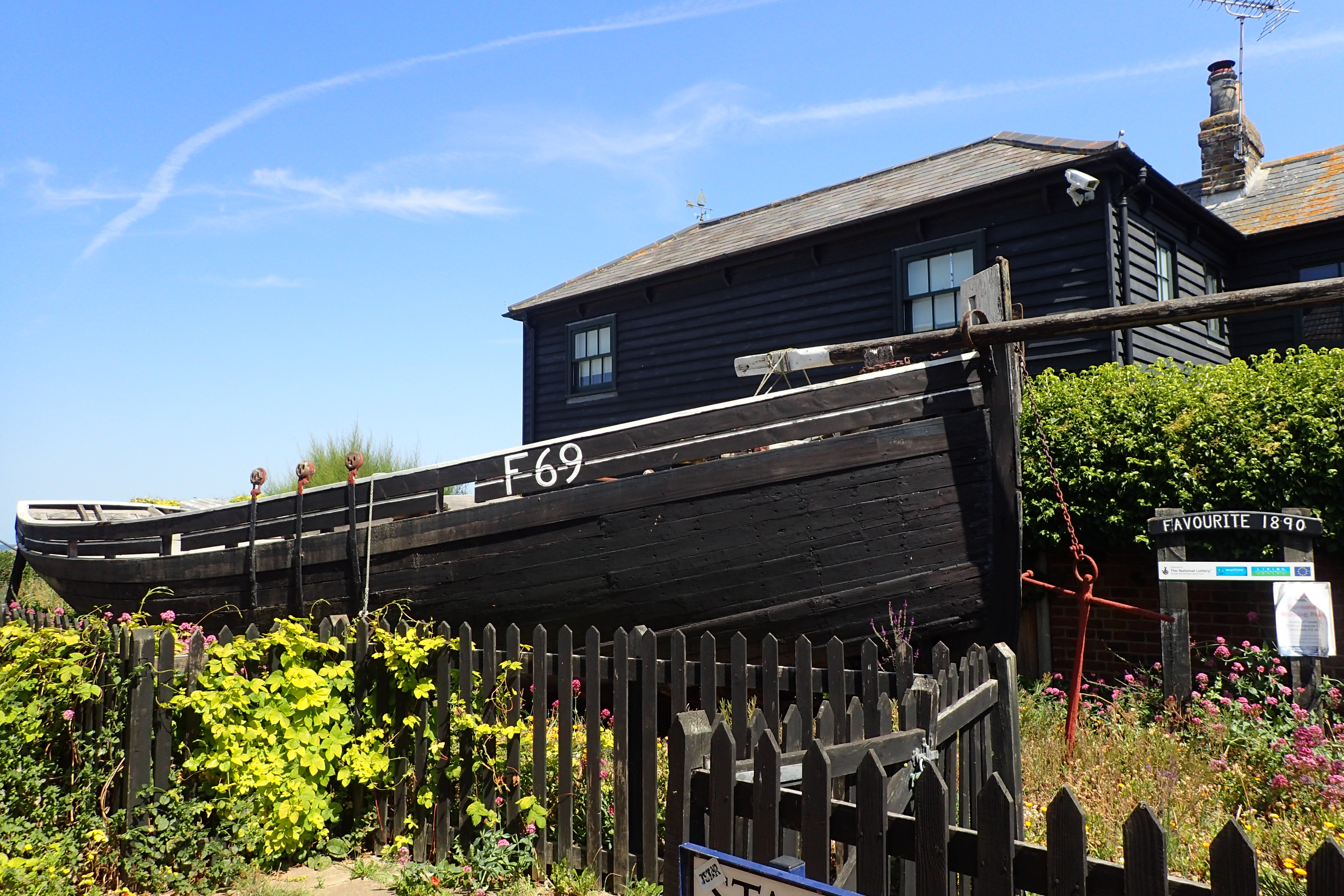
‘Favourite’ is the last surviving oyster yawl in Whistable. Built in 1890, her working life ended when shot at by a German fighter in 1944. She now sits in a garden beside the Saxon Shore Way
The Saxon Shore Way from Faversham starts with the pleasant and easy walk out and round Faversham Creek, past silent boatyards and out on to the sea wall on Nagden and Graveney Marshes. Harty, on the Isle of Sheppey is just a mile away, across the tidal Swale, that lonely and hard to reach place was the birthplace of British aviation. The water was low and a lot of mud was exposed. A couple of seals bobbed around out in the channel, no doubt looking for flat fish in the increasing current. Waders were in abundance but distant. Bright white Little Egrets paced the waters edge and I began to see, and hear, a handful of Little Terns as I approached Seasalter. In this Covid year the caravan park there was still closed when I walked past but the site owners were taking the opportunity of applying a lick of paint to spruce the place up. A brief wave, they went about their work and I went on with my walk. I was approaching Whitstable and I had hopes of fish and chips for lunch.
The town was heaving. The weather was fantastic and thousands of people, confined to quarters for too long and starved of stimuli, had descended on the place. Social distancing was an impossibility, the paths were full and I had to walk in the road, car mirrors brushing me as they threaded their way through rammed streets. I passed through the town, famous for oysters and other seafood, without halting. Looked like my simple cheese sarnie in my pack was going to suffice.
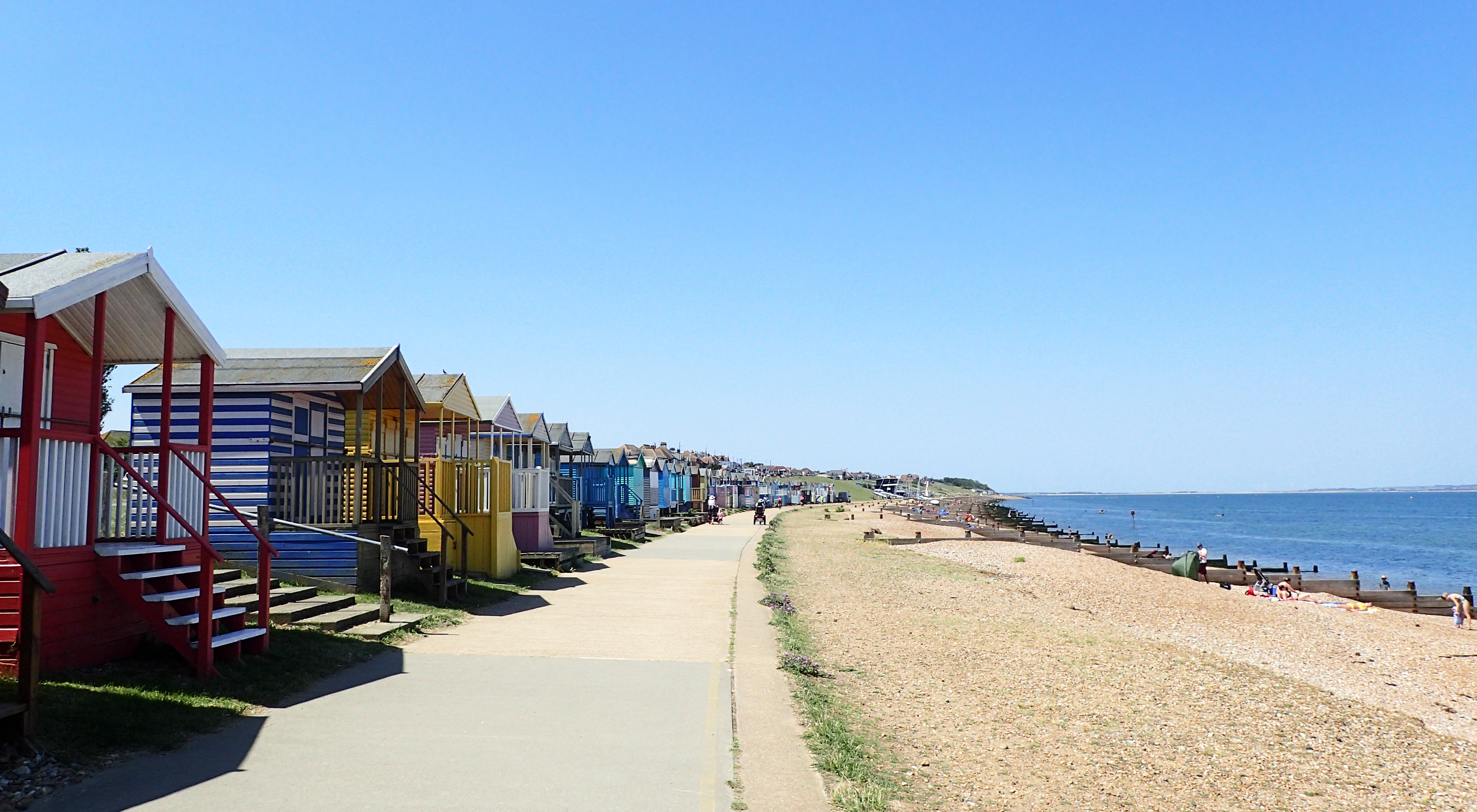
Approaching Herne Bay the Saxon Shore Way begins to pass brightly painted beach huts, now selling for tens of thousands of pounds each
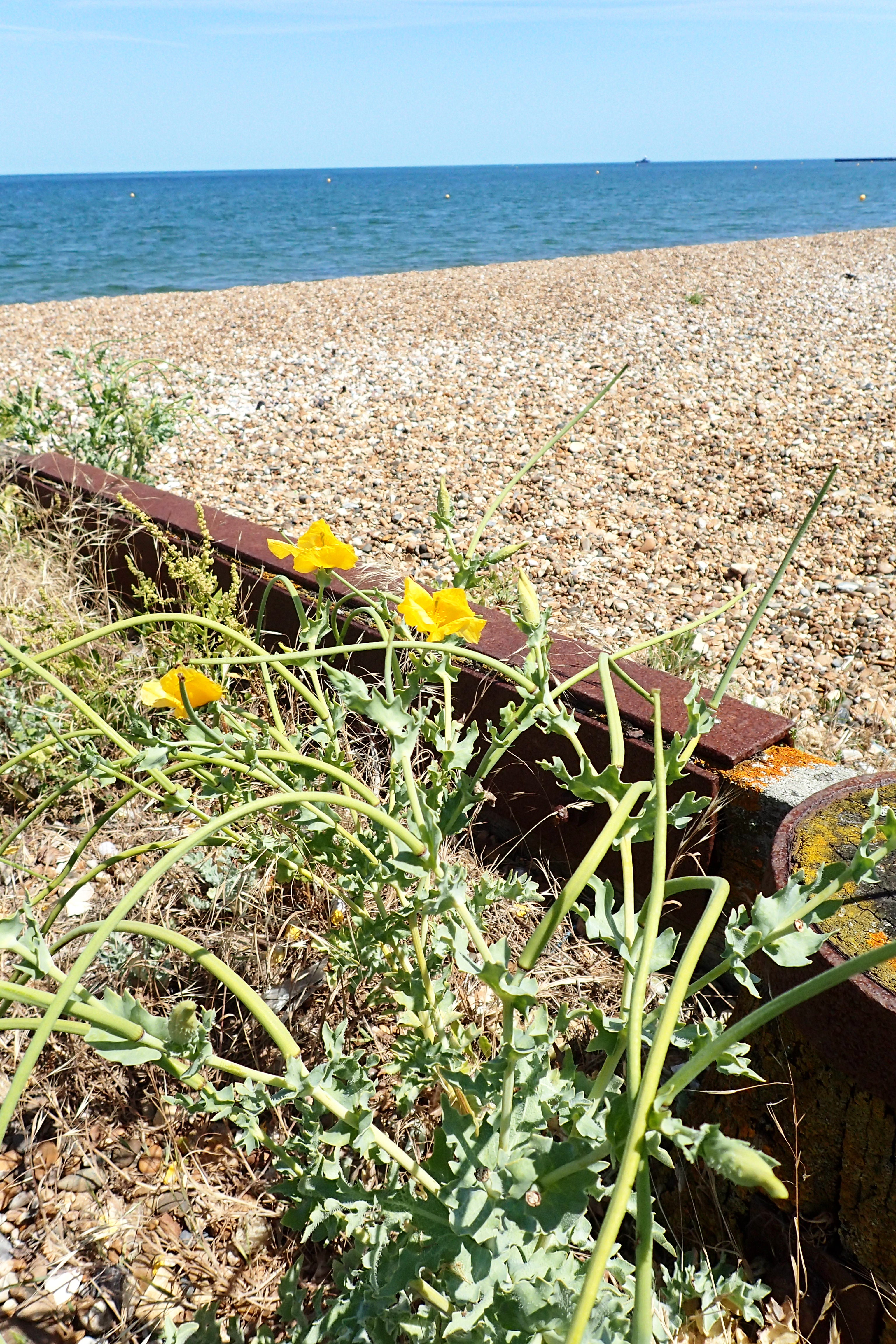
Yellow Horned Sea Poppy (Glaucium flavum) abounds
From Whitstable it is a wide and flat esplanade wander all the way to the end of my day at Herne Bay. It is a long enough stretch of coast that the many hundreds out enjoying the summer sun were mostly spread thin and there was plenty of room to keep up a swift pace.
Beach huts and coastline properties sell for a lot of money along this sheltered stretch. New builds are squeezed in where they can. A couple of years ago a developer upset the locals when they discovered that the latest building project was called ‘Impressive Erections’.
Having reached the pier it was just a half mile walk uphill to Herne Bay station, arriving mid-afternoon having completed almost 22 miles on easy almost flat surfaces all day.
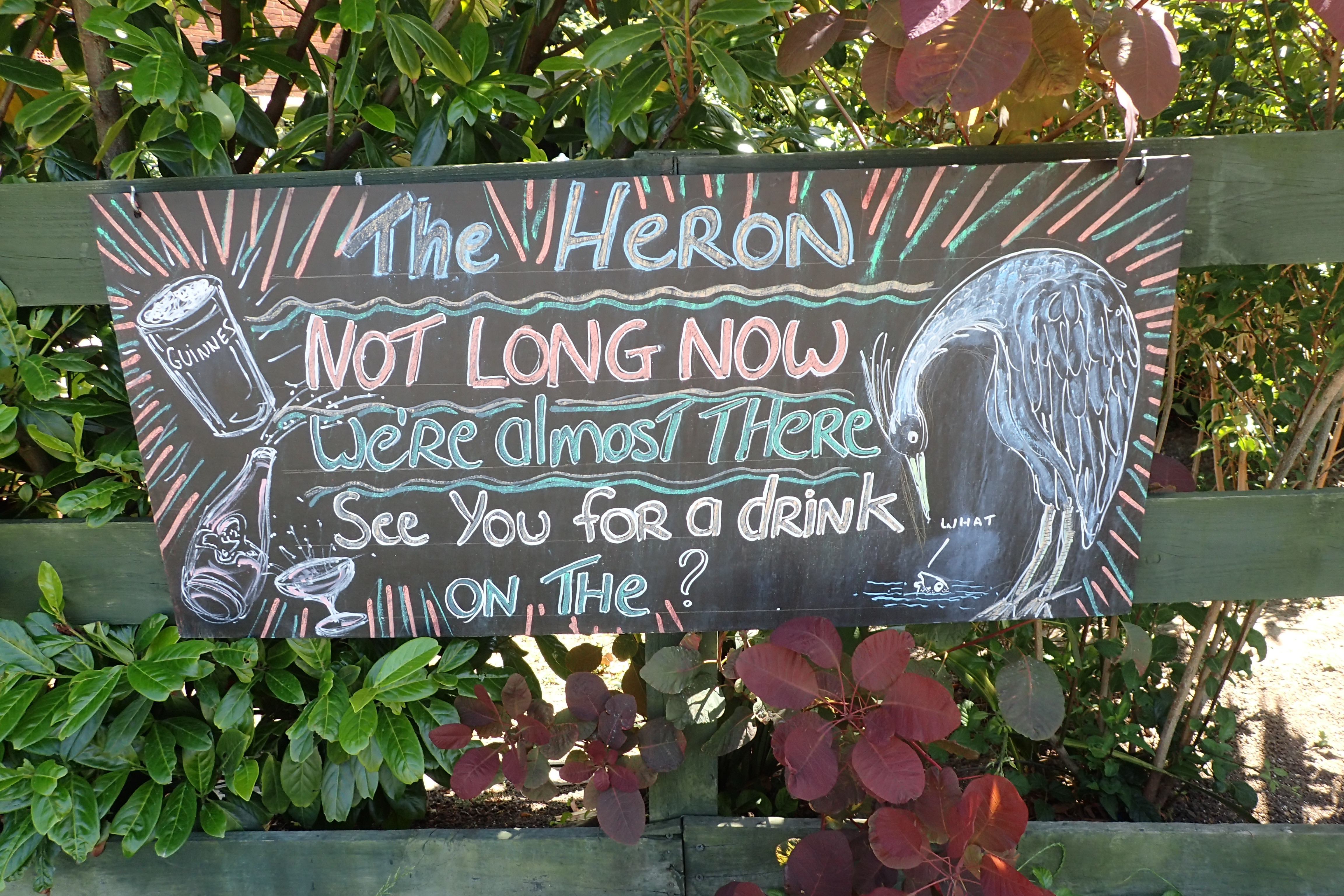
The Heron public house stands next door to Herne Bay railway station. Like all others in England, they were eagerly anticpating being allowed to reopen following coronvirus lockdown. This was eventually permitted on 4th July
Back the following morning to continue my walk, I found Herne Bay a charming and tidy place, lacking in much of the general tattiness and tackiness that afflicts so many English sea towns these days. An historic past and links with figures from history are evident, none more so than record-breaking Amy Johnson who disappeared offshore having crashed there during World War II. She was the first woman to fly solo from London to Australia and was an accomplished pilot, navigator and engineer. The cause of her death remains a mystery but rumours abound, one being that she perished under the propellors of the ship sent to rescue her.
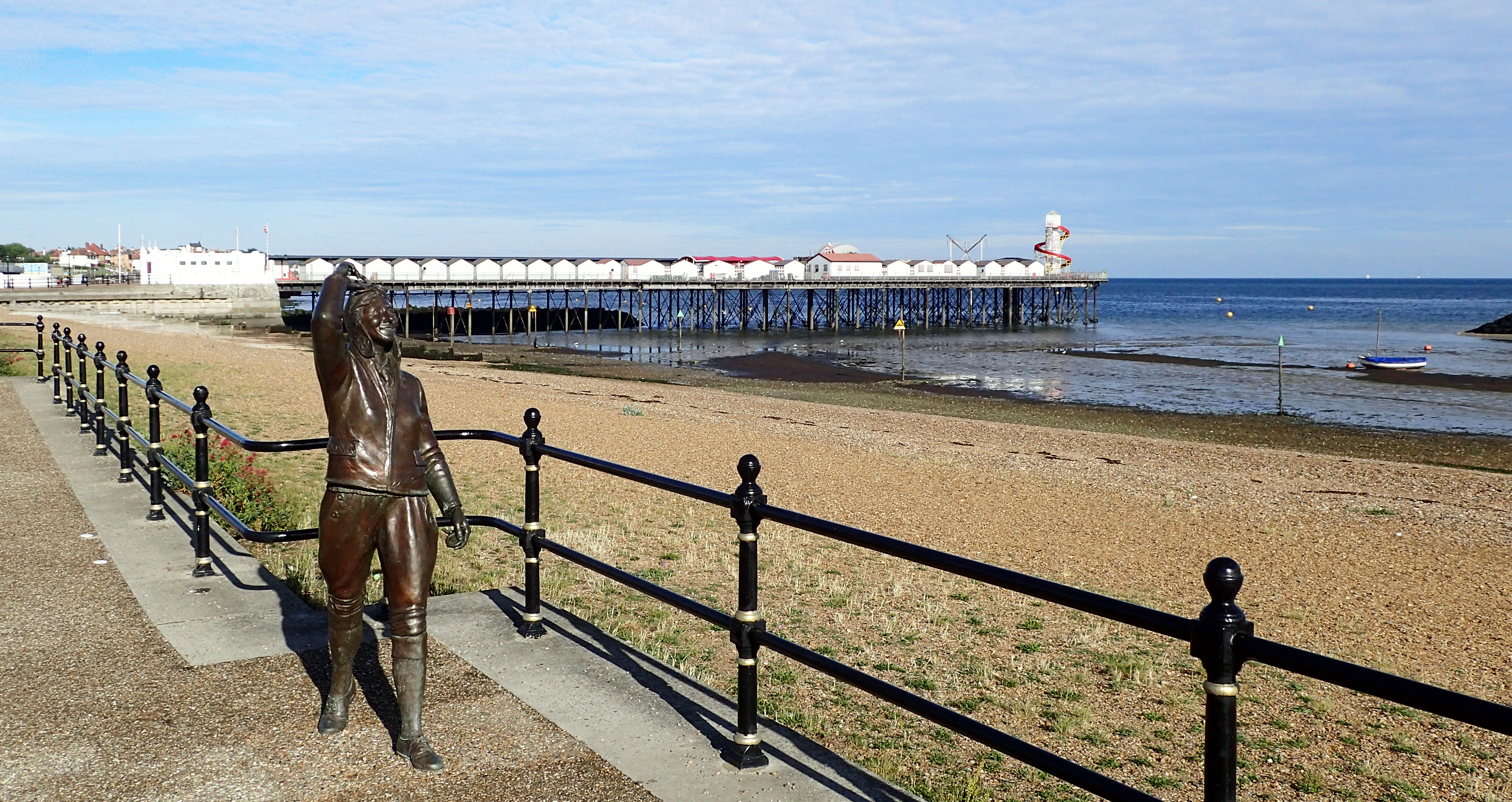
Bronze statue of Amy Johnson gazes out to the estuary where the pilot disappeared on 5th January 1941 while transporting an Airspeed Oxford as part of the Air Transport Auxiliary. She baled out after possibly running out of fuel. Another rumour suggests she was shot down by anti-aircraft crew after failing to give the corrent identification signal
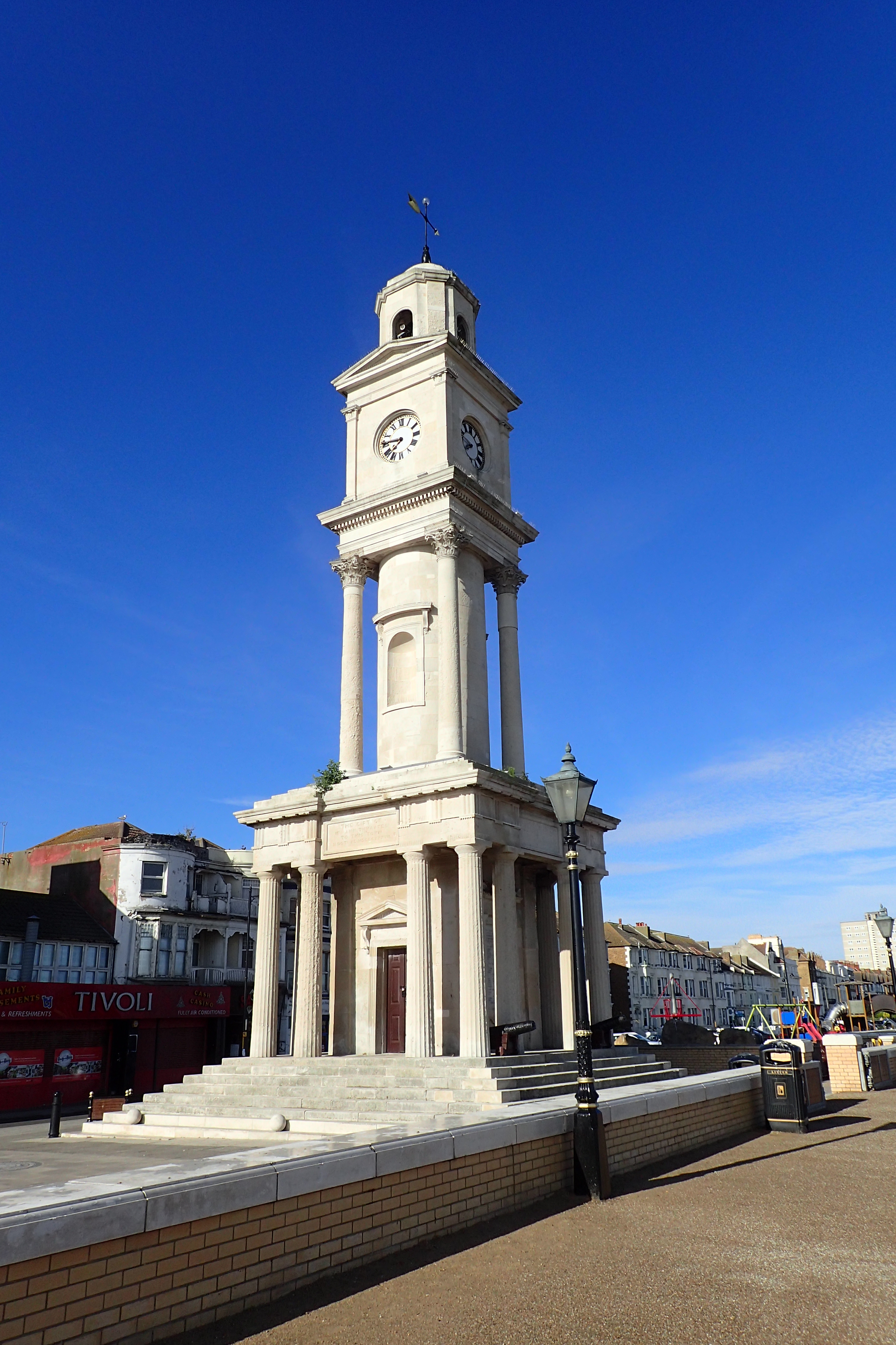
Clock Tower in Herne Bay
I pottered around Herne Bay a little before properly striking off as not only was I in search of a cup of tea and a bacon sarnie (unlucky in both), but it is also a lovely espanade and the clock tower alone demands a little time to admire it. Built in 1837 it is the oldest purpose-built, free-standing clock tower in the UK. It stands 85 feet (26m) tall including the weather vane. The two canons standing at its base were dredged from the sea bed when the town pier was being completed in 1899. Possibly Dutch in origin, they used to fire blanks as a fog warning to shipping.
It was off the coast here that Barnes Wallis and his colleagues experimented with the Upkeep Bouncing Bomb in April and May 1943 and Highball prototype in April 1943. Today there was little to see at sea other than an array of wind turbines and the distant Maunsell Forts.
Leaving Herne Bay it was more easy walking along the coast until a gentle rise up to Reculver Country Park. Plenty of dog walkers around taking all the pavement width with leads stetched from one side to the other. Its OK mate, I’ll go round you then…
There is a plethora of benches well sited, all with good views out to sea and I made use of one for a mid morning halt to rehydrate and snack on an oat bar. The weather was again kind and I had again packed along three litres of water as there are few places to replenish on this route. Soon after, it was the long sweeping drop down to the dramatic Reculver Towers.

Plan of Reculver Fort. Image courtesy of English Heritage
The 12th century towers atop a monastic church can be seen for miles across the flat landscape. So noticeable are they that they were rebuilt as a navigational aid for shipping. However the site’s history is far older than that as it was formerly a Roman fort. The coastline is extensively eroded here and the fort and subsequent church used to stand far inland. The encroaching sea has taken half of the fort and now laps at the feet of the towers. Recent sea defences may yet prevent them toppling.
After a decent wander and explore of the site, I found a small cafe that had just opened the day before, following months of lock-down closure. A good bacon sarnie was accompanied by a mug of tea, the proprietor followed my demands for ‘strong’ tea to the letter- superb. Why-oh-why is making a decent cup of tea a dying art!

Exploring Reculver Towers

Crossing the Isle of Thanet takes in countless drainage ditches and streams. Dragonflies quartered their ‘patch’. Frogs and voles abounded. Shrews and mice crossed my path frequently, a lone weasel chased one and kestrels were also on the hunt
Leaving Reculver my path now headed inland. The Saxon Shore Way runs concurrent with the Wantsum Walk and Stour Valley Walk for much of its way as it crosses the Isle of Thanet, missing out the top north east corner. Thankfully as otherwise the route would wander needlessly through Margate, Broadstairs and Ramsgate. That part of the coast now being almost completely built up.
Following on from a few days of mostly coastal walking, the Saxon Shore Way takes on a very different flavour on this inland section. My weather was superb- warm, sunny and dry. The air crackled with heat and bees and flies buzzed me companionably.
This part of the walk was so enjoyable that I might return one day to explore this area further. No-one was around and I had the paths to myself all the way to Grove Ferry. The large pub there was closed but an enterprising youngster had set up a caravan in the car park and was doing good trade with paddle boarders and anglers. I joined the two metre spacing queue and was soon enjoying yet another decent mug of tea and a quality burger. Lunch may have come early but sitting in the shade of a birch tree with a Flycatcher loudly snapping at flies on the wing infront of me, an hour sped by. Unusual for me who doesn’t normally halt for longer than is necessary.

Stour Valley Walk is a mixture of quiet roads and paths, rough grazing and farm crops. Hamlets and villages are dotted around and all is quintessentially British
From there it was another couple of hours of pleasant quiet walking all the way to Richborough Power Station with no-one beside inquisitive (perhaps too inquisitive) cows and skitterish sheep as occasional company. We all find interest in different things and Three Points of the Compass paused at two large Bailey Bridges that had been built across the River Stour for the farmer to move his cows across. I cast a critical eye over these as I have built dozens of them in another life decades previous.
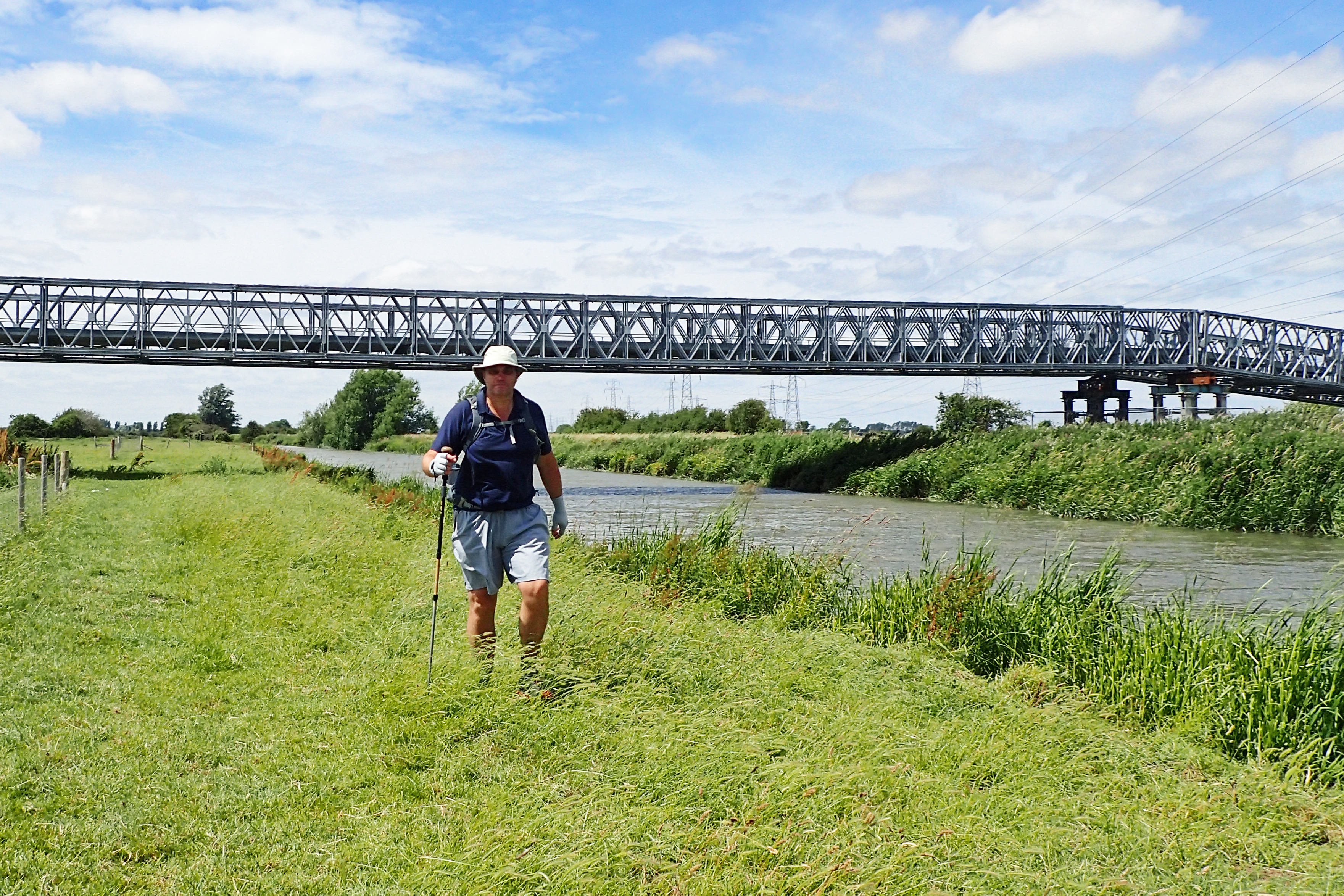
A grassy riverside trail follows the Stour all the way to the end of this days walk at Sandwich. This was a perfect hot and sunny day to be trying out a new piece of gear- Sun Gloves from Outdoor Research
These flat lands have been inhabited for thousands of years and evidence of Roman occupation continues to be unearthed. One place that was preserved years ago and is well worth a diversion is the Roman fort that is just a little way off-trail at Richborough. Even during its Roman occupation, the ‘castle’ underwent massive change. From AD43 Richborough was the major British port and from here legions would spread out across Britain, starting off along Watling Street, which commences here. The route today indicated by a little inconsequential concrete farm track. A large triumphal arch, possibly 25m high, was built straddling the road and entry through the arch signified formal arrival into Britannia. The arch foundations remain however the rest was utilised as building material for a Saxon fort built across the site around 277.
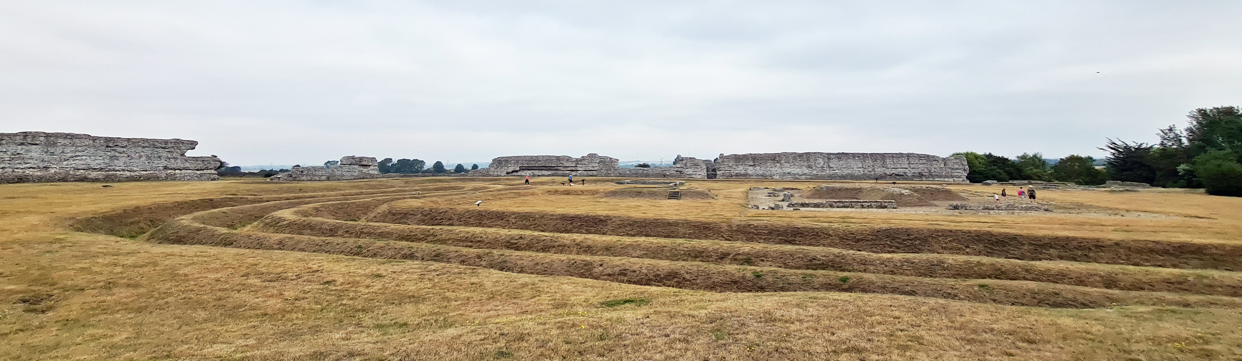
The Romans occupied Richborough from AD43 and the extensive and fascinating remains of the Roman fort are well worth exploring. The site was altered considerably over the centuries. Here, mid-thirteenth century ditches cut right through the foundations of second century buildings
From Richborough it is a short walk into Sandwich. This is possibly one of the most pleasant entries in to a town you could have, along the raised Rope Walk with shading trees and green spaces on both sides, looking down to some lovely period homes as you walk. A supermarket toward the end might just have been visited to pick up a bottle of Shiraz with which to celebrate another 19 miles completed.
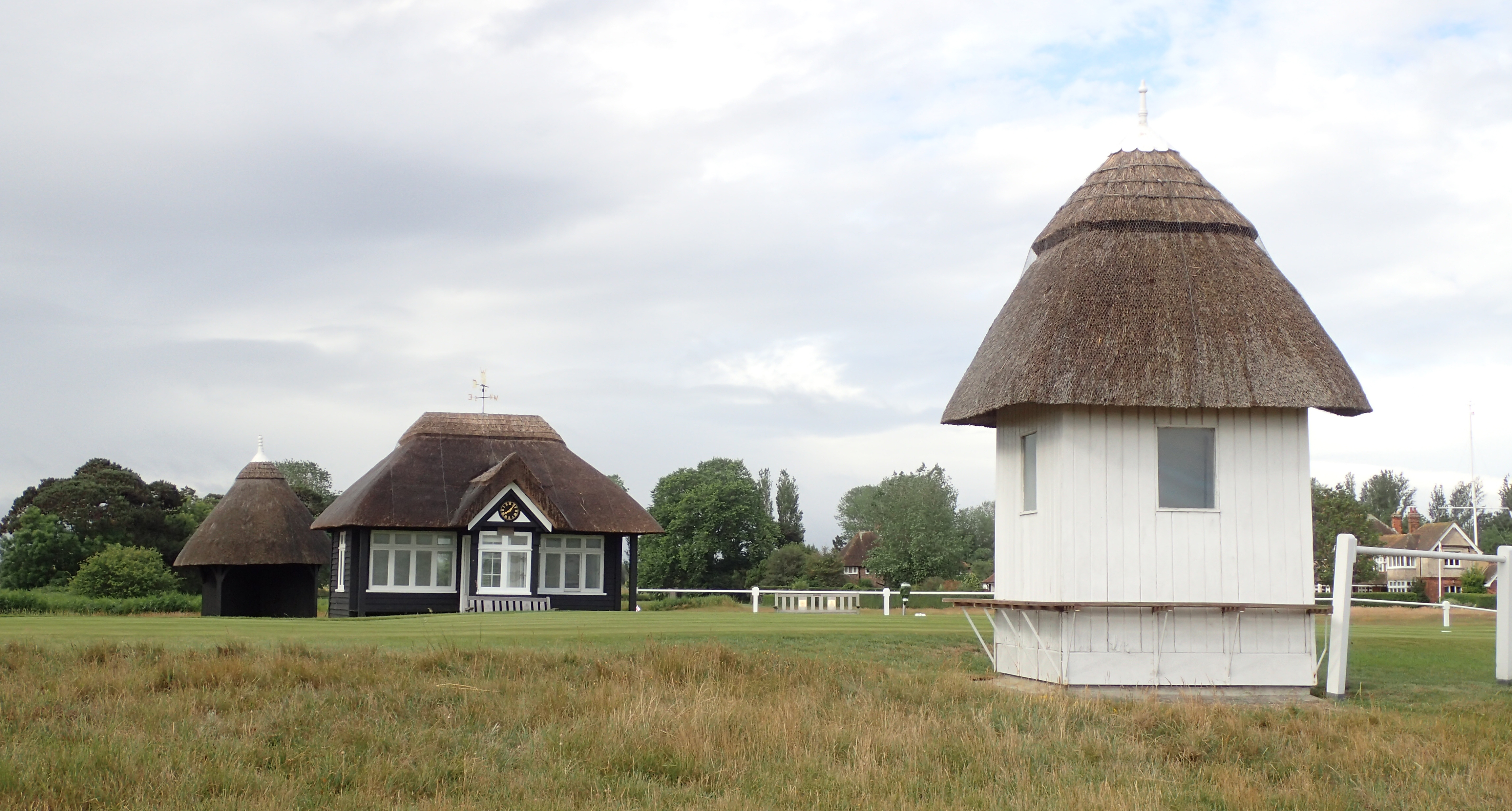
Thatched starters hut at the first hole on the Royal St. George’s Golf Club. Occasional host to the Open Championship
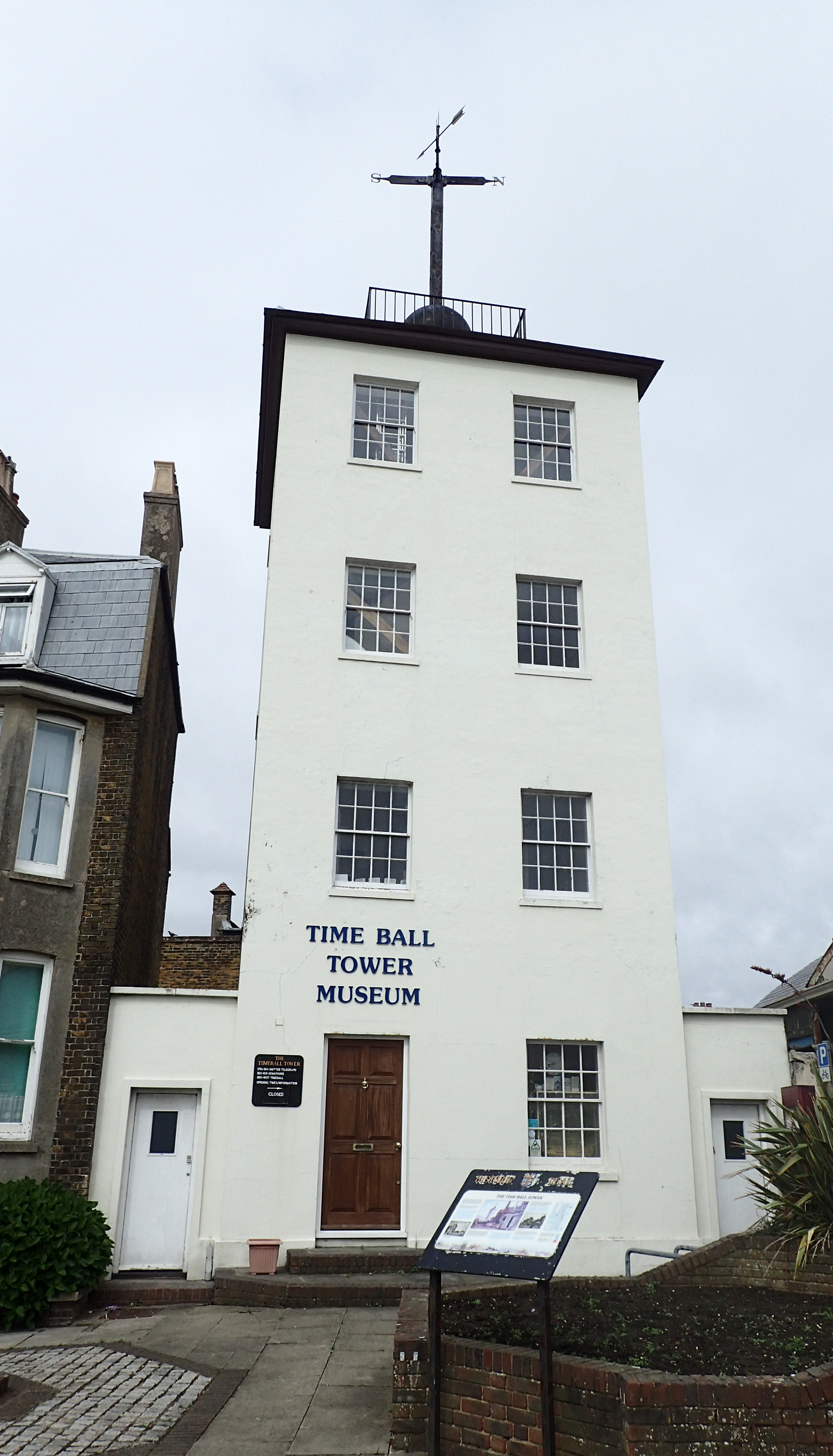
Deal Time Ball Tower. Built as a shutter telegraph in 1795-6, a message from here could reach the Admiralty in London in two minutes. Rebuilt as a semaphore tower in 1816, it was again rebuilt as a time-ball tower in 1833. At 12.55 a ball was raised half way up the mast and to the top at 12.58. At 13.00 an electrical current from Greenwich dropped the ball, enabling ships off shore to properly set their chronometers
The next day on the Saxon Shore Way sees an easy exit from town that heads toward the nearby coast, soon crossing the hallowed short turf of the Royal St. George’s Golf Club, founded in 1887, I wondered how the thousands of golfers over the decades have regarded hikers popping up and wandering across ‘their’ course. The trail dips and climbs over a few dunes as it crosses and there is little danger of being struck by an errant golfball. Lots of specialised mowers were going about their business taking another millimetre off the grass.
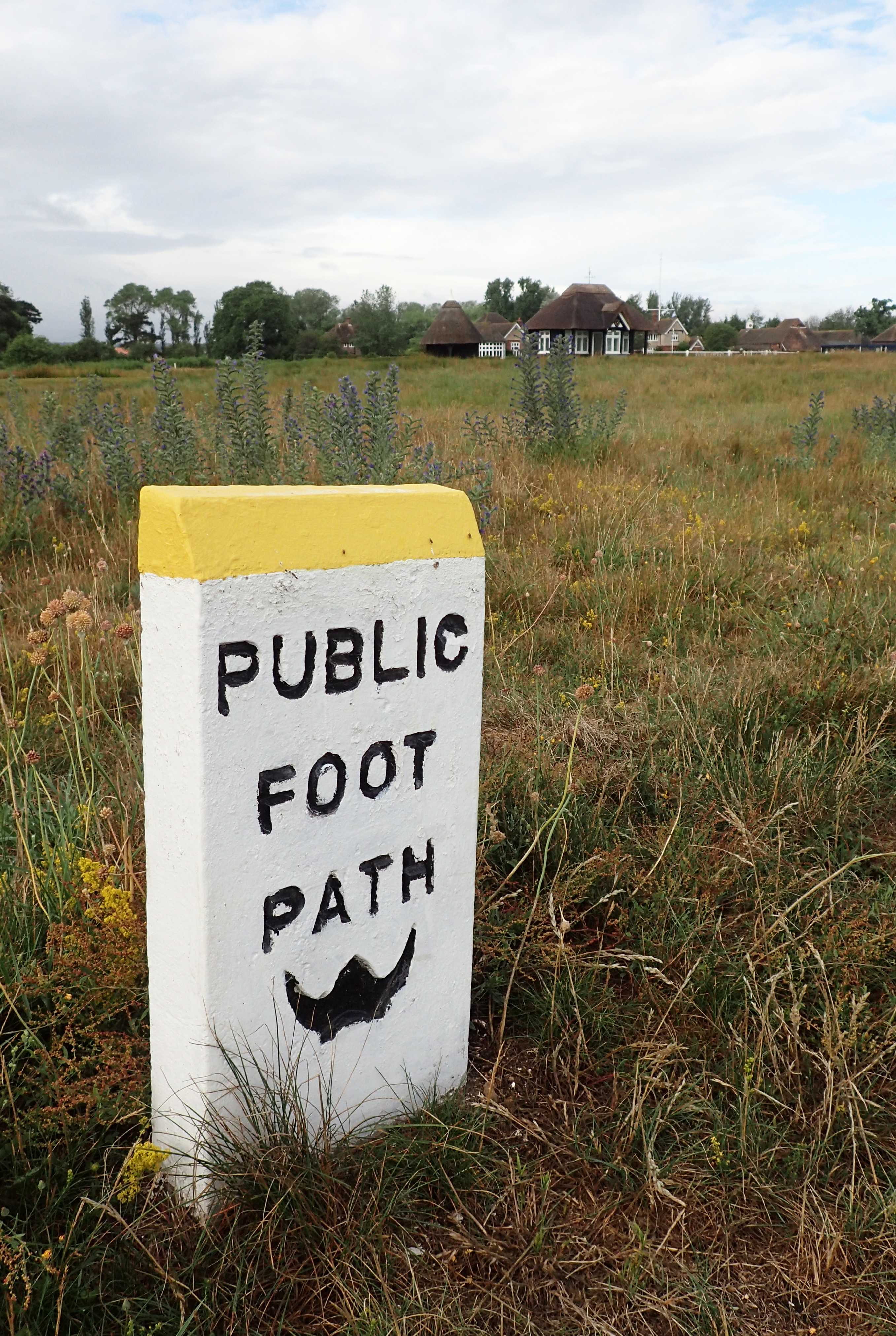
Combined Public Footpath and Saxon Shore Way marker- this trail is well sigposted for almost all its length
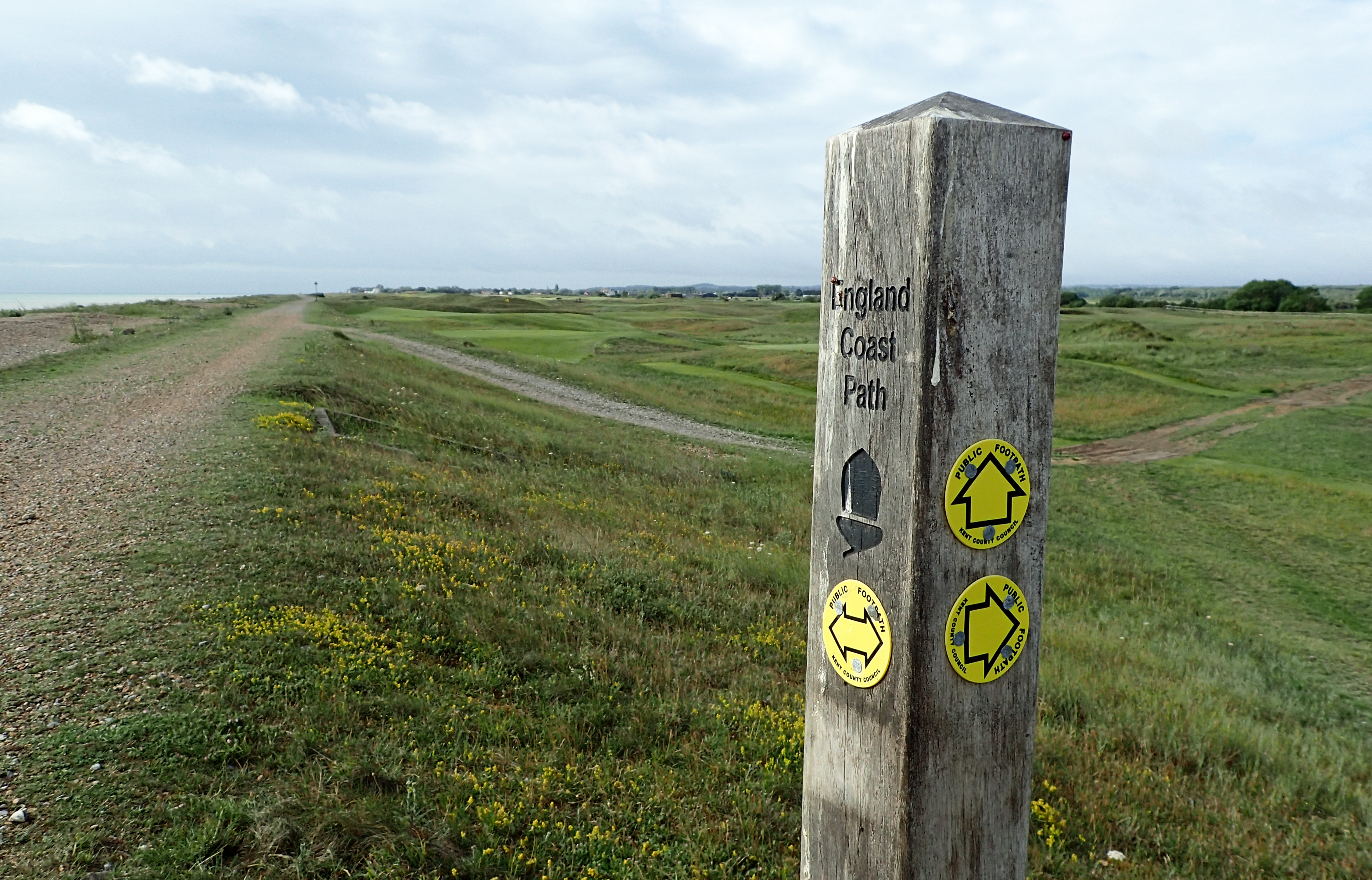
The England Coast Path was supposed to be completed in 2020 but is running severely late. This part of South East England was amongst the first to be completed and signage is already in place
Having butted up against the shingle and sea it is a sharp right turn and follow the coast again. A lot of joggers, dog walkers and very polite and proper locals taking a stroll. The Royal Cinque Ports Golf Links is passed and the shoreline closely followed all the way to Deal. Immediately noticeable is Deal Time Ball Tower, in use until 1927 and now a museum. Typically, due to Covid, it was closed.
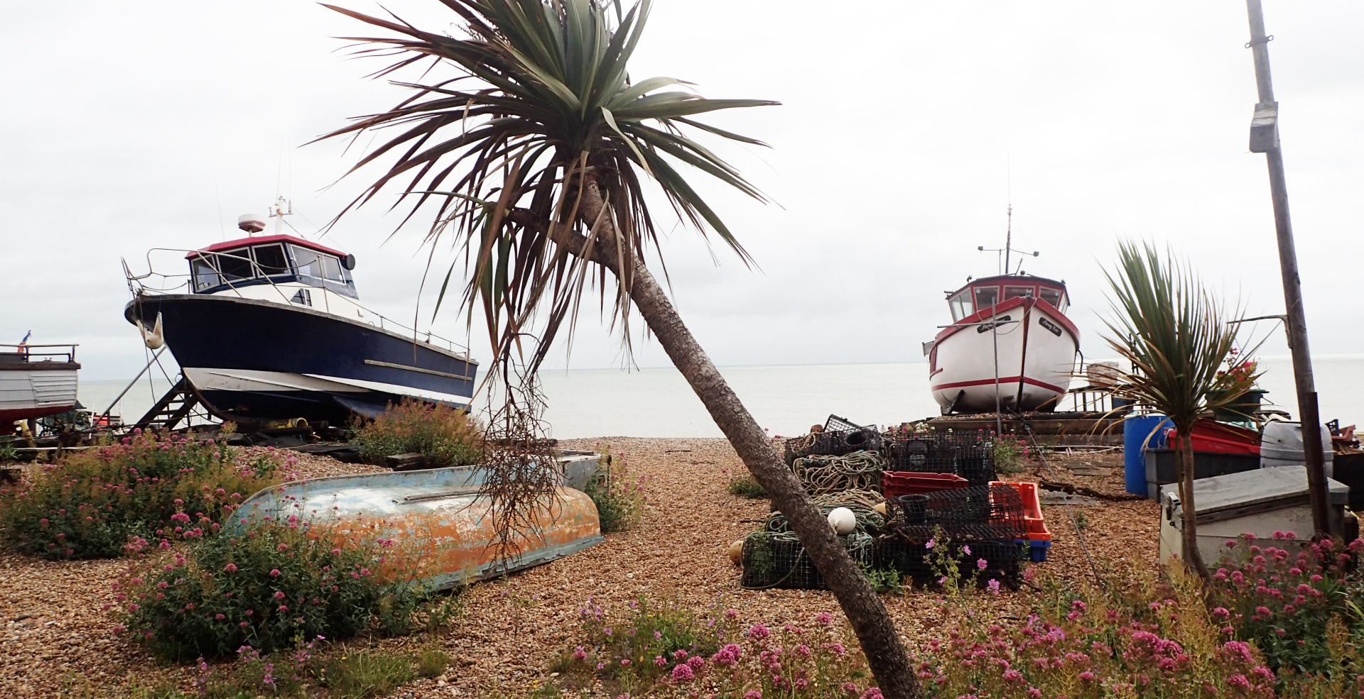
Fishing boats hauled up on to the shingle near Deal
In 1539-40, Sandown, Walmer and Deal castles became part of Henry VIII’s ‘Castles in the Downs’. Colonel Hutchinson, signatory to Charles I’s death warrant, was imprisoned at Sandown by a peeved Charles II. Little remains to be seen of Sandown Castle as you pass its shoreline situation as the council encased it in concrete and made it part of the seawall, but squat Deal and Walmer Castles are largely extant. All three castles were captured by Royalist troops during the civil war and held for three months. The clover leaf bastions were designed to deflect cannon fire. All interesting enough but come on, you can even go inside Walmer Castle and see a pair of tall leather boots that Arthur Wellesley asked his shoemaker to make for him. Later, as Viscount Wellington, he defeated Napoleon at the Battle of Waterloo. Soon everyone wanted to be seen wearing a pair of ‘Wellingtons’. The castles can be visited with prior booking but I’ve seen the boots before and could live without such excitement, so I contented myself with a few photos of the castle exteriors and walked on. I found the towns busy with activity and braced against a stiffening wind. I wasn’t sure I could agree with William Cobbetts assessment in 1823- ‘a most villainous place. It is full of filthy-looking people’.

Walmer Castle is one of England’s finest Tudor Castles, built under the instruction of Henry VIII

Car sticker for the pirate Radio Caroline
This part of the British shoreline has been notorious for centuries. Off-shore are the ‘Downs’ a safe area of water for ships, just inside the treacherous Goodwin Sands, a sandbank some six miles offshore that has claimed thousands of boats. Even the South Goodwin Lightship was taken in 1954. Three Points of the Compass grew up listening to pirate radio. MV Ross Revenge, from which Radio Caroline was broadcast, went onto the sands in November 1991. That was the end of off-shore pirate radio in Britain.
Daniel Defoe wrote of Deal men setting out to sea when they saw a boat had foundered, looting the wrecks and ignoring any survivors on the sands, condemming them to death when the tide rose. The town accused him of libel.
My verse should blast that fatal town,
And drown’d sailors’ widows pull it down;
No footsteps of it should appear,
And ships no more cast anchor there.
The barbarous hated name of Deal shou’d die,
Or be a term of infamy;
And till that’s done, the town will stand
A just reproach to all the land
from- Daniel Defoe, The Great Storm of 1703
The occupants of this island have been relying on good land grazing and bounty from the sea for thousands of years. Over 4000 years ago the Beaker folk were burying their dead at Kingsdown on the coast. The tumuli survive to this day. Neolithic cattle compounds, or krall, have been found. Flints and limpet shells have been excavated, these date from the Middle Stone Age 1200 BC onward. In more recent times, smuggling of goods such as tea, brandy and cloth occurred. Today, it seems to be people smuggling that is in vogue. What I found at Kingsdown was an open cafe. Signs instructed me to wait until permitted to enter and I impatiently loitered outside until beckoned in. Before ordering I dropped my pack on to a chair and checked I had a wallet and, more importantly a card to pay by as cash was not being accepted. Having placed my order, I moved to one side should anyone else enter the shop, providing sufficient social distance. I browsed the menu and considered ordering something for later but decided against it. Take-away tea and bacon sandwich prepared, I was beckoned forward, I paid through the perspex screen and retreated to an out of the way table to pack my sarnie away before donning the pack. Just as I was leaving, the proprietor came out to thank me for my custom and inform me that because I had touched a chair, a table, the menu, the counter, another chair and another table, he was now going to have to clean and disinfect half the seating area. It is going to take some getting used to this ‘new normal’.
It was at Kingsdown that the first woman to swim the English Channel made landfall in 1926, taking 14 hours and 34 minutes, almost two hours faster than any of the five men who had managed the swim previously. France is just 21 miles away but 20 year old Gertrude Ederle had to battle severe currents and swim 35 miles The first person the American record breaker met was an immigration officer who demanded a passport from “the bleary-eyed, waterlogged teenager“. She wore motorcycle goggles, sealed against her skin with paraffin, to protect her eyes from the salt water. Rather her than me…

Sea front statue, presumably the sport of fish wrestling is a big thing round here
Onward, onward, keep following the shore toward the next change in the Saxon Shore Way. My walk had been mostly pretty flat to date but it now began a gradual climb and offered a little rollercoasting as it neared Dover

Gradual and undemanding climbing on to cliffs at St Margaret’s at Cliffe
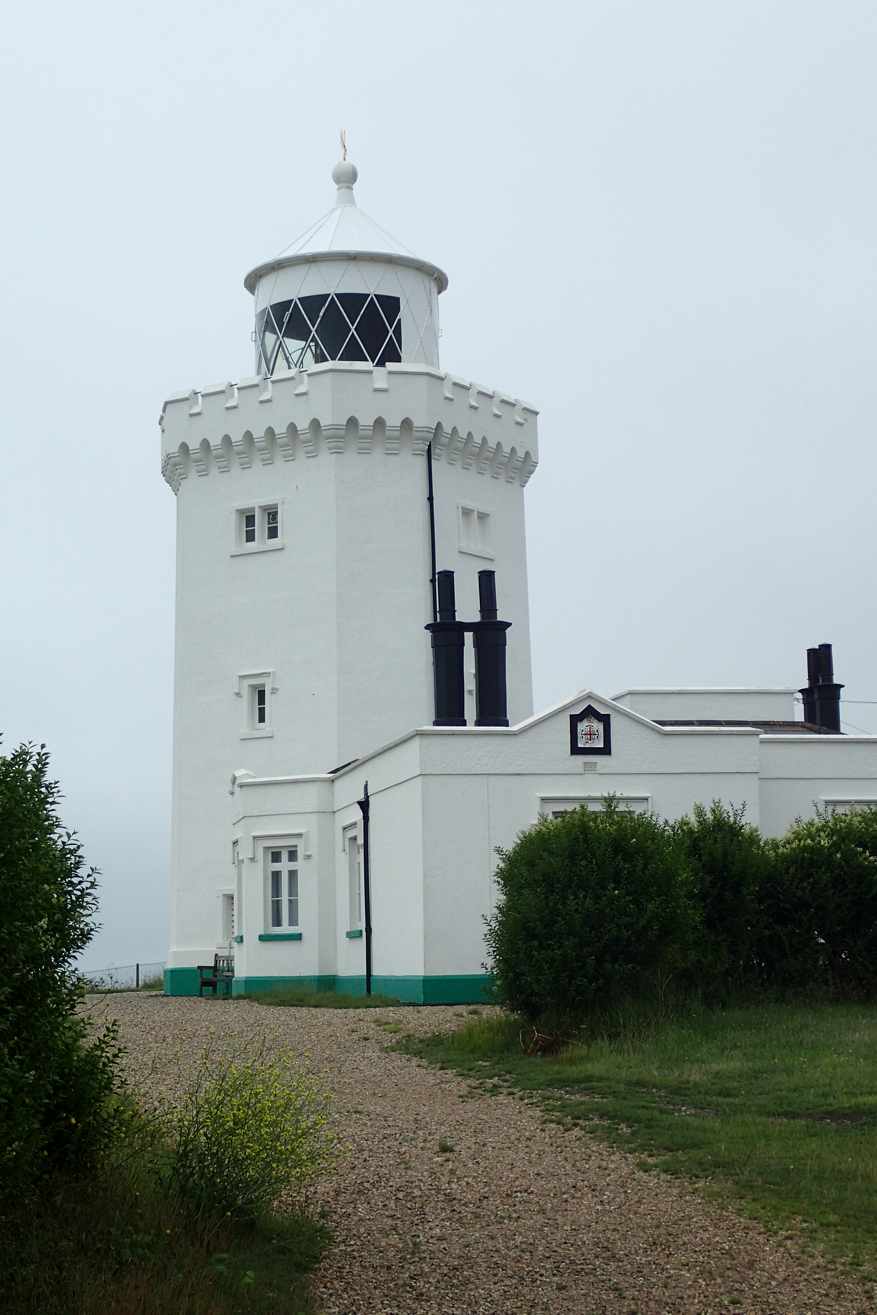
South Foreland Lighthouse, built in 1843. Under Faraday’s supervision, in 1858 it became the first lighthouse in the world to utilise an electric light. In 1898 it was chosen by Marconi as the site for his experiments with wireless radio transmissions. The first ship to shore transmission was made that year followed by the first international message in 1899
My day on trail was drawing to a close. I have walked these cliffs many times. My own family wandered far and wide when Miss Three Points of the Compass was just a nipper and the cafe at the top made a great place to bring my mother for a ‘cup of tea with a view’ as she lost her ability to walk far.
I often practiced my useless flora identification skills on the wide range of flowers and grasses found here. Though usually I would simply give up and go and watch the peregrines terrorising the nesting fulmars and gulls. I was too late in the year for that so I contented myself with watching the ferries in the busy port below. At least I was looking around. The only other people on the cliffs were teens all seemingly engaged in getting the best Instagram picture.
It is a surprisingly long walk to the station even after you have dropped down from the cliffs. There are a lot of new roads and the route has been carefully routed through these and the depressingly forgotten and grimy back streets and is followed with ease.

The Saxon Shore Way drops down to Dover town. Sadly, medieval Dover castle is not on route
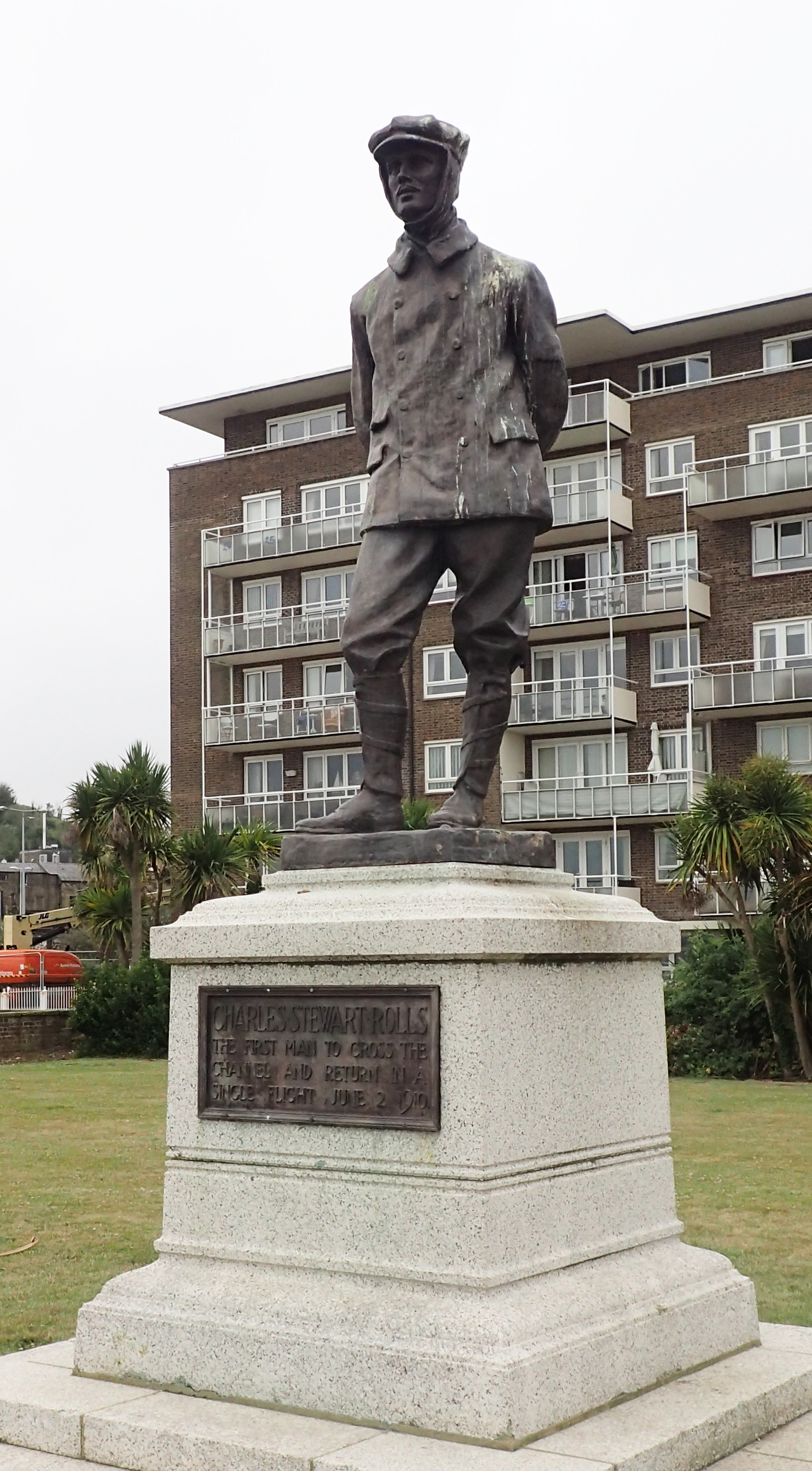
Charles Stewart Rolls, the first man to cross the channel and return in a single flight
A number of statues and memorials are passed- those who fell in World War I, the Merchant Navy Seamen lost in World War II, Operation Fuller, even one for Charles Rolls who looked at what Louis Blériot had achieved and said ‘I can do better’. I wondered how long before some miserable woke individuals decided that these offended them and demanded their removal.
Having met the confluence of three paths- where the North Downs Way ends at the Dover shoreline, meeting both England Coast Path and the Saxon Shore Way, I soon branched off to the railway station at the end of an interesting and enjoyable section of almost 17 miles.
My next four days on trail would see me moving in to the neighbouring county of East Sussex. Still to come I had a military canal, a zoo, more ups and downs than you can shake a stick at, and I might finally get the fish and chips that has so far evaded me.
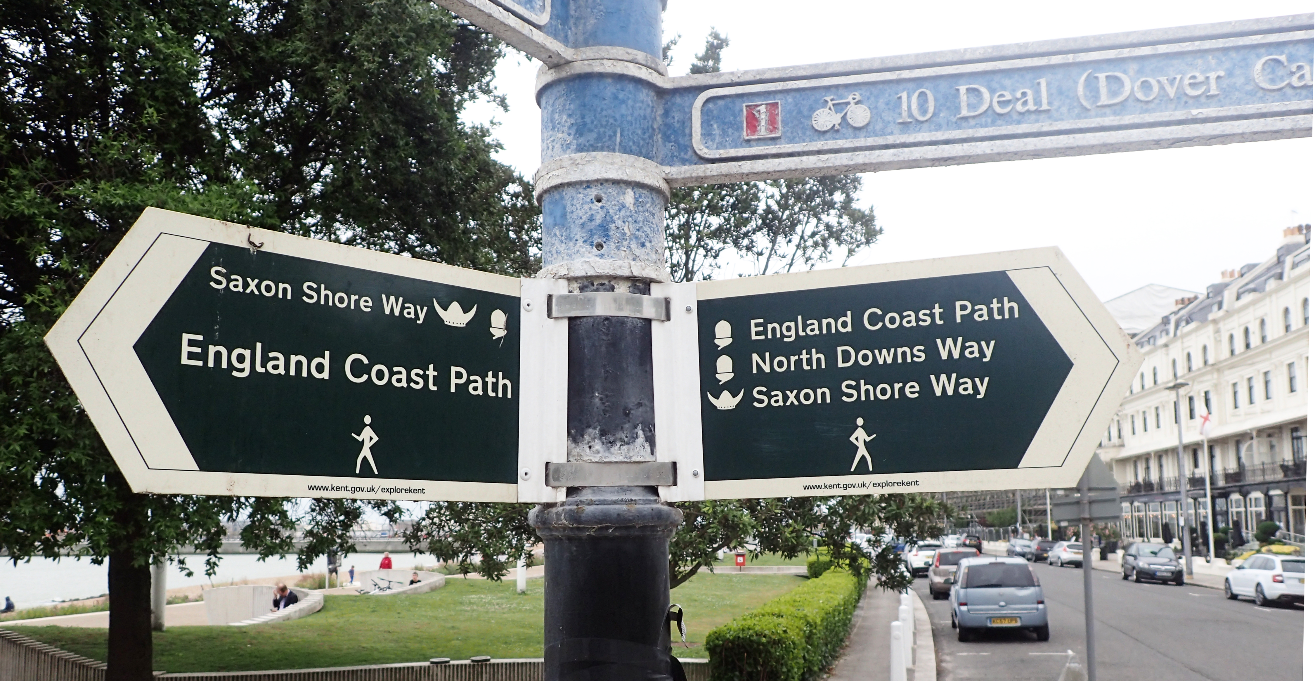
Dover- the confluence of three great trails
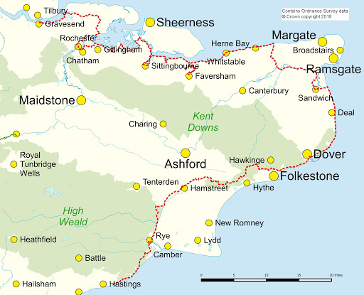
The Saxon Shore Way
- Section 1: Gravesend station to Strood station
- 21.12 miles, 1304 feet ascent
- Section 2: Strood station to Rainham station
- 11.25 miles, 785 feet ascent
- Section 3: Rainham station to Sittingbourne station
- 17.2 miles, 764 feet ascent
- Section 4: Sittingbourne station to Faversham station
- 14.73 miles, 470 feet ascent
- Section 5: Faversham station to Herne Bay station
- 21.93 miles, 580 feet ascent
- Section 6: Herne Bay station to Sandwich station
- 19.26 miles, 733 feet ascent
- Section 7: Sandwich station to Dover Priory station
- 16.83 miles, 2686 feet ascent
- Section 8: Dover Priory station to Sandling station
- 14.77 miles, 2540 feet ascent
- Section 9: Sandling station to Hamstreet station
- 13.19 miles, 1310 feet ascent
- Section 10: Hamstreet station to Rye station
- 12.85 miles, 693 feet ascent
- Section 11: Rye station to Hastings station
- 13.15 miles, 2331 feet ascent
Saxon Shore Way
Three Points of the Compass does not always blog on the trails walked. Links to those that have been covered can be found here.

3 replies »